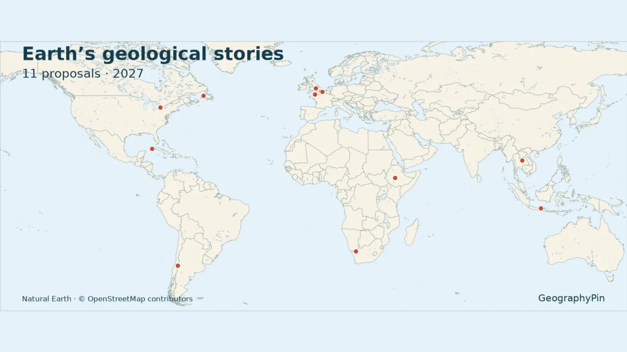
A recommendation is a significant step toward becoming a UNESCO Global Geopark, but it is not the final designation. The proposed 2027 group connects very different landscapes, from Newfoundland’s ancient oceanic rocks to Cuba’s limestone hills.
UNESCO’s Global Geoparks Council has recommended 11 sites for Executive Board endorsement in spring 2027. The group includes candidates in Canada, Chile, Cuba, Ethiopia, France, Indonesia, Namibia, Thailand and the United Kingdom. Cross Channel–Transmanche is one shared French–British proposal. None should be described as newly designated on the strength of this recommendation alone.
How to use this article: Compare the complete candidate list, examine the cross-Channel proposal, or check what happens next.
1. The proposed group and its status
The UNESCO announcement of November 6, 2026 identifies the eleven proposals following the Council’s November 2–4 meeting. Executive Board endorsement remains the next step. The list below follows that recommendation, not a tourism ranking or a compilation of every aspiring geopark.
It excludes renewals of existing designations and changes to existing geopark areas. Those decisions also appeared in the Council’s work, but they are not additional new candidates in this group. UNESCO’s separate list of fourteen new applications considered in 2026 is also not interchangeable with this recommendation list.
2. Map and complete candidate list
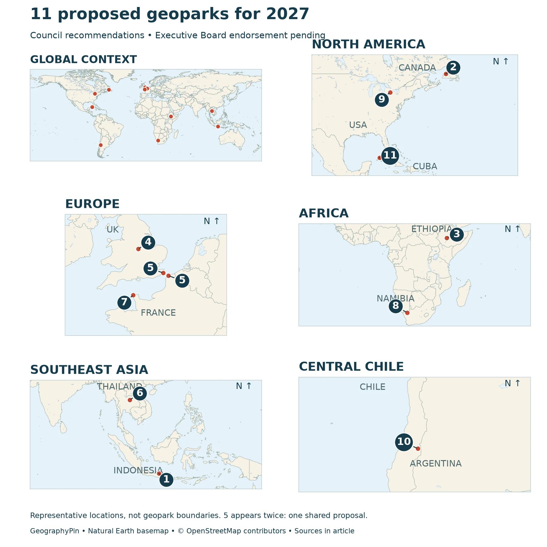
The numbered map uses representative locations, not proposed boundaries. Numbers identify candidates; they do not rank geological importance. Two locations marked 5 represent the French and British components of the same proposal.

Open larger map · Printable map and key · Download candidate list (CSV)
The complete candidate list
| Map | Candidate | Country | Geological focus |
|---|---|---|---|
| 1 | Bojonegoro | Indonesia | Petroleum systems and sedimentary rocks |
| 2 | Cabox | Canada | Ancient oceanic crust and mountain building |
| 3 | Central Ethiopia Rift Valley | Ethiopia | Rift-related volcanic landscapes |
| 4 | Charnwood Forest | United Kingdom | Ediacaran fossils and ancient rocks |
| 5 | Cross Channel – Transmanche | France / United Kingdom | Chalk landscapes and the Channel’s formation |
| 6 | Khon Kaen | Thailand | Dinosaur-bearing sedimentary rocks |
| 7 | La Hague | France | Ancient basement rocks and coastal change |
| 8 | Nama-!Garib | Namibia | Deformed ancient crust and river incision |
| 9 | Niagara | Canada | Escarpment, sedimentary rocks and river erosion |
| 10 | Pillanmapu | Chile | Andean volcanism and glacial landforms |
| 11 | Viñales | Cuba | Limestone karst, caves and marine fossils |
3. What makes each candidate geologically distinctive
1. Bojonegoro: East Java
Bojonegoro brings a different kind of geological story to this group: petroleum systems on land. The application summary identifies this as the geopark’s central theme. Rather than treating oil only as an industrial resource, the geological approach examines the rocks and processes behind its occurrence. The candidate lies in East Java. Geological and location background.
2. Cabox: Western Newfoundland
Cabox surrounds the Bay of Islands and Lower Humber Valley in western Newfoundland. Its geological importance includes the Bay of Islands Ophiolite Complex. An ophiolite is a section of oceanic crust and upper mantle exposed on land, offering evidence of an ocean’s history within a later mountain belt. Cabox therefore tells a plate-tectonic story quite different from the waterfall-and-escarpment landscape of Canada’s other candidate, Niagara. Geological and location background.
3. Central Ethiopia Rift Valley: East Guraghe and Siltie, Central Ethiopia
The application’s geographical summary places this candidate in East Guraghe and Siltie in Central Ethiopia. Its setting connects volcanic landforms with the geological development of the Ethiopian Rift. The name should not be interpreted as including every Ethiopian Rift Valley lake or all of the Afar region. This is a particular nominated territory within a much larger tectonic system, not a designation for that entire system. Geological and location background.
4. Charnwood Forest: Leicestershire, England
Charnwood Forest is associated with Ediacaran fossils, including Charnia, and rocks recording more than half a billion years of Earth history. These fossils help explain life before the familiar animal assemblages of later geological periods. The geopark organization also emphasizes minerals, varied rock types and the links between geology and present landscapes. Its name refers to an area in Leicestershire, not a continuous modern forest covering the whole candidate. Geological and location background.
5. Cross Channel – Transmanche: Kent and northern France
This is one transnational candidate, linking the Kent Downs with the Caps et Marais d’Opale area of northern France. Its geology connects landscapes on opposite sides of the Channel, including chalk cliffs and evidence relating to the separation of Britain from continental Europe. The international boundary does not divide the underlying geological story neatly in two. On the map, the two component locations share one number because they belong to one proposal. Geological and location background.
6. Khon Kaen: Phu Wiang and Wiang Kao area
Khon Kaen’s geological interest centers on dinosaur-bearing rocks and the Phu Wiang landscape of northeastern Thailand. Research on the geopark describes the Phu Wiang and Wiang Kao districts, west of Khon Kaen city. The fossils sit within a wider sedimentary-rock story: layers preserve evidence of past environments as well as the organisms that inhabited them. Geological and location background.
7. La Hague: Northwestern Cotentin, Normandy
La Hague lies at the northwestern end of the Cotentin peninsula. The local geological account connects ancient gneisses and granites with younger sedimentary formations and coastal deposits. This makes it a place to compare several chapters of geological history rather than a landscape formed by one event. La Hague is a separate candidate from Cross Channel–Transmanche, even though both involve the French Channel coast. Geological and location background.
8. Nama-!Garib: Lower Orange River area, ǁKaras
Nama-!Garib is in southern Namibia, in the Lower Orange River region. The UNESCO application summary describes rocks of the Namaqua–Natal Metamorphic Province, where deformation and intrusive rocks reveal the history of ancient crust. River incision helps expose that history. Its setting is the Lower Orange River and adjacent plateau, not the whole Namib Desert. Geological and location background.
9. Niagara: Ontario’s Niagara Peninsula
Niagara’s proposal concerns Ontario’s Niagara Peninsula, not the entire cross-border Niagara Falls region. Its learning landscape connects the escarpment, sedimentary rocks, falls and gorge with the effects of water and ice. The managing organization describes work following a 2024 UNESCO evaluation, an important reminder that this recommended group combines applications with different histories. Being included in the November list does not mean every candidate first applied in 2026. Geological and location background.
10. Pillanmapu: San Clemente, Maule Region
Pillanmapu’s current nomination is in San Clemente commune in Chile’s Maule Region. The proposed territory brings together volcanic features and landscapes shaped by glaciers in the Andes. The geopark’s own account highlights features such as the Descabezados volcanic group and Laguna del Maule. Geological and location background.
11. Viñales: Pinar del Río, western Cuba
Viñales is known for limestone karst, including steep-sided residual hills called mogotes and extensive caves. Water dissolving limestone helps explain these landforms, while marine fossils connect parts of the rock record to ancient seas. The geopark covers territory in Viñales and Minas de Matahambre municipalities. Cuba’s national geopark recognition and the Viñales Valley’s separate World Heritage inscription do not themselves confer UNESCO Global Geopark status. Geological and location background.
4. Geopark versus World Heritage Site
A UNESCO Global Geopark connects internationally significant geological heritage with education, conservation and local sustainable development. It is a managed territory, not simply a collection of scenic rocks. World Heritage is a different UNESCO system, with its own criteria and inscription process.
The distinction matters at Viñales. The valley’s World Heritage recognition concerns a cultural landscape; the proposed Global Geopark is a separate application. One label should never be substituted for the other. GeographyPin’s overview of UNESCO’s programs provides wider institutional context.
Similarly, a national geopark may exist before UNESCO endorsement. The word “geopark” in an organization’s name is therefore not proof that a place already holds the international designation.
5. What happens before designation
The next decision
The Council assesses applications; UNESCO’s Executive Board takes the final endorsement decision. UNESCO identifies spring 2027 as the expected decision period for this group. Until an official outcome is published, “proposed,” “recommended” or “pending endorsement” remains the correct description.
After designation, the work does not end. UNESCO Global Geoparks undergo revalidation on a four-year cycle. The system evaluates continuing management and quality rather than awarding a permanent label to a landscape regardless of how it is cared for.
Frequently Asked Questions
Can I visit a candidate before UNESCO endorsement?
The designation process is not an opening schedule. Individual museums, trails and geosites may already receive visitors, but access depends on their operators, local rules and conditions. Check the relevant managing organization rather than assuming the entire proposed territory is publicly accessible.
May I collect fossils or rocks in a geopark?
Do not assume that you may. Site protection rules and landowner permissions vary. Charnwood Forest, for example, explicitly warns against removing or damaging its protected fossils. Use interpretation, photographs and authorized educational activities instead.
What Did We Learn Today?
These eleven recommendations bring together several ways of reading Earth history: fossils, sedimentary layers, ancient oceanic rocks, volcanic landforms and changing coasts. Their shared status is a proposal awaiting endorsement, not an already completed designation. A useful map locates the candidates without pretending to supply their boundaries, while the geological comparison explains why each is more than a name on a list.
Sources & Data Notes
The candidate list and pending status follow UNESCO’s November 6, 2026 announcement, updated November 9. Candidate descriptions use the managing-organization, government and research sources linked above. Locator points are not surveyed centroids or nominated boundary polygons. The map’s number key uses the same candidate order as the comparison table. Khon Kaen is represented by the Phu Wiang Dinosaur Museum, with its OpenStreetMap location; Niagara by the Beamer Memorial geosite, using Birds Canada’s reference position. Other points follow documented application locations or clearly identified local references. None is presented as an official centroid.
- UNESCO: eleven Council recommendations
- UNESCO: 2026 application geographical and geological summaries
- UNESCO: Global Geopark criteria and revalidation
- UNESCO: proposal and evaluation process
- © OpenStreetMap contributors: Khon Kaen museum locator
- Birds Canada: Beamer reference position
- Natural Earth: public-domain basemap terms
- UNESCO: new applications considered in 2026
- Cabox: geological summary
- Charnwood Forest: geodiversity
- Maule Regional Government: Pillanmapu evaluation
- Viñales: geology