Kazakhstan leads the landlocked-country ranking, but the exact number depends on what “area” measures. This comparison uses land area consistently, with one reference year and a visible distinction between missing data and countries outside the scope.
The largest landlocked country
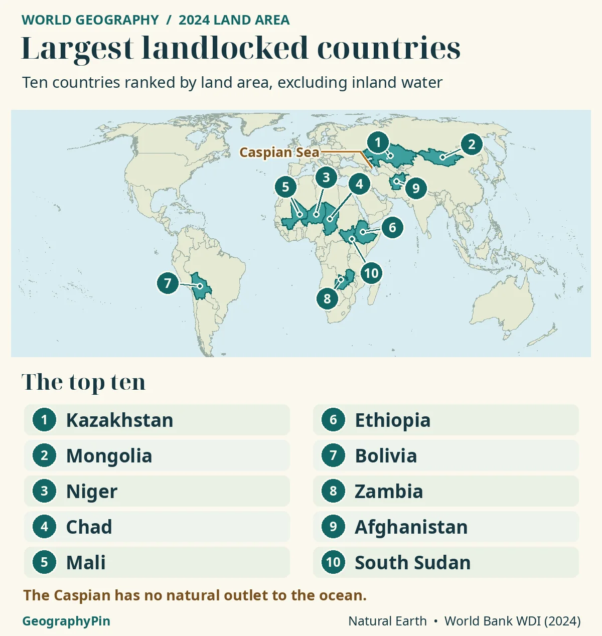
Kazakhstan is the largest landlocked country by land area, with 2,699,700 km² in the World Bank’s 2024 series. Mongolia is second. The comparison excludes inland water, uses one reference year and counts sovereign landlocked states. Kazakhstan’s Caspian coastline does not provide a coastline on the connected world ocean.
How to use this article: compare one metric from one reference year, a river route is not a national seacoast, why Kazakhstan’s Caspian shore does not remove it, keep water out of a land-area ranking.
The ten largest by land area
Compare one metric from one reference year
Kazakhstan is the largest landlocked country by land area. In the World Bank’s 2024 land-area series it measures 2,699,700 square kilometres, ahead of Mongolia. The ranking below excludes inland water rather than copying the larger total-area numbers often used in country profiles.
The scope is sovereign landlocked states that are UN members, plus Vatican City. Dependencies and partially recognized or de facto states are outside this comparison. This is a geographic rule, not the narrower UN category of landlocked developing countries.
The data use World Development Indicators series AG.LND.TOTL.K2, sourced by the World Bank from FAOSTAT. All displayed observations are for 2024. The downloaded API snapshot reports an update date of November 11, 2026; that release date is not the measurement year.
| Rank | Country | Land area, km² | Reference year |
|---|---|---|---|
| 1 | Kazakhstan | 2,699,700 | 2024 |
| 2 | Mongolia | 1,558,501 | 2024 |
| 3 | Niger | 1,266,700 | 2024 |
| 4 | Chad | 1,259,200 | 2024 |
| 5 | Mali | 1,220,190 | 2024 |
| 6 | Ethiopia | 1,122,135 | 2024 |
| 7 | Bolivia | 1,087,959 | 2024 |
| 8 | Zambia | 743,390 | 2024 |
| 9 | Afghanistan | 652,230 | 2024 |
| 10 | South Sudan | 631,930 | 2024 |
Of the 44 states in scope, 43 have 2024 values in this extraction. Vatican City has no matching value and is retained as missing rather than assigned zero. The table presents the largest ten available records, not a claim of complete numerical coverage for all 44.
Landlocked does not mean cut off from shipping
A river route is not a national seacoast
A landlocked country has no coastline on an ocean or an ocean-connected sea. It may still have ports, navigable rivers and international trade routes. “Landlocked” describes the country’s coastal geography, not whether goods can ever reach a ship.
River access through another state does not give a country its own ocean coastline. Nor does an agreement to use a foreign port change the location of its national boundary. These arrangements can greatly improve transport while leaving the geographic classification unchanged.
Apply that distinction before sorting area figures. If a list removes a country merely because it has a river port, it changes the membership rule, not the area calculation. The result is no longer comparable with a list using absence of a seacoast.
Likewise, the UN’s landlocked developing-country group is not a complete list of every landlocked state. Its development-policy purpose differs from this worldwide geographic comparison, which also includes European states outside that group.
Why the Caspian coast still counts as landlocked
Why Kazakhstan’s Caspian shore does not remove it
Kazakhstan has a coastline on the Caspian Sea but remains landlocked because the Caspian is an enclosed inland water body, not part of the connected world ocean. The name “sea” does not by itself establish an ocean coast.
The same classification issue applies to Azerbaijan and Turkmenistan, although neither appears in this top ten. A map that simply searches for blue water touching a boundary would misclassify all three. It must distinguish the type of water body.
Two separate decisions are involved: whether a country has an ocean-connected seacoast, and how much land it contains under the chosen statistical definition. The first determines inclusion. The second determines the rank. The Caspian question should be resolved before interpreting Kazakhstan’s area value.
This geographical classification is not a statement about the detailed legal regime of Caspian waters, maritime-resource rights or shipping arrangements. Those are different questions and are not used to create the table.
Land area and total area give different numbers
Keep water out of a land-area ranking
The World Bank defines this indicator as area excluding inland water bodies, continental-shelf claims and exclusive economic zones. It notes that inland water generally includes major rivers and lakes. A total surface-area figure therefore answers a different question.
Do not combine one country’s land area with another country’s total area and call the result a consistent ranking. The figures may look plausible individually while the comparison is wrong. Checking the indicator code is more reliable than relying on a column simply labelled “size.”
The underlying data retain more precision than the displayed table. Mongolia’s source value, for example, is 1,558,500.846 km², displayed here as 1,558,501 km². Sorting uses the unrounded values; rounding is only for readability.
A source revision also need not mean that a border physically moved. The indicator’s methodology warns that annual changes can reflect updated or revised information. Keep the source year and extraction date attached to the result instead of turning a changed number into an unsupported territorial claim.
How the ranking was calculated
Audit the calculation before interpreting the gap
The leading comparison is easy to reproduce: divide Kazakhstan’s 2,699,700 km² by Mongolia’s 1,558,500.846 km². The result is approximately 1.73, so Kazakhstan has about 73% more reported land area in this dataset.
The ranking was produced by selecting the 44-state geographic scope, filtering the WDI series to 2024, keeping missing records separate, and sorting non-missing values from largest to smallest. Regional aggregates and other World Bank groupings were excluded. No current value was silently replaced with a different year.
There are no equal unrounded values in the displayed top ten. If a future extraction produces a tie, it should be marked as a tie rather than resolved by rounding or an unexplained preference. Country names are display labels; ISO three-letter codes keep the extraction reproducible.
Missing data do not make Vatican City cease to be landlocked. Its official geography page describes a very small territory enclosed within Rome, so it does not challenge the largest-country conclusion; however, its independently published territory figure is not inserted into a WDI land-area column.
Download the full 2024 land-area ranking (CSV), including 43 numeric records and Vatican City marked as missing. The short top-ten table does not show every state in the geographic scope.
Frequently Asked Questions
Can a country move in the ranking without changing its borders?
Yes. A revised source estimate or a correction can alter reported area and potentially the ordering. Compare the same indicator across releases before interpreting a numerical change as a physical or political event.
Does “largest” here mean the country with the most people?
No. This table measures land area only. Population, economic size and distance to a seaport require different datasets and would produce different comparisons.
What Did We Learn Today?
Kazakhstan ranks first under a clear land-area rule, not because inland waters are ignored when deciding whether it has a coastline. The membership test and the measurement are separate. A coherent year, unrounded sorting and an explicit missing-data note make the comparison reproducible.
Sources & Data Notes
- NASA: Caspian Sea inland-water setting
- United Nations: sea-coast definition, UNCLOS Article 124
- World Bank: land-area series, source and licence
- World Bank: indicator definition and methodological limits
- World Bank API: reproducible land-area extraction for 2020–2025
- United Nations: landlocked developing-country category
- Vatican City State: geography and territorial scale
Downloaded November 19, 2026. WDI API source 2 reports last updated November 11, 2026. Reference year: 2024 for all numeric rows. Indicator: AG.LND.TOTL.K2; FAOSTAT source, World Bank distribution, CC BY 4.0. Scope: 44 states; 43 numeric values and Vatican City missing. Top ten shown; sorting uses unrounded source values, display rounds to nearest km². No total-area substitution or mixed-year fallback.
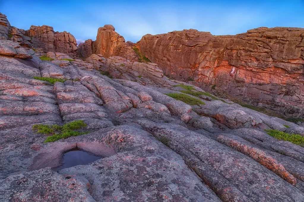
Map: GeographyPin original using Natural Earth countries (public domain). Generalized boundaries are for reference, not legal claims. Equal Earth projection; only the ten ranked countries are highlighted. Photograph: Edrey Mountains, Karaganda region, Kazakhstan, Astrobond, May 21, 2025, CC BY-SA 4.0. Resized and converted to WebP without crop or retouch.