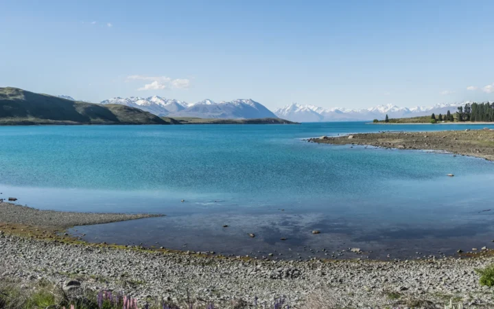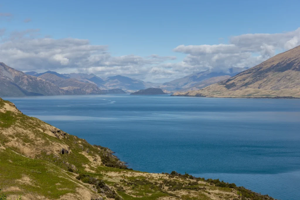
From Wānaka’s waterfront, the lake looks like a broad opening toward distant mountains. On a map, a different pattern emerges: a long glacial basin, an irregular southern shoreline and a neighboring lake with its own outlet. Understanding that layout makes the town, the islands and the Clutha River easier to place.
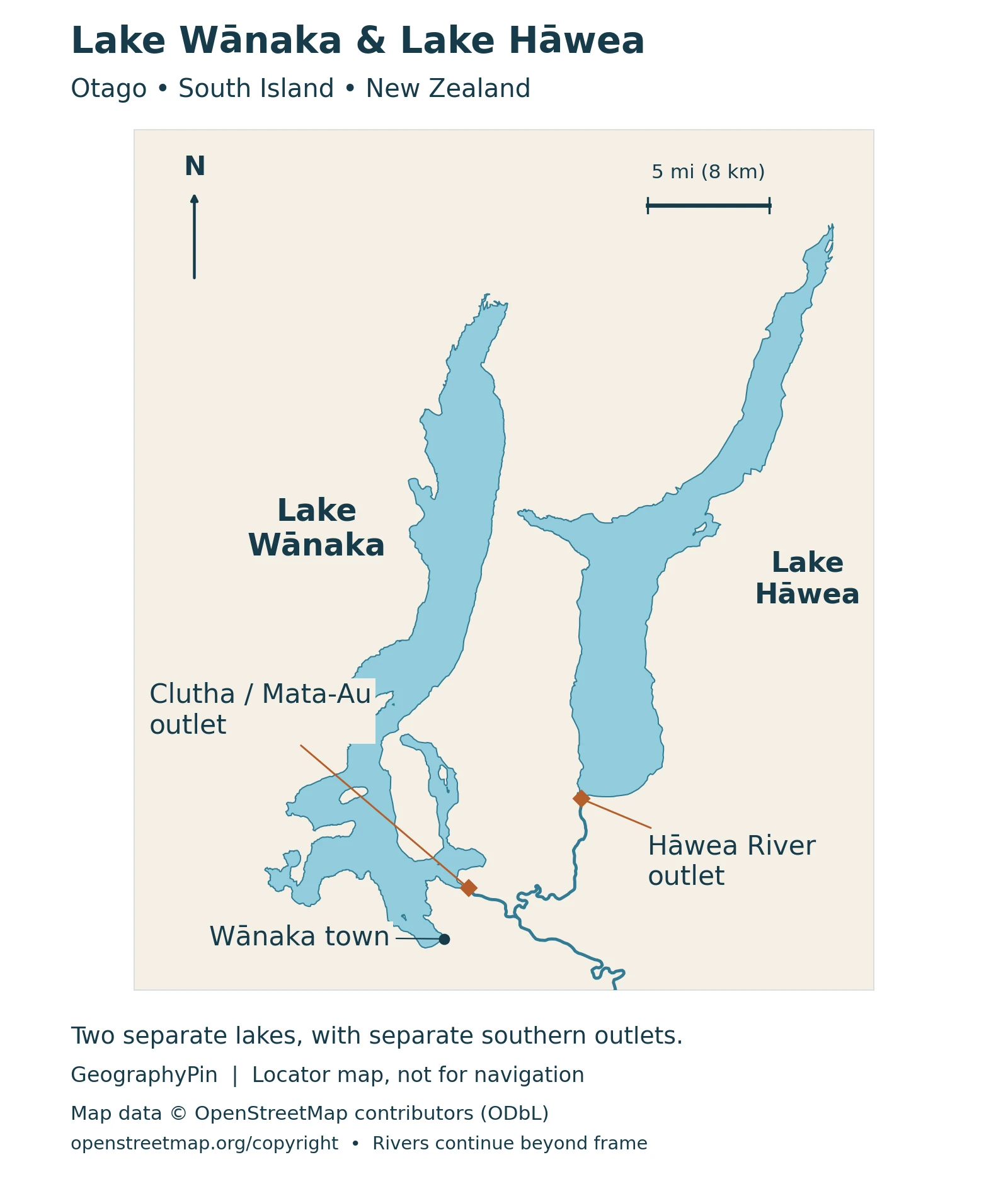
Lake Wānaka is a long glacial lake in Otago on New Zealand’s South Island. Wānaka town sits on its southern shore, while the Clutha River/Mata-Au leaves its southeastern end. Nearby Lake Hāwea is separate: its water reaches the Clutha through the Hāwea River downstream.
How to use this article: Start with the lake and town, compare the two drainage routes, or explore Mou Waho’s island pool.
1. Where Is Lake Wānaka?
Lake Wānaka is in Otago on New Zealand’s South Island, east of the main Southern Alps divide. Its long northern reach sits between mountain slopes; the southern end spreads into bays, peninsulas and islands. The town of Wānaka fronts Roys Bay, not the whole southern shoreline.
One name for a lake and its waterfront town
“Wānaka” can mean the waterbody, the town or the wider visitor region. Lake Hāwea, to the east, is a separate lake. A regional map helps keep those meanings apart: a photograph of the town waterfront does not show the full length of Lake Wānaka, and a mountain viewpoint may look over both lakes.
The lake’s southeastern outlet becomes the Clutha River/Mata-Au. That outlet is distinct from the town center. Te Ara’s regional account identifies the Makarora and Mātukituki as important incoming rivers, linking the lake to mountain catchments farther north and west.
2. How Large and Deep Is Lake Wānaka?
For a consistent reference, the table uses Otago Regional Council’s November 2009 report rather than combining measurements from different summaries. These are rounded geographical reference values, not a live water-level reading or the published results of a new survey.
| Measurement | Reference value | Meaning |
|---|---|---|
| Surface area | About 69 square miles (180 km²) | Water surface, not the surrounding catchment |
| Length | About 28 miles (45.5 km) | Lake length, not a shoreline walking distance |
| Maximum depth | About 1,020 feet (311 meters) | Deepest reference value, not average depth |
| Catchment area | About 1,000 square miles (2,590 km²) | Contributing drainage area, much larger than the lake surface |
Why some published figures differ
Te Ara gives a larger surface-area figure of about 74 square miles (192 km²). The consulted sources do not explain that difference, so it should not be presented as proof that the lake has expanded or contracted. The table keeps one identified reference series instead of silently switching between them.
Maximum depth also needs context. NIWA announced detailed new lakebed mapping in May 2024, but that announcement does not supply a replacement maximum-depth number. It is therefore inappropriate to relabel the older 311-meter figure as a new 2024 measurement.
3. A Valley Shaped by Glaciers
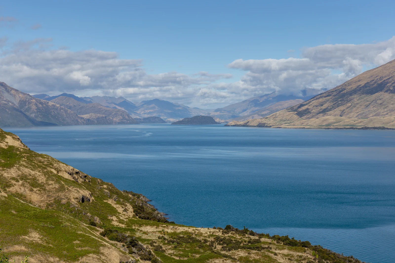
Lake Wānaka occupies a glacially carved valley, one of the basin-forming processes explained in our guide to what makes a lake. Moving ice excavated the trough that now holds the water, leaving a steep-sided mountain setting rather than a circular volcanic crater. The present lake and its feeding rivers occupy the landscape left as the ice retreated.
What modern mapping reveals beneath the surface
NIWA’s 2024 survey used a multibeam echosounder on a small research vessel to map the lakebed in detail. Its report describes steep underwater slopes and channels associated with incoming rivers. It also explains that earlier modeling had relied on charts from the 1970s, with particularly important improvements around shallow bays and river mouths.
That work helps researchers investigate water quality and geological hazards. A map showing steep slopes or an active fault is evidence for studying potential processes, not a prediction of when an earthquake, underwater landslide or lake wave will occur.
The distinction matters when looking at a scenic photograph: the visible shoreline is only the upper edge of a much larger three-dimensional basin. A locator map shows where features are; it cannot stand in for measured underwater contours.
4. Two Lakes, Different Outlets
The Makarora enters the northern end of Lake Wānaka, while the Mātukituki reaches its southwestern side. Water leaves toward the southeast through the Clutha/Mata-Au. Lake Hāwea drains through the Hāwea River, which joins the Clutha downstream of Wānaka’s outlet.
Hāwea is a neighbor, not an arm of Wānaka
The two lakes can appear close together on a map without being connected by an open channel across the land between them. Their waters join downstream through the river network. Treating Hāwea as a bay of Wānaka would therefore misrepresent both the geography and the flow of water.
There is also an important management difference. Otago Regional Council’s October 2024 flow report describes a control structure at Lake Hāwea’s outlet and the use of its storage for downstream hydroelectric generation. It characterizes the upper Clutha between Wānaka’s outlet and the Hāwea confluence as close to natural, while flows below the confluence are affected by Hāwea’s managed releases.
This does not make Wānaka isolated from downstream water management. It means that adjacent lakes can play different roles within the same river system. A whole-catchment flow statistic should not be substituted for the discharge at either individual lake outlet.
5. Islands Within the Mountain Landscape
The Department of Conservation highlights four significant islands: Mou Waho, Te Peka Karara, Mou Tapu and Ruby Island. That is a selection of prominent islands, not a claim that every small island or rock has been counted.
A pool above the surrounding lake
Mou Waho contains Arethusa Pool, a glacially scoured hollow above Lake Wānaka. This is a real example of a small waterbody on an island within a larger lake. DOC places the pool about 490 feet (150 meters) above the surrounding lake, so it is not simply an inlet connected at the same water level.
The islands also have different conservation and access arrangements. Mou Tapu has no tracks or visitor facilities; Mou Waho has a walking route and is managed as a scenic reserve. Do not assume that every island shown on a map is interchangeable as a landing or walking destination. DOC’s island guidance is the appropriate source for current restrictions and biosecurity precautions.
6. Reading the Landscape Before Exploring It
A useful first distinction is between the town lakefront, an island visit and a mountain outing. They involve different terrain and access conditions. A lake-wide geographical overview is not a route guide, and the lake’s quoted length is not the distance of a continuous public shoreline path.
A viewpoint is not automatically an easy walk
Matatiaho Conservation Area overlooks Wānaka and Hāwea. DOC describes access over private land by easement, steep and rocky sections, and alpine conditions that can occur at any time of year. Its information also lists an annual fawning closure for the Isthmus Peak and Glen Dene tracks from November 20 to December 20. Check the official page before setting out rather than assuming a photographed viewpoint is always accessible.
For a different kind of landscape experience, DOC describes the Hāwea River Track as a riverside connection between Albert Town and Hāwea. It follows part of the drainage network discussed above, rather than circling either lake. Its current access information explains the shared-use route and management responsibilities.
Finally, ecological research and immediate recreation conditions answer different questions. A historical report on nutrients or lake clarity cannot establish that a particular shore is safe for swimming today. Use current local notices for a specific outing, and use dated scientific studies to understand longer-term changes.
What Did We Learn Today?
Wānaka is both a town and a much larger glacial lake. Its mountain inflows, southeastern Clutha outlet and separate relationship with Hāwea explain the regional pattern. Dated measurements, underwater mapping and access guidance each describe different parts of that landscape; none should be mistaken for a complete picture on its own.
Sources & Data Notes
The measurement table follows one 2009 regional reference, with rounded conversions. Other sources publish different areas; no cause is assumed for that discrepancy. The 2024 survey announcement is not treated as a new numerical depth table. Access information can change and is linked to its managing agency.
- Otago Regional Council, November 2009: lake reference measurements and inflows, pages 80–81
- Te Ara: Lakes Wānaka and Hāwea, settlement and river context
- NIWA, May 16, 2024: detailed lakebed mapping and research purposes
- Otago Regional Council, October 2024: Clutha/Mata-Au and Hāwea flow management
- Department of Conservation: Wānaka islands and Arethusa Pool
- Department of Conservation: Matatiaho terrain, access and seasonal closure
- Department of Conservation: Hāwea River Track
Map methods: The locator uses OpenStreetMap lake polygons, island outlines, settlement coordinates and mapped river lines retrieved in November 2026. It uses a local equirectangular projection with equal horizontal and vertical axes. Outlet diamonds identify the mapped outlet areas; small differences between shoreline and river datasets are not corrected by drawing invented connections. No roads, hiking routes, bathymetry, catchment boundaries or current access conditions are represented.