Lake Champlain looks like a long dividing line on a northeastern North America map. Look a little closer, and it also becomes a connection: between two U.S. states, across the Canadian border, and onward through a river system to the Atlantic.
Lake Champlain is a freshwater lake shared by New York, Vermont, and Québec. Its outlet is the Richelieu River in Canada, which carries water to the St. Lawrence River and ultimately the Atlantic. It is not one of the five conventionally recognized Great Lakes, despite belonging to the wider St. Lawrence drainage system.
How to use this article: Locate the three jurisdictions, follow the Canadian outlet, explore the earlier inland sea, or find shore-access guidance.
1. Where Lake Champlain Is
Two states and one Canadian province
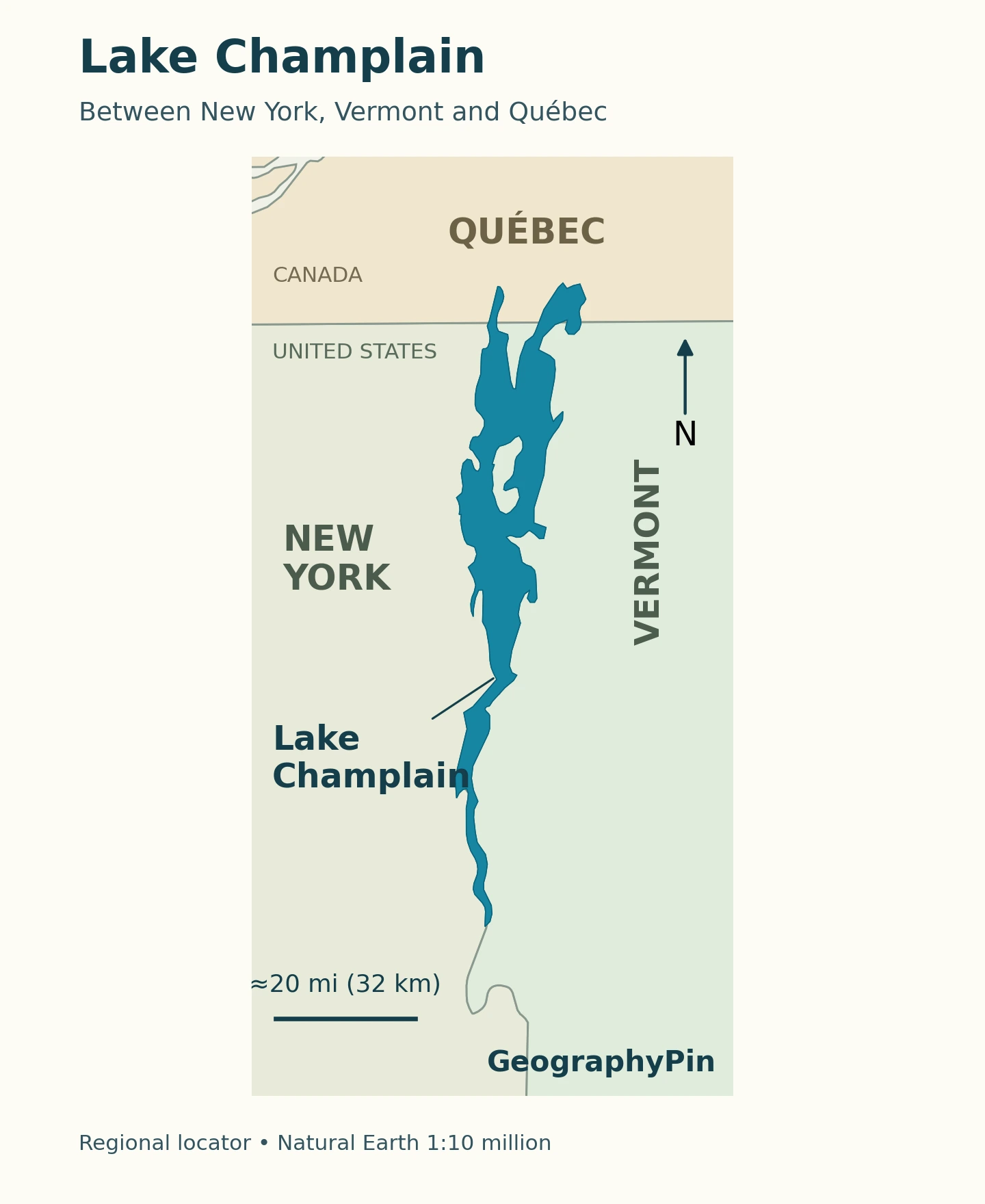
Lake Champlain lies between New York and Vermont and extends north into Québec, Canada. New York is on the western side of the main lake and Vermont on the eastern side. The international border crosses its northern waters; it does not mark the lake’s northernmost shore.
This is why calling Champlain simply a Vermont lake leaves out an essential part of the picture. Its geography belongs to both countries. The Lake Champlain Basin Atlas’s political-boundaries overview explains why cooperation across jurisdictions matters: administrative lines divide responsibility, but they do not stop water or the material it carries.
The shoreline is not the watershed boundary
The lake is the body of open water. Its drainage basin includes the surrounding land whose runoff can reach it. A place need not be beside the shore to affect lake water quality: a tributary can carry water from an inland settlement, forest, or farm.
The Basin Atlas’s watershed maps divide the region into smaller tributary catchments, including those of the Winooski, Saranac, Ausable, and Missisquoi. These are not separate lakes. They are connected parts of the larger drainage system. For the general distinction between standing water and the land supplying it, see what is a lake?
2. Lake Size, Depth and Water Level
The Lake Champlain Basin Program’s Lake and Basin Facts gives the following approximate reference measurements. They describe the lake’s scale, not conditions at a particular beach or boat launch.
| Measure | Reference value |
|---|---|
| Length | 120 miles (193 km) |
| Greatest width | 12 miles (19 km) |
| Surface area | 455 square miles (1,179 km²) |
| Maximum depth | 400 feet (122 m) |
| Average depth | 64 feet (19.5 m) |
| Water type | Freshwater |
Published summaries differ: the Basin Atlas lake overview instead lists 435 square miles (about 1,127 km²). The table follows the Program’s Facts page, rather than mixing area figures or treating either as a current shoreline survey.
Depth and elevation answer different questions. Depth measures the distance from the water surface to the bottom; elevation locates the surface relative to a vertical reference. Neither the maximum depth nor an average lake level tells a boater how much water is available at a specific landing. Use current observations and navigation information for that decision.
3. The Route Through Canada to the Atlantic
The Richelieu is the lake’s outlet
Water leaves Lake Champlain toward the north through the Richelieu River in Québec, then reaches the St. Lawrence River and, downstream, the Gulf of St. Lawrence and Atlantic Ocean. The Canadian connection is therefore a drainage route, not merely a border crossing.
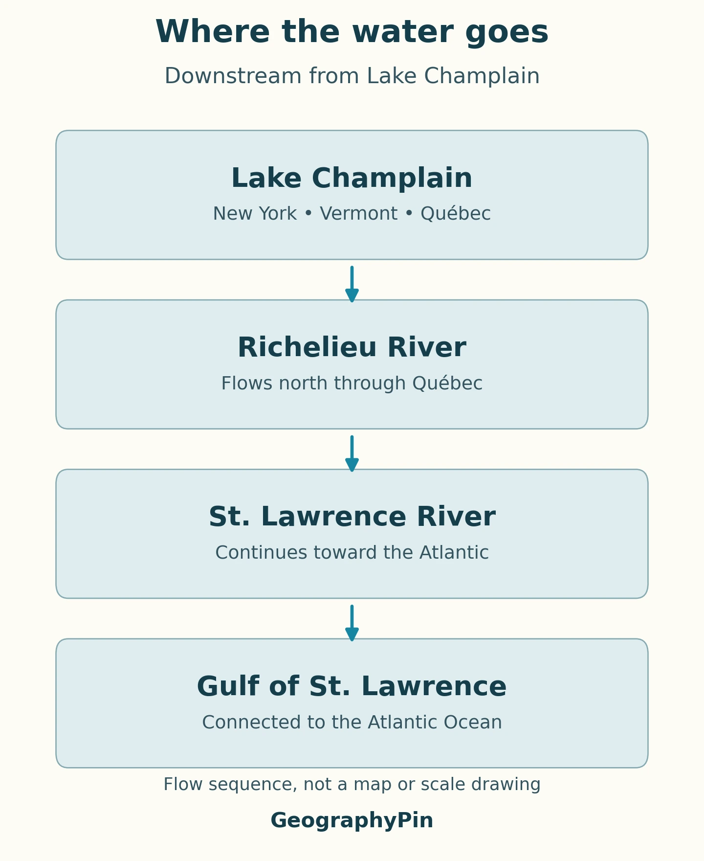
Read the diagram as a sequence of connections. It does not portray river bends, distances, discharge, or a navigable itinerary. The watershed maps show where water comes from; this diagram shows where water leaving the lake goes next. For the terminology behind tributaries, outlets, and drainage networks, see the parts and flow of a river.
A canal connection is a different kind of link
At the southern end, the Champlain Canal connects the lake at Whitehall, New York, with the Hudson River. The Basin Atlas’s canals history describes how engineered waterways expanded the region’s transport links in the nineteenth century.
A canal map and a drainage map consequently answer different questions. A boat connection to the Hudson should not be mistaken for the lake’s natural outlet. Locks and other navigation infrastructure create routes that cannot be understood simply by following the lowest river valley on a small-scale map.
4. Why Champlain Is Not One of the Five Great Lakes
Lake Champlain is not one of the five conventionally recognized Great Lakes. NOAA’s Great Lakes overview identifies those as Superior, Michigan, Huron, Erie, and Ontario. Champlain has its own lake basin and joins the St. Lawrence system through the Richelieu.
Both drainage systems ultimately connect with the Atlantic, but a shared downstream destination does not make their lake names interchangeable. Lake Ontario belongs to the conventional five-lake group; Lake Champlain does not. This distinction is more useful for reading a regional map than an unqualified claim that Champlain is a “sixth Great Lake.”
5. From Ice-Age Lake to Inland Sea
A changing basin after the ice retreated
Today’s freshwater lake occupies a landscape reshaped by continental ice. The Basin Atlas’s Ice Age Waters account describes an earlier glacial Lake Vermont, held back by ice to the north. As that ice withdrew, the valley’s water connections changed.
The land had been depressed under the ice sheet’s weight. Marine water subsequently entered from the St. Lawrence region, forming the Champlain Sea. The Atlas places this marine phase approximately between 13,000 and 10,000 years ago. These are rounded geological ages, not precise dates for every shoreline location.
As the land rebounded, the marine connection was cut off and freshwater replaced the saltwater. Marine fossils, including the well-known beluga whale remains found at Charlotte, Vermont, record the earlier environment. A present-day lake can therefore contain evidence of an ancient sea without being saline now.
6. Water Quality and Visiting the Shore
Why the wider basin matters
Phosphorus is essential to aquatic life, but excessive inputs can support excessive growth. The Basin Program identifies nutrients and cyanobacteria as a major concern. Runoff from different land uses can carry phosphorus into the lake; warm water and calm conditions can help blooms develop.
That does not mean every bay has the same conditions, or that every visit encounters a bloom. It explains why an attractive photograph, a lake-wide average, and a beach warning are different kinds of evidence. A long-term environmental profile cannot replace a current local observation.
Choose the access point, then check conditions
The Basin Atlas beach map is a useful starting point for finding shoreline recreation sites. Choose the shore and access point you actually intend to use, then confirm opening arrangements and notices with that site’s operator. A point shown on a regional map is not a promise of unrestricted public access.
For Vermont locations, the Department of Health’s cyanobacteria guidance links to recent reports and explains what blooms can look like. Keep people and pets away from suspected blooms and follow posted closures. For New York and Québec sites, consult the relevant local beach or public-health authority rather than applying a Vermont observation to the entire lake.
This profile is a geographical introduction, not a live swimming, boating, ice-safety, or border-entry advisory. Match the information to the activity: a watershed map explains the landscape, while a site notice tells you whether that particular facility is open today.
What Did We Learn Today?
Lake Champlain is best understood as both a border lake and part of a larger drainage network. Its shoreline, watershed, and political boundaries describe different things. Its Canadian outlet leads to the St. Lawrence, while its glacial and marine history explains why an inland freshwater lake preserves traces of a much different landscape.
Sources & Data Notes
Measurements follow the Lake Champlain Basin Program’s Facts page; the differing area in its Basin Atlas is disclosed above. Neither page supplies a survey date for that summary figure. Geological ages are approximate. The locator uses generalized geographic data, not a navigation chart; the outlet diagram is schematic. Current access and water-quality notices should be checked separately.
- LCBP — Lake and Basin Facts
- Basin Atlas — Lake Champlain
- Basin Atlas — Political Boundaries
- Basin Atlas — Watersheds & Tributaries
- Basin Atlas — Canals
- NOAA — Great Lakes Region
- Basin Atlas — Ice Age Waters
- LCBP — Nutrients and Cyanobacteria
- Basin Atlas — Beaches
- Vermont Department of Health — Cyanobacteria
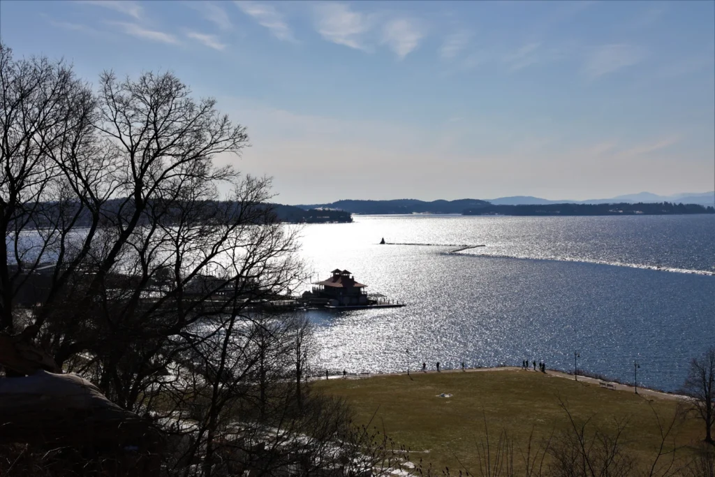
Featured photograph: Lake Champlain from Battery Park in Burlington, Vermont. Photo: USGS, public domain. Resized and converted for faster loading; no generated elements or watermark added.