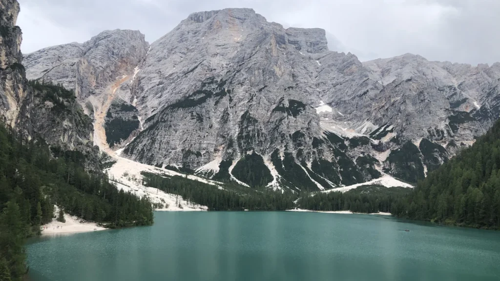
A photograph of Lake Braies captures its steep mountain backdrop, but it cannot explain how the basin formed or how its depth was measured. Reading the lake alongside a map and its geological history reveals more than the familiar view of peaks reflected in water.
Lake Braies, also called Lago di Braies or Pragser Wildsee, is a mountain lake in South Tyrol, northern Italy. It lies in the Dolomites within Fanes-Sennes-Braies Nature Park. The provincial environmental agency reports a surface elevation of about 4,908 feet (1,496 meters) and a maximum depth of about 118 feet (36 meters).
How to use this article: Compare the lake measurements, understand the natural dam, or identify the Italian and German names.
1. Where Is Lake Braies?
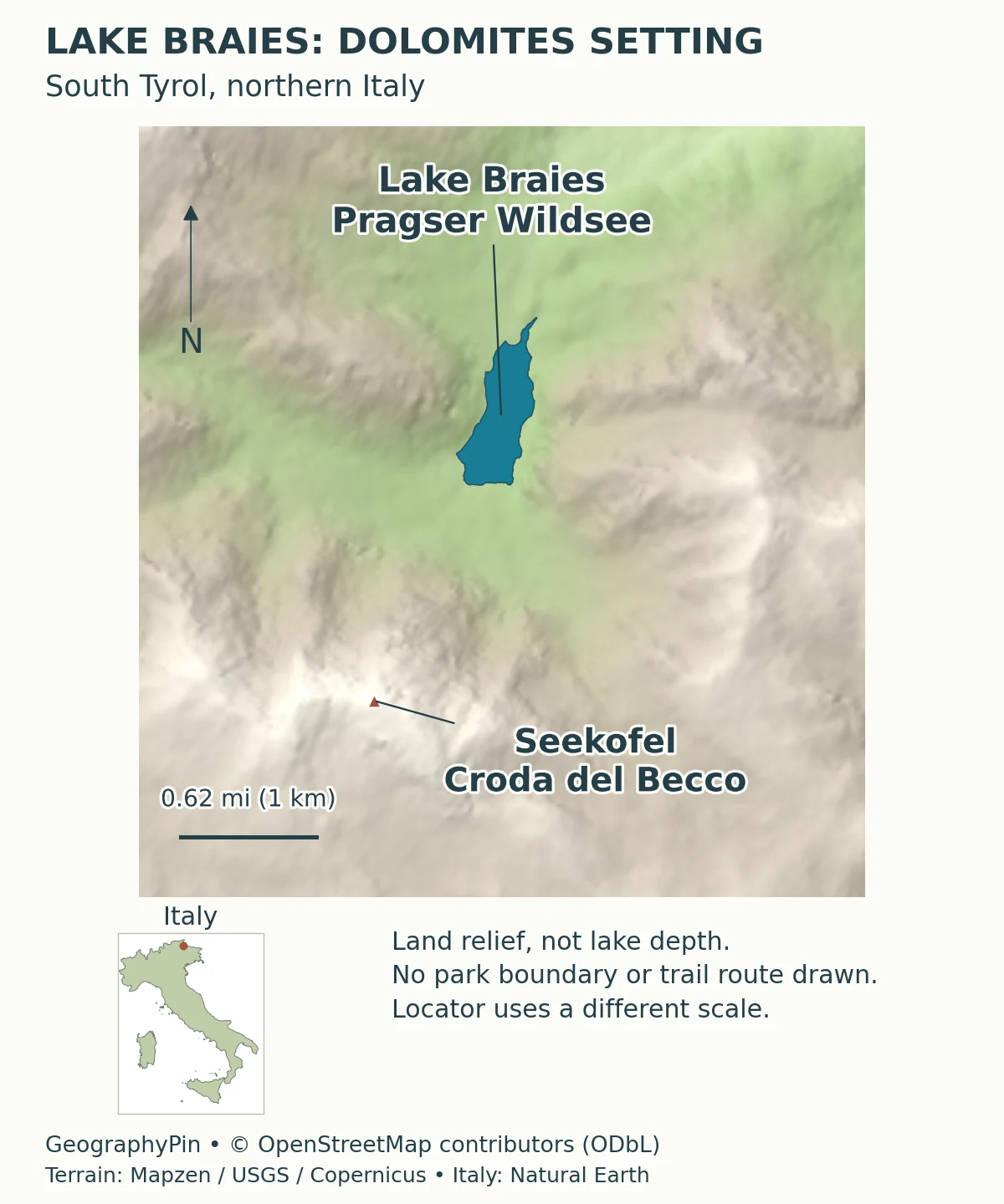
Lake Braies lies in the municipality of Braies, or Prags, in South Tyrol, northern Italy. Its basin sits among the Prags Dolomites inside the Fanes-Sennes-Braies Nature Park. The setting is Alpine, but the lake is not in Austria: South Tyrol is an Italian province bordering Austria, and its Italian and German place names often appear together.
The mountain above the southern shore
The prominent mountain associated with the lake is Seekofel, also called Croda del Becco, rising to about 9,220 feet (2,810 meters). Italy’s national tourism portal identifies it above the southern shore. The mountain and lake belong to the same landscape, but their elevations describe very different places: the summit is far above the water surface.
That distinction matters when reading a photograph. A mountain reflected in the lake does not necessarily stand directly behind the photographer, and a shoreline view cannot show the entire drainage basin. The map supplies orientation that the familiar mountain-and-water image alone cannot provide.
2. Lake Braies Depth, Size and Elevation
Use one clearly identified measurement source
The figures below come from the Autonomous Province of Bolzano–South Tyrol’s environmental lake profile. Keeping that source together avoids combining a tourist description’s area, another page’s depth and an unrelated route elevation into an apparently precise but inconsistent set of facts.
| Measure | Reported value | How to read it |
|---|---|---|
| Surface elevation | About 4,908 feet (1,496 meters) | Height of the lake surface, not the mountain summit. |
| Surface area | About 82 acres (33 hectares) | The water surface, approximately 0.13 square miles (0.33 km²). |
| Maximum depth | About 118 feet (36 meters) | The deepest reported point, not a uniform depth. |
| Mean depth | About 56 feet (17 meters) | An average across the lake basin. |
| Shoreline | About 1.90 miles (3.05 km) | The reported water-edge length, not a guaranteed walking-route distance. |
| Catchment area | About 10.29 square miles (26.64 km²) | The drainage-basin area, distinct from the water surface. |
The agency page does not attach a single survey date to this complete set of figures. They should therefore be read as its published lake-profile values, not as a new measurement of today’s water level. Rounded unit conversions also do not create additional measurement precision.
Maximum and mean depth answer different questions. A lake with a deepest point of about 118 feet (36 meters) is not that deep beside every shore. Likewise, the catchment includes the landscape contributing drainage to the basin; it is much larger than the lake’s visible surface. These distinctions are useful when comparing Braies with other mountain lakes.
3. How the Natural Dam Formed
Landslide deposits and a sediment fan
Lake Braies is held behind a natural barrier, but its origin is more complicated than a single falling rock wall. The Italian geological authority ISPRA describes a dam formed by landslide deposits together with a postglacial sediment fan. Its explanatory notes for the Dobbiaco geological map trace the deposits and the surrounding valley history rather than assigning the lake a simple tourist legend.
In that reconstruction, older rockfall material probably fell onto a glacier and was transported with the ice. Debris accumulated downstream of the present lake, while a sediment fan developed on the western side after glaciation. Together these features helped close the valley and retain water.
A sediment fan is an accumulation spread outward where flowing water or debris emerges into a less confined area. It is not the same thing as the main landslide deposit. Recognizing both parts explains why describing Braies as a natural landslide-dammed lake is useful, but saying glaciers played no role in the landscape is too absolute.
The geological report also discusses younger rock-avalanche deposits farther along the valley. Those deposits, the older barrier materials and dated lake sediments are different evidence. A sediment age does not automatically supply the exact birthday of the lake, and the published reconstruction does not justify reducing this entire history to one confidently dated event.
For a comparison of another complex Alpine basin, Lake Molveno shows why the age of a rockslide deposit and the age of a lake must be distinguished. Similar-looking mountain lakes need not share an identical formation history.
4. Water, Color and Mountain Ecology
Clear water is not the same as unchanging water
The provincial environmental agency describes Braies as an oligotrophic lake, meaning it has relatively low nutrient concentrations, including low total phosphorus. The agency also identifies it as a calcareous lake. These characteristics belong to its water chemistry and ecology; they are more informative than treating its appearance as a permanent color label.
Visibility can change. The same profile notes that algae and suspended material following heavy rainfall affect water clarity. A photograph taken in calm conditions can therefore look different from the lake after rain, without the water body becoming a different kind of lake.
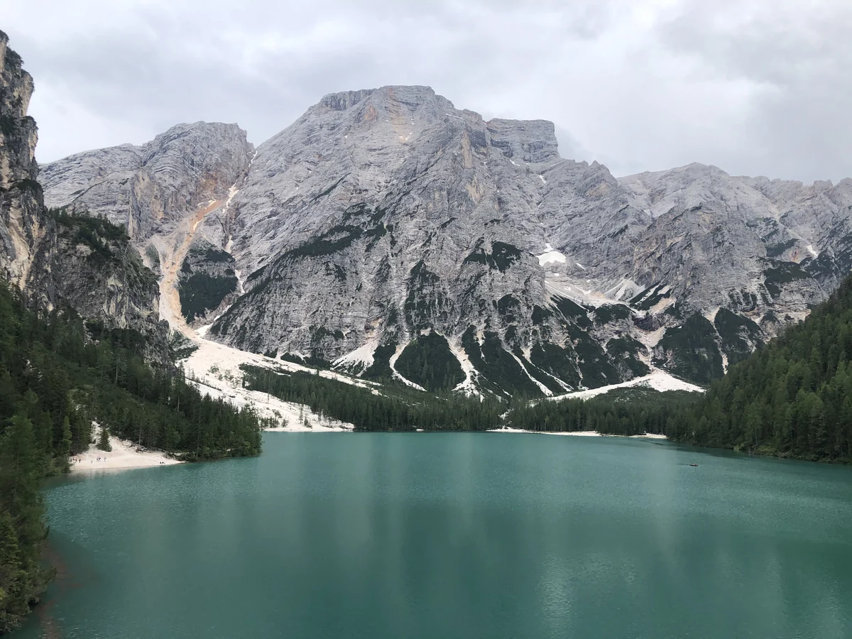
Bright water in a mountain photograph does not by itself prove that suspended glacial flour is the cause. Nor does apparent clarity establish drinking-water safety. The provincial description supports discussion of nutrient status and variable transparency, not a claim that every turquoise-looking lake has the same physical explanation.
The nature-park setting places the shore within a larger mountain environment. The water, wooded slopes, rock faces and high ground are connected, but the lake’s published catchment area should not be mistaken for the boundary of the entire protected park.
5. Lake Names and the Dolomites Setting
Lago di Braies and Pragser Wildsee are the same lake
Lago di Braies is the Italian name; Pragser Wildsee is the German name. English-language pages commonly use Lake Braies. These names identify one lake, not a group of neighboring lakes. Braies and Prags likewise refer to the municipality in different languages.
The nature park also appears under language variants, including Fanes-Sennes-Braies and Fanes-Sennes-Prags. When comparing maps or transport information, match the geographic place rather than assuming a change of spelling means a different destination.
Seekofel and Croda del Becco provide another example of this multilingual geography. Using both names once makes the mountain easier to recognize on different maps without repeating every label in every sentence.
Braies is part of the Dolomites, not a synonym for the whole mountain region. Lake Misurina is another Dolomite lake with a different basin, measurements and surrounding mountains. A photograph of one should not illustrate the other merely because both show pale mountain rock above water.
6. Planning a Visit Without Confusing Access Rules
Check the season before choosing how to arrive
Road access and transport arrangements are not fixed year-round. The local Prags visitor portal publishes seasonal traffic regulation and reservation information. A statement such as “cars are always banned” or “no reservation is ever needed” would erase that seasonal distinction.
Public transport connects the valley with surrounding towns. The local portal lists bus 442 from Toblach/Dobbiaco and Niederdorf/Villabassa toward the lake. Check its current timetable, reservation requirements and operating dates for the day you plan to travel rather than relying on an undated travel article.
The shoreline measurement in the table is not a promise about the distance, accessibility or condition of a visitor route. Paths can take a different line from the water’s edge, and seasonal conditions may change access. Use current local notices for route decisions; the geographic map above is not a navigation or winter-safety guide.
Frequently Asked Questions
Is Lake Braies in Italy or Austria?
It is in South Tyrol, Italy. German-language names such as Pragser Wildsee reflect the multilingual region, not a location across the Austrian border.
How deep is Lake Braies?
The provincial environmental agency reports a maximum depth of about 118 feet (36 meters) and a mean depth of about 56 feet (17 meters). The maximum does not describe the whole lake bottom.
How did Lake Braies form?
A natural barrier of landslide deposits and a postglacial sediment fan retained water in the valley. ISPRA’s geological reconstruction also identifies glacial transport in the earlier history, so its formation cannot be reduced to one simple, precisely dated rockfall.
What Did We Learn Today?
Lake Braies is one multilingual lake in the Italian Dolomites, not several destinations with similar names. Its deepest point differs from its average depth, and its natural dam records landslide, sediment-fan and glacial history. Water clarity changes, photographs capture only one moment, and seasonal access information belongs alongside, not inside, permanent geographic facts.
Sources & Data Notes
- Province of Bolzano–South Tyrol: Lago di Braies. Lake measurements, park location, nutrient status and variable clarity. The profile does not give one survey date for all measurements.
- ISPRA: Geological Map of Italy, sheet 016 Dobbiaco, explanatory notes. Especially printed pages 141–142 for the barrier deposits and sediment fan; later valley deposits are discussed separately.
- Italia.it: Lake Braies. Mountain setting and the Seekofel/Croda del Becco elevation.
- Prags local visitor portal. Current seasonal road-access information and bus links. Check the information for the actual travel date.
Original cartography: GeographyPin. The lake outline uses OpenStreetMap relation 14517899 and the summit position uses its mapped peak node. © OpenStreetMap contributors (ODbL). Historical Mapzen elevation tiles supply land relief, not bathymetry. Global terrain data courtesy of the U.S. Geological Survey; European terrain produced using Copernicus data and information funded by the European Union (EU-DEM layers), following Mapzen attribution guidance. Exact per-tile source composition was not independently resolved. Italy locator: Natural Earth, public domain. No park boundary, walking route or landslide extent is mapped.
Body and featured photographs: Einaz80, Lake Braies view 1 (July 15, 2020), CC BY-SA 4.0. Resized and converted to WebP; the featured version is cropped to 16:9. Photo derivatives remain CC BY-SA 4.0. No GeographyPin ownership is claimed for the photograph.