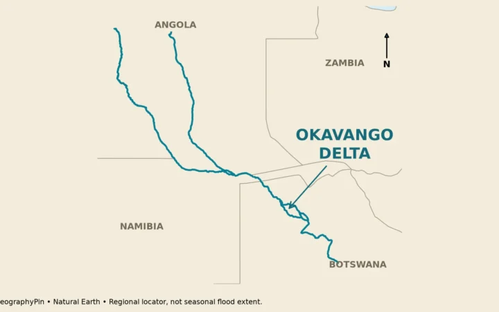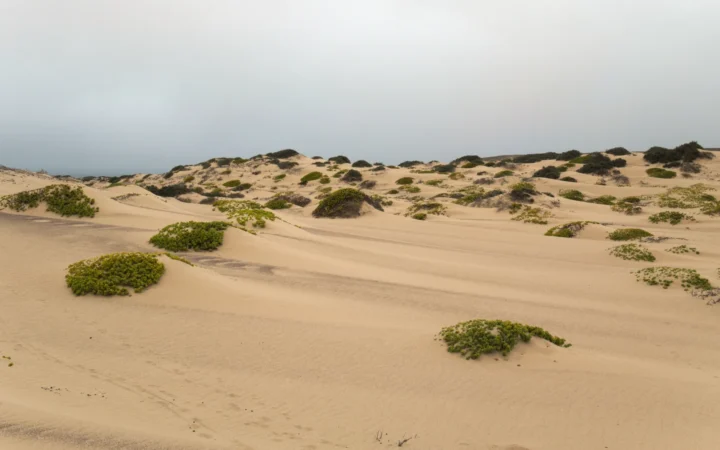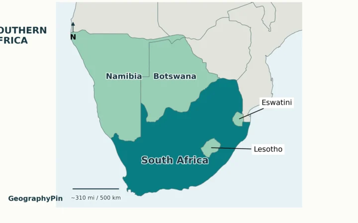
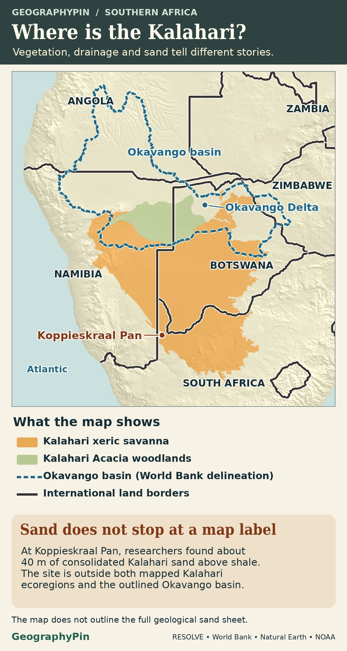
The Kalahari Desert, the geological Kalahari Basin and the Okavango watershed are three different things. The map compares two dryland ecoregions with the regional Okavango watershed; it does not trace the geological basin. At Koppieskraal Pan, researchers found about 130 feet (40 m) of Kalahari sand outside all three mapped areas.
The Kalahari Desert describes dry landscapes centered on southwestern Botswana and adjoining parts of Namibia and South Africa. The geological Kalahari Basin includes a much wider area of sediment, including sand beneath wetter landscapes. It is not the same boundary as the modern Cubango–Okavango River Basin.
How to use this article: Start with the two map layers, then compare sand at Koppieskraal Pan, the wetter Okavango margin and the mapped watershed.
Ecological regions and the Okavango watershed
Start with the dry southwest, then switch layers
Find the Kalahari’s dry core around southwestern Botswana, eastern Namibia and northwestern South Africa. In the RESOLVE 2017 ecological classification, the Kalahari xeric savanna and Kalahari Acacia woodlands are separately mapped units. They give the desert and some of its surrounding sandy country a geographic setting. Their edges do not mark everywhere geologists find Kalahari sand.
| If the label says… | It is describing… | It is not… |
|---|---|---|
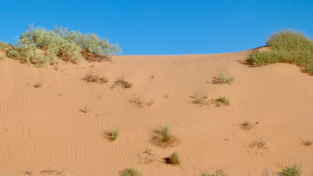
| Kalahari Desert | Dry country with dunes, sandy plains, shrubs and grasses, especially in the southwest. | Every place that contains Kalahari sand. |
| Geological Kalahari Basin | The much broader interior where layers of Kalahari Group sediments accumulated. | A single modern drainage catchment. |
| Cubango–Okavango River Basin | A mapped drainage system linked to a river that spreads into the inland Okavango Delta. | The boundary of the desert, the sand sheet or the protected wetland. |
The Kalahari sand sheet extends beyond the desert
Read what the rock layers reveal at Koppieskraal Pan
The modern desert is a landscape. The geological Kalahari Basin preserves a longer record underfoot. A regional synthesis by geologists Ian Haddon and Terence McCarthy traces Kalahari Group sediments for roughly 1,370 miles (2,200 kilometers) from South Africa north toward the Democratic Republic of the Congo. The succession includes river gravel and other deposits as well as windblown sand. It is not one uninterrupted field of active dunes.
At Koppieskraal Pan in South Africa, Vainer and colleagues documented about 130 feet (40 meters) of consolidated Kalahari sand over much older Karoo shale at an exposed pan wall. That thickness is specific to the site. It shows why a map of present vegetation cannot stand in for a map of sediment.
The Okavango at the wetter Kalahari margin
A wetland and sandy deposits can occupy the same place
In northwestern Botswana, the Okavango spreads into a low-lying inland fan instead of reaching a sea. The Botswana World Heritage nomination dossier describes Kalahari Sands beneath the delta, above older rock. Flooded grassland or open water at the surface does not tell you what lies underneath.
One interior delta reference point falls in RESOLVE’s Zambezian flooded grasslands. That is a broader ecological class also mapped elsewhere. It is not an outline of this year’s flooded area, and it is not the UNESCO property boundary. The useful contrast is how an ecology map distinguishes a wetland even where a geology map still records Kalahari sediment.
What the regional drainage basin actually shows
Trace the watershed back toward the Angolan highlands
On the drainage map, follow the connected system from the Angolan highlands through Namibia to the Okavango Delta in Botswana. The Permanent Okavango River Basin Water Commission distinguishes its large topographic extent from the smaller headwater area that supplies most of the flow. The World Bank’s regional watershed outline is a regional model of the watershed. It does not show where rain in any particular year flowed, or define the commission’s legal jurisdiction.
Koppieskraal Pan is outside that watershed even though it contains Kalahari sand. South Africa’s water department identifies the pan as a local depression. It does not drain to the Okavango just because both places occur within the much wider Kalahari geological setting.
Why a mapped edge can run past familiar Kalahari scenery
The South African water department uses its Kalahari Duneveld Bioregion for the Koppieskraal Pan reference site. The same mapped point falls in Gariep Karoo in the global RESOLVE dataset, rather than the selected Kalahari ecoregions. Neither classification changes the measured sand layer at the pan.
Use an ecological map to compare broad landscapes, a geological map to follow sediment or bedrock, and drainage data to trace a watershed. The names sometimes overlap, but the boundaries answer different questions.
Frequently Asked Questions
Is the Kalahari the same as the Namib Desert?
No. The Namib lies farther west along the Atlantic margin of Namibia, while the Kalahari is in the interior. UNESCO’s Namib Sand Sea is a separate coastal dune system, not an extension of the Kalahari because both places have sand.
Are the Nossob and Auob always dry?
No. South African National Parks describes their channels in the southern Kalahari as normally dry but capable of flowing after unusually heavy rain. A mapped riverbed does not describe its present water level.
Can an ordinary satellite image show how old a Kalahari dune is?
Not by itself. A satellite image shows the surface on a date. The Koppieskraal study constrained the age of buried sediment with field samples and laboratory measurements, rather than reading the age from a dune’s color or shape.
What Did We Learn Today?
The Kalahari Desert, geological basin and Okavango watershed are not three outlines of the same thing. Koppieskraal Pan records Kalahari sand even outside the mapped Okavango basin, while wet ground near the delta can also overlie Kalahari Sands. Follow the legend to see whether the map is tracing vegetation, rock or water.
Sources & Data Notes
GeographyPin’s ecological maps use selected Dinerstein et al. RESOLVE Ecoregions 2017, CC BY 4.0, excerpted and recolored. The water map uses the World Bank’s Major River Basins of the World (2019 data, CC BY 4.0), with the four named Okavango records combined. The resulting outline does not depict active drainage for a particular year. Haddon and McCarthy describe the geological extent; Vainer and colleagues measure the Koppieskraal exposure; the South African Department of Water and Sanitation provides a reference locality and classification. The pan marker is not the exact rock face; the outlines do not define a complete sand sheet, protected area or current flood extent. Coast and international borders use Natural Earth, with NOAA ETOPO 2022 terrain.
Photo: Red dune in Kgalagadi Transfrontier Park by Bernard DUPONT, November 14, 2011, CC BY-SA 2.0 (cropped and resized, same terms). Map data: Natural Earth, NOAA ETOPO 2022, RESOLVE Ecoregions 2017, Dinerstein et al. (CC BY 4.0; selected features and colors adapted), World Bank Major River Basins of the World (CC BY 4.0; Okavango records combined and styled).