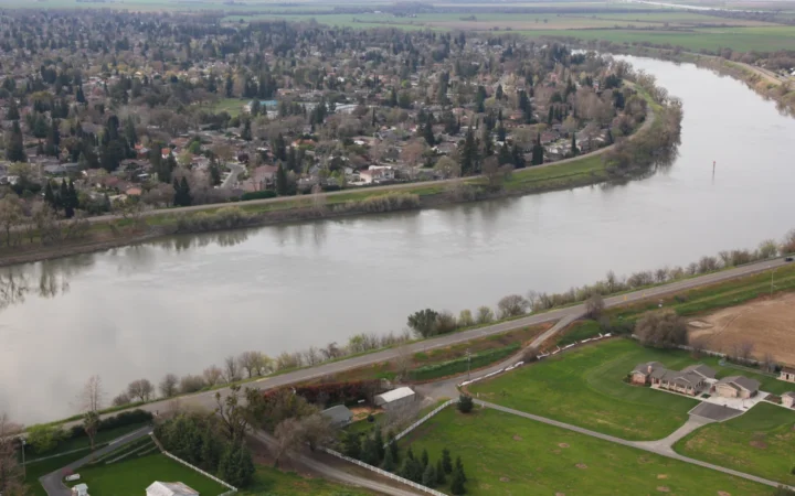
The Hudson near Albany is far from the ocean, but its water level still rises and falls with the tide. To understand why, follow the river from its Adirondack headwaters to New York Harbor and separate the head of tide from the moving edge of salt water.
The Hudson River runs from the Adirondacks through eastern New York to New York Harbor. Tides reach the Federal Dam at Troy, about 153 river miles (246 km) from the Battery at Manhattan’s southern tip. That is the limit of the tidal reach, not the limit of salt water.
How to use this article: Find the Adirondack source and named channel, follow the head of tide at Troy, or see why tidal water can still be fresh.
Follow the Hudson from the Adirondacks to the harbor
A mountain lake marks the headwaters
Look for Lake Tear of the Clouds near Mount Marcy. The U.S. Geological Survey’s Hudson basin study uses this small Adirondack lake as the river’s headwater source. A headwater marker traces the origin of a connected stream system. It does not mean every little segment between the lake and the wider river carries the Hudson name.
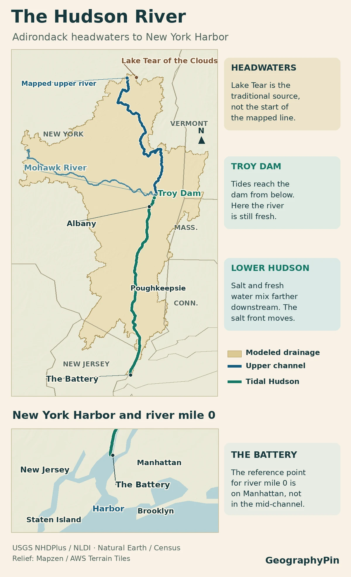
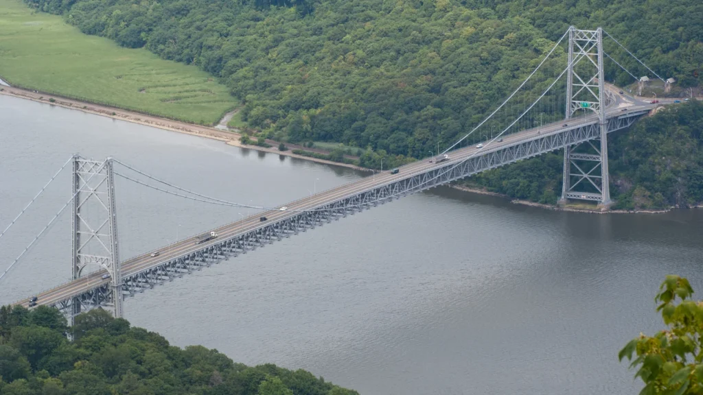
From the mountains, the Hudson makes its way into the valley of eastern New York. It passes the Albany area, continues past Kingston and Poughkeepsie, and runs along Manhattan’s west side before joining New York Harbor. The New York State Department of Environmental Conservation (DEC) measures about 315 miles (507 km) from Lake Tear of the Clouds to the Battery. That figure uses the Battery as its endpoint, not the outer edge of the harbor.
At Troy the tidal Hudson meets the upriver channel
The Federal Dam marks the head of tide
Near the Albany area, find two different features: the Mohawk River junction and the Federal Dam at Troy. The USGS places the dam just downstream from the junction. The Mohawk adds water and a large tributary basin; the dam marks the upstream end of the tidal river. The dam is at Hudson River Mile 153 in the DEC convention.
Below the dam the rise and fall at the coast changes the level of the river. That effect travels upstream through connected water and does not require salt water to travel the same distance. Rising tides can briefly push currents upstream in parts of the tidal Hudson even as freshwater ultimately makes its way seaward.
The DEC’s Hudson River Almanac counts river miles north from the Battery. The George Washington Bridge is at mile 12, the Mid-Hudson Bridge near Poughkeepsie at mile 75 and the Federal Dam at mile 153. These are positions along the water, not straight-line or highway mileages.
The tide and the salt front are two different boundaries
Why the water can be fresh at Troy
The tide is a regular change in water level and current. The salt front marks the inland edge of seawater influence. New York DEC locates it at the point where chloride drops to 100 milligrams per liter as you go upriver. Freshwater inputs usually push the front seaward when runoff is high. During dry periods it can creep back upstream, without moving the head of tide at Troy.
In the 2002 water year, USGS measurements placed the salt front between 30 and 81 river miles (48–130 km) upstream of The Battery. That report used specific conductance of 500 microsiemens per centimeter at 25°C, based on three estuary stations. The salt front moved; Troy Dam still marked the head of tide. Above the salt front, water can still rise and fall with the tide while remaining fresh.
The Hudson’s channel, watershed and harbor
The channel is the river’s path. The watershed is the surrounding land that sends water into that path, including the Mohawk valley and smaller tributary valleys. The state’s watershed overview treats the upper Hudson, Mohawk and lower Hudson as distinct watershed units, even though their waters meet.
The Battery is a useful river-mile reference, but not a wall between river and sea. Water continues through Upper New York Bay and the Narrows farther south. The Hudson River Estuary Management Program includes the connected harbor waters down to the Narrows. A map of that program boundary covers more than the line between Troy and the Battery.
Frequently Asked Questions
Is the Hudson River entirely in New York State?
The river’s source and almost all of its route are in New York. Along part of the lower river, New Jersey is on the west side and New York on the east. The New York–New Jersey harbor at its lower end is a shared estuary, not a waterbody contained by New York alone.
Does the Erie Canal use the same connection as the Mohawk River?
Yes. The New York State Canal Corporation places the eastern entrance at the Mohawk–Hudson junction at Waterford. The canal uses locks to travel uphill from there; the route is not a second natural river mouth.
What does it mean if a Hudson River site is called tidal freshwater?
The ocean tide still changes the surface level, but dissolved salts there are low enough for the water to be classified as fresh. The two measurements answer different questions: how the level moves and what is dissolved in the water.
What Did We Learn Today?
The Hudson begins in the Adirondacks and reaches the harbor past Manhattan. The Federal Dam at Troy marks the head of tide about 153 river miles from the Battery. Salt water does not extend that far; its reach changes with runoff. The river channel, watershed and estuary management boundary each cover a different area.
Sources & Data Notes
The U.S. Geological Survey’s Hudson basin study establishes the headwater and Mohawk junction. Hudson river miles, the management boundary and salinity behavior come from the New York State Department of Environmental Conservation’s Almanac, estuary program and conservation framework. The mapped tidal reach is not a fixed salt front or a chart for navigation. Bear Mountain Bridge, Hudson River: Fran Trudeau, July 28, 2011, via Wikimedia Commons (CC BY 2.0); cropped to 16:9, resized and converted to WebP.
Map: GeographyPin. River lines use USGS NHDPlus data via NLDI. The outline is the modeled contributing basin to the lower Hudson reference reach, not the DEC estuary management area, not an estimate from this map, and excludes additional harbor/adjacent coastal drainage. New York DEC Hudson River Estuary Program and USGS Green Island gauge description identify the dam, Mohawk order and river/estuary scope. DEC estuary education describes the moving salt front; its river-mile note places mile 0 at The Battery. Natural Earth 1:10m land supplies generalized harbor coast, U.S. Census 2025 state cartographic outlines and Mapzen / AWS Terrain Tiles supply context. Not for navigation.