In Colorado and New Mexico, the Rio Grande is a river within the United States. Farther downstream it becomes an international boundary, but not at the state line where it enters Texas. The basin crosses the border in places even when the main river does not.
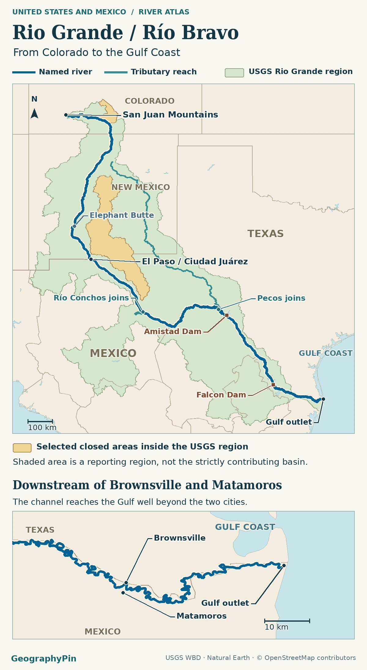
The Rio Grande rises in Colorado’s San Juan Mountains, flows south through New Mexico and reaches the Gulf Coast downstream of Brownsville and Matamoros. The river begins forming the U.S.–Mexico boundary at the downstream end of American Dam in El Paso, Texas. On Mexican maps the same river is called Río Bravo.
How to use this article: Locate the start of the river boundary, identify the actual Gulf outlet, or compare the two basin areas.
From the San Juan Mountains through New Mexico
Start in the mountains of southwestern Colorado. The young river flows east into the San Luis Valley, then turns south through New Mexico and continues into Texas. Around Alamosa it runs along a broad valley floor rather than following the mountain crest. The USGS geologic map around Alamosa shows why a blue river line through the valley should not be mistaken for the entire valley’s drainage.
The International Boundary and Water Commission (IBWC) reports about 1,900 miles (3,060 km) for the full route from the San Juan headwaters to the Gulf; the international reach is only part of it. These are approximate miles along the river course, not a straight-line distance or a result calculated from this map. The commission’s basin study gives the two reaches separately.
El Paso and Ciudad Juárez: where the river becomes the border
The Texas line and the international river boundary are separate
On the regional map, follow the river into Texas first. Continue through the El Paso area to American Dam. The U.S. section of the International Boundary and Water Commission identifies the dam’s downstream end as the point where the Rio Grande begins forming the international boundary. Ciudad Juárez is on the Mexican side of this metropolitan reach.
Downstream, the river broadly marks the boundary between Texas and Mexico. For an individual bank, bar or island, a generalized blue line cannot identify jurisdiction. The 1970 Boundary Treaty sets out rules for the channel under normal flow, along with specific exceptions. The visible shoreline at a particular water level is not a survey line.
Río Conchos, Big Bend and the Pecos junction
At Presidio, Texas, and Ojinaga, Chihuahua, the Río Conchos enters from Mexico. That meeting is upstream of Big Bend and helps explain why a reach just below El Paso cannot stand for the whole river. The National Park Service’s Big Bend river page identifies the Conchos as a major source of water downstream of Presidio.
The river bends through Big Bend country, then continues toward the Amistad area, where the Pecos joins from the Texas side. The IBWC basin summary locates the Pecos junction in Val Verde County. Farther downstream, the main river passes through the Falcon Reservoir reach toward the lower valley. None of the tributary lines replaces the named Rio Grande below its point of entry.
Beyond Brownsville and Matamoros: the lower delta
The cities are inland of the river mouth
Continue downstream past Brownsville and Matamoros to Boca Chica Beach and the coast. The river mouth is a separate place from the cities and the Brownsville Ship Channel. A NASA Earth observation of the lower river shows sediment moving from the Rio Grande mouth into the Gulf and distinguishes the adjacent ship channel.
The mouth can change even though the river still has the same coastal outlet on an atlas. A historical Texas Water Development Board study documented a sandbar temporarily closing the connection with the Gulf in 2001. An outlet marker identifies the geographic mouth area, not whether a water passage exists on a particular day.
Why the drainage basin has two published sizes
Count the closed valleys separately
| Scope | Approximate area | What is counted |
|---|---|---|
| Wider basin region | 336,000 sq mi (870,000 km²) | Includes internally drained areas in the broader region. |
| Surface drainage to the named river | 182,000 sq mi (472,000 km²) | Excludes those closed basins from the contributing area. |
These rounded figures come from the binational Rio Grande–Río Bravo study. The difference is not a disagreement about the river’s position. For example, much of the northern San Luis Valley is internally drained, according to the USGS aquifer study. It is near the upper Rio Grande, but surface runoff in a closed basin generally stays within that basin rather than entering the named channel.
Compare that with the Río Conchos catchment. Its land is in Mexico, but it is part of the contributing system because its river reaches the Rio Grande. Use the map legend to check which basin convention the shading represents; do not read the national boundary as a watershed divide.
Frequently Asked Questions
Does a gauge reading apply to the whole river?
No. At Otowi Bridge, New Mexico (station 08313000), the USGS water-year report lists a May mean of 3,778 cubic feet per second (107 m³/s) for water years 1971–1999. That is a historical monthly average for one station, not a present flow, a border flow or an estimate for the Gulf outlet.
Do Río Bravo and Río Bravo del Norte mean the same river?
Yes. Mexico’s INEGI geographic overview uses Río Bravo. Its protected area agency uses the longer Río Bravo del Norte name for the natural monument on the river opposite Big Bend. The different wording does not signal a new tributary.
Can water enter the Rio Grande from across a natural drainage divide?
Yes, if people transfer it. The Bureau of Reclamation’s San Juan–Chama Project moves water from part of the Colorado River basin into the Rio Grande system in New Mexico. That engineered transfer does not turn the donor streams into natural tributaries.
Does a continuous river line mean water flows there year-round?
No. A mapped line locates the channel. The IBWC study documents intermittent flow on the reach below El Paso–Ciudad Juárez toward Presidio–Ojinaga. That historical description is not a gauge reading for any particular day.
What Did We Learn Today?
The Rio Grande runs from Colorado’s San Juan Mountains to the coast beyond Brownsville and Matamoros. Its role as the U.S.–Mexico boundary starts at American Dam in El Paso, not at the state line. Read the basin fill separately from the river: closed valleys can sit inside the wider region without contributing surface water to the channel.
Sources & Data Notes
The principal references are the International Boundary and Water Commission, U.S. Geological Survey, National Park Service, Bureau of Reclamation, INEGI, Mexico’s protected area agency, NASA and the Texas Water Development Board. The length and area figures are rounded and depend on what was counted; the gauge and sandbar examples apply only to their recorded station, reach and period. AI tools assisted in preparation.
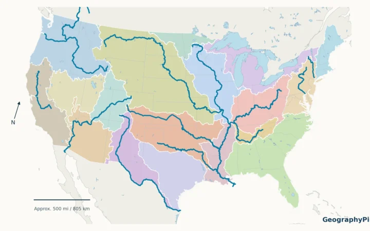
Map: GeographyPin. The named main stem uses the Rio Grande relation and the Río Conchos detail uses selected waterway segments, © OpenStreetMap contributors, ODbL, retrieved November 20, 2026. Pecos line, state borders and coast use public-domain Natural Earth 1:10m. Green is generalized USGS Watershed Boundary Dataset Region 13, not a reconstruction of either IBWC basin-area figure. Highlighted closed areas are Rio Grande Closed Basins (1305) and San Luis (13010003), not an inventory of all disconnected land. The river line gives geographic orientation, not current flow or legal jurisdiction.
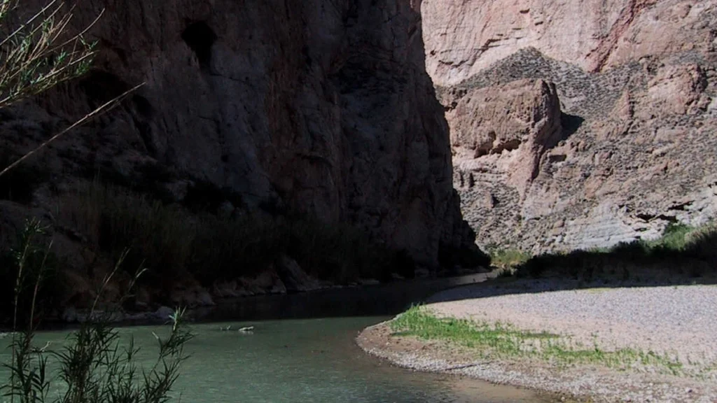
Photograph: Rio Grande at Boquillas Canyon, Stewart Tomlinson / U.S. Geological Survey, April 14, 2002; public domain, cropped and converted to WebP.