American Samoa’s coastlines reveal only the tops of much larger volcanic landforms. Tutuila’s deeply indented harbor and the steep islands of Manuʻa contrast with the territory’s two atolls. Reading those landscapes alongside neighboring Samoa helps separate three different ideas: an island chain, a U.S. territory and an independent country.
American Samoa is an unincorporated U.S. territory in the South Pacific, distinct from the independent country of Samoa. Its five volcanic islands include Tutuila and the Manuʻa group, while Rose and Swains are atolls. Pago Pago is the conventional capital reference on Tutuila; Fagatogo is the constitutional seat of government.
How to use this article: Compare the volcanic landscape, follow the harbor and coast, or locate the capital and government seat.
1. Tutuila, Manuʻa and the Wider Island Setting
American Samoa lies in Polynesia in the southern Pacific Ocean. Its main volcanic islands occupy the eastern part of the Samoan archipelago. Independent Samoa lies to the west; it is not a western district of the U.S. territory.
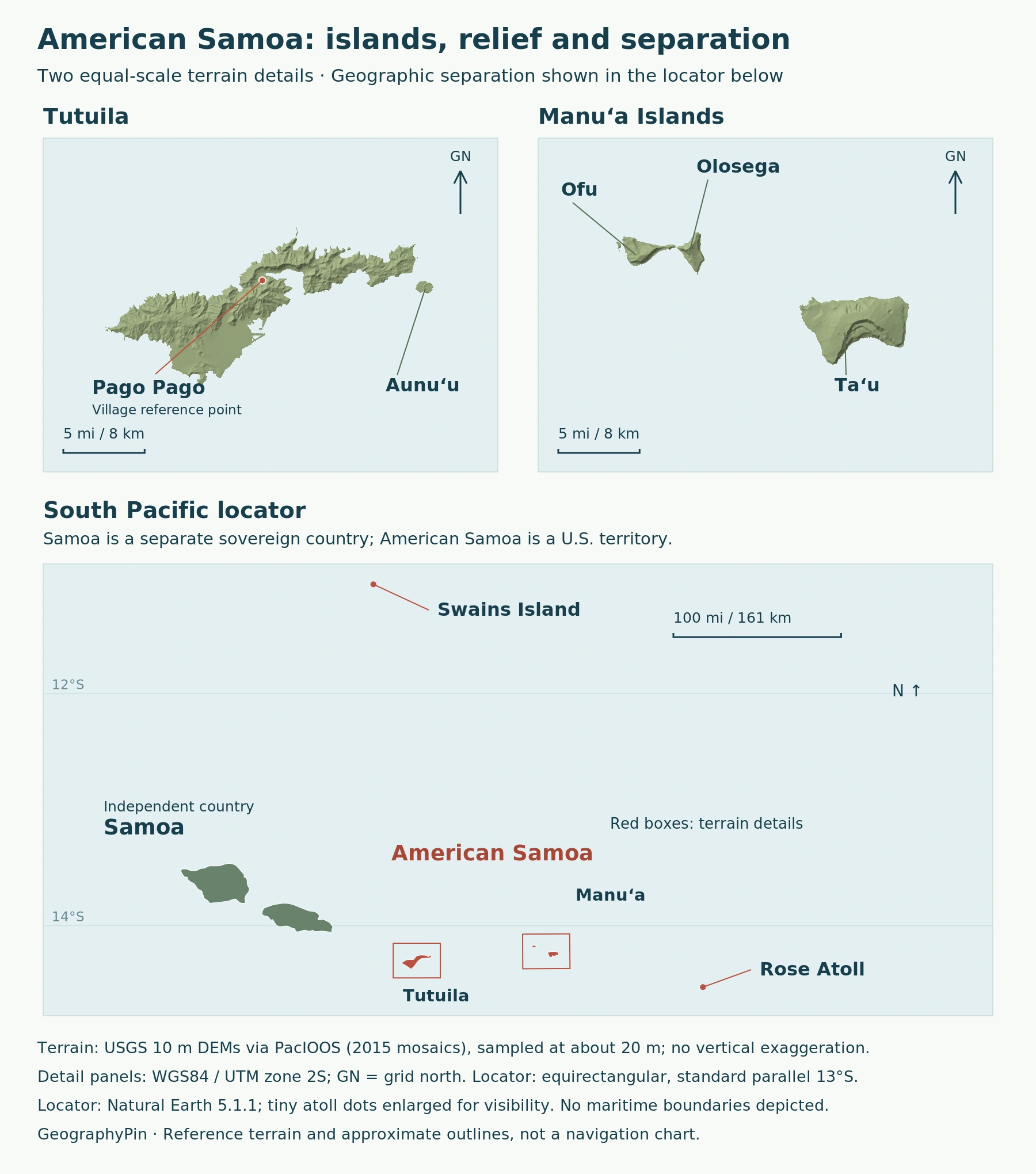
NOAA’s island overview identifies Tutuila, Aunuʻu, Ofu, Olosega and Taʻū as the five volcanic islands. Ofu, Olosega and Taʻū collectively form Manuʻa. That name denotes a group, not an additional sixth volcanic island.
| Island or group | Physical setting | Useful distinction |
|---|---|---|
| Tutuila and Aunuʻu | Volcanic islands | Pago Pago Harbor is on Tutuila |
| Manuʻa | Ofu, Olosega and Taʻū | A group east of Tutuila |
| Rose Atoll | Coral atoll farther east | Not a high volcanic island |
| Swains Island | Low coral atoll farther north | Politically American Samoa; geologically associated with Tokelau |
The remote atolls matter when defining the territory’s extent. Swains, in particular, shows why political membership and geological grouping need not match. A close-up of Tutuila and Manuʻa cannot by itself represent every part of American Samoa.
2. Volcanic Landforms Above and Below the Sea
The visible island is only the summit
The high islands have rugged peaks and relatively limited coastal plains. Their shorelines are not the bases of the volcanoes: much of each volcanic structure continues below the water. The sea-level outline therefore hides a large part of the terrain.
The USGS account of Taʻū describes it as the top of a shield volcano whose bulk lies beneath the ocean. A summit caldera and major landslides have modified the original volcanic shape. Much of the southern caldera has been removed by slope failure, helping explain why the island is not simply a symmetrical cone.
Taʻū and Ofu–Olosega sit along the predominantly submarine Samoan Ridge. This places the emerged islands within a larger underwater landscape rather than treating the spaces between them as geologically empty. The USGS describes these volcanoes as potentially active; that classification is not a statement that an eruption is occurring now.
Rock and sediment also vary at smaller scales. The National Park Service’s geological inventory records volcanic rocks alongside younger carbonate sand, slope debris and stream deposits on Tutuila, and younger sedimentary deposits on Ofu. A sandy beach and a dark rock face can belong to different parts of the same island’s history.
3. Pago Pago Harbor and the Coastal Landscape
Volcanic history shapes a sheltered inlet
Pago Pago Harbor cuts deeply into Tutuila. NASA’s Tutuila overview places the harbor within a collapsed volcanic caldera. The natural deep-water harbor is therefore part of the island’s geological story, not just a convenient gap along an otherwise uniform coast.
Other shorelines show different stages of reshaping. NASA describes wave erosion at Vaiʻava Strait leaving a narrow ridge of volcanic rock, while on nearby Aunuʻu a volcanic cone’s rim encloses a freshwater marsh. These examples connect the original volcanic structure with later erosion, water accumulation and coastal landforms.
Reefs and forests add another layer to that physical setting. The National Park Service describes rainforest, coastal forest, wetlands, beaches and coral communities within its island units. The protected landscape crosses the shoreline, so the land and nearby marine habitats belong in the same geographic account.
The national park protects particular land and marine areas across several islands. Its boundaries are not the territorial boundary, and the presence of a park unit does not mean an entire island lies inside the park.
American Samoa’s tropical climate brings rain throughout the year, with a wetter period from November through April in NOAA’s climate overview. Steep terrain, vegetation and coastal lowlands consequently sit within a wet tropical environment, not a dry volcanic landscape.
4. Pago Pago, Fagatogo and the Census Geography
Capital reference and government seat are not identical labels
NOAA identifies Pago Pago on Tutuila as the capital. For the more precise government location, the American Samoa Historic Preservation Office identifies Fagatogo village as the constitutional seat of government and the location of the Fono, or legislature.
These references should be read together rather than forcing every office, settlement and harbor feature onto one map point. Pago Pago is the familiar capital reference, while Fagatogo identifies the seat named in the constitutional framework. A harbor label and a village label also serve different purposes on a local map.
The 2020 census counted 49,710 residents in American Samoa as of April 1, 2020. That is the territory’s census population, not the population of Pago Pago village or a current estimate.
The Census Bureau reports separate district, county and village tables. These geographic units make it possible to study settlement patterns without treating an island, a village and the whole territory as interchangeable areas.
5. A U.S. Territory, Separate From Samoa
American Samoa is an unincorporated U.S. territory, not an independent sovereign country or a U.S. state. The National Park Service’s regional explanation explicitly distinguishes it from independent Samoa within the wider archipelago.
The Interior Department traces the territorial relationship through the cession of Tutuila in 1900, Manuʻa in 1904 and congressional inclusion of Swains in 1925. It also explains that American Samoa adopted its own constitution in 1967 without a congressional organic act.
This distinction explains the technical term unorganized territory, used alongside “unincorporated” and “self-governing” in NOAA’s 2022 sanctuary condition report. “Unorganized” refers to the absence of a congressional organic act; it does not mean the territory lacks a government or constitution.
The separation from Samoa also matters in country lists. Our world map with countries follows a sovereign-country roster. American Samoa is not another name for independent Samoa and does not add a second sovereign Samoa to that list.
What Did We Learn Today?
American Samoa combines high volcanic islands with remote coral atolls. Tutuila’s harbor and the modified volcanoes of Manuʻa show why coastal outlines reveal only part of the landscape. Pago Pago and Fagatogo require distinct geographic labels, while the U.S. territory must remain separate from independent Samoa in maps and country lists.
Sources & Data Notes
Sources, dates and map conventions
Population refers to April 1, 2020. Island grouping follows NOAA, while USGS and NPS sources support the volcanic-landform discussion. Pago Pago is the conventional capital reference; the territorial Historic Preservation Office identifies Fagatogo as the constitutional seat. The technical status terminology is explained through Interior Department information and NOAA’s 2022 report.
- NOAA: island grouping and sanctuary geography
- NOAA: landscape, capital and tropical climate
- USGS: Taʻū volcanic history
- NPS: American Samoa geodiversity atlas
- NASA: Tutuila landforms and Pago Pago Harbor
- American Samoa Historic Preservation Office: Fagatogo
- U.S. Census Bureau: April 1, 2020 population
- U.S. Interior Department: territorial framework
- NOAA: 2022 sanctuary condition report, territorial status on printed page32
- NPS: American Samoa and independent Samoa regional distinction
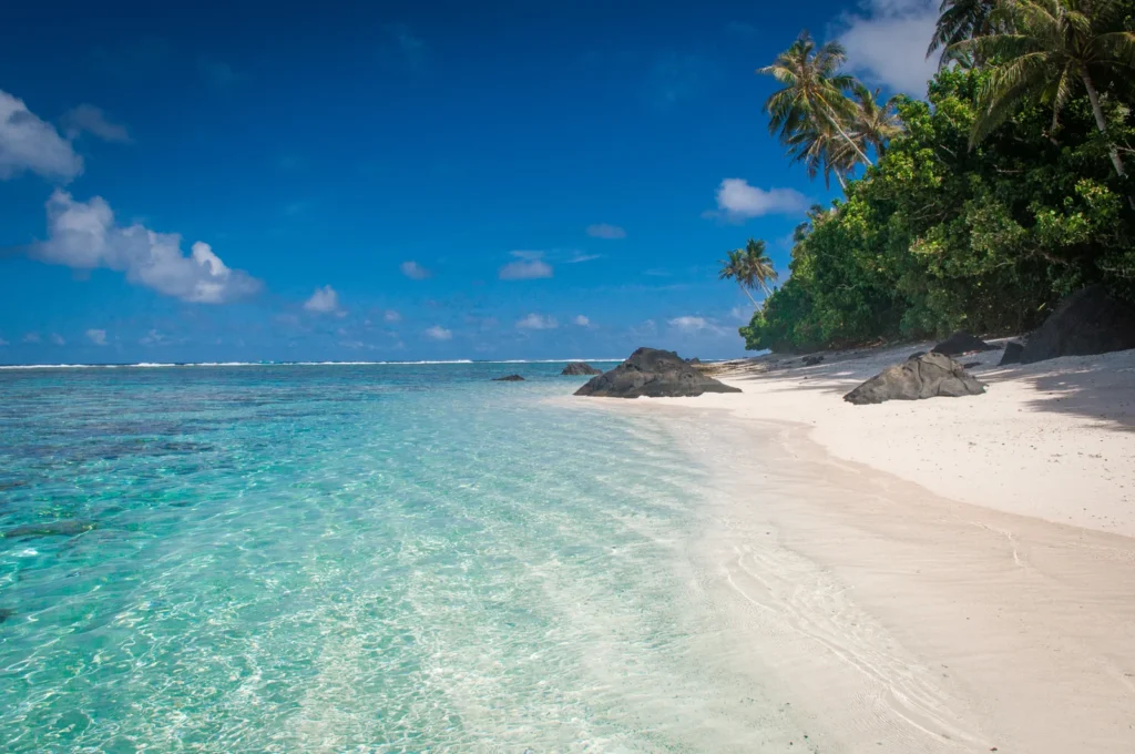
Featured photo: Ofu beach, June 22, 2012. Bob Meadows / NPS Natural Resources, via Wikimedia Commons; public domain in the United States, resized.
