The Mackenzie starts at a lake outlet in the Northwest Territories, not at a mountain spring. Yet a map of the whole river system reaches back to mountain headwaters in British Columbia. Those are two different routes to measure.
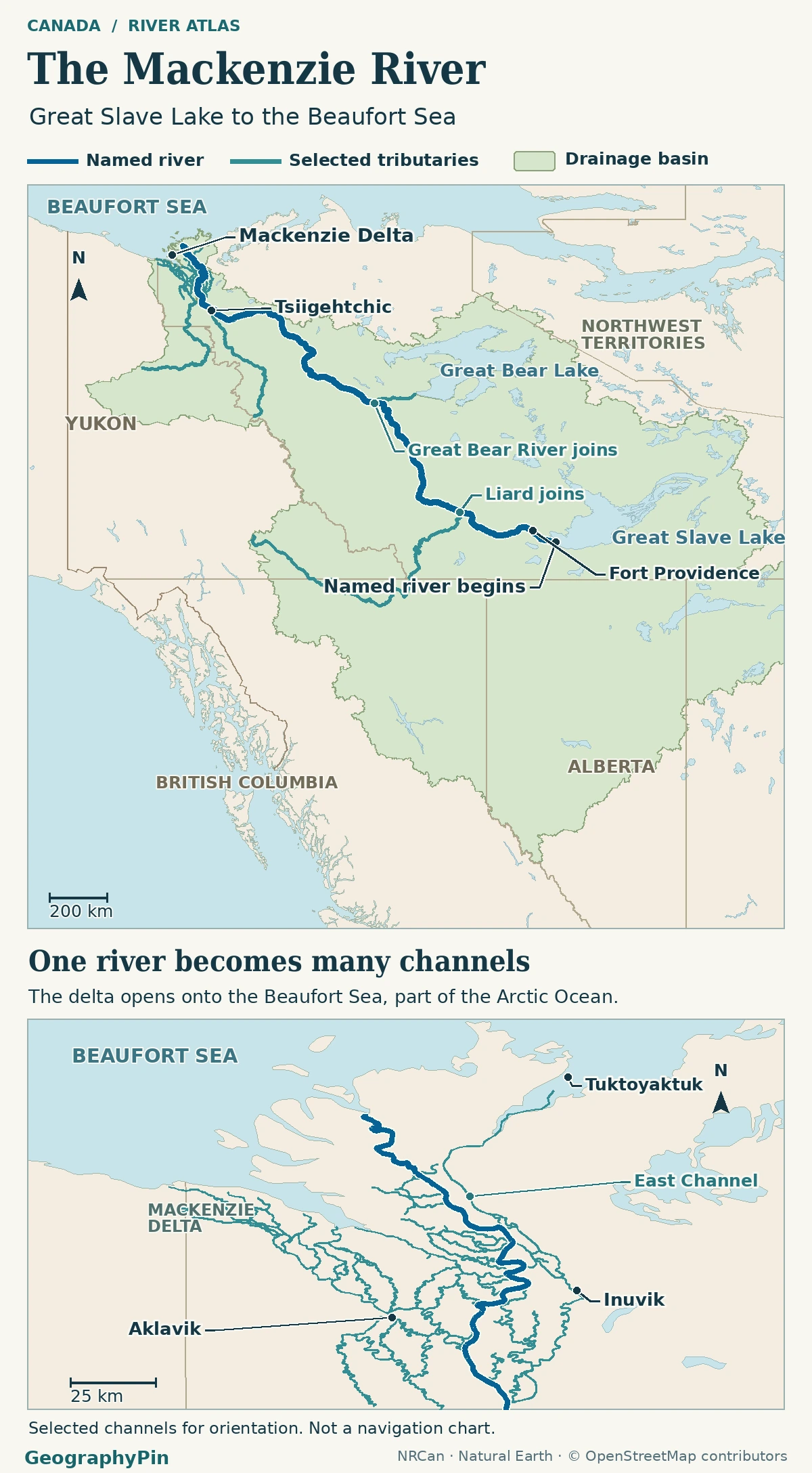
The Mackenzie River starts at the western outlet of Great Slave Lake and runs through the Northwest Territories to the Beaufort Sea, part of the Arctic Ocean. Its named channel is about 1,080 miles (1,738 km) long. The much longer system measurement follows connected rivers upstream of the lake to the head of the Finlay.
How to use this article: Find the lake outlet, compare the two river lengths, or see what the lower gauge measures.
Great Slave Lake is the start of the named Mackenzie
Look for the western outlet near Fort Providence
Start at the western end of Great Slave Lake, near Fort Providence in the Northwest Territories. Water leaving the lake becomes the named Mackenzie River there. On the opposite side of that distinction is the Slave River, a major inflow that enters the lake from the south. The Slave and the Mackenzie are not two names for the same part of the course.
The Mackenzie River Basin Board describes a chain extending back through the Slave River and the Peace–Athabasca Delta. The Peace continues as the Slave below its meeting with Rivière des Rochers, a route for water leaving Lake Athabasca. So the lake at the named river’s start has already collected water from a large part of western Canada.
Why the full river system is much longer
The main stem and the connected route start in different places
| What is measured | Starting point | Reported length |
|---|---|---|
| Named Mackenzie main channel | Great Slave Lake’s west outlet | About 1,080 miles (1,738 km) |
| Connected Mackenzie river system | Head of the Finlay River in British Columbia | About 2,635 miles (4,241 km) |
The Northwest Territories water report gives the main-channel figure; Statistics Canada’s Atlas of Canada table gives the longer figure measured to the head of the Finlay. Reading the connected route downstream, follow Finlay → Peace → Slave → Great Slave Lake → Mackenzie. This traces connected waters, not a second start for the named Mackenzie. The Finlay now enters Williston Reservoir; the British Columbia naming record documents the flooding of its former lower reach.
The Liard junction and the turn north
From Great Slave Lake, the Mackenzie goes west toward Fort Simpson, where the Liard joins. Downstream it turns north. The territorial Dehcho hydrology report puts the drainage area near the lake outlet at about 378,000 square miles (980,000 square kilometers) and the area just below the Liard at Fort Simpson at about 490,000 square miles (1.27 million square kilometers).
Those are the areas upstream of two different points, not two estimates of the same basin. Farther north, Great Bear Lake empties through the Great Bear River, which joins the Mackenzie separately. Follow the main channel north for the route; look sideways to see how far tributary valleys extend the drainage area.
The Mackenzie Delta opens to the Beaufort Sea
Below Tsiigehtchic, the lower river enters a delta rather than ending at one narrow channel. Water divides among branches that carry it across the low ground to the Beaufort Sea. A line at the scale of the whole basin must simplify those branches; do not read a single outlet symbol as the only way the Mackenzie reaches the sea.
The main channel lies in the Northwest Territories, but the whole basin, about 695,000 square miles (1.8 million square kilometers) in the Canada Water Agency basin overview, extends far beyond it. The coastline marks where the system meets the sea; the watershed boundary is the inland divide showing which land feeds it.
A gauge reads one point in the lower river
The Arctic Red River station is above the delta
The station named Mackenzie River at Arctic Red River (10LC014) measures the Mackenzie, not only the Arctic Red tributary whose name appears in the station title. The Water Survey of Canada station register lists roughly 655,000 square miles (1.70 million square kilometers) of gross drainage area upstream of that gauge. It does not measure the separate flow through every delta channel.
At that station near Tsiigehtchic, the archived monthly mean was about 123,000 cubic feet per second (3,480 m³/s) in February 1999 and 692,000 cubic feet per second (19,600 m³/s) in June 1999. Those two months illustrate the seasonal rise described in the territorial hydrologic report’s 1972–1999 record. They are not present-day readings or measurements at the coast.
Frequently Asked Questions
What names might appear instead of Mackenzie River?
The Northwest Territories water report records Dehcho in South Slavey, Deho in North Slavey, Nagwichoonjik in Gwich’in, Kuukpak in Inuvialuktun and Grande Rivière in Michif. The government and Indigenous partners’ nomination announcement uses multiple names for the river.
Which other rivers enter Great Slave Lake before water leaves as the Mackenzie?
The basin board’s annual report names the Hay, Lockhart and Taltson alongside the Slave River. Their water joins the lake before reaching the Mackenzie outlet; they do not enter the named Mackenzie separately downstream.
Is the Peace–Athabasca Delta the same as the Mackenzie Delta?
No. The Canada Water Agency overview identifies them as separate deltas in one watershed. The Peace–Athabasca Delta is inland beside Lake Athabasca. The Mackenzie Delta is the coastal one, where the named Mackenzie reaches the Beaufort Sea.
Does the basin on the map end at the Canadian provincial and territorial lines?
No. Those lines show administrative jurisdictions. The basin edge follows drainage divides. The whole basin includes land beyond the Northwest Territories even though the named main stem is entirely in that territory.
What Did We Learn Today?
The named Mackenzie starts at Great Slave Lake, takes in the Liard near Fort Simpson and reaches the Arctic through the Beaufort Sea delta. Its longer system length begins at the Finlay headwaters. Use the measured starting point for a length, the shaded land for watershed extent and the station name and recording period for flow.
Sources & Data Notes
The Northwest Territories water and hydrology reports, Statistics Canada’s Atlas of Canada table, the Mackenzie River Basin Board, British Columbia’s geographical names record, the Canada Water Agency and the Water Survey of Canada provide the geographic and gauge references. Converted areas are rounded and flow timing refers to the specified historical record. AI tools assisted in preparation.
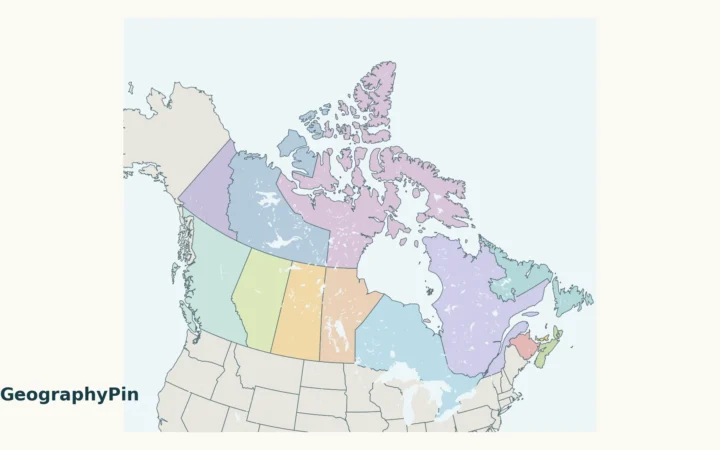
Map: GeographyPin. Drainage shading combines Atlas of Canada watershed units: Great Slave Lake Drainage Area, the selected Liard/Mackenzie/Great Bear/Lower Mackenzie sub-basins, and upper, central and lower Peel including western Mackenzie Delta. Neighboring direct Beaufort Sea coastal watersheds are excluded. Contains information licensed under the Open Government Licence – Canada. Geography is generalized; no original basin area is measured from it. Main stem, selected tributaries and selected delta channels use OpenStreetMap ODbL data examined Nov 20, 2026; main relation 2824475, plus Liard 7910706, Great Bear 9175104, Arctic Red 13577577 and Peel 13577580. Coastline and generalized regional boundaries use Natural Earth 1:10m, public domain. The Northwest Territories water chapter and Dehcho hydrologic overview support the outlet and tributary distinctions. The basin’s longer headstream convention is not drawn as the named river.
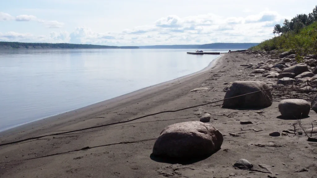
Mackenzie River at Fort Simpson photograph: David Adamec, July 2009, Wikimedia Commons, released into the public domain by the photographer; slightly cropped and converted to WebP.