A forested mountain reservoir and a resort community share the name Lake Arrowhead. That makes a simple map search less straightforward than it looks: finding the destination does not tell you which shoreline or boating facilities you can use. The useful starting point is to separate the waterbody, the surrounding settlement and the permissions attached to particular activities.
Lake Arrowhead is a freshwater reservoir on Little Bear Creek in California’s San Bernardino Mountains. The name also identifies the surrounding unincorporated community. Its water supports local supply and recreation, but lake use is restricted: visiting the community is not the same as having permission to boat, swim or use shoreline facilities.
1. Where is Lake Arrowhead?
The reservoir and the settlement
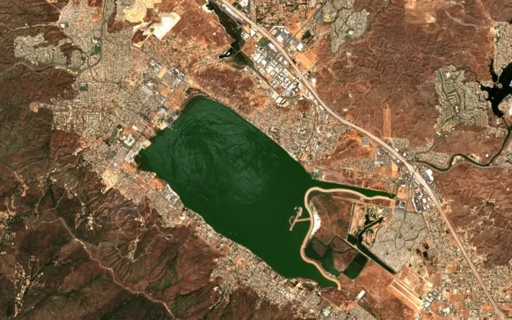
This Lake Arrowhead is in San Bernardino County, Southern California. Its mountain setting distinguishes it from the Lake Arrowhead namesake in Texas. The reservoir is the blue waterbody on the map; the community extends across surrounding land and is not simply another name for the water surface.
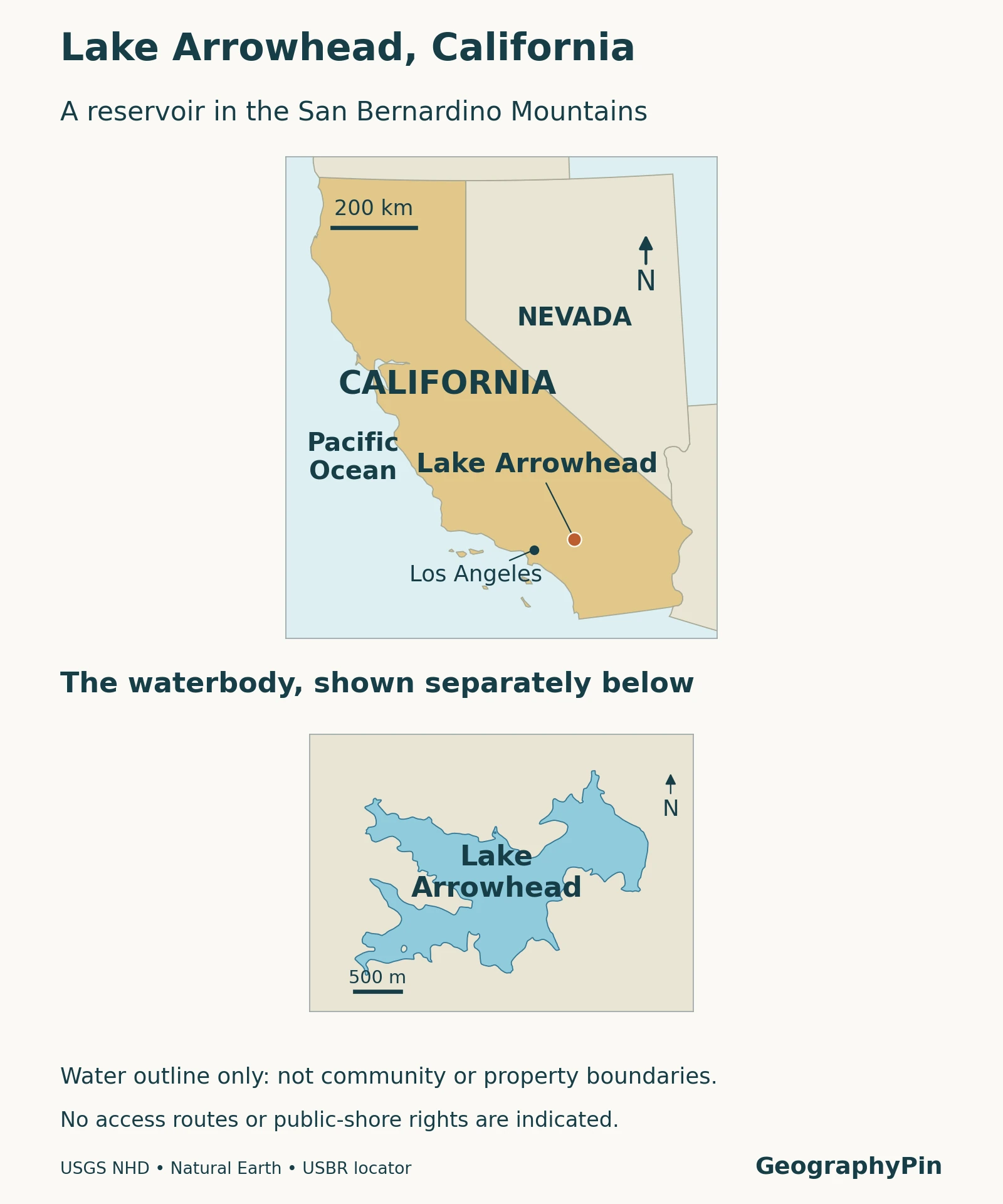
Lake Arrowhead Village is a lakeside visitor destination within that broader setting. A business address or a hotel’s use of “Lake Arrowhead” should therefore not be interpreted as a location directly on the water, or as evidence of lake-access rights. Check the actual property and the activity you intend to do, rather than relying on the destination name alone.
The map is for geographic orientation. It does not show property ownership, legal access easements or a continuous public shoreline trail. Those are different kinds of information and require current, more detailed sources.
2. What the lake’s measurements describe
Area, storage and elevation are different quantities
| Measure | Reference value | What it means |
|---|---|---|
| Waterbody type | Freshwater reservoir | Impounded water, not proof of a naturally formed mountain lake. |
| Approximate surface area | 780 acres (3.16 km²) | Descriptive figure in LACSD’s June 2024 budget packet, not a new shoreline survey. |
| Approximate storage | 47,000 acre-feet (58 million m³) | Volume described in the same district document, not today’s measured contents. |
| ALA full-lake reference | 5,106.70 feet (1,556.52 m) | Published association reference elevation; the visible table does not specify a vertical datum. |
| Location | San Bernardino County, California | Mountain reservoir and surrounding unincorporated community. |
An acre measures area; an acre-foot measures volume. A reservoir covering 780 acres does not contain 780 acre-feet of water. Storage depends on the shape and depth of the submerged basin as well as the water level. Likewise, surface elevation is a height relative to a reference system, not the depth beneath a boat.
The association’s lake-level page separates its full-lake reference from a dated current reading. Use that timestamped page for changing conditions. Reclamation’s catalog also lists an elevation for a location record, but that metadata is not identified as full-pool water-surface elevation; it should not replace the association’s operational reference. Neither number supplies a verified maximum depth.
3. How the reservoir developed
A water project that became a resort setting
Reclamation describes initial development in the 1890s as a proposed diverted water supply for the San Bernardino area. Those intended diversions did not materialize. The reservoir, formerly known as Lake Little Bear, subsequently became associated with the Lake Arrowhead resort community.
This history matters when interpreting the landscape. A mountain setting does not make every lake glacial, and a wooded shoreline does not make a waterbody natural. Here, the dam and impoundment are essential to the explanation. The reservoir’s recreational identity came to coexist with its practical water-supply role rather than eliminating it.
For the wider distinction, see what makes a waterbody a lake. “Reservoir” identifies how water is retained and managed; “lake” is also used in the everyday name. The two descriptions are not contradictory.
4. A mountain catchment and a local water supply
The water is more than scenery
Little Bear Creek is the named stream associated with the dam and reservoir in the federal record. The Lake Arrowhead Community Services District withdraws reservoir water for treatment and distribution to local residents. Recreation and drinking-water supply are therefore connected uses of the same waterbody, not separate lakes with the same name.
A catchment is the land from which water drains toward a receiving stream or lake. Its boundary follows drainage divides, not a postal address or the edge of a resort development. Rainfall, runoff, withdrawals and releases can change the amount of water held in a reservoir. A shoreline photograph captures one moment, not a permanent storage level.
The locator shows the reservoir, not its watershed boundary. Reclamation’s administrative regional label should also not be mistaken for a statement that the lake drains into the Colorado River. Agency jurisdictions and physical drainage basins are different maps.
5. Visiting the community versus using the lake
Check the permission for the specific activity
The following panel summarizes access information checked in November 2026. It is a guide to which organization to consult, not a parcel-specific legal opinion or a promise that an activity will be operating on your travel date.
| Situation | What to establish first |
|---|---|
| Visiting the community or Village | Check the individual destination’s public opening and parking arrangements. A visit is not general lake-use permission. |
| Personal boating or beach-club use | Consult ALA’s membership categories and current rules; different membership types provide different privileges. |
| Camping nearby | North Shore Campground’s official listing specifically says the private lake is not accessible from the campground. |
| Taking a boat tour | The Lake Arrowhead Queen operator sells tour tickets. That specific service is distinct from unrestricted personal boating. |
ALA’s published eligibility rules refer to residential property owners in Arrowhead Woods, with stated exceptions, and require membership for boating access. Do not assume that buying any nearby property, renting a cabin or staying at a hotel automatically provides the same rights. Ask what the particular arrangement includes and confirm it with the relevant organization before bringing a vessel.
Conversely, describing the lake as private should not imply that the whole community is closed or that no visitor can experience the water. A ticketed operator tour is a concrete example of a visitor activity with its own arrangements. It does not turn all shoreline land or boat-launch facilities into public access.
6. Planning a visit without confusing the places
Start with the experience you want: a village visit, a forest campground stay, a boat tour or a permitted lake activity. Then confirm access and operating information for that specific choice. This avoids planning a beach day from a photograph of a private dock, or assuming a nearby campsite includes swimming in the reservoir.
For road conditions, use Caltrans QuickMap rather than a general travel description. Mountain roads and visitor services can be affected by changing conditions. The geographic map here is deliberately not a route planner, an opening-hours notice or a statement that a particular road is currently passable.
Finally, keep water measurements separate from travel arrangements. A published lake level does not establish swimming permission, and a tour ticket does not provide access to unrelated shoreline facilities. Understanding those distinctions makes Lake Arrowhead easier to navigate as both a physical landscape and a lived-in community.
What Did We Learn Today?
Lake Arrowhead is a California mountain reservoir as well as the name of a surrounding community. Its approximate area and storage describe different measurements, while a current water level needs its own timestamp and reference. Most importantly for visitors, reaching the destination does not establish permission to use the lake: membership arrangements, nearby camping and ticketed tours must be considered separately.
Sources & Data Notes
Area and storage are approximate descriptive values from a June 2024 district budget packet, not a new bathymetric survey. The full-lake elevation is ALA’s published reference, with no datum stated in its visible table. Access information was reviewed in November 2026 and should be checked again with the responsible organization before a visit. The map is not a property, access-rights or navigation map.
- Bureau of Reclamation: Lake Arrowhead sedimentation-survey catalog. Location, historical development and water use; catalog metadata is not treated as a full-pool survey.
- Lake Arrowhead Community Services District, June 25, 2024 board packet. Approximate area, storage and community setting.
- Arrowhead Lake Association: Lake Level/Statistics. Reference pool and separately timestamped readings.
- Arrowhead Lake Association: Types of Membership. Eligibility and differing activity privileges.
- Recreation.gov: North Shore Campground. Specific campground and lake-access distinction.
- Lake Arrowhead Queen. Ticketed visitor tours; consult the operator for current arrangements.
- Caltrans QuickMap. Current road-condition service.
- USGS National Hydrography and Natural Earth. Original map source geometry; Reclamation supplies the locator point.
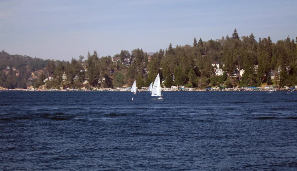
Featured photograph: Takwish / Wikimedia Commons, CC BY-SA 3.0. Photographed July 2007; resized and converted to WebP. The adapted photograph retains that license.