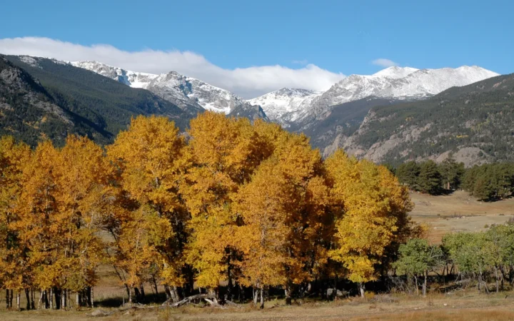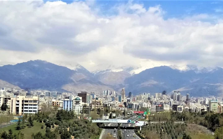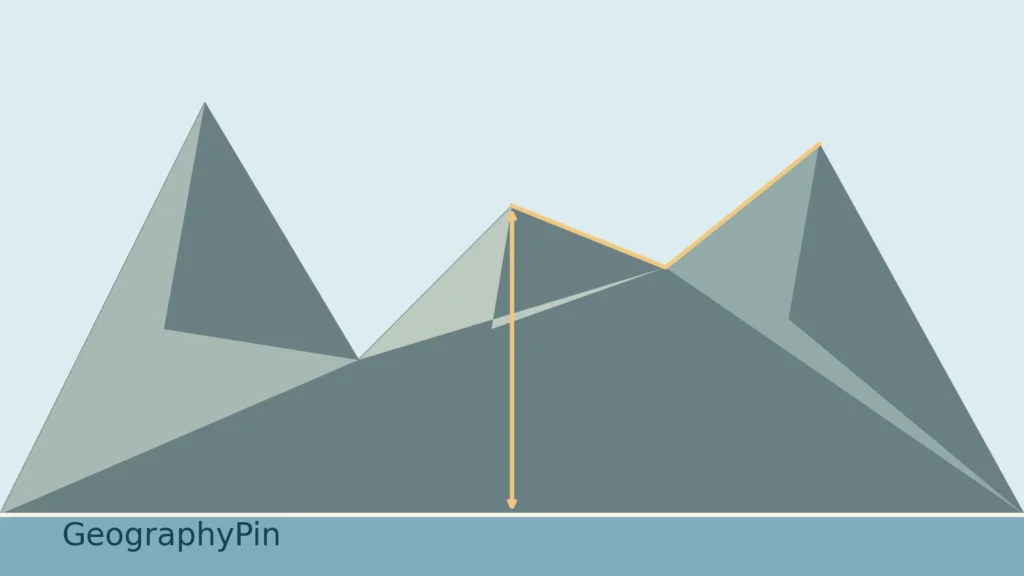
A high number beside a summit does not fully explain why a landscape is mountainous. The surrounding terrain matters too. Understanding mountains means separating their form, their height measurements and the processes that built and reshaped them, rather than looking for one worldwide hill-to-mountain cutoff.
A mountain is an elevated landform that rises substantially above its surroundings, commonly with marked slopes and one or more summits. There is no single universal elevation threshold separating every mountain from every hill. Elevation, local relief and prominence describe different aspects of its height, while tectonic deformation, faulting and volcanism help explain its formation.
How to use this article: Check why thresholds differ, compare three height measurements, or explore mountain-building processes.
1. A mountain rises above its surroundings
A mountain is an elevated landform that stands substantially above surrounding terrain, commonly with pronounced slopes and one or more summits. The description is useful, but it does not supply a universal numerical boundary between a hill and a mountain. Shape, local relief, naming traditions and the purpose of a classification all matter.
The USGS: Mountain, hill and peak terminology notes that the U.S. Board on Geographic Names has no official definition separating mountain, hill and peak. That is a statement about its naming system, not a rule requiring every country or scientific project to use identical terminology.
Why one height threshold is not enough
The Global Mountain Biodiversity Assessment: Mountain definition explains that different methods identify mountainous terrain differently. Its research definition uses terrain ruggedness rather than a minimum elevation above sea level. The older UNEP-WCMC: Mountains of the World classification combines elevation with slope and local elevation range.
These are tools for mapping mountain areas, not universal instructions for naming individual summits. A high, relatively level surface and a rugged low-elevation landscape can be treated differently depending on the method. Before comparing a mountain-area statistic, check how its authors defined the terrain.
2. Elevation, local relief and prominence
The word “height” needs a reference. Elevation compares a point with an adopted vertical datum, often described in everyday language as sea level. It is not the distance from whatever valley happens to be closest. For example, the Ordnance Survey: Ordnance Datum Newlyn explains the fixed reference used for heights in Great Britain, rather than treating the tide at the moment of measurement as zero.
The British Geological Survey: Relief defines relief through differences in height across the land surface. Local relief therefore depends on the surroundings being compared. A summit above a selected valley and a summit above a broad plateau can present very different height contrasts.
One imaginary summit, three answers
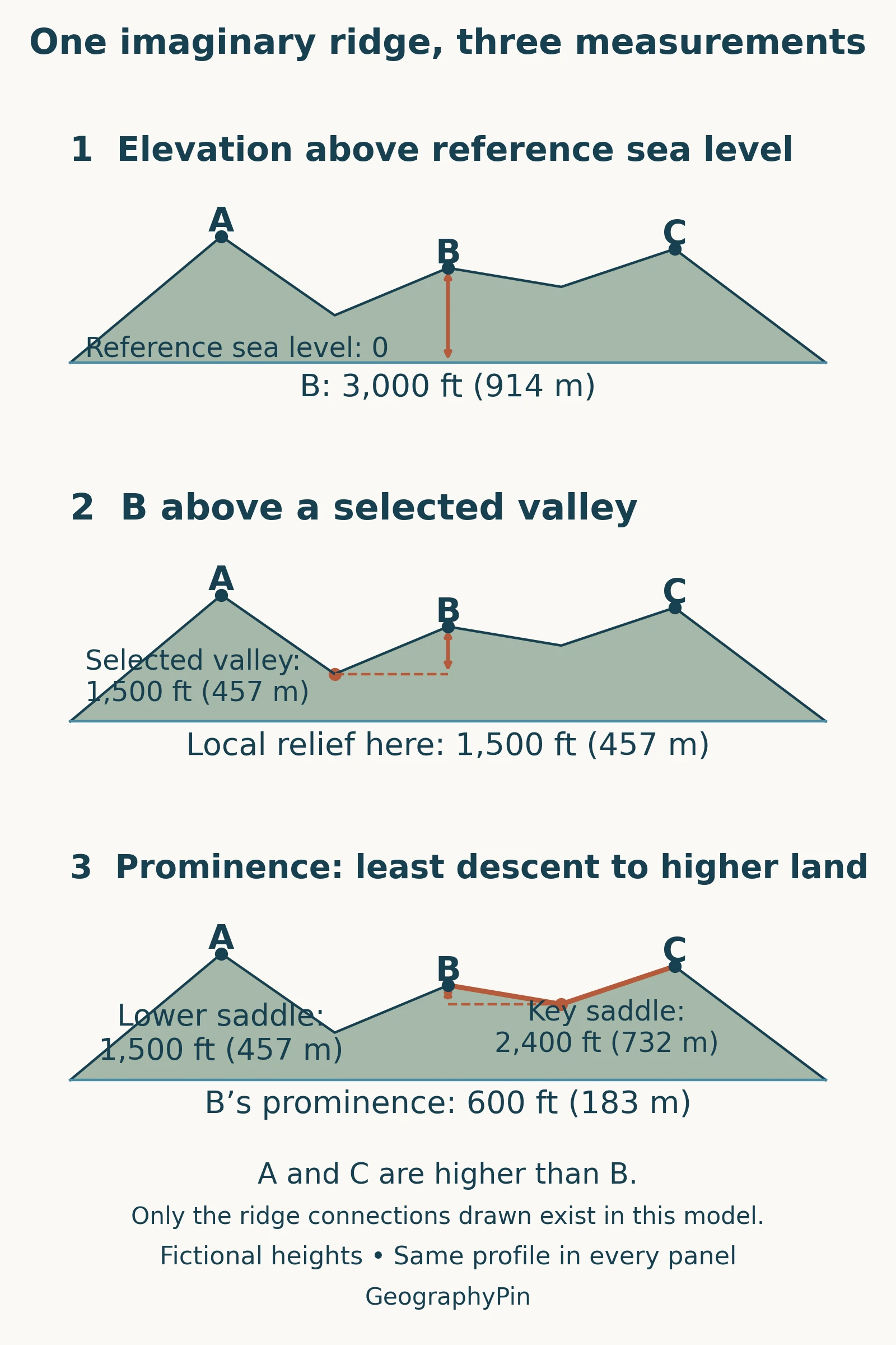
B stands at 3,000 feet (914 meters) above the reference level. Compared with the selected 1,500-foot (457-meter) valley, its local rise is 1,500 feet (457 meters). Its prominence is only 600 feet (183 meters), because the higher connecting saddle toward C lies at 2,400 feet (732 meters).
Andrew Kirmse: Topographic Prominence explains prominence as the minimum vertical descent needed before reaching higher terrain. The deepest nearby valley is not automatically the controlling saddle. Our detailed prominence versus elevation guide explains real-world saddle identification and why one arbitrary cross-section cannot establish it.
None of these measures equals a walk’s total ascent. That depends on the route and every climb along it, not simply a summit label.
3. How mountains form
Mountains can develop through several interacting processes. The National Park Service: Tectonic landforms and mountain building describes folding, fault movement and volcanism as important ways of building mountainous terrain. These are explanatory categories, not three boxes into which every mountain must fit perfectly.
Compression, fault movement and volcanic accumulation
| Process | What happens | Important qualification |
|---|---|---|
| Compression and deformation | Rock layers fold, fault and become incorporated into uplifted terrain. | Folding and thrust faulting can operate together. |
| Fault-block movement | Blocks of crust move relative to one another along faults, creating differences in elevation. | A mountain front can reflect both raised terrain and a lowered neighboring basin. |
| Volcanic accumulation | Erupted material builds a volcanic landform over successive eruptions. | Not every volcano has a steep, pointed cone. |
The Himalayas illustrate continental collision. The National Park Service: Evidence of plate motions describes their development where India and Asia converge. This involves deformation of a large region, not simply two rigid slabs pushing up one neat crease. “Fold mountains” is a useful introductory label, but the wider mountain belt contains complex structures.
Volcanic mountains add material at the surface. The British Geological Survey: Types of volcano explains that fluid basaltic lava can spread widely and build broad shield volcanoes, while more viscous material can accumulate nearer a vent. Mauna Loa is a shield-volcano example. A gently sloping volcanic mountain is still a mountain; steepness and a dramatic point are not compulsory features of every named summit.
A formation category describes an important part of a mountain’s history, not necessarily its entire appearance today. Later erosion can modify an uplifted block, a folded belt or a volcano so strongly that its original form is difficult to recognize.
4. Mountain, summit, ridge, range and plateau
These words refer to different aspects or scales of terrain. A summit is the highest part of a hill or mountain in ordinary use; a ridge is an elongated crest. A mountain range groups related mountainous terrain rather than naming one summit. The USGS: Geographic Names Information System feature classes uses broad categories for storing geographic names, which should not be confused with a complete geological classification.
A plateau emphasizes a relatively extensive elevated surface, often with gentler terrain on top. The National Park Service: Plateaus and mesas describes extensive elevated surfaces bordered by steep slopes, as well as smaller, flat-topped mountains or hills called mesas. A mountain need not end in a sharp point. The words describe different relationships, so a flat upper surface does not automatically make “mountain” an incorrect place name.
Hill and mountain overlap in ordinary naming. Treat a local name as a name first, then examine the actual terrain. The label alone cannot tell you a summit’s elevation, the steepness of its sides or the difficulty of reaching it.
This is a basic habit of geographical thinking: distinguish the object you are describing from the scale and measurement used to describe it. A summit, a mountain group and an entire mountainous region are not interchangeable units.
5. Mountains change after they rise
Mountain building and erosion can happen at the same time. The British Geological Survey’s relief guide explains how rock properties and structure influence which parts of a landscape resist erosion. Water, weathering and the removal of material help reshape the terrain rather than merely reducing every summit at the same rate.
The USGS: Young mountains, old rocks — the Teton Range offers a particularly clear example of different geological clocks. Ancient rocks form much of the Teton Range, but normal faulting responsible for much of its modern mountain-front relief began far later. Movement raised the range relative to Jackson Hole, and glaciers subsequently helped carve its valleys.
Consequently, “How old is this mountain?” needs a more precise question. The age of its rocks may be very different from the age of a fault movement, an uplift episode or a glacial valley. A photograph records the present shape, not a single geological birthday.
Frequently Asked Questions
Does an online elevation reading give the exact summit height?
Not necessarily. USGS: Mountain peak elevations explains that elevations interpolated from a terrain grid may miss the precise highest point. A surveyed summit elevation and an approximate reading from a digital terrain model are not equivalent measurements.
What Did We Learn Today?
A useful mountain description says more than “high land.” It identifies the surrounding relief, keeps elevation separate from prominence, and explains the processes behind the terrain. Naming conventions and mapping definitions serve different purposes, while ancient rocks and a much younger mountain landscape can be part of the same place.
Sources & Data Notes
The three-peak diagram and featured illustration are original GeographyPin teaching graphics, not real terrain or survey data. The complete fictional network has A at 4,000 feet (1,219 meters), B at 3,000 feet (914 meters) and C at 3,600 feet (1,097 meters); the two connecting saddles are 1,500 feet (457 meters) and 2,400 feet (732 meters). No unshown connection exists in the model. Local relief uses the explicitly selected left valley, not a universal base. Metric equivalents are rounded from feet using 1 foot = 0.3048 meters; calculations use the unrounded feet.
Precise prominence methodology also follows Gaurav Sinha’s 2008 dissertation on topographic eminences, section 3.4.2, page 63. No dissertation illustration is reproduced. The GMBA and UNEP-WCMC methods are examples of different research definitions, not a universal legal standard.
- USGS: Mountain, hill and peak terminology
- Global Mountain Biodiversity Assessment: Mountain definition
- UNEP-WCMC: Mountains of the World
- British Geological Survey: Relief
- Ordnance Survey: Ordnance Datum Newlyn
- Andrew Kirmse: Topographic Prominence
- National Park Service: Tectonic landforms and mountain building
- National Park Service: Evidence of plate motions
- British Geological Survey: Types of volcano
- National Park Service: Plateaus and mesas
- USGS: Geographic Names Information System feature classes
- USGS: Young mountains, old rocks — the Teton Range
- USGS: Mountain peak elevations