The Dolomites are famous for pale towers and steep mountain walls, but their geography is easier to understand as a collection of groups rather than one continuous ridge. Their rocks also tell a longer story than their appearance suggests: marine sediment, later Alpine deformation and continuing erosion all helped create the landscape.
The Dolomites are a mountain region in northeastern Italy’s Alps, made up of distinct massifs, valleys and plateaus. Many characteristic cliffs expose carbonate rocks formed in ancient marine environments and later raised and reshaped during Alpine mountain building. The nine-part UNESCO World Heritage property protects selected areas, not the whole geographical region.
How to use this article: Start with the map’s mountain groups, explore the limestone exception, or check the nine UNESCO systems.
1. Where are the Dolomites?
The Dolomites are a mountain region of the Italian Alps, in northeastern Italy. They are not a separate country, one municipality or one uninterrupted ridge. Their landscape contains individual massifs, high plateaus, valleys and passes, so a familiar photograph of one group shows only a small part of the region.
The map below locates selected groups and landmarks rather than drawing an exact outer boundary. Brenta lies toward the west; Marmolada, Sella and the Pale di San Martino provide central reference points, while the Tre Cime di Lavaredo help orient the northern part of the region. These are examples, not a complete inventory.
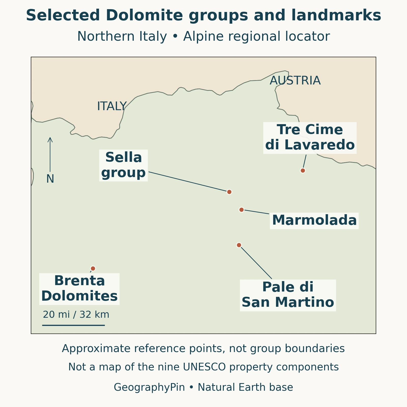
Read the groups, not one continuous wall
A massif is a substantial mountain body or group, not necessarily a long chain with a single crest. Valleys can separate neighboring groups even where their cliffs appear to join in a distant view. For geographic orientation, identify the group first, then the valley or lake beside it.
This also prevents a common scale error: the Dolomites and their UNESCO World Heritage property are related, but they are not interchangeable areas on a map. The protected property consists of selected components within the wider mountain setting.
2. Different groups, different settings
Brenta, the northern groups and Marmolada
The Dolomites UNESCO Foundation: Brenta Dolomites describes Brenta as the westernmost Dolomite group. Its main ridge runs broadly north–south, with the Val di Non to the east, Val di Sole to the north and the Giudicarie valleys to the west. This is a useful counterweight to the idea that all Dolomite scenery lies immediately around the best-known eastern viewpoints.
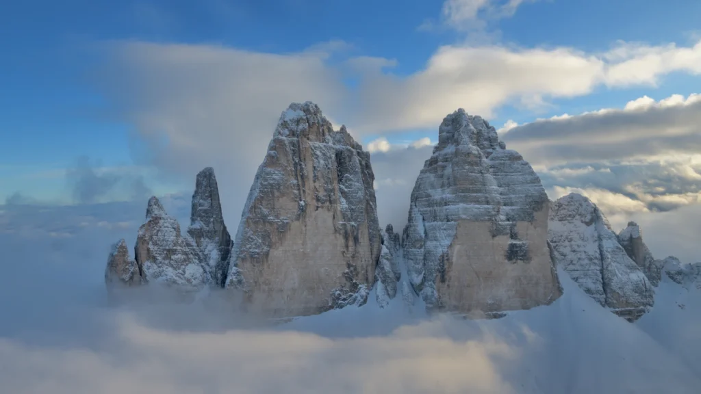
The Dolomites UNESCO Foundation: Northern Dolomites brings together several distinct mountain areas, including Sesto–Cadini, Fanes–Senes–Braies, Tofane–Cristallo and the Cadore Dolomites. Tre Cime di Lavaredo belongs to this northern setting. Its three recognizable towers should not be used as a substitute name for the whole mountain region.
Nearby valleys help distinguish the groups. The Foundation identifies the Landro valley between Sesto–Cadini and Fanes–Senes–Braies, and the Val d’Ansiei between Sesto–Cadini and Cristallo. These separations matter more for reading a detailed regional map than the impression of one solid skyline.
Marmolada supplies a different reference point. The Dolomites UNESCO Foundation: Marmolada gives Punta Penia an elevation of about 10,968 feet (3,343 meters), the highest summit in the Dolomites. That is summit elevation above sea level, not the climbing distance from a trailhead or the height of a vertical cliff.
3. Dolomite, dolostone and limestone
The name of the mountains and the name of a mineral are closely connected, but they describe different things. Museum Gherdëina: Dolomite explains dolostone as a carbonate rock associated with the mineral dolomite, a calcium–magnesium carbonate. In geological writing, “dolomite” may also be used for the rock; “dolostone” makes the distinction from the mineral clearer.
Limestone and dolostone are not identical labels. Dolomitization can alter an original limestone as magnesium-bearing fluids interact with it. That process concerns the composition of the rock; it is not the later tectonic process that raised the mountain landscape.
Why Marmolada is a useful exception
The Dolomites UNESCO Foundation: Marmolada geology sheet identifies the Marmolada carbonate massif as limestone rather than dolomite rock. It explains that volcanic material covering the former carbonate platform helped prevent the dolomitization seen elsewhere. The region also contains volcanic rocks, so neither its place name nor the pale color of a cliff proves that every exposed layer is dolostone.
This is why a regional mountain name should not be treated like a rock-identification label. Geography describes where the massif belongs; geology asks what its particular layers contain and how they formed.
4. From marine platforms to mountain cliffs
The Dolomites UNESCO Foundation: A tropical archipelago is born describes Triassic carbonate platforms growing in a marine setting beside deeper basins. Organisms including algae, corals and sponges contributed to carbonate accumulation. Calling these landscapes “ancient coral reefs” captures only part of that history: the platforms included more than coral, and their sediments did not begin as today’s exposed towers.
Carbonate accumulation and mountain building happened at different stages. Marine sediment became rock; much later, tectonic deformation brought that rock into an Alpine mountain setting. The present cliffs are therefore not unchanged islands simply lifted intact out of a modern sea.
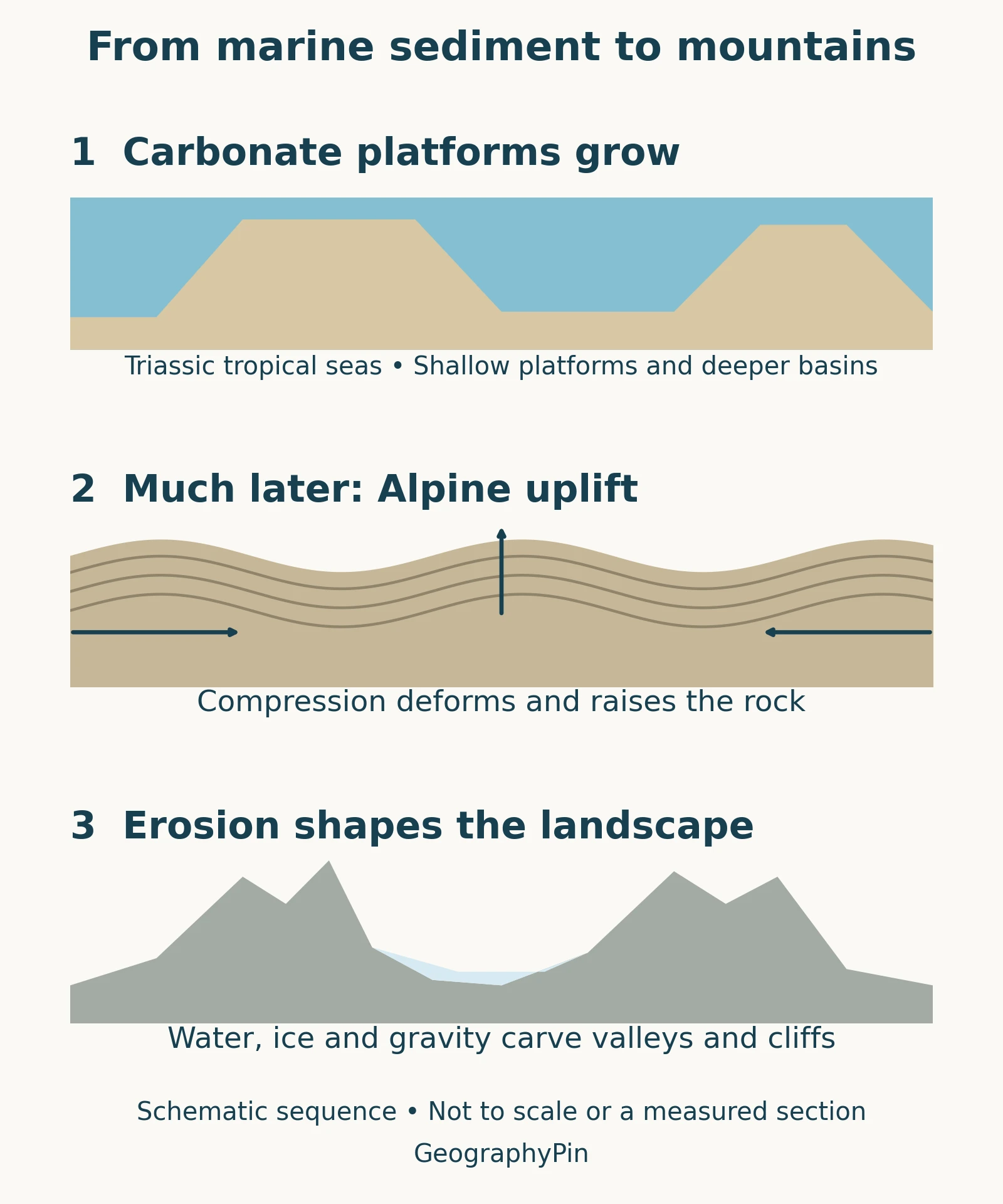
The Dolomites UNESCO Foundation: The lifting of the Dolomites connects the later rise and deformation of the Dolomites with convergence between Africa and Europe. Compression produced structures such as folds, faults and thrusts, rearranging rocks that had formed in earlier environments. An uplifted mountain group can consequently preserve marine geological evidence without remaining an undeformed copy of its original depositional setting.
The sequence is more useful than assigning one age to “the mountains.” The age of a sedimentary layer, the timing of deformation and the development of a modern valley answer different questions. A single date cannot describe all three.
5. Why the landscape has towers and valleys
The Dolomites UNESCO Foundation: What has shaped the Dolomites emphasizes the interaction between geological structure and erosion. Resistant carbonate layers can form prominent walls, while weaker rocks are worn down differently. Fractures and bedding help influence how cliffs break apart; the resulting landforms are not produced by rock chemistry alone.
Water, ice and gravity continue to modify the landscape. Glaciers have carved and reshaped valleys, running water removes material, and rockfall moves debris from steep walls toward their bases. In carbonate terrain, dissolution also contributes to karst features. These processes overlap, rather than operating as one neat succession that ended before the present.
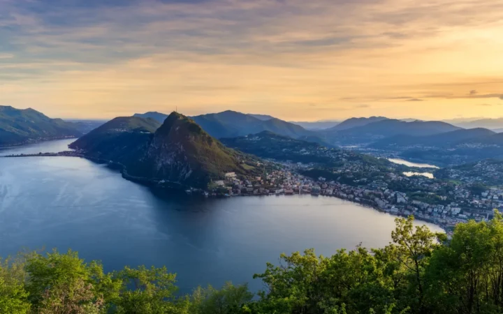
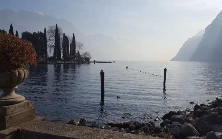
Lakes help connect the mountain overview to more local geography. Lake Molveno lies beside the Brenta setting; Lake Misurina provides a northern example among the surrounding mountain groups. Each has its own basin history, so neither lake should be explained simply by saying that it is “in the Dolomites.”
6. What the UNESCO designation includes
UNESCO World Heritage Centre: The Dolomites inscribed the Dolomites in 2009 as a serial World Heritage property. “Serial” means that the designation consists of separate components contributing to one recognized property, not a single continuous protected polygon. Its listed property area is approximately 548 square miles (1,419 square kilometers), separate from its buffer zones. That figure is not the area of the entire geographical Dolomites.
The nine listed systems
The Dolomites UNESCO Foundation: The nine systems identifies the following systems. Several combine more than one named mountain group; Bletterbach also illustrates why a list of components is not simply a list of nine highest summits.
| System | Name |
|---|---|
| 1 | Pelmo and Croda da Lago |
| 2 | Marmolada |
| 3 | Pale di San Martino, San Lucano, Dolomiti Bellunesi and Vette Feltrine |
| 4 | Dolomiti Friulane and d’Oltre Piave |
| 5 | Northern Dolomites |
| 6 | Puez–Odle |
| 7 | Sciliar–Catinaccio and Latemar |
| 8 | Bletterbach |
| 9 | Brenta Dolomites |
Use the designation to understand the selected geological and landscape heritage. Do not read it as proof that every town, road or mountain within a broadly defined Dolomites region lies inside the property. For a particular site, consult the component boundaries rather than extending the name across the whole map.
What Did We Learn Today?
The Dolomites are a region of distinct mountain groups, not one ridge or a uniform block of dolomite rock. Marine carbonate formation preceded Alpine deformation, and erosion shaped the cliffs and valleys we see today. Their UNESCO designation covers nine selected systems, whose boundaries should not be confused with the wider geographical region.
Sources & Data Notes
The locator shows selected approximate massif or landmark reference positions, not precise summit coordinates or World Heritage boundaries. The geological sequence is conceptual, not a measured section. Marmolada elevation follows the Foundation’s current summit figure; feet and the UNESCO property-area conversion are rounded. No current glacier extent is inferred from older photographs or historical geological sheets.
- UNESCO World Heritage Centre: The Dolomites
- Dolomites UNESCO Foundation: The nine systems
- Dolomites UNESCO Foundation: Brenta Dolomites
- Dolomites UNESCO Foundation: Northern Dolomites
- Dolomites UNESCO Foundation: Marmolada
- Dolomites UNESCO Foundation: Marmolada geology sheet
- Museum Gherdëina: Dolomite
- Museum Gherdëina: Calcite on Dolomite
- Dolomites UNESCO Foundation: A tropical archipelago is born
- Dolomites UNESCO Foundation: The lifting of the Dolomites
- Dolomites UNESCO Foundation: What has shaped the Dolomites
Map and process diagram: GeographyPin. The locator uses Natural Earth public-domain country outlines and approximate group reference positions from Wikidata structured data (CC0): Brenta, Sella, Marmolada massif, Pale di San Martino and Tre Cime, checked against the Foundation’s geographical descriptions and overview map. It uses an equirectangular projection centered at 46.4°N; the scale is approximate. No Foundation map artwork or property polygons are reproduced.
Featured photograph: Snow-covered north faces of Tre Cime di Lavaredo in February 2018. Photo by Wolfgang Moroder / Wikimedia Commons, CC BY-SA 3.0. Cropped, resized and converted to WebP; this derivative retains the same license. The photograph does not show current snow conditions.