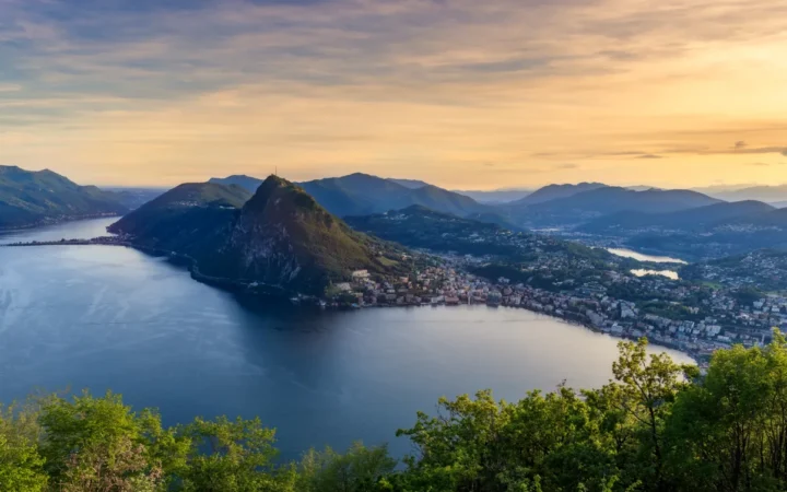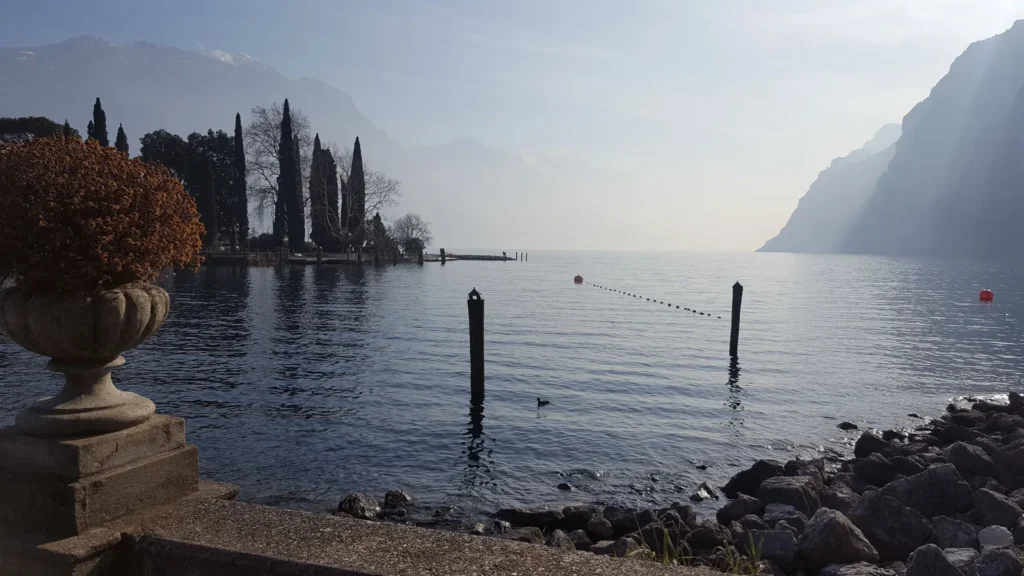
Lake Garda changes character from one end to the other. In the north, mountain walls frame a narrow reach of water; in the south, the lake opens toward hills and the Po Plain. That contrast connects its shape, river system and famous local winds, and gives a better introduction than a list of lakeside resorts.
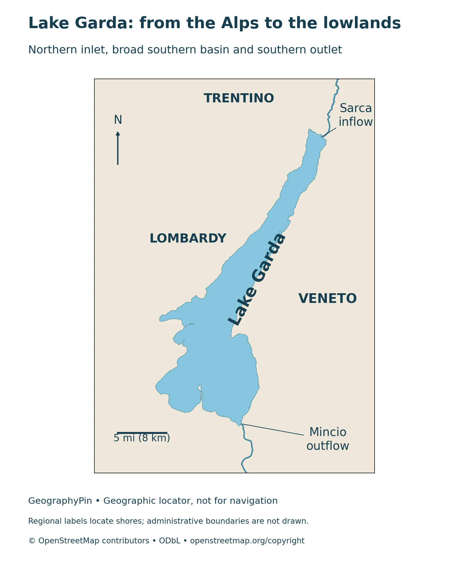
Lake Garda lies entirely in northern Italy, with shores in Lombardy, Veneto and Trentino. Its narrow northern valley broadens into a southern basin shaped by geological structure and glacial processes. The Sarca is its principal inflow, while the Mincio leaves at Peschiera and carries water toward the Po.
How to use this article: Locate the three regional shores, read the reference measurements, follow the river connection, and understand the local winds.
1. Where Is Lake Garda?
Lake Garda, also called Lago di Garda or Benaco, lies in northern Italy where the southern Alps meet the landscapes leading toward the Po Plain. No other lake in Italy has a greater surface area. Unlike a lake shared between countries, Garda lies entirely in Italy, although its shores belong to three different regional administrations.
One lake, three regional shores
Lombardy borders the western and southwestern shores, Veneto the eastern and southeastern shores, and Trentino the northern end. More precisely, Trentino is the Autonomous Province of Trento within the Trentino-Alto Adige/Südtirol region. It is not a fourth region or a separate country.
The lake’s shape makes these relationships easier to remember than a list of resorts. The long, narrow northern reach runs between mountain slopes. Farther south the water spreads into a much broader basin. A town described simply as “on Lake Garda” may therefore have a very different setting from another town on the same lake.
Our locator shows the shoreline and the regional setting without drawing administrative boundaries across the water. The lake, its surrounding mountains and its drainage basin are different features: an area quoted for the catchment should not be mistaken for the area covered by water.
2. Lake Garda’s Size and Depth
A useful set of reference measurements appears in the 2004 report of the Osservatorio dei Laghi Lombardi, published in 2005. These compiled dimensions describe the lake’s scale; they are not a fresh survey or a live reading of the water level.
Reading the measurements consistently
| Measurement | Rounded U.S. units | Published metric value |
|---|---|---|
| Surface area | 142 square miles | 368 km² |
| Maximum depth | 1,148 feet | 350 meters |
| Mean depth | 436 feet | 133 meters |
| Water volume | About 11.8 cubic miles | About 49.0 km³ |
| Mean surface elevation | 213 feet above sea level | 65 meters above sea level |
The mean depth summarizes the whole water body; it does not describe a typical swimming beach. Maximum depth refers to the deepest part of the basin. Elevation, by contrast, is the water surface’s height relative to sea level, not the distance to the lake bottom.
Other published summaries give slightly different dimensions. Keeping one attributed series together is more useful than combining an area from one source with a depth or volume from another. The volume here is rounded from the report’s 49,031 million cubic meters. Its mean elevation should not be treated as today’s gauge reading.
3. From an Alpine Valley to a Broad Southern Basin
Garda’s narrow northern reach and wider southern waters reflect a landscape shaped by more than one process. Ice occupied a pre-existing geological depression, eroding rock and moving sediment. The surrounding hills and lake-floor deposits preserve parts of that longer history.
Glaciers reshaped an older landscape
A 2020 study by Gasperini and colleagues describes a major glacier tongue occupying the depression during the Last Glacial Maximum. Its seismic investigations also examine tectonic deformation and sediment laid down during and after deglaciation. This is not a story of a single glacier suddenly excavating a finished lake in otherwise featureless ground.
As ice advanced and retreated, erosion and deposition changed the basin and its surroundings. Glacially transported material contributed to the morainic hills around the southern landscape. These deposits are part of the transition from the steep northern valley to lower, more open terrain toward the plain.
The visible north–south contrast is not the same as the lake’s underwater subdivision. ARPAV identifies a deeper northwestern basin and a shallower southeastern basin, separated by a submerged ridge extending between the Sirmione peninsula and Punta San Vigilio. A map of the shoreline alone cannot reveal that ridge or provide a depth profile.
This combination of inherited structure, glacial modification and later sedimentation makes Garda a useful example alongside other types of lake basins. Its broad southern outline is also quite different from the branching shape of nearby Lake Como.

4. Sarca Inflow and Mincio Outflow
The Sarca is Garda’s principal inflowing river, entering at the northern end. The Mincio carries water away from the southern end at Peschiera del Garda. Other streams also contribute water, so the main river labels should not be read as a complete inventory of every inflow.
Following the water toward the Po
Downstream, the Mincio passes through morainic hills and the plain, links with the lake-and-wetland landscape around Mantua, and eventually joins the Po. Garda therefore belongs to a river-connected drainage system rather than a closed basin whose water can leave only through evaporation or seepage.
The broad direction of drainage is different from the movement of water at a particular beach. Wind, basin shape and other processes can produce local circulation that does not resemble a single straight stream running down the lake. Inflow and outlet markers explain river connections; they are not a diagram of currents or a navigation aid.
5. Why Garda’s Winds Change Through the Day
The surrounding mountains and the contrast between lake and land help shape Garda’s local winds. Two names recur in sailing and weather descriptions: the northerly Pelèr and the southerly Ora. A wind is named for the direction it comes from, not the direction it is heading.
Pelèr in the morning, Ora in the afternoon
Meteotrentino describes the Pelèr as typically blowing from the north during the night and morning, often weakening around midday. The Ora generally arrives from the south around the middle of the day and continues into the afternoon. The narrowing northern valley can strengthen the flow there; the Ora is usually stronger in summer than in winter.
These are recurring patterns, not an appointment that the weather must keep. Larger weather systems and other local winds can alter direction, strength and wave conditions. A calm waterfront at one hour does not establish that the same place, or the opposite shore, will remain calm later.
For an actual outing, use the official upper-Garda wind forecasts and local advice rather than treating a general geographical explanation as a safe-weather guarantee.
6. Using the Geography to Plan a Visit
Choose the part of the lake that matches the landscape you want to explore. The northern end emphasizes the close relationship between lake and steep mountain valley. The wider southern basin makes the transition toward hills and plain more apparent. Neither setting represents every shoreline on Garda.
Check crossings rather than assuming a full-lake service
Boat travel can connect shores without following the entire lake perimeter, but the services are not interchangeable. Navigazione Laghi distinguishes passenger routes from the Maderno–Torri vehicle ferry. Timetables change by season, and bad weather or strong waves can interrupt journeys.
Consult the operator’s current Garda timetables and notices for the exact ports and travel date. A route printed in a summer guide is not evidence that it operates in winter. Likewise, a lake map identifies geography, not an open path, a ferry reservation or permission to launch a boat.
It is worth keeping the physical and practical maps separate: first understand which shore and landscape you are visiting, then confirm the transport and weather information needed to reach it.
What Did We Learn Today?
Garda is one lake shared by three Italian regional shores, with a narrow Alpine north and a broader south. Its basin records both geological structure and glacial change. The Sarca–Garda–Mincio connection explains drainage, while the Pelèr and Ora explain recurring winds, not guaranteed daily conditions. Reference dimensions and current travel information answer different questions.
Sources & Data Notes
The fact table uses one compiled OLL reference series, not a new survey. U.S. conversions are rounded; the reported volume of 49,031 million cubic meters is presented as about 49.0 km³. Mean elevation is not a current water-level observation. Geological discussion draws on the accessible research abstract and the local authority’s explanations; forecast and transport links should be checked for the actual travel date.
The locator uses actual OpenStreetMap lake and river geometry. Source river routing through the lake is omitted; visible river–shore contacts are computed intersections, not surveyed engineering locations. No regional boundary, current direction or bathymetry is implied. The photograph is an attributed historical view, not a statement of current conditions.
- Osservatorio dei Laghi Lombardi, 2004 report (published 2005), Garda-1: reference dimensions and regional geography
- ARPAV: Garda’s two underwater basins and principal river connections
- Gasperini and colleagues, 2020: geological structure, glaciation and lake sediments
- Comunità del Garda: the basin’s geological history
- Comunità del Garda: glacial erosion, deposition and surrounding landscape
- Parco del Mincio: the river from Garda through hills and plain to the Po
- Meteotrentino: typical wind patterns and current forecast access
- Navigazione Laghi: route types, seasonal timetables and weather limitations