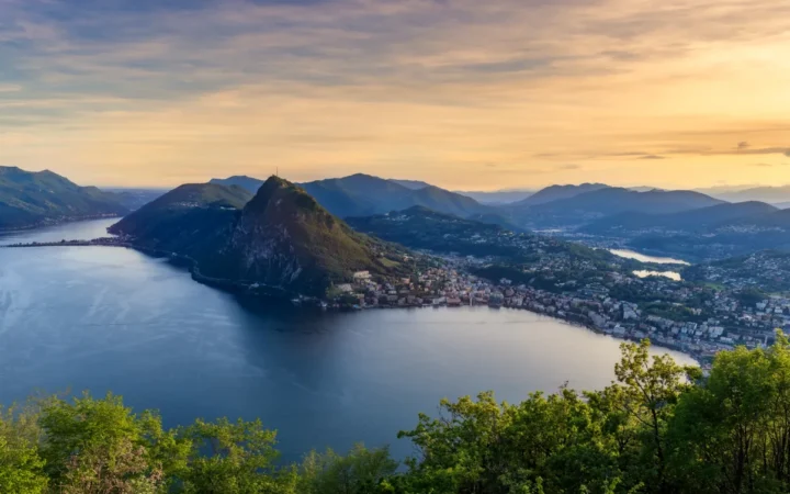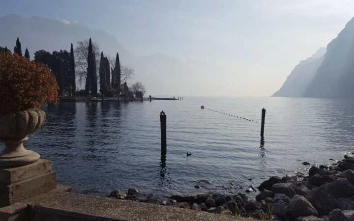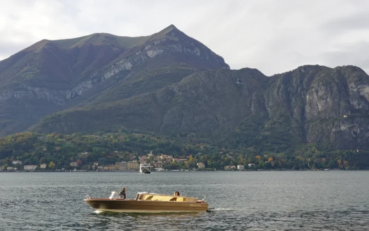
The mountains above Lake Molveno tell only part of its story. A natural barrier helped create the lake, while later hydropower engineering changed how water moves through the surrounding landscape.
Lake Molveno is a landslide-dammed lake in Trentino, northern Italy, below the Brenta Dolomites and beside the Paganella–Monte Gazza ridge. Its basin is natural, but its modern water connections are partly engineered for hydropower. Molveno village, the small northern Bior basin and nearby Lake Nembia are distinct places.
How to use this article: Begin with the mountain setting, examine the landslide evidence, or follow the managed water connections.
1. Where Is Lake Molveno?
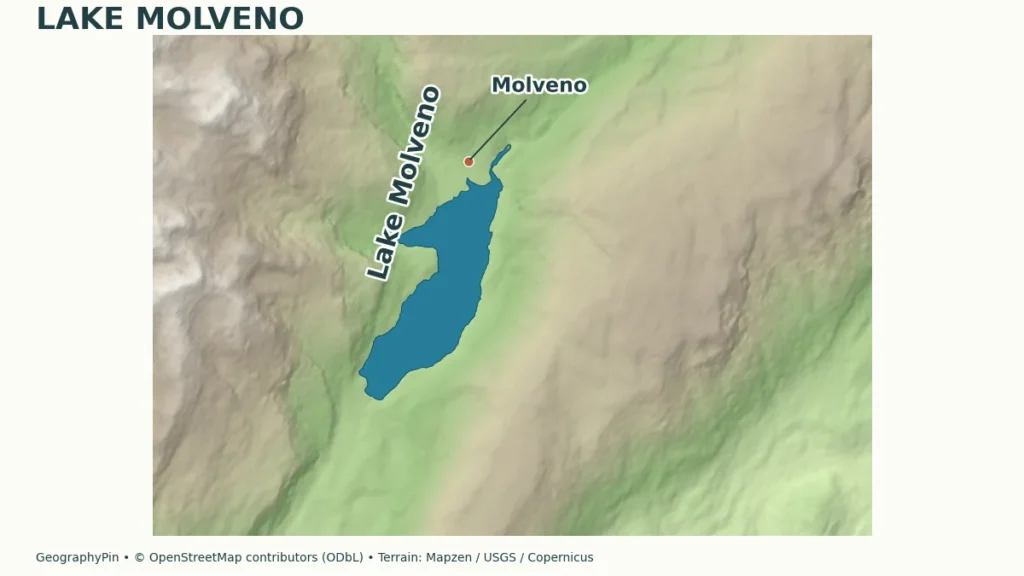
Lake Molveno, or Lago di Molveno, lies in Trentino in northern Italy. The Brenta Dolomites rise to its west, with the Paganella–Monte Gazza ridge on the southeastern side. Molveno village occupies the northern end of the lakeside landscape. The water, settlement and mountain group are closely connected places, but their names do not describe the same geographic unit.
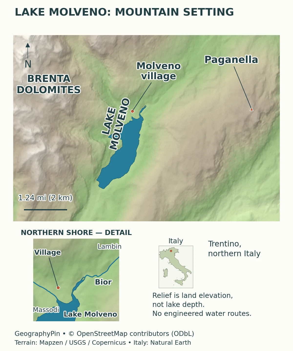
Start with the basin, then the mountains
Read the long basin first, then compare the high ground on either side. This is more useful than treating the view as a single wall of “the Dolomites.” Brenta identifies the mountain group west of the lake; Paganella and Monte Gazza orient the opposite side. The village’s northern position also explains why photographs taken from the settlement tend to look along the water rather than across its full length.
The distinction matters when interpreting an address or a route description. A reference to Molveno may mean the village or municipality, while a reference to Lake Molveno means the water body. A route into the Brenta is a mountain excursion, not simply an extension of a walk on the beach.
2. Lake Size: What the Numbers Describe
The municipality’s 2025 environmental declaration provides a consistent starting point for the lake’s dimensions. The figures below use that document, with rounded US customary conversions. They describe the basin rather than the water conditions on any particular day.
| Measure | Reference value | Meaning |
|---|---|---|
| Surface area | About 1.3 square miles (3.3 square kilometers) | Rounded municipality reference; water surface, not surrounding land |
| Length | About 2.7 miles (4.4 kilometers) | Municipality’s maximum-length description |
| Maximum width | About 0.9 miles (1.5 kilometers) | Not the width everywhere along the basin |
| Maximum depth | About 404 feet (123 meters) | Municipal 2025 reference, not a current sounding |
Why other official tables differ slightly
The provincial Water Protection Plan 2022–2027 lists a surface area of about 1.25 square miles (3.237 square kilometers) and a maximum depth of about 407 feet (124 meters). These are different published reference values, not evidence that the lake suddenly changed between two web pages. The documents do not provide enough shared measurement detail to reconcile every difference here, so the table above does not mix their figures.
Lake level can affect the exposed shoreline and the depth measured beneath the surface, particularly in a managed basin. That general relationship is not a license to invent a specific explanation for each discrepancy. A map outline, a regulatory table and a lake-level reading serve different purposes and should not be treated as interchangeable measurements.
3. A Landslide-Dammed Lake Below the Brenta
The strongest dating evidence is more specific than a visitor summary
Molveno is a natural landslide-dammed lake, not a basin first created by twentieth-century hydropower construction. Rock debris blocked the valley, allowing water to collect upstream. The much older Alpine landscape provides the setting, but that does not make the lake simply a glacier-carved hollow with no later history. Our guide to glacial erosion landforms explains that different process; a mountain setting alone does not establish how a particular lake was impounded.
A 2020 study by von Wartburg and colleagues dated the main Molveno rock-avalanche deposits to approximately 4,800 ± 500 years ago using chlorine-36 exposure dating. Its reconstruction identifies Monte Soran as the source area. Municipal and visitor summaries often give approximately 3,000–4,000 years; the research estimate is reported separately here rather than averaged with those broader descriptions. Dating the avalanche deposits is not the same as directly dating the first filling of the lake.
The researchers distinguish the main event from younger exposure ages near Nembia. They discuss shielding by former water cover as a possible explanation for those younger measurements, rather than simply assuming that every different date proves a different major landslide. The precise trigger of the main failure should not be presented as a confirmed earthquake or a single proven climatic event.
This case shows why a lake’s origin and its modern use are separate questions. “Natural lake” describes how the basin and impoundment developed. It does not mean that the water balance, shoreline or outlet remain untouched by people.
4. Natural Water and Engineered Connections
The lake participates in a wider hydropower system
Local runoff and streams contribute water to Molveno, but the modern system also transfers water from outside the lake’s immediate catchment. A provincial description of the Sarca network explains that water is collected and carried through underground works toward Molveno. A surface map alone therefore cannot explain every important connection.
The Province of Trento’s May 2022 description of the Santa Massenza–Nembia concession identifies a sequence in which diverted Sarca-basin waters pass through the Nembia power plant and are returned to Lake Molveno. Stored and regulated water from Molveno is then used by Santa Massenza I, with discharge into Lake Santa Massenza. The same document also describes pumping connections, so the system should not be reduced to a permanently one-way natural river.
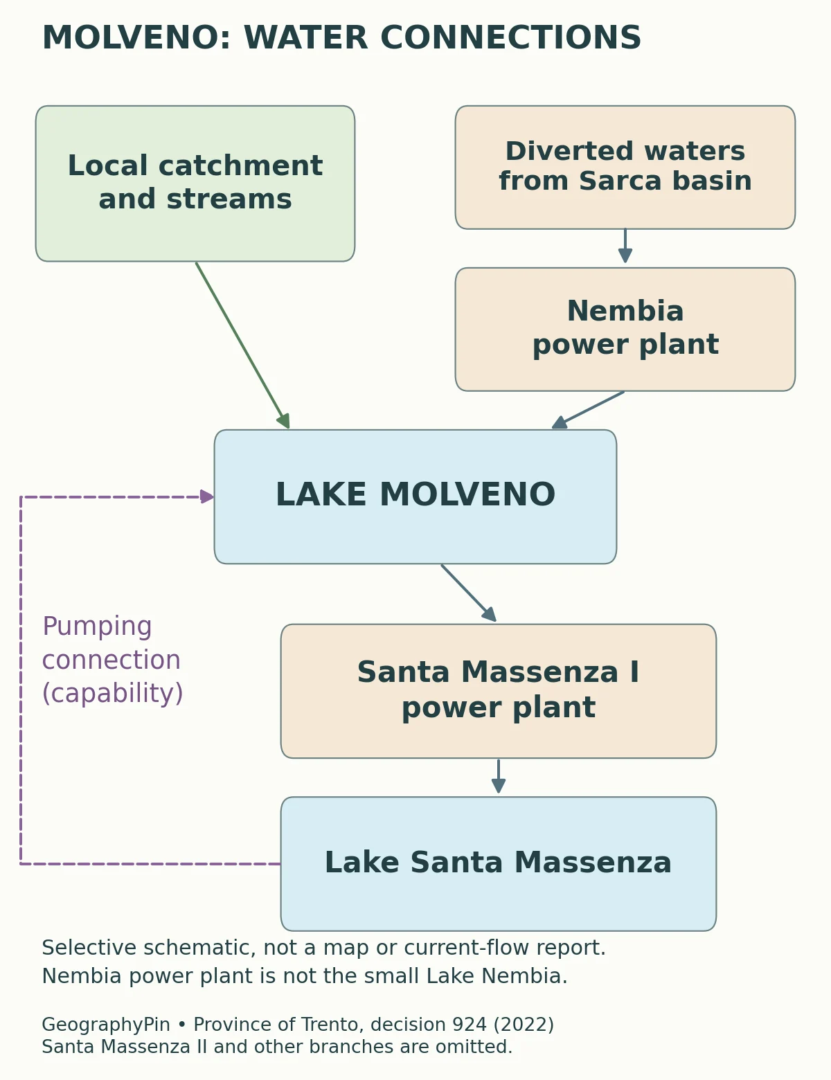
The provincial Water Protection Plan classifies Molveno as a heavily modified water body because of significant water-level variation over time. That regulatory category does not contradict its natural landslide origin. It describes the extent of later physical modification rather than rewriting the geological history.
There is also a useful distinction between ordinary operation and exceptional maintenance. The municipality records a major lowering of the lake during winter 2016–2017 to work on normally submerged hydraulic structures. Photographs from that episode should not be used to imply that the lake is currently drained, or that every low shoreline photograph has the same cause.
5. Molveno, Bior and Nembia Are Not Interchangeable
Two nearby names with different connections
Bior is the small northern branch or basin communicating with the main body of Lake Molveno. Nembia lies farther south and has a different history. Neither name is a replacement for the main lake, and the Nembia power plant in the engineering description must not be confused with the small scenic Lake Nembia.
Adamello Brenta Natural Park explains that Nembia was originally supplied by underground water arriving from the higher Lake Molveno. Hydropower construction beginning in the 1950s altered that system, and the small lake dried out. A restoration project begun in 1995 recreated it, including an artificial water supply.
That history is why a modern map should not casually draw an uninterrupted natural stream from Molveno to Nembia. A former underground connection, a restored small lake and a named power plant are three different things. Showing a blue line between similarly named places without explaining its meaning would hide the most interesting part of this landscape.
6. What the Geography Means for a Visit
The northern village and lakeside recreation area provide a different experience from the wooded shores and mountain routes above them. Regional tourism information describes lakeside walking and views from Pradel, but a geographic profile is not a substitute for current route conditions or lift information.
Before choosing an outing, decide whether you want a shoreline walk, a village visit or a mountain route. Those choices involve different distances, terrain and preparation. The relief map helps explain the setting; it does not certify that a route is open, accessible or suitable for every walker.
For practical arrangements, use Trentino’s lake information and the current local transport and trail notices. This article keeps fares, operating hours and swimming advice outside its enduring geographic facts. Water color and scenic awards are not substitutes for current bathing assessments or access information.
The main reason to look beyond the familiar postcard is the combination of processes. Brenta relief frames a landslide-dammed basin; later engineering links its water to a much wider system; the village and nearby smaller lakes occupy different parts of that landscape. Seeing those layers together explains why Molveno is more than either a completely untouched lake or a purpose-built reservoir.
What Did We Learn Today?
Lake Molveno has a natural landslide origin and a strongly managed modern water system. Its Brenta setting, dated measurements and engineered connections answer different questions. Bior, Nembia and Molveno village should remain distinct on a map, while a schematic of hydropower transfers should never masquerade as a surveyed river or tunnel route.
Sources & Data Notes
The measurement table follows the municipality’s 2025 document; the provincial regulatory table uses somewhat different reference values. Neither is presented as a current water-level measurement. The rock-avalanche age is a dated research result with its published uncertainty. Engineering connections describe a documented system, not real-time operating flows.
- Comune di Molveno: environmental declaration, 2025 update. Pages 5–6: dimensions, mountain setting and 2016–2017 maintenance episode.
- von Wartburg et al. (2020): Molveno rock-avalanche deposits. Exposure dating and Monte Soran source interpretation; the uncertainty belongs to the research estimate.
- APPA: Water Protection Plan 2022–2027, Annex A. Lake typology and heavily modified designation; its dimensions are kept separate from municipal values.
- Province of Trento: resolution 924, May 27, 2022. Page 2: Nembia, Molveno and Santa Massenza hydropower connections and pumping capability.
- Comunità delle Giudicarie: the Sarca. Regional context for diverted waters and underground conveyance toward Molveno.
- Adamello Brenta Natural Park: Lake Nembia. Historical underground supply, drying and restoration; not a map of current natural surface flow.
- Visit Trentino: Lake Molveno. Village, Bior and visitor-orientation context. Scenic rankings and unverified current schedules are not adopted.
Map sources and method: Original GeographyPin cartography uses lake outlines, village and peak locations, and mapped streams from © OpenStreetMap contributors, under the Open Database License. The Bior arm and its island are retained; mapped outlines illustrate location rather than replace the official dimension tables. Terrain comes from historical Mapzen elevation tiles, with global terrain data courtesy of the U.S. Geological Survey; European terrain produced using Copernicus data and information funded by the European Union – EU-DEM layers. Exact per-tile source composition was not independently resolved. Shading is land relief, not lake-bottom depth, current vegetation or route difficulty. The main scale is approximate at the central latitude; the shoreline and Italy insets use separate scales. The Italy inset uses public-domain Natural Earth country geometry. No tunnels, landslide boundaries or current operating flows are mapped. The separate water-connections schematic is an original visualization of selected factual relationships in the provincial concession document, not a reproduction of another organization’s artwork.