Lake Como’s familiar waterfront views can hide its most important geographical feature: the lake divides into three long arms. Locate those branches, and the positions of Como, Bellagio and Lecco become much easier to understand.
Lake Como is a deep freshwater lake in Lombardy, northern Italy, with an inverted-Y shape. Its southwestern arm ends at Como, its southeastern arm at Lecco, and its northern arm extends toward Colico. Bellagio separates the southern branches. The Adda enters in the north and leaves at Lecco.
How to use this article: Locate the three arms, compare the depth references, or understand how rivers and glaciers shaped the basin.
1. Where Is Lake Como?
Lake Como lies in Lombardy, northern Italy, among the southern Alpine foothills. Its Italian names include Lago di Como and Lario. The waterbody is entirely in Italy, along the provinces of Como and Lecco; it is not a lake divided by the Italian–Swiss border.
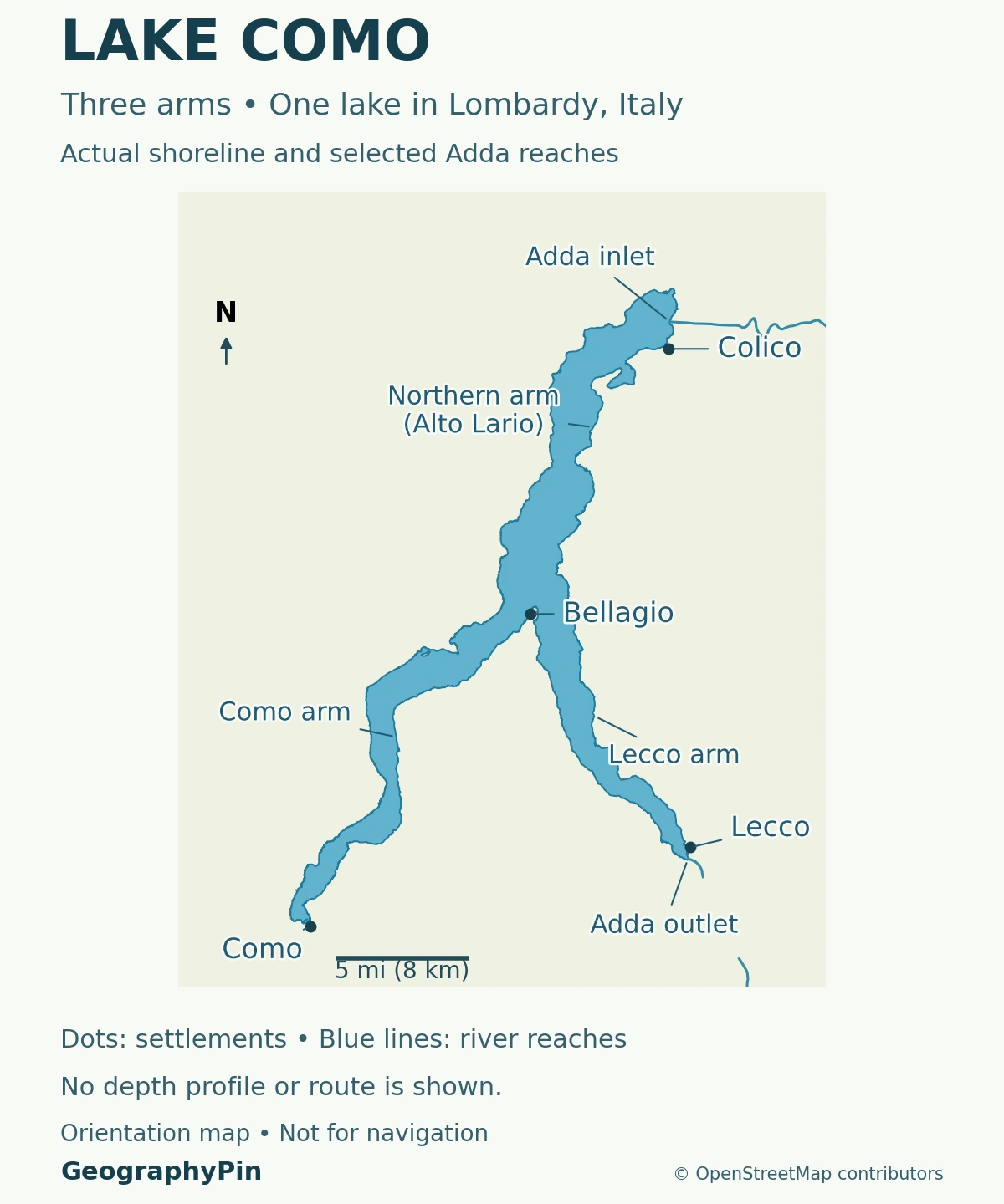
Como, Lecco and Colico identify the three arms
On a north-up map, the lake resembles an upside-down Y. The Como arm points southwest, the Lecco arm southeast, and the Colico arm stretches north. Bellagio stands on the promontory between the two southern arms.
The names can be confusing because Como and Lecco are both cities and names for branches of the lake. Saying that a place is “on Lake Como” does not necessarily mean it is near the city of Como. Colico, at the northern end, occupies a different part of the same waterbody.
The map shows these relationships rather than a sightseeing itinerary. Its inlet and outlet labels identify the Adda’s entry and exit; the map does not show ferry routes or model currents throughout the lake.
2. How Large and Deep Is Lake Como?
A lake’s area, average depth and deepest point answer different questions. The table below uses one consistent reference: the Lombardy Lake Observatory’s first report, titled OLL 2004 and published in 2005. These are reference measurements, not a new survey or today’s water level.
| Measurement | Reference value, converted and rounded |
|---|---|
| Surface area | About 56 square miles (145 square kilometers) |
| Maximum depth | About 1,345 feet (410 meters) |
| Mean depth | About 509 feet (155 meters) |
| Mean surface elevation | About 650 feet (198 meters) above sea level |
| Water volume | About 5.4 cubic miles (22.5 cubic kilometers) |
Why some references give a different maximum depth
A 2025 research paper by Dezuanni and colleagues lists a maximum depth of about 1,394 feet (425 meters), drawing its morphometric table from earlier publications. That is not the same value as the older OLL report’s approximately 1,345 feet (410 meters), and the paper should not be described as a new depth survey.
Both references describe a very deep lake, but they do not establish why their maximum-depth values differ. Averaging them would create a number neither source reports. For that reason, the table retains the identified OLL series rather than mixing figures from different references.
Maximum depth also does not describe the water beside every town or beach. A lake-wide mean and a deepest-point value are not substitutes for a local depth chart.
3. The Adda Connects the Lake to a Larger River System
The Adda enters Lake Como from the Valtellina valley at its northern end. It leaves through the southeastern arm at Lecco, not through the southwestern arm at Como. Downstream, the river eventually joins the Po near Cremona.
ARPA Lombardia identifies the Adda as the principal inflow and the lake’s only outflowing river. Principal does not mean only: other streams enter the lake, and the Mera system brings water through Lake Mezzola and the northern wetland area.
The lake surface and its drainage basin are different areas
A catchment includes the land whose water drains toward a selected point. Its boundary depends on that point. A figure measured at a downstream dam can therefore cover more land than a figure for the lake alone. The international extent of the wider drainage basin does not make the lake itself cross-border.
The Consorzio dell’Adda describes a regulation structure between Lakes Garlate and Olginate, downstream of Lake Como, operating since 1946. Its catchment figures are tied to that downstream location. The lake’s storage and regulated discharge connect the landscape to irrigation and hydropower farther along the Adda.
Water-level gauge readings require similar care. A gauge zero is a reference height used to interpret readings, not a statement that the lake surface always sits at that elevation.
4. A Deep Basin Shaped by Rivers and Ice
Lake Como is often described as a glacial lake. That is useful shorthand, but it does not mean the entire basin appeared during a single glaciation.
Glaciers modified an older valley system
A geomorphological account by Bollati, Pelfini and Smiraglia describes inherited deep valleys and canyons associated with river incision, followed by substantial modification during Pleistocene glaciations. Moving ice reshaped the valleys and removed earlier sediment. The modern lake occupies part of this longer-lived landscape.
The result is a narrow, branching waterbody enclosed by steep terrain rather than a shallow pond spread over a broad plain. Its shape reflects an inherited valley network subsequently modified by ice, not three unrelated lakes placed side by side.
Deposition matters as well as erosion. Rivers carry sediment toward the lake, helping build low-lying ground around their mouths. The same regional account connects northern sediment accumulation with the separation of Lake Mezzola from the main lake.
Calling Lake Como fjord-like describes an appearance, not its water connection. It is a freshwater inland lake, not a marine inlet. Our explanation of what makes a lake a lake helps separate the waterbody from the landform containing it.
5. Reading the Shoreline Before Choosing a Destination
The inverted-Y shape is more useful for orientation than treating the lake as one destination with one center. First identify the arm, then the shore, and finally the settlement. This avoids confusing a city at the end of a branch with a village farther along the same lake.
Bellagio and the Larian Triangle separate the southern arms
Lombardy’s regional tourism service identifies the Larian Triangle by Como, Bellagio and Lecco. It is the land between the two southern branches, not an island in the center of the lake. Bellagio marks its northern tip.
That arrangement explains a practical map-reading distinction: two places on opposing shores can look close across water while belonging to different land routes. A locator map shows position, not journey time. Check the appropriate road, rail or boat connection rather than estimating a trip from a straight line.
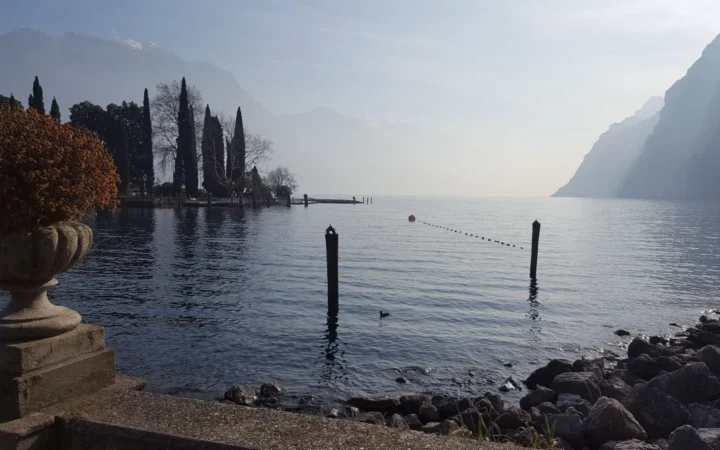
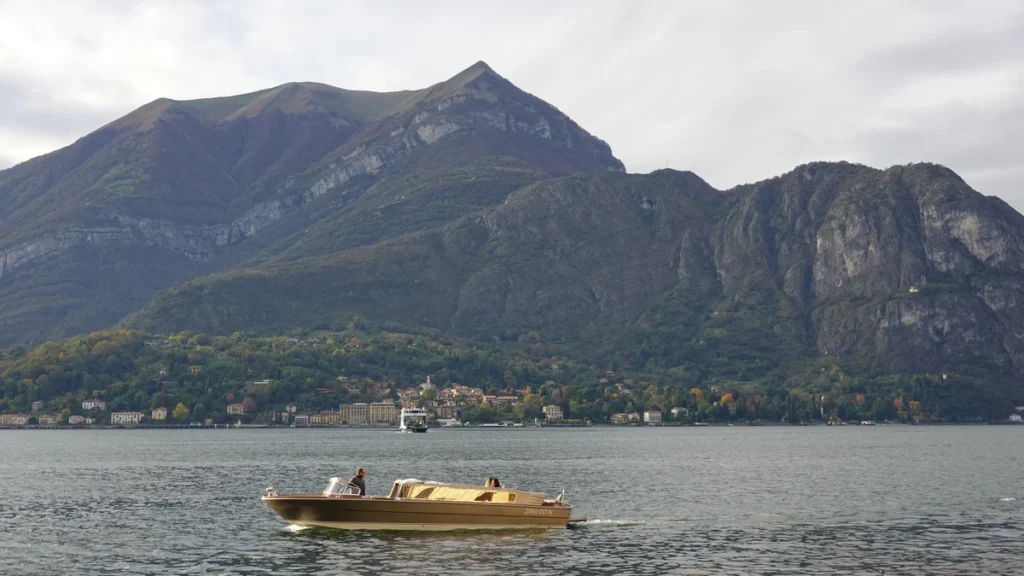
Likewise, a landscape photograph shows one viewpoint, not the whole Y-shaped lake. Hills can hide another branch completely. Use the map to understand the setting before expecting every lakeside view to include all three arms.
This profile does not supply live transport timetables or bathing conditions. Lake measurements and scenic photographs cannot establish whether a particular service is running or a particular beach is suitable for swimming today.
What Did We Learn Today?
Lake Como’s geography is organized around three connected arms, with Bellagio between the southern branches and the Adda flowing out at Lecco. Its deep basin records both older river erosion and later glacial modification. Reference depths need attribution, while catchments, gauge heights and live conditions must not be confused with the lake’s basic dimensions.
Sources & Data Notes
The measurement table uses one historical reference series, with rounded U.S. customary conversions. The OLL report’s 2021 upload path is not its publication or measurement date. The different maximum depth in the 2025 paper is disclosed, not averaged or treated as a new survey. No present-day bathing-water assessment is inferred from these sources.
- Lario Basin Authority: lake identity and three-branch geography
- Lombardy Lake Observatory: OLL 2004 report, published 2005, Como 1 profile
- Dezuanni and colleagues, 2025: research paper and alternative morphometric table
- ARPA Lombardia: Lake Como and its inflows
- Consorzio dell’Adda: basin, regulation and gauge references
- Bollati, Pelfini and Smiraglia: northern Lombardy landscapes, section 3.6
- Lombardy regional tourism: the three branches and Larian Triangle
Featured photograph: “Lake Como @ Bellagio” by Guilhem Vellut, via Wikimedia Commons, CC BY 2.0. Cropped, resized and converted to WebP. This is a real photograph, with no synthetic alterations or GeographyPin watermark.
Map methods: The locator uses OpenStreetMap’s complete lake polygon, mapped islands, settlement points and Adda river geometry. UTM zone 32N projection and equal axis scaling preserve local geographic relationships. Inlet and outlet annotations are anchored at intersections of the mapped river and lake boundary. River lines over open water are omitted; no detailed circulation, basin divisions, bathymetric contours or road connections are inferred.