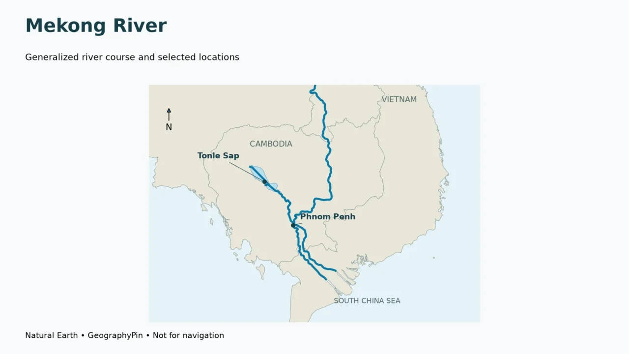
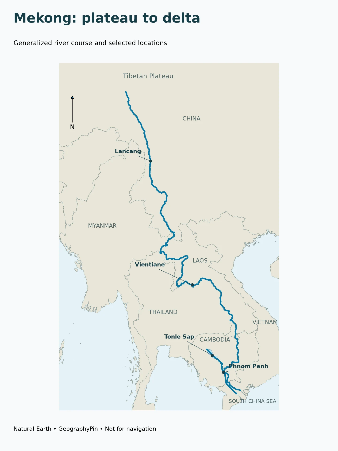
The Mekong links the Tibetan Plateau with mainland Southeast Asia and the South China Sea. Its course runs through China, where it is called the Lancang, and along or through Myanmar, Laos, Thailand, Cambodia and Vietnam. Tonle Sap connects to it in Cambodia, while the lower river divides into delta channels before reaching the coast.
How to use this article: Distinguish country and border reaches, locate the lake connection, and understand what reverses seasonally.
1. Follow the Mekong from the plateau to the sea
Lancang and Mekong are names within one river system
A map of Asia can make the Lancang and Mekong look like separate rivers if it changes the label at a national boundary. They belong to the same connected river system. The Chinese upper course is commonly called the Lancang; Mekong is the familiar name farther downstream.
The Mekong River Commission gives an approximate length of 3,045 miles (4,900 kilometers). Treat this as an attributed, rounded reference, not a measurement made from the illustration below. A small-scale line smooths bends and leaves out fine headwater detail, so tracing its pixels will not reproduce a surveyed river length.
Parallel rivers are not the same river
In mountainous southwestern China, the upper Mekong lies near the Yangtze and Salween. UNESCO’s Three Parallel Rivers description emphasizes the deep, roughly north–south gorges and the mountain ranges between them. Nearby lines on a regional map do not imply that their waters merge.
This is a useful place to distinguish proximity from connection. Two valleys can be close together horizontally while a high drainage divide separates them. Follow the actual channel rather than jumping between whichever blue lines look nearest. The Mekong’s route continues toward mainland Southeast Asia; it does not become the Yangtze because both appear within the same protected-area region.
Read downstream order before memorizing names
The broad sequence is plateau and mountain valleys, the international river reaches around northern mainland Southeast Asia, Laos and its borderlands, Cambodia, and the delta toward Vietnam’s coast. This ordering is more useful than a disconnected list of six countries.
2. Which countries does the Mekong connect?
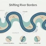
Flowing through a country is different from forming its border
China, Myanmar, Laos, Thailand, Cambodia and Vietnam are the six countries normally associated with the Mekong system. But “through six countries” can conceal an important distinction: parts of the river run inside a country, while other parts lie along an international boundary.
| Country | Relationship to the main course | Useful map-reading distinction |
|---|---|---|
| China | Upper river, commonly called the Lancang | Follow the river south from the plateau and Yunnan region |
| Myanmar | River frontage along the Myanmar–Laos boundary | Do not imagine a long route through Myanmar’s interior |
| Laos | Interior reaches and international boundary reaches | The river is not a border along its entire Lao course |
| Thailand | Important Thailand–Laos boundary reaches | Thailand’s relationship is not a continuous inland crossing |
| Cambodia | Main river through the country | Phnom Penh helps locate the Tonle Sap connection and downstream branching |
| Vietnam | Lower delta channels toward the sea | The river reaches the coast through a network, not one simple outlet |
These are broad geographic relationships, not legal descriptions of individual islands or boundary channels. River-border treaties can distinguish banks, channels and islands in ways that a small-scale country outline cannot show. GeographyPin’s river-border explainer examines why physical channel movement does not automatically move sovereignty.
The basin extends beyond the blue line
A river basin is the land whose drainage feeds a river system. A place does not have to sit on the Mekong’s bank to contribute water to it: a tributary may connect an inland catchment to the main channel. Conversely, a country touching the river does not mean every part of that country drains to it.
The labels Upper Mekong and Lower Mekong are also regional descriptions, not additional rivers. For a particular report or dataset, check its stated geographic division before comparing area totals. This guide uses the terms to orient readers upstream and downstream, without treating a map label as a new measurement.
3. Place Vientiane, Phnom Penh and Tonle Sap
Cities help anchor the lower river
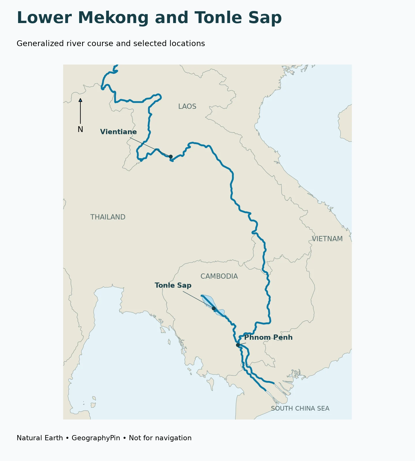
Vientiane and Phnom Penh provide two recognizable reference points in the lower part of the system. Vientiane is on the Lao side of the Mekong near Thailand. Phnom Penh is farther downstream in Cambodia, where the Tonle Sap connection and the branching toward the delta become particularly important.
Tonle Sap is a lake with a connecting river
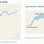
Tonle Sap Lake lies northwest of Phnom Penh. The Tonle Sap River links the lake to the Mekong system. The lake is therefore not a reservoir placed directly across the Mekong’s main channel, and the main river does not simply pass through its center.
This distinction is easy to miss on a crowded map. First locate the main Mekong course east of the lake. Then follow the connecting waterway southeast toward Phnom Penh. The side connection is the key to understanding the seasonal reversal.
4. What actually reverses at Tonle Sap?
It is the connecting river, not the entire Mekong
During the wet season, rising Mekong water can drive flow back along the Tonle Sap River toward the lake. During the dry season, the lake drains outward through that connection. UNESCO describes this seasonal exchange as a central part of the lake’s hydrology.
The statement “the Mekong flows backward” is therefore a misleading shortcut. The relevant reversal is in the connecting Tonle Sap River. It does not mean water from the Mekong Delta travels all the way upstream to the Tibetan Plateau.
A simple way to picture the relationship is to think of two connected water bodies whose relative levels change. The direction through the connection depends on the water-level difference, rather than on a permanent arrow printed on a map. That explanation concerns the mechanism, not a forecast for a particular day.
A seasonal pattern is not a fixed calendar promise
The Mekong River Commission describes strong differences between high-flow and low-flow periods and considerable variation between years. Its hydrology overview also explains why annual flooding matters to wetland habitats and fish movements.
A static geography article cannot establish when reversal will begin in a specific year, how long it will last, or how much water will enter the lake. Those questions require observations and a defined reporting period. The same caution applies to a photograph showing unusually high or low water: it records conditions at a time and place, not the full range of the system.
For current conditions, consult the MRC’s monitoring and forecasting information rather than interpreting this map as a live flow display. This article does not provide a flood warning, navigation clearance or travel-safety assessment.
5. Understand the Mekong Delta without oversimplifying it
Tributaries join; distributaries branch away
A tributary carries water toward a larger river. A distributary branches away from a main channel. Near Phnom Penh, the Bassac branches from the Mekong, and the river system continues across the lowland delta toward the coast.
The terms describe the direction of connection within a network. They do not imply that every branch is the same size, carries the same volume, or remains equally important through time. Likewise, the presence of two visible lines on a general map does not establish that the delta has only two outlets.
One river connects very different landscapes
The upper mountain valleys, international border reaches, Cambodian lake connection and delta plain are not interchangeable parts of the landscape. They have different channel shapes and different relationships to surrounding land. Yet water and sediment can connect them through the river network.
That is why a useful Mekong map should do more than label six countries. It should help readers see which places lie upstream or downstream, distinguish a border reach from an inland channel, and separate the main river from a lake connection or delta branch. These relationships remain useful even when a newer survey refines a channel line or a later report updates a water-level measurement.
Frequently Asked Questions
Is the Lancang the same river as the Mekong?
Lancang is the usual name for the Chinese upper course of the same connected river system.
Does the Mekong run through Thailand’s interior?
Important reaches form the Thailand–Laos boundary. A six-country list should not be read as six continuous inland crossings.
Does the whole Mekong reverse direction?
No. The familiar seasonal reversal concerns the Tonle Sap River, which connects the Cambodian lake to the Mekong system.
Does the Mekong flow through Tonle Sap Lake?
The lake is connected to the main river by the Tonle Sap River. It is not a lake placed directly across the main Mekong channel.
Where does the Mekong reach the sea?
Its lower system reaches the South China Sea through the delta toward Vietnam’s coast. It is a branching network rather than one single outlet.
What Did We Learn Today?
The Mekong is one connected system with different names, country relationships and landscapes. Following the Lancang–Mekong course helps separate border reaches from inland channels, while the Tonle Sap connection explains why a tributary can reverse seasonally without the whole river flowing backward. Downstream, the delta is a branching network rather than a single mouth.
Sources & Data Notes
The approximate river length is attributed to the Mekong River Commission. Country relationships describe broad geography, not island ownership or legal boundary channels. Seasonal explanations are not current flow observations.
- MRC: Geography: approximate length, country context, tributaries and downstream branching.
- MRC: Geographic Regions: Lancang naming and regional setting.
- MRC: Hydrology: seasonal variability and flood-dependent ecosystems.
- UNESCO: Three Parallel Rivers of Yunnan Protected Areas: separate river gorges and mountain divides.
- UNESCO: Angkor water crisis: Tonle Sap seasonal flow reversal.
- Natural Earth: public-domain data: country, river, lake and populated-place geometry.
Map method: Original GeographyPin cartography uses Natural Earth 1:10m Lancang, Mekong and Tonle Sap river/lake-centerline features, lake and country outlines, plus 1:50m city locators. A Lambert conformal conic projection preserves the regional layout without stretching the map to fill the frame. The lake marker is an approximate locator, not a gauge. The northern endpoint is the dataset endpoint, not a surveyed source. Selected waterways omit many tributaries and delta channels; outlines are static and not current flood extents. Maps are not navigation charts.