South Ossetia at a Glance
Definition & setting. South Ossetia sits on the southern slopes of the Greater Caucasus ridge, between Georgia’s Shida Kartli lowlands to the south and the Russian Republic of North Ossetia–Alania to the north. Mountain ranges, narrow valleys, and fast rivers shape life here; winter snows can cut minor passes, while the main north–south route threads a high road tunnel under the mountains.
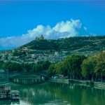
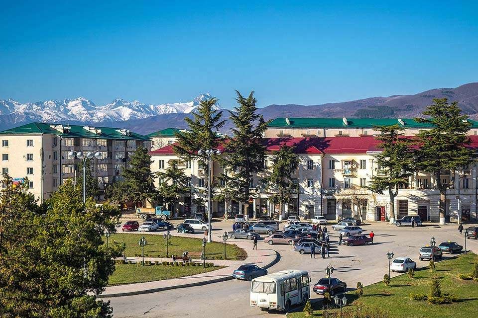
Quick facts. The territory’s area is commonly cited as about 3,885 km² (1,500 sq mi). A 2022 estimate places the population at ~56,500, though figures are debated due to displacement and limited independent surveying. Tskhinvali’s elevation is around 2,870–2,900 ft (≈875–885 m), giving it cool summers and snowy winters.
Location & Relief
South Ossetia spans upland basins and spurs of the Greater Caucasus. The highest summit commonly associated with the area is Mount Khalatsa at roughly 12,920 ft (3,938 m). Rivers drain south toward the Mtkvari (Kura) basin, and north via gorges into the Terek.
Key Connections
The Trans-Caucasus Highway (Transkam) links Tskhinvali to Russia through the Roki Tunnel—about 2.32 miles (3,730 meters) long—beneath the main ridge to North Ossetia–Alania. Southward, roads descend to Georgia’s central corridor near Gori and Tbilisi, though access depends on the political situation.
| Metric | Value |
|---|---|
| Area | 1,500 sq mi (3,885 km²) |
| Population (estimate) | ≈56,500 (2022) |
| Capital | Tskhinvali |
| Tskhinvali elevation | ≈2,867 ft (874 m) |
| Highest peak (nearby) | Mount Khalatsa ~12,920 ft (3,938 m) |
| Official languages (de facto) | Ossetian, Russian |
| Currency in use | Russian ruble (RUB) |
| Key route | Trans-Caucasus Highway via Roki Tunnel (2.32 mi / 3,730 m) |
Sources: widely cited geographical and demographic summaries; elevation/weather tools; language provisions in the de facto constitution.
Political Status & International Recognition
De jure vs. de facto. The United Nations and the vast majority of states recognize South Ossetia as part of Georgia. Georgia refers to it as the “Tskhinvali Region/South Ossetia,” and Georgian law designates it as an occupied area following the 2008 conflict. At the same time, de facto authorities—politically, economically, and militarily linked to Russia—administer the territory, with Russian forces present since 2008.
UN votes (2025). On 3–4 June 2025, the UN General Assembly once again adopted Georgia’s annual IDP/refugee resolution regarding Abkhazia and the Tskhinvali Region/South Ossetia, with a record 107 states in favor, 9 against, and 49 abstentions. (See the UNGA plenary record and vote summary.) These votes reaffirm the right of return and Georgia’s territorial integrity.
Recognition Snapshot
As of 2025, five UN members recognize South Ossetia as a state: Russia (since Aug. 26, 2008), Nicaragua, Venezuela, Nauru (2009), and Syria (2018). Following Syria’s 2024 regime change, Tbilisi-based outlets noted an abstention by Syria in 2025 UN voting and political debate over its earlier recognition, but formal revocation has not been confirmed by the UN.
A Short History to the Present
Soviet roots and early fighting. South Ossetia was a Soviet autonomous oblast within the Georgian SSR. Tensions rose during the USSR’s breakup, culminating in armed conflict (1990–1992) and a Russia-brokered ceasefire that left the area outside Tbilisi’s control. A 1990s–2000s “frozen conflict” persisted with episodic violence and failed status talks.
2008 war and after. Fighting escalated dramatically in August 2008. An EU-mandated Independent International Fact-Finding Mission (2009) found that Georgia initiated large-scale hostilities in Tskhinvali on 7–8 August, while also concluding that all sides—Georgian, Russian, and South Ossetian forces—committed IHL and human-rights violations. Russia subsequently recognized South Ossetia; most states and organizations did not.
August 2008—What Happened?
Hostilities flared after months of tensions and incidents along the line of contact. Georgian artillery and armor entered Tskhinvali; Russia responded with large-scale force through the Roki Tunnel and beyond. The six-point ceasefire (Aug. 12) ended major fighting, but left a hardened line and long-term international monitoring.
Recent politics. The de facto leadership remains closely tied to Moscow. Parliamentary elections on 9 June 2024 reshaped party balances, and discussions about a future referendum on joining Russia resurface periodically, most recently highlighted in 2024 reporting.
People, Languages & Culture
By the de facto 2015 census, Ossetians formed the large majority, with Georgians and Russians as notable minorities. External researchers warn that population figures vary widely due to displacement after the early-1990s and 2008 wars. Eastern Orthodoxy prevails across ethnic groups.
Ossetian (an Eastern Iranian language) and Russian are official languages in the de facto system; Georgian is used in some communities and schools. A 2011 referendum and constitutional texts formalized Ossetian and Russian at state level.
Economy & Connectivity
Economic profile. The local economy is small and heavily subsidized by Russia, with limited industry, agriculture in valley floors, and public employment. Trade and investment are constrained by the unresolved status and restricted crossings with the rest of Georgia.
Transport. The Roki Tunnel to North Ossetia–Alania (Russia) is the primary all-weather link. Toward Georgia proper, roads descend to Gori/Tbilisi but are affected by de facto crossing regimes. Distance from Tbilisi to Tskhinvali is roughly 62 miles (100 km); Tskhinvali sits near 2,867 ft (874 m) elevation, giving a cool, continental-mountain climate.
Security & Humanitarian Issues
ABL and “borderization.” The Administrative Boundary Line (ABL) between Tskhinvali-controlled territory and Georgia proper is monitored by the EU Monitoring Mission (EUMM). Since 2019, closures of major crossing points (e.g., Odzisi/Mosabruni and Sinaguri) have restricted family visits, work, healthcare, and education. Co-facilitators of the Ergneti Incident Prevention and Response Mechanism (IPRM) repeatedly call for full reopening. See the EUMM note from September 2019 and OSCE/EUMM statements from 2024–2025.
For primary documentation, consult EUMM and OSCE releases, and relevant UN and Council of Europe reports describing prolonged closures and detentions affecting civilians. A short starting point is the EUMM release on 2019 closures alongside Council of Europe consolidated reports.
FAQ
Is South Ossetia a country?
Most states and international organizations treat South Ossetia as part of Georgia. A handful of UN members (Russia, Nicaragua, Venezuela, Nauru, Syria) recognize it; UN General Assembly votes in 2025 again backed Georgia’s position and IDP rights.
How big is South Ossetia and how many people live there?
About 1,500 sq mi (3,885 km²); population is commonly cited just above 56,000 (2022). Numbers vary by source due to displacement and limited independent access.
How do you get in and out?
North–south travel uses the Roki Tunnel to Russia (≈2.32 mi / 3,730 m). Routes south toward Tbilisi pass the ABL and are subject to closures and permit regimes controlled by de facto authorities.
What Did We Learn Today?
- South Ossetia is internationally recognized as Georgian territory; 2025 UNGA support reached 107 states.
- Area is about 1,500 sq mi (3,885 km²); population cited ≈56,500 (2022).
- Key corridor: Roki Tunnel—2.32 mi (3,730 m)—linking to Russia.
- Official languages (de facto): Ossetian and Russian; Tskhinvali sits near 2,867 ft (874 m).
- Crossing-point closures since 2019 have had major humanitarian effects; international monitors urge reopening.