The “Four Continents” is a historical way of dividing Earth into four parts—Europe, Asia, Africa, and America—popular in early modern Europe (c. 16th–18th centuries). It emerged after Europeans recognized the “New World” and often appeared in art and monuments that personified each continent with symbols and rivers.
A Quick Primer: What “Four Continents” Means Today
In plain terms, “Four Continents” is not a scientific rule but a historical convention. It bundled Earth into four macro-regions—Europe, Asia, Africa, and America—at a time when global geography was still being pieced together. Modern geography usually teaches six or seven continents; the four-continent model survives mostly as a cultural reference (for example, in museum labels and city monuments). Britannica defines a continent as a large, continuous landmass but notes competing models; in some traditions, the Americas can be treated as a single continent called “America.”
If you see “Four Continents” in a gallery or guidebook, think of it as a historical lens. It is useful for understanding older maps, classical allegories, and how Europeans once imagined the world’s order—not as a replacement for the modern seven-continent approach taught in today’s English-speaking classrooms.
Old World vs. New World after 1492
The fourfold scheme took hold after European contact with the Americas in 1492. Mapmakers who had long organized the world as three parts (Europe, Asia, Africa) now added “America” as a fourth. This explains why many 17th-century works speak of the “four parts of the world.”
Why Australia/Oceania and Antarctica were absent
Australia (and broader Oceania) entered European maps gradually in the 1600s–1700s, and Antarctica was unknown to those artists and patrons or considered uninhabited and peripheral. Because the four-continent idea was already embedded in art and rhetoric, the set often stayed fixed at four even as new knowledge grew.
| Era/Context | Typical “Continents” Listed | Why It Looked That Way |
|---|---|---|
| Medieval (Europe) | Europe, Asia, Africa (3) | Classical and biblical geography; world known to Europeans. |
| Early modern (c. 1500s–1700s) | Europe, Asia, Africa, America (4) | Recognition of the “New World” as a distinct part of Earth. |
| Modern school models | Usually 6 or 7 (e.g., Asia, Africa, North America, South America, Europe, Australia/Oceania, Antarctica) | Scientific mapping; tectonics; educational standardization. |
The Four Continents in Art and Public Monuments
Artists personified continents as crowned women with animals and objects—lions for Africa, camels for Asia, ships for Europe, feathered headdresses for America. Peter Paul Rubens’s painting often titled The Four Continents (c. 1612–1615) shows female figures for Europe, Asia, Africa, and America alongside male personifications of their “great rivers”: the Danube, Ganges, Nile, and Río de la Plata—today in Vienna’s Kunsthistorisches Museum.
In Rome’s Piazza Navona, Gian Lorenzo Bernini’s Fountain of the Four Rivers (1651) dramatizes the same idea with sculpted river gods for the Nile (Africa), Danube (Europe), Ganges (Asia), and Río de la Plata (the Americas). A walk around the fountain is like circling a 17th-century world map in stone.
Across the Atlantic, Daniel Chester French’s marble groups The Four Continents (1905–1907) front the Alexander Hamilton U.S. Custom House in New York City. Each grouping—Asia, America, Europe, Africa—compresses an era’s global worldview into allegory. Even today, debates continue about meaning and context, which is part of why museums and archives interpret them carefully.
Geography and Numbers: What the Four Include, and How Big They Are
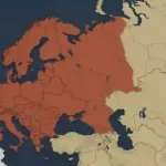
Under the Four Continents idea, “America” combines North and South America. Using Britannica’s areas, the combined “America” covers roughly 16.23 million square miles (42.04 million square kilometers)—North America at 9,355,000 sq mi (24,230,000 km²) plus South America at 6,878,000 sq mi (17,814,000 km²). Asia spans about 17,226,200 sq mi (44,614,000 km²); Africa about 11,724,000 sq mi (30,365,000 km²); and Europe about 4,000,000 sq mi (10,000,000 km²).
These four together account for roughly 49.18 million sq mi (≈127.0 million km²) of land—most of Earth’s 57.5 million sq mi (149 million km²) of land area—with the remainder largely in Oceania and Antarctica (which the old model left out). Figures are rounded for readability and reflect widely cited reference values as of 2025.
| Continent (Four-model) | Area (sq mi) | Area (km²) |
|---|---|---|
| Asia | 17,226,200 | 44,614,000 |
| Africa | 11,724,000 | 30,365,000 |
| Europe | ~4,000,000 | ~10,000,000 |
| America (N + S combined) | ~16,233,000 | ~42,044,000 |
How Other Continent Models Compare (and What the UN Uses)
Today’s English-language curricula mostly use a seven-continent model (Asia, Africa, North America, South America, Antarctica, Europe, Australia/Oceania). Other traditions group the Americas into one “America,” or merge Europe and Asia into “Eurasia,” yielding five or six continents. These choices reflect cultural and historical practice as much as geology.
For statistics, the United Nations doesn’t publish a mandatory “continent list” so much as a standard set of macro-regions (Africa; Asia; Europe; Latin America and the Caribbean; Oceania; Northern America). This system supports comparable data collection rather than declaring a single “correct” continent count. It roughly aligns with continents but splits the Americas into two statistical areas.
Why the Four-Continent Model Declined—and Where It Still Shows Up
As global exploration, mapping, and science advanced, educators preferred models that distinguished Oceania/Australia and Antarctica. Tectonic plate studies and standardized atlases reinforced six- and seven-continent teaching. By the 20th century, “Four Continents” had become a cultural artifact rather than a classroom rule.
Yet the idea remains visible in city squares, museum labels, and art history surveys. Bernini’s fountain in Rome, Rubens in Vienna, and the marble groups outside New York’s Custom House keep the four-continent lens alive—often prompting helpful conversations about how people once divided the world and why. For visitors, these sites offer a tangible “time capsule” of geography-as-imagined.
FAQ
Which four continents are in the “Four Continents” model?
Europe, Asia, Africa, and America (with “America” combining North and South America). This set appears across early modern maps and artworks, especially in Europe.
Why isn’t Oceania/Australia or Antarctica included?
When the four-continent idea crystallized (1500s–1700s), knowledge of Australia/Oceania was partial and Antarctica was unknown or sidelined. Later school models added them, which is why modern textbooks list six or seven continents.
What system does the United Nations follow?
The UN uses a statistical geoscheme that groups countries into macro-regions (Africa, Asia, Europe, Latin America and the Caribbean, Northern America, Oceania) to standardize data reporting; it is not a decree on “how many continents” there are.
Is “America” one continent or two?
It depends on tradition. The four-continent and many Romance-language traditions treat “America” as one; most English-language schooling splits it into North and South America. Both reflect historical usage rather than a single scientific rule.
What Did We Learn Today?
- “Four Continents” means Europe, Asia, Africa, and America—an early modern convention, not today’s school standard.
- It flourished in art and monuments (Rubens; Bernini; Daniel Chester French in New York).
- Combined “America” spans ~16.23 million sq mi (42.04 million km²); Asia ~17.23 million sq mi (44.61 million km²).
- Modern education often uses six or seven continents; the UN uses macro-regions for statistics.
- The four-continent idea helps us read older maps and public art with the right historical context.