Tuvalu is often reduced to a row of dots on a Pacific map or a headline about rising seas. Neither view explains how the country works. Its islands differ in shape, their settlements are separated by open ocean, and everyday life depends on the relationship between reefs, rainfall, usable land and reliable connections.
Tuvalu is a Polynesian country in the South Pacific made up of nine named island groups, with Funafuti as its capital. Not all are classic ring-shaped atolls: Nanumaga, Niutao and Niulakita are reef islands, while Vaitupu has mixed features. Low elevation, rainwater supply and sea transport shape its geography, but climate risk is not a fixed disappearance date.
How to use this article: Compare island forms, understand freshwater, follow capital names, or check population coverage.
1. Locate Tuvalu and Understand Its Capital
Nine island groups across the Pacific
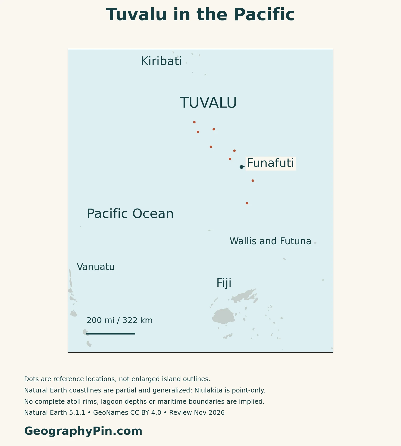
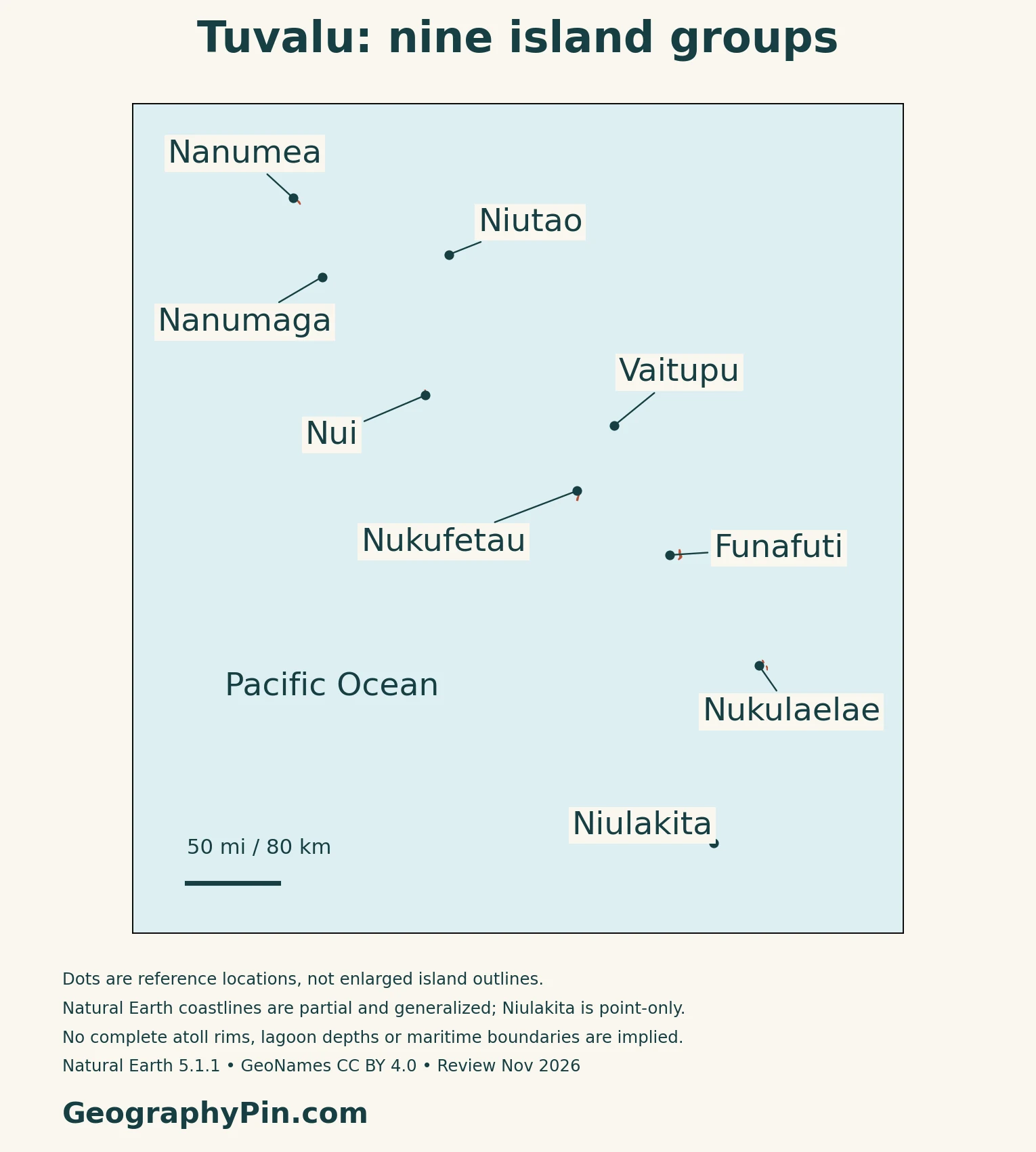
Tuvalu lies in Polynesia in the South Pacific, south of Kiribati and north of Fiji. Its nine main island groups are Nanumea, Nanumaga, Niutao, Nui, Vaitupu, Nukufetau, Funafuti, Nukulaelae and Niulakita. Some names refer to a reef island, while others encompass an atoll with several islets and a lagoon.
The national outline therefore cannot be read like a single island’s coastline. Open water separates the groups, and the number of named groups is not a count of every individual islet.
Funafuti, Fongafale and Vaiaku are nested places
Funafuti, the capital, is an atoll. Fongafale is its principal inhabited islet, and Vaiaku is the government-office area on that islet. The names describe different geographic scales, rather than three competing capitals.
Use the Oceania countries and capitals guide for the wider regional comparison.
2. Atolls, Reef Islands and a Mixed Case
Are all nine islands atolls?
No. The 2024 climate-hazards assessment prepared for Tuvalu’s government distinguishes five coral atolls, three table reef islands and one mixed atoll–reef island.
| Landform | Named islands | What to notice |
|---|---|---|
| Atolls | Nanumea, Nui, Nukufetau, Funafuti and Nukulaelae | Reef rims enclose substantial lagoons; dry islets occupy only part of the system |
| Reef islands | Nanumaga, Niutao and Niulakita | More continuous land surrounds small enclosed or infilled lagoon features |
| Mixed form | Vaitupu | Combines atoll and reef-island characteristics, with nearly enclosed lagoons |
For the broader formation process, see the atolls and coral formation guide.
A reef island need not have an open central lagoon
Tuvalu’s 2024 cultural-landscape submission describes Niutao and Nanumaga as former atolls whose lagoon spaces have been partly filled by accumulated material. Enclosed water, swamp and vegetation can therefore occur inside a compact island rather than within a broad, open lagoon. Vaitupu’s almost enclosed lagoon is another reason to look beyond the simple ring-shaped stereotype.
Low-lying does not mean one uniform height
A 2024 national LiDAR study measured a mean land elevation of about 5.1 feet (1.55 m) above mean sea level. Its highest natural features were storm-built coastal ridges around 21 feet (6.5 m), while some higher measured points were piles associated with human excavation.
The broad low-lying character is clear, but the often-repeated claim that every point is below 16 feet (5 m) is too simple. Elevation figures also depend on whether the reference is mean sea level or a higher tidal datum.
3. Rainfall, Water and Coastal Adaptation
A wet tropical climate can still bring drought
Tuvalu is warm and humid, with trade winds and frequent showers. The Pacific Soils Portal describes wetter conditions toward the southern islands and a generally wetter December–March period. Rainfall is not evenly distributed across the country or reliable from one year to the next.
La Niña can bring prolonged dry conditions. This matters because rain falling on a roof becomes a household resource only if there is enough collection and storage capacity to carry it through a dry spell.
Freshwater planning starts with tanks and demand
A November 2026 UN disaster-risk case study describes Tuvalu’s Water Resource Tool, which combines rainfall forecasts with information about household tanks and water use. It is designed to estimate how much water remains and support decisions such as conservation warnings and additional desalination.
This is a practical distinction between rainfall and water security. A forecast of rain does not say whether a particular household has a sound roof catchment, a full tank or enough stored water for its needs.
Flood risk is not a countdown to disappearance
Tuvalu’s coastal flooding reflects interacting tides, waves and sea-level conditions. The 2024 national hazard study models increasing flood frequency under specified future scenarios; it does not provide one date when every island disappears. Its projections also state assumptions about island and reef geometry.
Adaptation is already changing some shorelines. In October 2025, UNDP reported completion of roughly 20 acres (8 hectares) of elevated reclaimed land on Fongafale. That is a specific completed project, not proof that all of Funafuti or the entire country is protected. Broader hazard and adaptation outcomes remain location-dependent.
4. Settlement, Connections and the Ocean Economy
Outer-island connections depend on the sea
Funafuti is the national transport hub, but reaching an outer island requires more than crossing its lagoon. ADB’s July 2026 transport announcement describes sea travel as the connection between the capital and outer islands, with passenger and cargo services supporting access to markets, education and health care.
Vessels and landing facilities must work together. Maintenance, safe transfer between ship and shore, and suitable harbor infrastructure matter as much as the distance on a map.
Reef food and ocean fisheries operate at different scales
The Fisheries Department’s 2024 report distinguishes local subsistence and artisanal fishing from the offshore sector. Coastal fishing supplies fish, crabs and shellfish for consumption, sharing and local exchange. Oceanic fisheries involve licensing, vessel monitoring and regional management arrangements.
That difference helps explain why a small land area does not mean a small maritime economy. The nearby reef and lagoon contribute directly to livelihoods, while access to more distant fishing grounds links Tuvalu to international fleets and Pacific institutions.
Gardens are adapted to coral-island conditions
Traditional pulaka cultivation uses pits dug toward the groundwater table and enriched with organic material. Breadfruit, coconut and pandanus also belong to the cultivated landscape. These practices are responses to limited land, sandy coral substrates and water constraints, rather than evidence of the deep volcanic soils found on some higher Pacific islands.
5. Country Facts, Population and Government
| Item | Reference | Date or scope |
|---|---|---|
| Capital | Funafuti | Capital atoll; government offices at Vaiaku on Fongafale |
| Population | 10,643 | Total enumerated; December 12, 2022 |
| Surface area | About 10 sq mi (26 km²) | UN series, 2023; not surrounding ocean |
| Languages | Tuvaluan and English | Listed in the 2026 PCGN reference |
| Currency | Australian dollar (AUD) | National currency |
| Government | Constitutional monarchy | Parliamentary government |
| Local government | Eight Kaupule councils | Distinct from nine main island groups |
A census total includes more than resident households
The published 2022 census recorded 10,643 people on December 12: 10,632 residents and 11 non-residents. People living outside Tuvalu at the time were excluded, while residents in institutions were included. Fieldwork extended into 2023, and the report was released in April 2025.
Funafuti held 6,602 of the 10,632 residents, about 62%.
Local institutions and continuing statehood
Island-level governance combines traditional Falekaupule assemblies with their executive councils, the Kaupule. The Home Affairs directory lists eight councils; the nine geographic island groups do not correspond to nine separate councils.
Tuvalu’s 2023 Constitution expressly provides for the state’s continuity despite climate change or other causes of physical territorial loss. Physical habitability, adaptation and legal continuity are related but different questions.
What Did We Learn Today?
Tuvalu’s geography begins with differences within a small island country: broad atoll lagoons, compact reef islands and Vaitupu’s mixed form. Funafuti concentrates national functions, while other communities depend on maritime links. Rainwater storage, coastal exposure and marine resources connect the physical landscape to everyday life. Climate adaptation and constitutional continuity address different problems; neither should be confused with a simple prediction that the country vanishes on a particular date.
Sources & Data Notes
Population uses the December 12, 2022 census reference and distinguishes total enumerated people from residents. The report was released in 2025, not a new 2025 count. Surface area follows the UN’s 2023 series; it is not a current reclamation survey or maritime-area total. The climate-hazards report is dated 2024 despite its 2025 portal upload. Landform categories follow its explicit mixed treatment of Vaitupu. LiDAR elevations and flooding scenarios are from the 2024 research, with stated tidal datums and assumptions. The cultural-landscape source is Tuvalu’s tentative submission, not World Heritage inscription. Reclamation wording concerns completed works reported in October 2025; transport descriptions are not live schedules.
- Tuvalu Statistics: original 2022 census report
- Tuvalu Statistics: census release, April 2025
- UNData: Tuvalu reference series
- Tuvalu Home Affairs: local institutions
- Asia-Pacific Telecommunity: Tuvalu mission report, 2017–2018
- PCGN: Pacific Islands names and languages, November 2026
- Australian DFAT: Tuvalu country brief
- Tuvalu: 2023 Constitution, section 2
- CSIRO and partners: Tuvalu climate-hazards assessment, 2024
- Wandres and colleagues: national coastal flood-hazard assessment, 2024
- Tuvalu ministry: cultural-landscape tentative submission, 2024
- Pacific Soils Portal: climate setting
- UNDRR: water-resource forecasting, November 2026
- UNDP: completed coastal-adaptation works, October 2025
- ADB: maritime transport, July 2026
- Tuvalu Fisheries Department: 2024 annual report
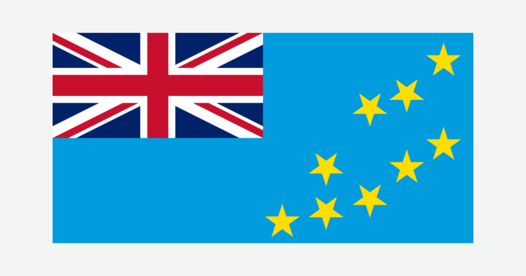
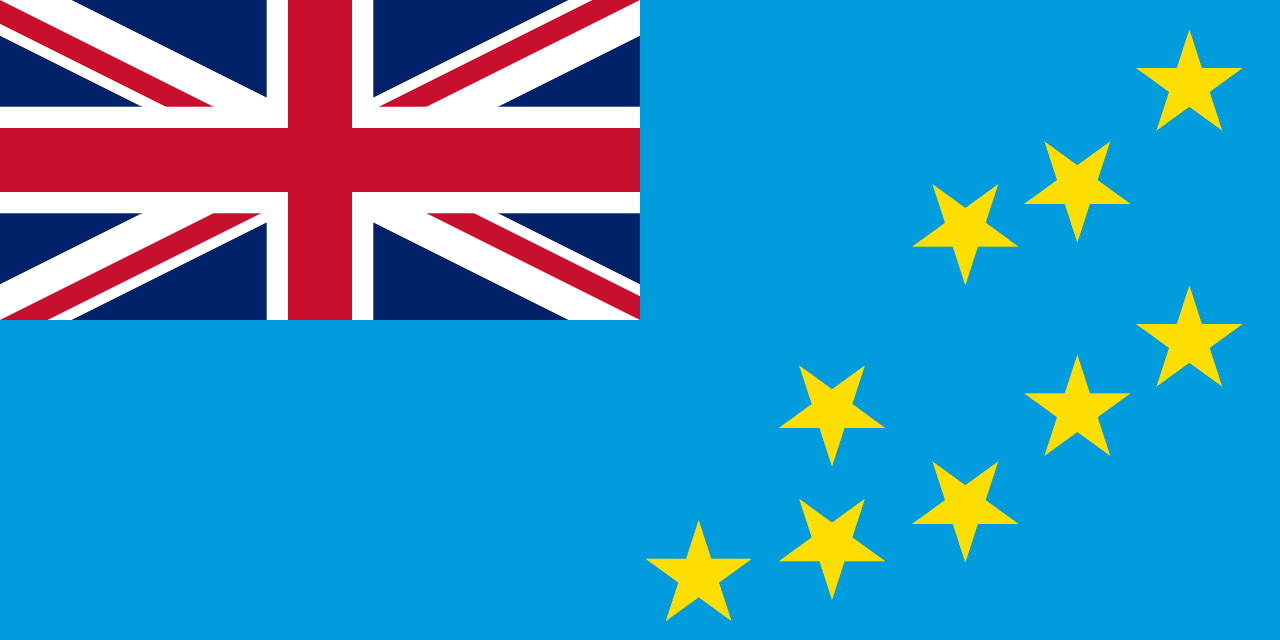
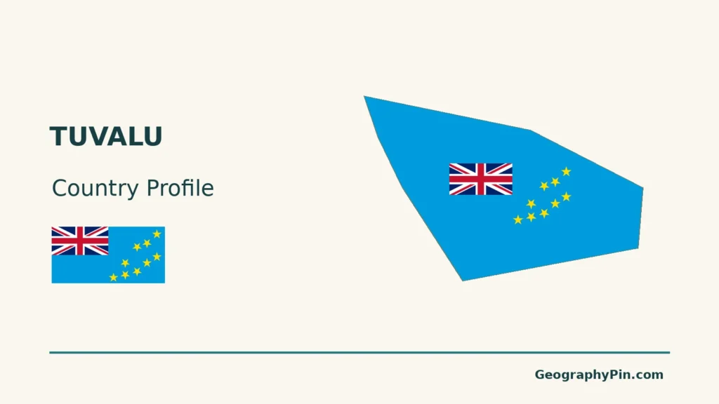
Map method: Original GeographyPin maps use public-domain Natural Earth country geometry v5.1.1 and GeoNames reference coordinates under CC BY 4.0. All nine source polygon components are retained, but these are not the nine named island groups: source coastlines are partial, and Niulakita is omitted by the polygon dataset. All named groups are located with reference points; dots do not enlarge actual land area. The maps show island geography, not relief, complete atoll rims, reef boundaries, lagoon depths, maritime claims or predicted flooding. Pacific-centered longitude keeps neighboring islands across 180° in context. The clean featured graphic deliberately uses a generalized Niutao island detail, not the whole country outline. Its separate intact flag and decorative motifs use FlagCDN artwork, with the Union flag and nine stars checked against Tuvalu’s 2022 revised National Flag Act. National symbols are used for editorial identification, without implying endorsement.