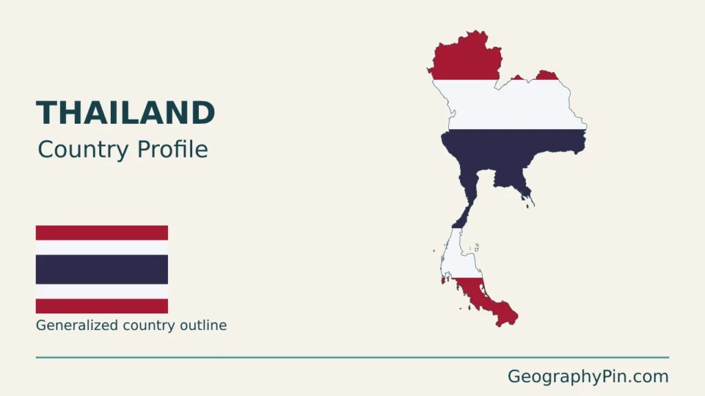
Thailand’s shape joins a broad mainland interior to a long southern peninsula. That outline contains quite different landscapes: northern mountain basins, the low Chao Phraya plain, the northeastern Khorat Plateau and two contrasting tropical coasts. Those differences explain much more about the country than a single description of beaches, rice fields or a nationwide rainy season.
Thailand is a Southeast Asian country with Bangkok as its capital. Its main geographic contrasts include northern and western mountains, the Chao Phraya lowlands, the Khorat Plateau and the southern peninsula. Rivers connect some of these landscapes, while drainage divides separate others. Monsoon winds and mountain exposure give the two southern coasts different rainfall patterns.
How to use this article: Compare the main landscapes, follow the different river systems, or see why rainy seasons vary between coasts.
1. Locate Thailand and read its map
Thailand lies in mainland Southeast Asia, with Myanmar to the west and northwest, Laos to the north and east, Cambodia to the southeast and Malaysia at the southern end of its land territory. The Gulf of Thailand opens beside the central and eastern coasts; the Andaman Sea borders the western side of the southern peninsula.
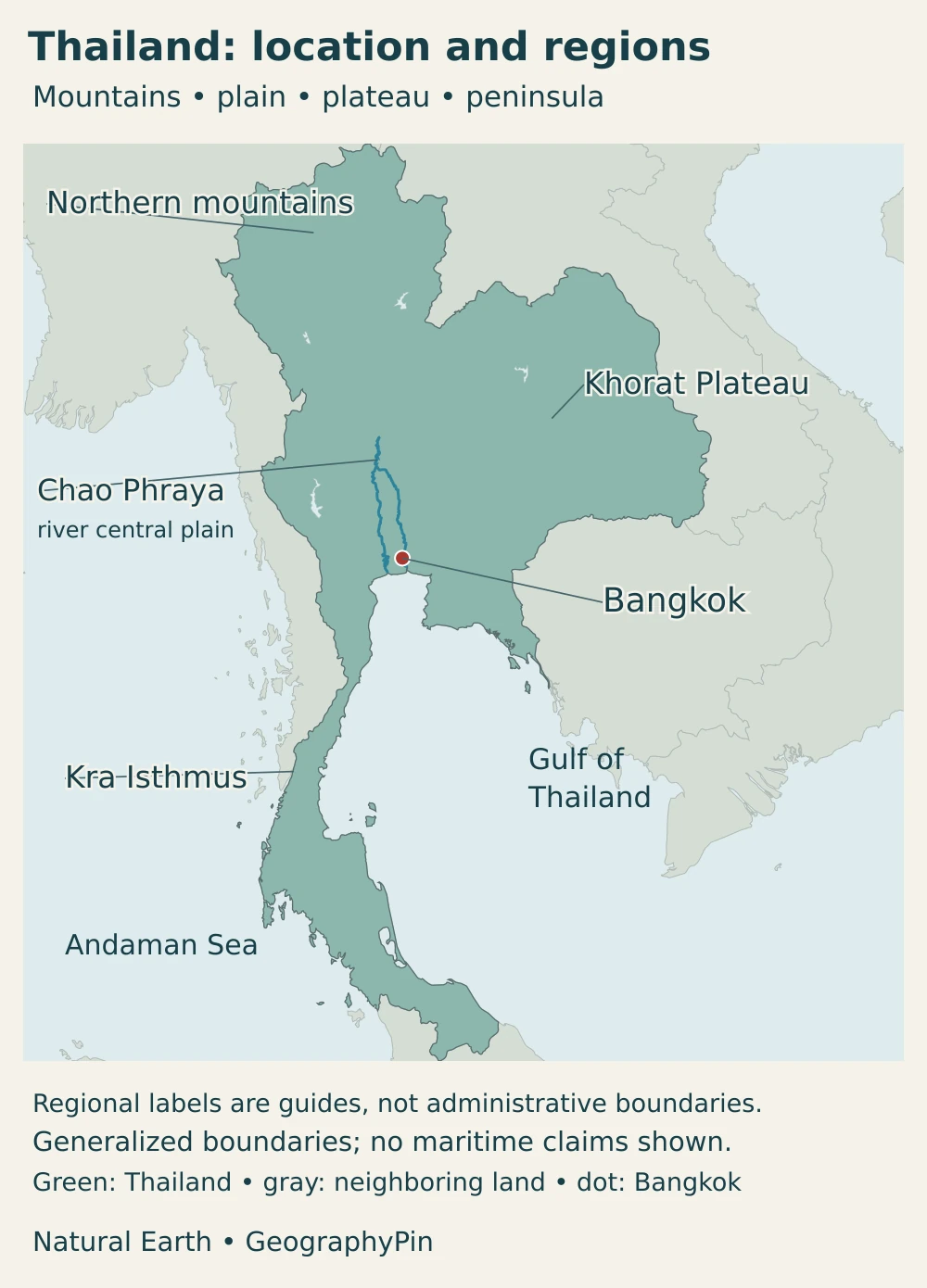
Bangkok stands on the lower Chao Phraya near the head of the gulf. The northern mountains and northeastern plateau occupy the broader mainland portion. Farther south, the country narrows into a peninsula shared geographically with southern Myanmar and continuing into Malaysia.
The Kra Isthmus is a narrow land connection between the broader mainland and the Malay Peninsula. It is not a waterway separating Thailand into two islands. A national locator can show that connection without implying that a proposed canal or transport project has been built.
For the wider regional setting, see our Southeast Asia map and country guide. This profile focuses on Thailand’s internal landscapes and the ways people use and connect them.
2. Country facts with dates and scope
| Item | Figure or description |
|---|---|
| Capital | Bangkok, also known by Thai-name forms including Krung Thep Maha Nakhon |
| Population | About 70.3 million usual residents on April 1, 2025, in the National Statistical Office’s 2025 census report published in 2026 |
| Area | Approximately 198,000 square miles (513,000 km²); rounded national area, not a separately measured dry-land total |
| Language | Thai is the principal national and official language; regional and community languages are also spoken |
| Currency | Thai baht (THB) |
| Government | Constitutional monarchy with a prime minister and a two-chamber National Assembly |
| Administrative scope | Provinces and local authorities; Bangkok has a special administrative status rather than belonging to a surrounding province |
The population figure refers to the census reference date, not a live count for today. The area is deliberately rounded: the government overview gives 513,115 km² without a detailed land-versus-inland-water methodology. It should not be presented as a precisely comparable dry-land statistic or used to calculate a highly precise density.
A census, a civil-registration total and a demographic projection answer different questions. Registered residence need not be the place where someone currently lives or works. Population figures for Bangkok also change substantially depending on whether they describe the administrative city or the wider metropolitan region.
Physical regions are another separate classification. The northern mountains, central plain, northeastern plateau and southern peninsula are useful geographic groupings, not four provinces or a single universal administrative system. Climate agencies may subdivide the south into eastern and western coasts because their rainfall differs.
3. Mountains, plain, plateau and peninsula
Four useful contrasts, not four identical blocks
Northern Thailand alternates between ridges and basins. Valleys such as the Chiang Mai basin provide comparatively level ground among higher terrain. The central lowlands are different: river deposits form a broad plain extending toward Bangkok and the gulf. In the northeast, the Khorat Plateau belongs largely to the Mekong drainage system rather than to the Chao Phraya basin.
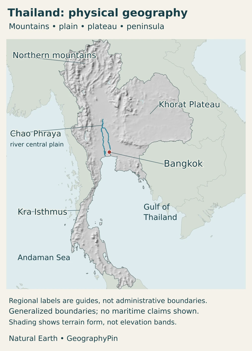
| Setting | Physical character | Geographic significance |
|---|---|---|
| Northern and western uplands | Ridges, high ground and intermontane basins | Valleys concentrate settlement and routes; drainage divides separate neighboring catchments |
| Chao Phraya plain | Low alluvial terrain opening toward the Gulf of Thailand | Farming, canals and metropolitan development share a floodplain setting |
| Khorat Plateau | Rolling northeastern terrain, river terraces and surrounding uplands | Tributaries connect much of the northeast with the Mekong, not with Bangkok’s river |
| Southern peninsula | Mountainous interior between Andaman and gulf coasts | Coastal exposure produces different rainfall seasons on opposite sides |
The Khorat Plateau is not a perfectly flat elevated tabletop. The Mekong River Commission describes a landscape of sedimentary terrain and eroded bedrock with resistant sandstone around its margins. Tributaries such as the Mun link the plateau with the Mekong. Smaller valleys, hills and river terraces matter within that broad regional label.
The peninsula likewise is not simply a strip of beach. Interior ranges separate coastal catchments; mountains approach the sea closely along parts of the Andaman side, while coastal plains are more extensive in parts of the east. A route across the peninsula can therefore cross a drainage divide as well as a change in weather exposure.
4. Climate, rivers and environmental contrasts
Why the two coasts have different rainy seasons
The southwest monsoon generally brings moist Indian Ocean air from roughly mid-May to mid-October. Much of upper Thailand becomes wetter, and exposed western coasts and mountain slopes receive rain. These are typical seasonal patterns, not fixed dates that apply identically every year.
During the northeast monsoon, air arriving from the Asian mainland often produces cooler, drier conditions in the north and northeast. On its way across the Gulf of Thailand, however, that air can collect moisture. The eastern side of the southern peninsula can consequently remain wet late in the year, when much of upper Thailand is drying out.
The usual hot, rainy and cool-season division works best as an overview of upper Thailand. It is less useful if applied mechanically to every southern beach. Elevation, coastal orientation and the timing of monsoon changes all affect local conditions. A dry-season label does not guarantee a rain-free week, nor does a rainy-season label mean continuous rain all day.
Bangkok’s river is not the Mekong
The Chao Phraya system carries water through central Thailand to the Gulf of Thailand. Its wider basin includes northern valleys associated with the Ping, Wang, Yom and Nan. Bangkok occupies the lower part of this system, where river flow, canals and low-lying urban development meet.
The northeast has a different outlet. Much of the Khorat Plateau drains toward the Mekong through tributaries including the Mun. The Mekong River also forms stretches of the boundary with Laos, but it is not the whole Thai–Lao boundary and does not run through Bangkok. Watershed boundaries therefore explain the country better than assuming all rivers flow south to the capital.
Flood risk also differs between settings. A large lowland river can rise after rain far upstream; a small steep catchment can respond much faster to local downpours. In the Bangkok region, development and drainage management interact with an already low-lying river landscape. A national relief map supplies context, not a property-level flood forecast or a substitute for current local warnings.
5. People, cities and languages
Bangkok and its metropolitan region
Bangkok is the conventional English name of the capital; Krung Thep and the longer Krung Thep Maha Nakhon are Thai-name forms encountered in official and everyday usage. These names do not identify different capitals. The city’s administrative boundary is also different from the larger urban and economic area around it.
The Bangkok Metropolitan Region convention includes Bangkok and five neighboring provinces: Nakhon Pathom, Nonthaburi, Pathum Thani, Samut Prakan and Samut Sakhon. It is not a single enlarged city government. Commuting, housing and industry can extend across those boundaries even when a statistical table reports each jurisdiction separately.
That distinction matters when comparing cities. A registered population for Bangkok should not be placed beside a metropolitan estimate elsewhere and presented as a like-for-like ranking. The reference date, residence definition and geographic boundary belong with the number.
Thai and regional language diversity
Thai is the principal national and official language. Regional speech and other community languages remain important: Isan in the northeast, for example, is closely related to Lao. Nationality, a physical-region label and a household’s language are not interchangeable categories.
Regional centers connect different landscapes rather than forming smaller copies of Bangkok. Chiang Mai lies in a northern basin, while northeastern cities serve plateau communities and southern settlements connect inland routes with coastal activity. The capital’s importance should not obscure those separate regional networks.
6. Government and economy in their geographic setting
Thailand is a constitutional monarchy. The national legislature has a House of Representatives and a Senate, while the prime minister heads the government. Provinces and local authorities organize administration at different levels; geographic labels such as the Khorat Plateau do not establish separate regional governments.
The Eastern Economic Corridor illustrates how policy regions differ from natural regions. Its core provinces are Chachoengsao, Chon Buri and Rayong, east and southeast of Bangkok. The program connects industrial development with transport and other infrastructure on the Eastern Seaboard. It is a development area, not an additional province or a synonym for all of eastern Thailand.
That concentration is only one part of the national economy. Central lowland farming, northeastern agricultural communities, northern regional services and southern coastal activity occupy different physical settings. Landform influences access to water and transport, but it does not mechanically determine what every resident does for a living.
Infrastructure can strengthen connections while introducing shared vulnerabilities. A lowland industrial district and nearby housing may depend on the same drainage network; a port’s supply routes can extend inland across several jurisdictions. Understanding the landscape helps explain why water management, transport planning and economic development cannot be treated as unrelated subjects.
Frequently Asked Questions
Why do Thailand’s regions have different rainy seasons?
Monsoon winds reach the country from different directions during the year. Mountains and coastal exposure affect where moisture falls. The northeast monsoon often dries upper Thailand but can bring substantial rain to the southern gulf coast after passing over warm water.
What are Thailand’s main physical regions?
A useful overview distinguishes northern and western mountains, the Chao Phraya plain, the Khorat Plateau and the southern peninsula. These are broad landscape groupings, not four administrative provinces; more detailed classifications subdivide them.
Does the Mekong flow through Bangkok?
No. Bangkok is on the lower Chao Phraya. The Mekong belongs to a different river system and forms stretches of Thailand’s boundary with Laos. Much of the northeastern plateau drains toward it through tributaries.
What Did We Learn Today?
Thailand’s northern basins, central plain, northeastern plateau and southern peninsula create different patterns of water, settlement and climate. The Chao Phraya and Mekong are separate drainage systems, and the two southern coasts do not share one identical rainy-season calendar. Bangkok’s administrative city is smaller in scope than its metropolitan region. Keeping those distinctions clear makes the country’s maps and statistics easier to interpret.
Sources & Data Notes
- National Statistical Office, 2025 Population and Housing Census report: 2026 report: approximately 70.3 million usual residents on April 1, 2025; not a civil-registration total.
- Thai government portal, national area: Area rounded to approximately 513,000 km² because this overview does not specify a detailed land/water accounting method.
- Thai government portal, currency: Baht and THB currency code.
- Election Commission of Thailand, Constitution translation: Constitutional institutions; English translation for reference, with the Thai legal text authoritative.
- Land Development Department, physiographic regions: Regional terrain and drainage settings; older geological chronology and numerical extremes not reproduced.
- Mekong River Commission, geographic regions: Khorat Plateau and its connection with Mekong tributaries.
- Thai government portal, meteorological department monsoon explanation: Seasonal wind direction and contrasting southern gulf-coast rainfall.
- Land Development Department, seasons: Seasonal overview and the southern east-coast exception.
- UK Permanent Committee on Geographical Names, Thailand factfile: Capital names, language context and Kra Isthmus; older population not used.
- OECD, Bangkok: Building Resilient Cities: Metropolitan geography and lowland flood-management context; older population and economic totals not presented as current.
- Eastern Economic Corridor Office, background: Core provinces and the distinction between a development initiative and an administrative unit.
Map sources and scope: Original GeographyPin compositions use public-domain Natural Earth land, city, river and lake geometry and its actual georeferenced shaded-relief raster. The maps use a Lambert azimuthal equal-area projection centered near 13°N, 101°E. The entire country shares one frame and scale; islands are not relocated.
The blue Chao Phraya line follows the source river geometry, not an invented extension through its northern tributaries. Broad mountain, plateau and isthmus labels identify approximate locations, not measured physiographic or administrative boundaries. Relief illustrates terrain form rather than elevation bands or hazard levels. Generalized coastlines can omit small islands and fine detail.
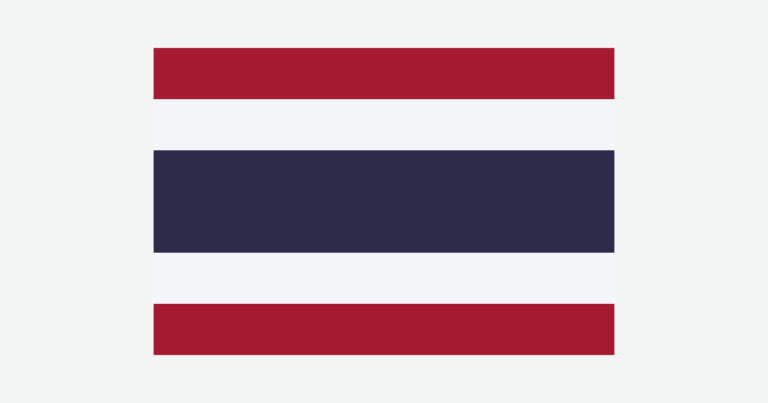
These source boundaries are not a legal demarcation, a real-time territorial-control map or a ruling on contested border sites. No maritime claims are drawn. The cover uses the Thai flag vector cited in the media provenance, with its original proportions retained before decorative clipping and a complete flag shown separately. GeographyPin branding identifies the original composition.