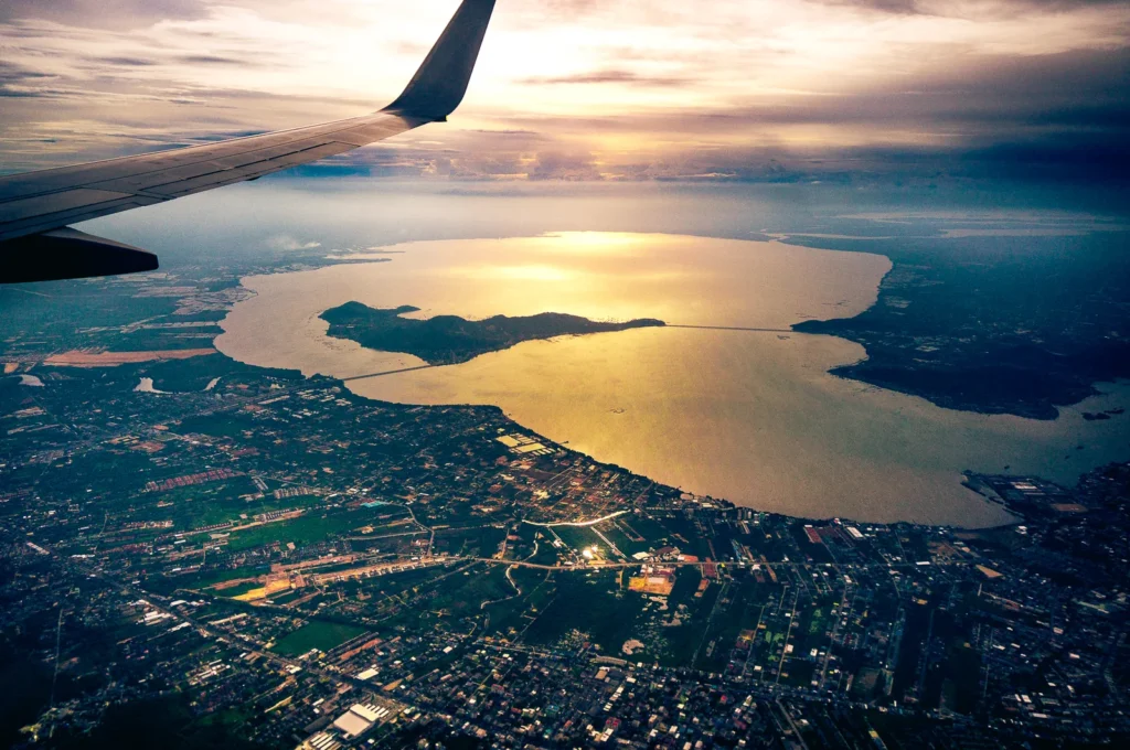
Songkhla Lake is not a uniform freshwater lake. It is a connected coastal lagoon system in southern Thailand, with inland wetlands, broad shallow basins and an opening to the Gulf of Thailand near Songkhla.
One connected system, different water conditions
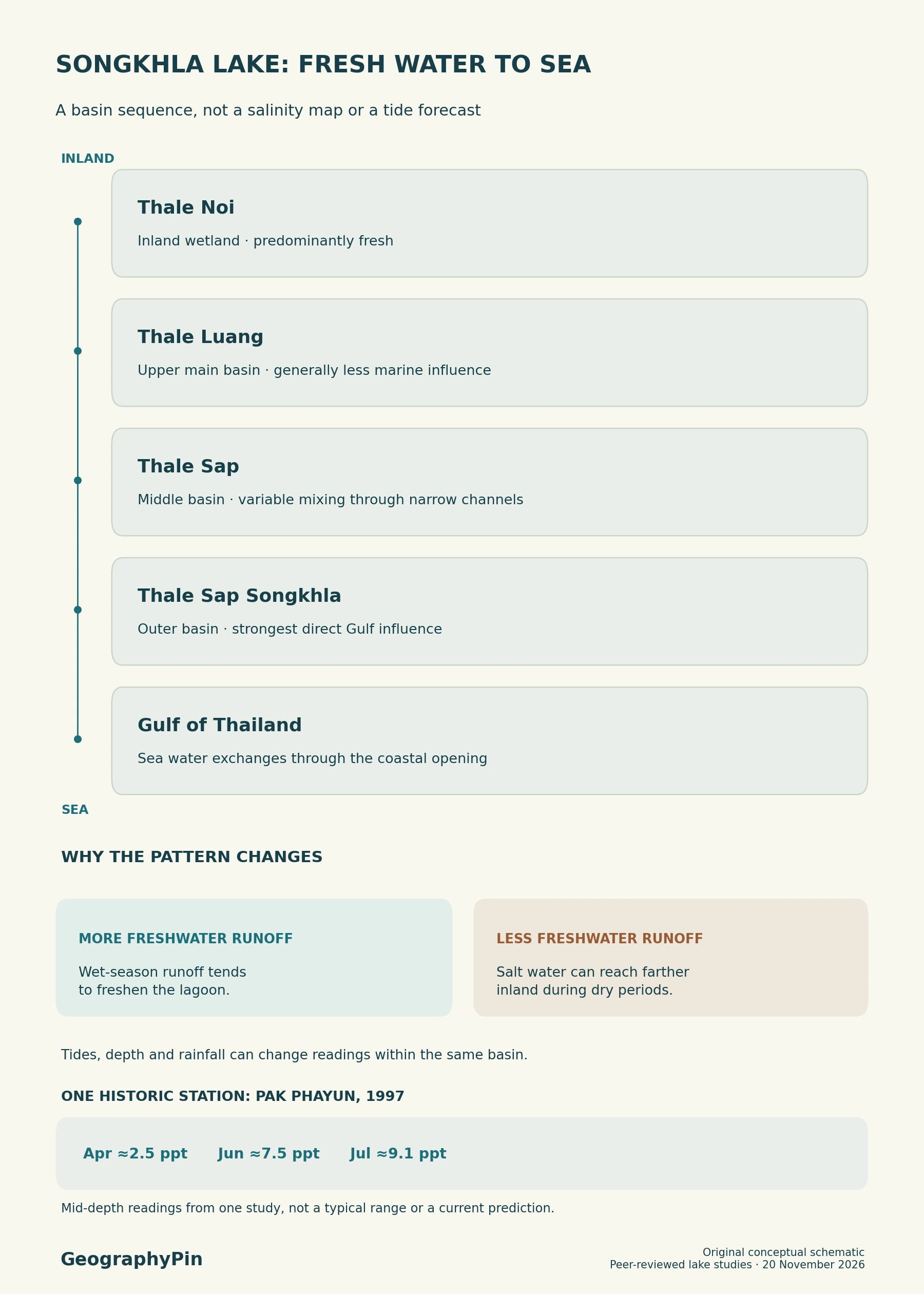
Songkhla Lake is a coastal lagoon system with generally fresher water toward Thale Noi in the north and stronger seawater influence near the southeastern entrance to the Gulf of Thailand. Its connected basins respond to tides, freshwater inflow and seasonal changes, so salinity varies across both place and time.
Compare the basin names, follow the salinity change inland, or see what a salt reading measures.
Where Songkhla Lake lies on the map
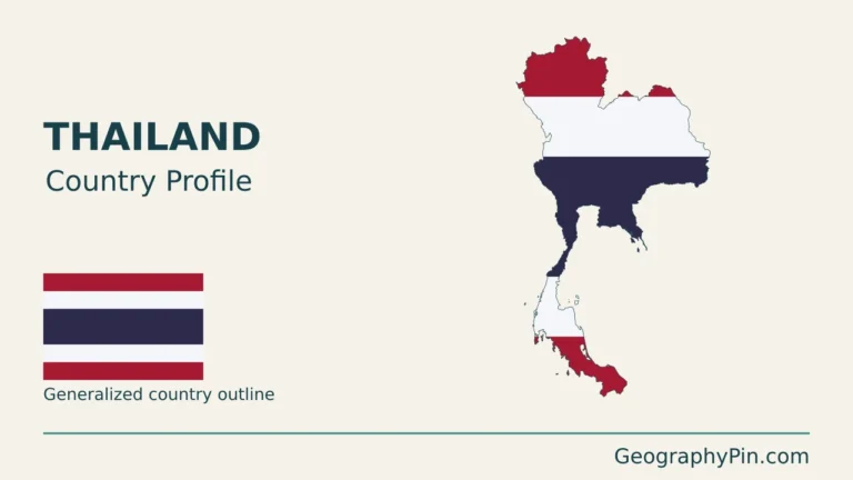
Songkhla Lake is a coastal lagoon system on the eastern side of southern Thailand’s peninsula. Its inland waters lie west of the Gulf of Thailand, with the main sea entrance beside Songkhla at the southeastern end. It is not on the Andaman coast.
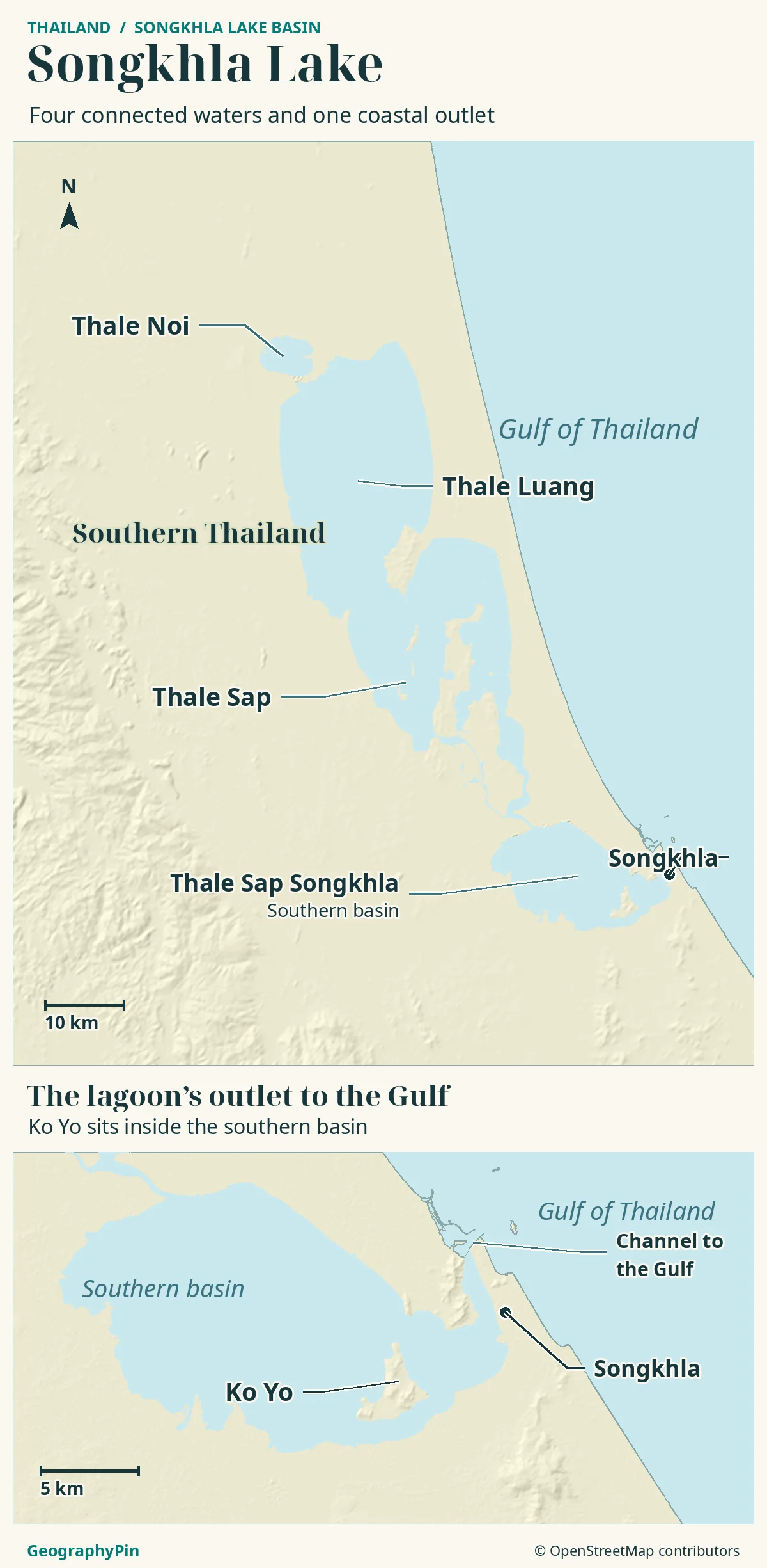
The long water body has several connected sections rather than one uniform basin. A useful reading order runs from Thale Noi in the north, through the upper and middle waters, to the lower lagoon and its entrance to the gulf.
Four parts, with names that are sometimes grouped differently
This article uses the four-part arrangement in Prince of Songkla University research: Thale Noi, Thale Luang, Thale Sap and Thale Sap Songkhla. Some references combine the broad middle waters under Thale Luang and describe three main lakes. That is a difference in grouping, not evidence that a lake has vanished.
Songkhla can also mean the city or province. “Songkhla Lake Basin” extends beyond the open water to the land draining toward it. A basin-area statistic therefore cannot be substituted for the lagoon’s water surface.
Thale Noi: the freshwater northern end
Thale Noi is the small northern lake and its associated wetland landscape. A 2021 study describes its lake surface as about 11 square miles (28 square kilometers). That is not the area of the entire surrounding wetland, non-hunting area or Songkhla system.
The distinction is visible on a map: open water is only part of a broader landscape containing seasonally flooded ground and vegetation. A line around a conservation area may include far more than the blue lake polygon.
FAO recognizes the Thale Noi Wetland Pastoral Buffalo Agro-ecosystem as a Globally Important Agricultural Heritage System, designated in 2022. Buffalo herding, fishing and cultivation are connected to the annual flooding cycle, rather than being separate activities superimposed on an unchanging lake.
FAO describes herders moving buffalo through flooded grazing areas and changing livelihood activities with the seasons. These practices help explain why an apparently empty wetland margin can still be productive, managed land. They do not establish that any field or grazing route is open for unrestricted visitor access.
Thailand’s Ramsar report identifies Phru Khuan Khi Sian within the Thale Noi Non-Hunting Area. That named designation does not cover every part of the Songkhla Lake system.
Thale Luang and Thale Sap: the changing middle waters
South of Thale Noi, the system broadens into Thale Luang, the upper lake, before narrowing into connected waters farther south. In the four-part convention, Thale Sap is the middle section between this upper lake and the lower lagoon.
These are not sealed containers. Water exchange through connecting channels links their conditions, while freshwater arriving from surrounding land changes the balance with saltwater arriving from the gulf. “Brackish” means a mixture of fresh water and seawater, not one fixed salt concentration.
A north–south trend, not permanent bands of salinity
The general pattern is fresher water inland and stronger marine influence toward the sea entrance. But a map divided into permanent freshwater, brackish and saltwater blocks would be too simple. The position and strength of the transition change with runoff, tidal exchange and water losses.
A salt-transport study published in 2005, using 1997 surveys, found different dry-season salinities across the connected sections and reduced tidal influence farther inland. Its measurements demonstrate spatial variation, but they are not readings for a trip today.
The lake’s shared name does not require uniform water. A sample taken at one bank, depth and date describes those conditions. It cannot automatically represent another section, a different season or even a deeper layer at the same location.
The Gulf of Thailand entrance and the lower lagoon
Thale Sap Songkhla, the lower or outer lagoon, has the most direct connection to the Gulf of Thailand. The entrance lies at the system’s southeastern end near Songkhla, not at Thale Noi in the north.
The geographic distinction between a lake and a lagoon matters here. The land and coastal barrier partly enclose the water, but the channel maintains a connection with the sea. Calling the system a lagoon explains why tides and seawater matter even far from an ocean-facing beach.
Flow is not simply a one-way river arrow pointing out to sea. Tides exchange water through the entrance, while freshwater drainage can push water outward. The balance changes over time, and channel geometry influences how readily water and salt move between sections.
On a regional map, locate the sea opening before interpreting the long inland shape. The closest-looking point on the eastern shore is not necessarily another open connection to the gulf. A coastline map is also not a navigation chart: it supplies orientation, not channel depths, safe routes or clearance information.
How to interpret the landscape without misreading its water
| Visible feature | Useful interpretation | Limit |
|---|---|---|
| Thale Noi and wetland margins | The northern freshwater landscape includes more than open water. | A wetland boundary is not a lake-surface measurement. |
| Connected middle basins | Narrow passages link larger expanses of water. | Each basin does not have a permanent, uniform salinity. |
| Lower lagoon entrance | The direct gulf connection explains marine influence. | Mapped water does not establish navigable depth. |
Salinity is not the same as water quality
Salinity measures salt content, not pollution or whether water is safe to drink.
At Pak Phayun, an inland station in the lagoon system, a 1997 survey measured about 2.5 parts per thousand at mid-depth in April, 7.5 in June and 9.1 in July. The same place changed over a few months. These are historical observations, not today’s readings.
A Rajamangala University of Technology Srivijaya report describes local salinity monitoring on April 1, 2024, undertaken because changing salt levels affected water storage, agriculture and aquaculture. Its practical message is that local decisions need measurements, not just the name of the lake or the usual seasonal pattern.
The underlying sediments also record a different part of the environmental story. Research published in 2021 examined a sediment core collected in 2019 to reconstruct changes in trace-metal inputs over preceding decades. Such a study is historical environmental evidence, not a live water-quality certificate for every shore.
For a visit, identify the intended lake section and the actual departure point. A Thale Noi wetland outing and a lower-lagoon trip near Songkhla show different parts of the same system. Neither should be described as covering the whole lagoon without a route that demonstrates it.
Frequently Asked Questions
Which part of Songkhla Lake is most affected by seawater?
The lower lagoon, Thale Sap Songkhla, opens directly to the Gulf near Songkhla. The other basins are farther inland. Tides and freshwater inflow change the strength of the marine influence; there is no fixed line on the diagram between fresh and salty water.
Is Ko Yo an offshore island in the Gulf of Thailand?
No. Thailand’s official tourism directory places Ko Yo, also written Koh Yo, within Songkhla Lake. A visit there is a lagoon-island experience, not a visit to an island out in the open gulf.
What Did We Learn Today?
Songkhla Lake is best read from its northern wetlands to its southeastern sea entrance. Thale Noi, the upper and middle basins and the lower lagoon share water connections but not identical conditions. Basin names depend partly on grouping, and salinity changes with location and time; neither a simple color band nor a historic sample describes the whole system today.
Sources & Data Notes
The four-part naming convention follows Prince of Songkla University research in the 2018 World Lake Conference proceedings. ILEC groups some waters differently and contains historical observations, not live conditions. The 2005 salt-transport paper reports surveys from 1997; the chart uses only three dated mid-depth measurements at Pak Phayun. FAO, Thailand’s Ramsar reporting and Thai university work support the wetland and management distinctions. Thale Noi’s area follows the 2021 research description; the square-mile conversion is rounded. No current salinity, navigation depths or boat schedules are asserted.
- Prince of Songkla University: Songkhla Lagoon study, 2018 proceedings, pages 380–382
- ILEC World Lake Database: historical Songkhla description and grouped basin names
- Pornpinatepong et al., 2005: Salt transport in Songkhla Lake; 1997 Pak Phayun series, p. 892
- Dong and colleagues, 2021: lake setting and sediment-core research
- FAO: Thale Noi agricultural heritage system
- RUTS: local salinity monitoring, evidence dated April 1, 2024
- Thailand: Ramsar national report, specific named protected sites
- Thailand Tourism Directory: Ko Yo in Songkhla Lake
Map: GeographyPin original atlas using OpenStreetMap coastlines from November 18, 2026, and mapped lake polygons, Songkhla and Ko Yo retrieved November 19. © OpenStreetMap contributors, ODbL. Relief: Mapzen/AWS Terrain Tiles and underlying elevation sources. The four-part grouping is for orientation; no salinity boundaries, bathymetry or boat routes are shown.
Photograph: Songkhla Lake aerial view, Nopphasin Suksawat, 2014, CC BY-SA 3.0. Resized and converted to WebP; this is a historical view, not evidence of present water conditions.
Sources checked November 19, 2026.