Explainers & Big Questions
Countries With the Most Time Zones (and Why France Beats Everyone)
Ask a pub quiz question like “Which country has the most time zones?” and most people will shoot back “Russia” or “the United States.” Both are huge, both…
Browse GeographyPin
Ask a pub quiz question like “Which country has the most time zones?” and most people will shoot back “Russia” or “the United States.” Both are huge, both…
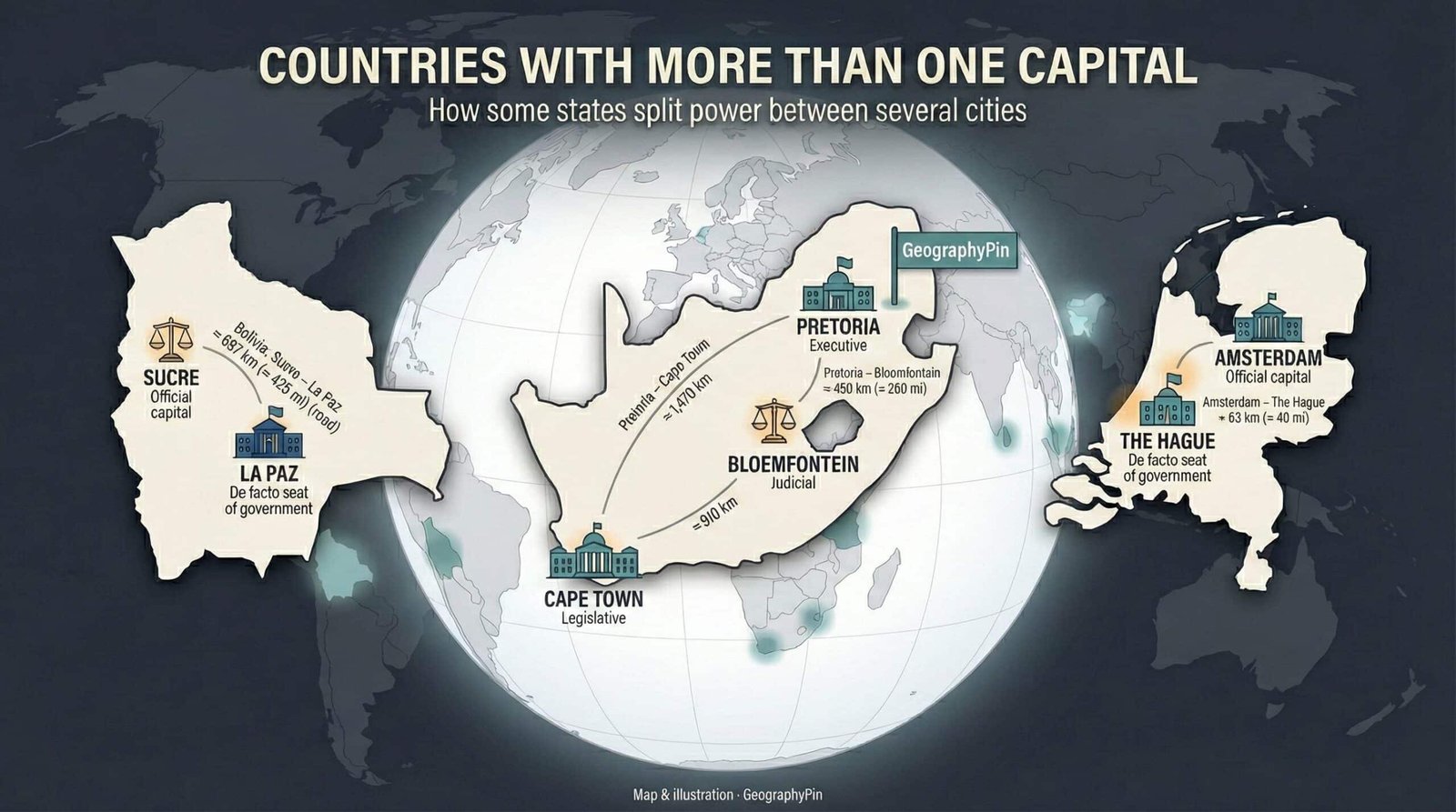
Most countries pick one big capital city and put almost everything there.But a small group — from South Africa to Bolivia and the Netherlands — deliberately split power…
Rivers do not stay where maps put them. Banks erode, channels split, and sandbars appear, but those physical changes do not always move an international boundary. The decisive…