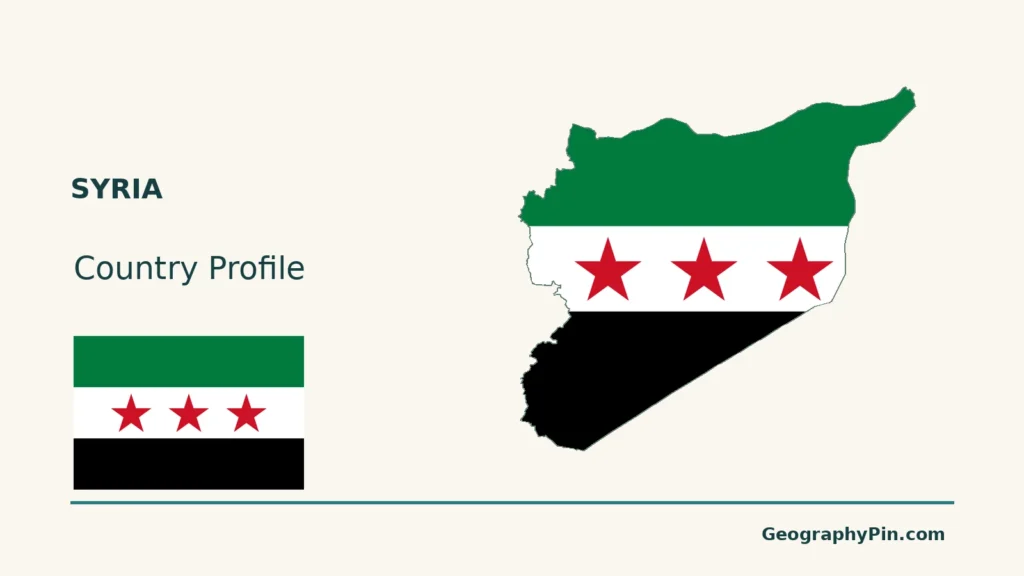
Syria stretches from a Mediterranean shore through western mountains to inland plains and the dry Badia. A coastal scene and a view of the Euphrates corridor therefore describe different parts of the country, not competing pictures of one uniform desert. Understanding those contrasts also means keeping physical geography separate from changing political control.
The sea moderates conditions along Syria’s western coast, while elevation makes the mountains cooler. Farther inland, the maritime influence weakens and daily and seasonal temperature contrasts become larger. The southeastern steppe is much drier than the western margin. These are broad climatic patterns, not a forecast for every place or year.
How to use this article: Locate the country, compare the physical settings, or follow the Euphrates corridor.
1. Locate Syria and Read Its Physical Regions
Between the Mediterranean and Inland Western Asia
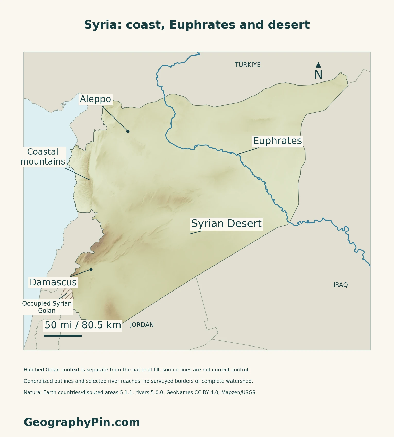
Syria has a Mediterranean coast in the west, Türkiye to the north, Iraq to the east, Jordan to the south and Lebanon to the southwest. Damascus and Aleppo provide useful city reference points. The southwestern map also distinguishes the occupied Syrian Golan; it is not a current-control map.
For the wider setting, see the Middle East regional guide.

Four Broad Landscape Settings
| Setting | Geographic character |
|---|---|
| Mediterranean margin | A narrow coastal strip west of the mountains. |
| Western mountains | Uplands running broadly parallel to the coast. |
| Interior plains | Inland settings including the plains around Damascus, Homs, Hama and Aleppo. |
| Badia | Dry steppe and semi-desert toward the Iraqi and Jordanian borders. |
2. Compare Coastal and Inland Climate
Sea Influence and Elevation
The 2010 national climate communication describes rainy winters and drier summers on the western coast, colder mountains and larger day-to-night and seasonal temperature ranges inland.
The Badia has hot, dry summers but can have very cold winter nights. Desert conditions do not imply year-round heat.
3. Follow the Euphrates Corridor
Water Arrives From Beyond the Local Landscape
The Euphrates reaches Syria from Türkiye and continues into Iraq. Much of its flow originates in wetter upstream highlands, so a river can cross a dry landscape without depending only on rainfall immediately beside it.
The UN-ESCWA/BGR basin inventory identifies the Sajur, Balikh and Khabour among its Syrian tributaries. It also describes irrigation, hydropower and drinking-water uses, and how dams have changed the river’s seasonal flow pattern.
Course, Catchment and Current Flow Differ
The river line shows a course, not its drainage-basin boundary, present discharge or water quality. Historical basin descriptions do not establish whether a particular installation is operating today.
For the wider basin, see the Tigris and Euphrates map guide.
4. Distinguish Long-Term Geography From a Crop Season
A Dated Example of Rainfall Variability
FAO’s August 28, 2026 country brief described improved cereal-growing conditions after the drought-affected 2025 harvest. Rainfall from December 2025 helped crop development, while increased water flow and heavy rain also caused localized flooding and crop damage in parts of the Euphrates corridor during spring 2026.
That combination matters: a wetter season can improve production overall while damaging particular places.
Historical Monitoring Has a Different Purpose
A separate FAO summary published in September 2026 describes a satellite-based assessment of agricultural drought during 2021–2025. It identifies vulnerability in rainfed cropland and grazing areas. This historical assessment and the later seasonal brief answer different questions; neither is a live map of conditions today.
5. Check Dated Country Facts
| Item | Reference |
|---|---|
| Capital | Damascus |
| Population reference | About 25.620 million; UN medium-fertility projection for July 1, 2025 |
| Area reference | About 71,498 sq mi (185,180 km²); UNData surface-area figure dated 2023 |
| Currency | Syrian pound (SYP) |
| Official language | Arabic, under Article 4 of the March 2025 Constitutional Declaration |
| Legal framework | Transitional framework established by the March 13, 2025 declaration |
| Administrative reference | 14 governorates, used in UNICEF’s January–March 2026 reporting |
Population during displacement and return
The UN figure is a projected de facto population, not a new census or a worldwide count of Syrian citizens. The UN’s Common Country Analysis identifies 2004 as the last national population census. Its statistical annex gives a different estimate, 24.4 million for August 2025. Those references should not be treated as a measured population decline between two dates.
Displacement, return and gaps in statistical coverage make the reference date and method essential. Refugee, returnee and internally displaced-person totals cannot simply be added to a national population estimate: these categories measure different circumstances and can overlap.
Legal framework and territorial scope
The declaration provides a five-year transitional period and names Damascus as the capital. SANA’s October 11, 2026 account of parliamentary committee work still refers to the declaration; the old 2012 Constitution is not presented here as the current framework.
The UN identifies the occupied Golan as Syrian territory. That legal status is distinct from military control. Governorate names, national statistics and generalized map outlines do not establish present control, access or travel safety.
For a broader comparison, see the Asian countries and capitals reference.
What Did We Learn Today?
A physical map, a dated population estimate and a current-control map are different kinds of reference.
Sources & Data Notes
Sources, dates and map conventions
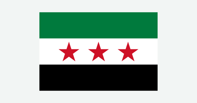
Population and area follow explicitly dated UNData references; its technical notes define the listed surface area as excluding inland water. The original Arabic declaration was visually checked for the capital, language, flag motif and transitional provisions; its automated English translation was used only as an aid. Flag proportions follow the identified rendition rather than an interpretation of the declaration’s dimension wording. The administrative reference is a dated UNICEF reporting framework, not a map of control. FAO’s older agricultural overview supports stable physical regions only, not its population, economic or land-use totals. The April 2010 national climate communication supports qualitative contrasts; old station normals and pre-transition political descriptions are not used as current facts. The 2013 UN-ESCWA/BGR inventory supports river geography and water-use categories, not current discharge, operating infrastructure or treaty compliance. The online FAO seasonal brief is explicitly dated August 28, 2026. The separate September 2026 drought-summary page was read; its full technical report is not claimed to have been inspected. No source imagery is reused.
- UNData: Syrian Arab Republic, dated population and area references
- UNData technical notes: population and surface-area conventions
- United Nations Common Country Analysis: Syria 2025, consultation in early 2026
- March 13, 2025 Constitutional Declaration: original Arabic, Articles 4–6 and 50–53
- SANA, October 11, 2026: constitutional committee work
- UNICEF Syria response snapshot, January–March 2026
- UN General Assembly resolution 80/81: occupied Syrian Golan
- EUAA Syria Country Focus, July 2026: replacement of the 2012 Constitution
- FAO: Syrian agriculture overview, physical-region descriptions only
- Syria’s Ministry of Environment/UNDP/GEF: Initial National Communication, April 2010, qualitative climate context
- UN-ESCWA/BGR: Euphrates River Basin, 2013 inventory
- FAO GIEWS: Syria country brief, August 28, 2026
- FAO: September 2026 summary of agricultural drought assessment, 2021–2025
Original maps: Natural Earth public-domain countries and disputed areas 5.1.1, rivers 5.0.0; GeoNames CC BY 4.0 coordinates; Mapzen/USGS terrain. The cover and main fill use the source Syria outline; occupied Syrian Golan is separately hatched in the maps and removed from neighboring Israel’s fill. This follows the distinction in UN resolution 80/81, not present control or a new boundary survey. Small Shebaa source geometry is also kept separate. Source borders are generalized; review date November 17, 2026 is not their survey date. Five source Euphrates records, including Firat and Al Furat aliases, are plotted without invented joins; the map is not the entire watershed. Region labels are approximate. Six isolated negative terrain anomalies were withheld using a local-median test; other negative samples remain. No precise elevations or current water extent are asserted. Flagpedia’s reusable rendition uses three red stars; the motif was checked against original Arabic Article 6 of the 2025 Constitutional Declaration. The separate flag is complete.