Find the head of the Gulf of California on a Sonoran Desert map. The desert extends inland from both shores and crosses the U.S.–Mexico border, taking in river flats, cactus-covered slopes and volcanic ground. Where its color stops on the Baja California peninsula depends on which classification the map uses.
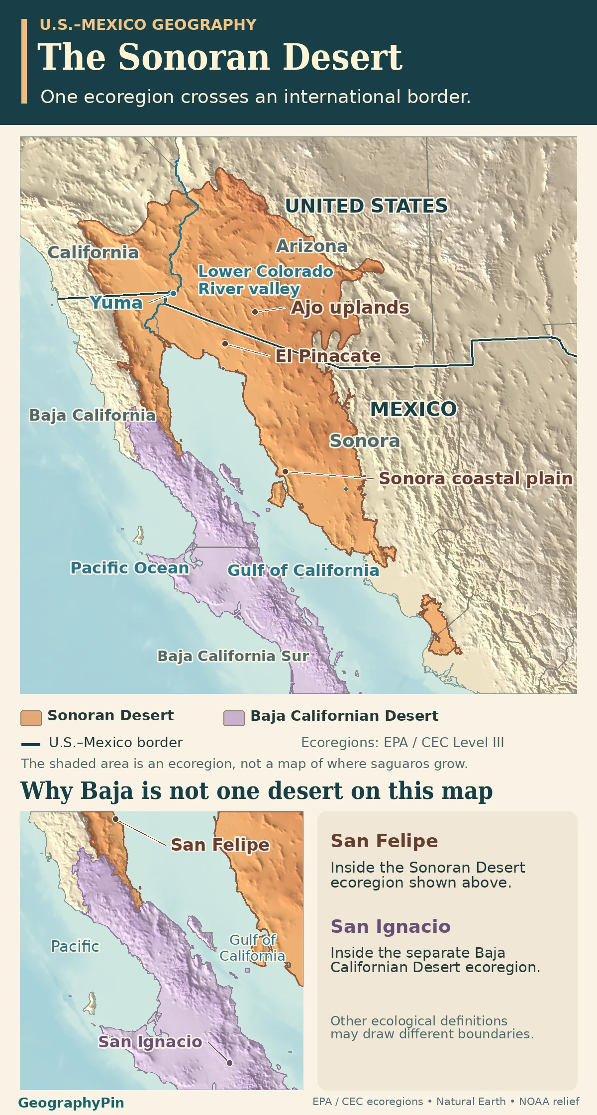
The Sonoran Desert includes parts of southeastern California, southwestern Arizona and northwestern Mexico. The continental ecological map follows the desert around the upper Gulf of California and across the international border. It does not include every part of Sonora or the Baja California peninsula, and saguaros grow in only part of it.
How to use this article: Check the cross-border outline, then compare the lower Colorado valley, the Arizona uplands and dunes and lava near the Gulf.
Where the Sonoran Desert crosses the border
Read the ecology and the international line separately
The Sonoran Desert reaches from southeastern California and southwestern Arizona into northwestern Mexico around the upper Gulf of California. The Commission for Environmental Cooperation’s Level III classification calls it ecoregion 10.2.2. Its outline includes parts of Arizona, California, Baja California and Sonora and the northern tip of Sinaloa. The U.S.–Mexico boundary crosses that outline; it is not the southern edge of the desert.
The code is useful because it says what is being mapped: a continent-wide ecological region. Neither a state map nor a range map for one cactus species is expected to match it.
Lower Colorado valley: two kinds of water on a desert map
Follow the river past Yuma toward the Gulf
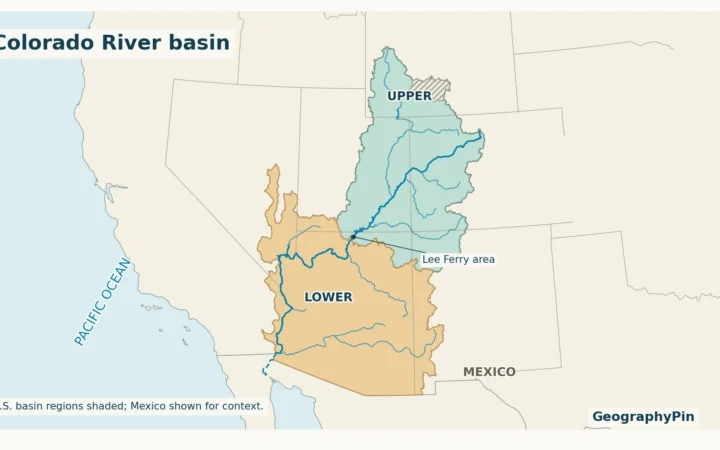
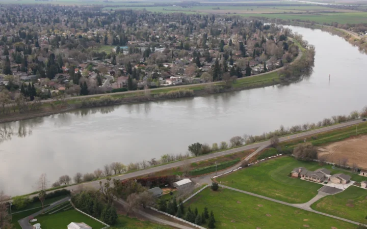
On the western side, follow the lower Colorado River past Yuma to its delta in Mexico, at the head of the Gulf of California. The river has brought water and sediment from a basin far larger than the desert. Riverbank vegetation and irrigated fields can sit beside dry desert flats without suggesting that the whole lowland has a wet climate.
The U.S. Bureau of Reclamation’s delta account describes a regulated river reach and records a 2014 environmental release that reached the sea. A map line shows the river’s geographic course, not continuous surface water at the mouth. It is also not the edge of the ecological region.
Arizona uplands: where saguaros find suitable slopes
Read the plants across a slope, not just across a border
At Organ Pipe Cactus National Monument, both Arizona Upland and Lower Colorado Desert landscapes are represented. The National Park Service’s field description notes more saguaro, palo verde and organ pipe cactus higher on the gently sloping fans below the mountains, and more creosote and saltbush on the lower ground. They are different habitats within one desert.
That is why a wild saguaro range map is smaller than the Sonoran Desert. The cactus does not occupy the entire region. Freezing can damage it, and local moisture, elevation and slope position affect where stands occur. A saguaro-rich photograph shows an example of the desert, not the rule used to draw its edge.
Sonora coastal plain: dunes and lava in the same desert
Find El Pinacate beside the Gran Desierto de Altar
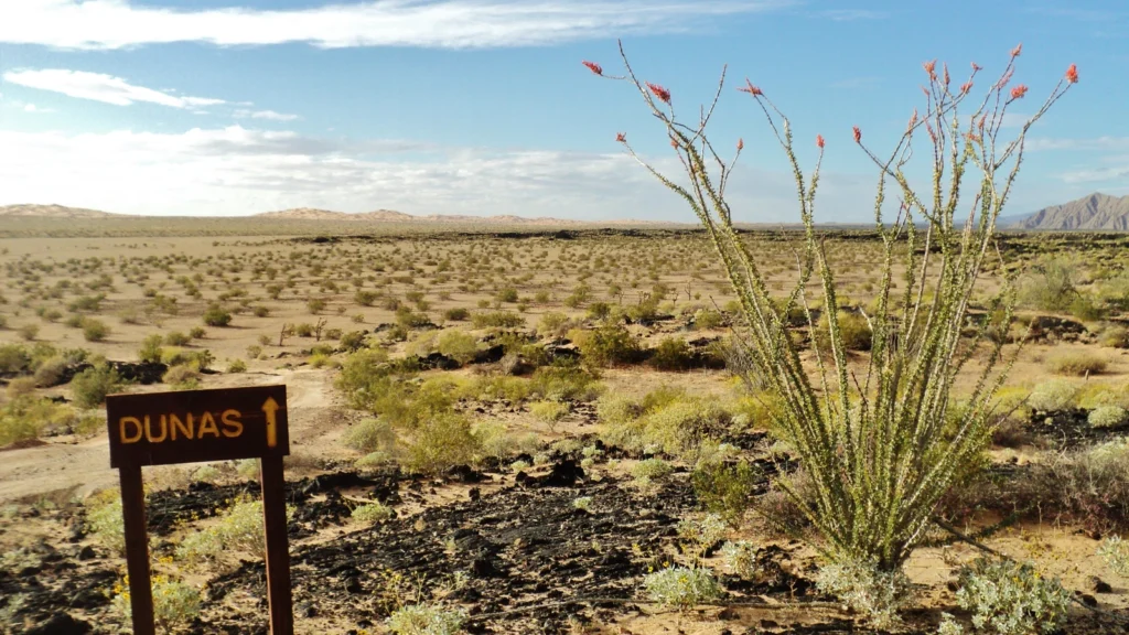
Look inland from the upper Gulf near Puerto Peñasco. Mexico’s protected-area agency identifies the dune fields of the Gran Desierto de Altar next to the dark lava and craters of El Pinacate. A sand-colored desert fill can hide that contrast: the desert includes both a field of windblown dunes and a volcanic landscape.
Mexican ecological work divides the desert at a finer scale. CONABIO’s Level IV categories distinguish the Upper Gulf deserts, the Central Sonoran Desert, and a different set of alluvial plains associated with the Yaqui, Mayo and Fuerte rivers farther south. These names describe different ground and vegetation, not new national borders or exact equivalents of U.S. local subdivisions.
Which map puts the Baja California edge where?
Pick two places on the peninsula. San Felipe, on the upper Gulf, falls inside the EPA-hosted continental Sonoran polygon at its town-center point. Farther south, San Ignacio and the nearby Vizcaíno Desert are in the separate Baja Californian Desert, code 10.2.3. The point check at the town of Villa Alberto Andrés Alvarado Arámburo gives the same classification. Both sides of that ecological line can look unmistakably desert-like.
The boundary changes if the map uses another classification. Forrest Shreve’s vegetation study, shown in a comparative analysis of Baja bioregions, included the Vizcaíno Desert as a Sonoran subdivision. The CEC classification groups it separately. So “is the Vizcaíno part of the Sonoran Desert?” has different answers under those two rules, not because the coastline or state border moved.
Frequently Asked Questions
Is the Gran Desierto de Altar another name for the entire Sonoran Desert?
No. It is a specific dune landscape at the upper Gulf in northwestern Sonora. El Pinacate and Gran Desierto de Altar form a named biosphere reserve within the larger Sonoran Desert.
Is the Salton Sea part of the Gulf of California?
No. It is an inland lake with no outlet, separated from the Gulf by the low crest of the Colorado River delta. The U.S. Geological Survey traces its modern formation to a 1905–07 breach of an irrigation canal that sent Colorado River floodwater into the basin.
How can you tell an organ pipe cactus from a saguaro?
Compare where the stems branch. An organ pipe cactus usually has many slender stems rising from near the base. A mature branching saguaro has a main trunk with arms that grow from its sides farther above the ground. Both can occur in the same Arizona uplands.
What Did We Learn Today?
The Sonoran Desert crosses a political border and contains very different landscapes: the lower Colorado corridor, cactus-bearing slopes in Arizona and dunes beside lava in Sonora. San Felipe and Vizcaíno show why two otherwise credible maps can disagree on the Baja edge. Read the legend before deciding what lies inside.
Sources & Data Notes
The original GeographyPin atlas uses EPA-hosted Commission for Environmental Cooperation Level III polygons, Natural Earth coastline and boundaries, and NOAA ETOPO 2022 terrain. The Baja point examples were checked against those polygons, not used to determine whole municipal boundaries. CONABIO documents the finer Mexican categories. Shreve’s historical vegetation classification is a separate convention. U.S. Reclamation, the U.S. Geological Survey, the National Park Service and Mexico’s protected-area commission support the drainage and habitat examples; no present water or travel conditions are implied.
Photo: El Pinacate y Gran Desierto de Altar by Kyle Magnuson, February 28, 2014, CC BY 2.0 (cropped and resized). Map data: Natural Earth, NOAA ETOPO 2022, EPA/CEC North American Level III ecoregions.