The Philippines is often pictured as beaches and scattered islands, but its geography also includes mountain corridors, broad agricultural valleys and densely settled metropolitan districts. The seas connect those landscapes while making travel between them dependent on ports, ferries and air routes. Reading the country through Luzon, the Visayas and Mindanao helps organize that complexity without pretending every island has the same terrain or hazards.
The Philippines is an archipelagic country in Southeast Asia with Manila as its capital. Its islands are commonly grouped into Luzon, the Visayas and Mindanao. Luzon and Mindanao are also individual large islands, while the Visayas is a group of islands. Mountain ranges, river valleys, monsoon exposure and urban connections create important differences within each group.
How to use this article: Compare the main island landscapes, distinguish Manila from Metro Manila, or explore why hazards vary by place.
1. Locate the Philippines and read its map
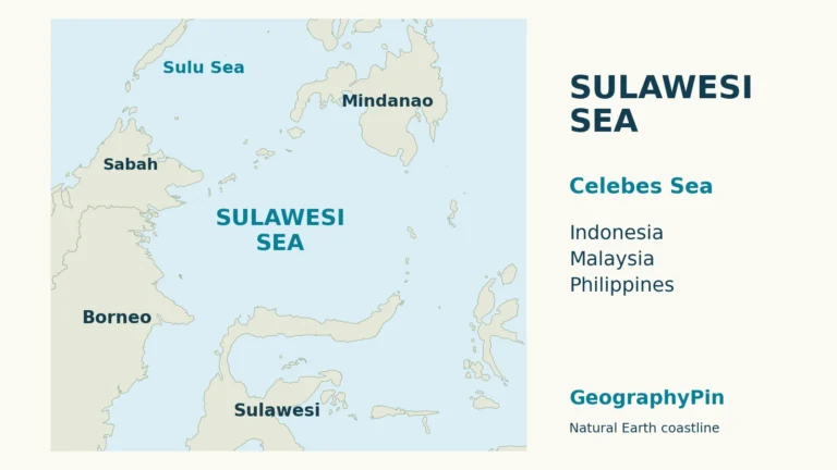
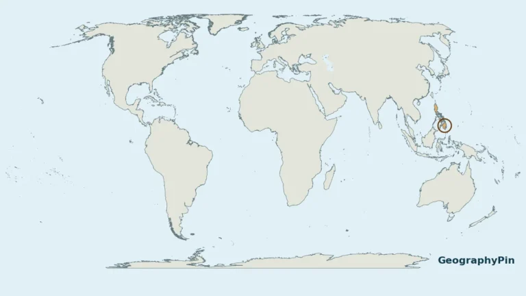
The Philippines lies in the western Pacific, east of Vietnam, south of Taiwan and north of Indonesia. The Philippine Sea is on its eastern side; the South China Sea lies to the west. The Sulu Sea and the Sulawesi, or Celebes, Sea help define its southern maritime setting.

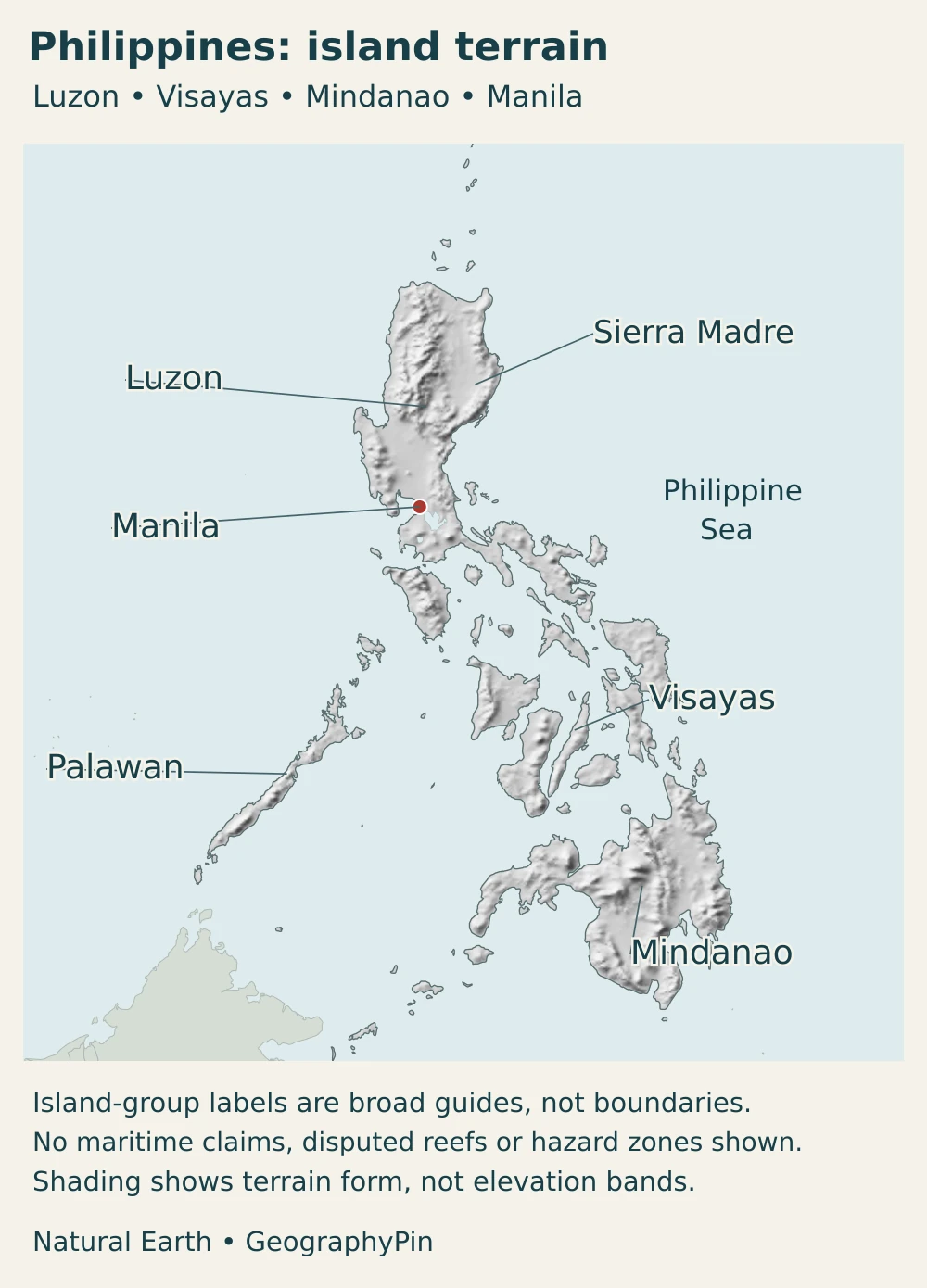
Luzon occupies the northern part of the main archipelago, the Visayan islands lie centrally, and Mindanao is farther south. Palawan extends southwestward toward Borneo rather than forming a bridge of continuous land. The country has no land border with a neighboring sovereign state.
For a detailed world and regional locator, use our separate guide to where the Philippines is located. This profile concentrates on what those islands are like: their relief, water, climate, settlements and economic connections.
2. Country facts with dates and scope
| Item | Figure or description |
|---|---|
| Capital | Manila; the wider Metro Manila area is designated the permanent seat of national government |
| Population | 112,729,484 on July 1, 2024, from the 2024 Census of Population |
| Area | About 115,831 square miles (300,000 km²), published as land area in the 2025 Philippine Statistical Yearbook; underlying survey basis explained below |
| Island count | 7,641, the NAMRIA preliminary inventory figure cited by the Department of Tourism in March 2022 |
| Languages | Filipino is the national language; Filipino and English are official languages for communication and instruction, with regional languages auxiliary official languages in their regions |
| Currency | Philippine peso (PHP) |
| Government | Republic with a presidential system |
| Administrative regions | 18 in the Philippine Statistics Authority’s 2025 regional accounts |
The census total is dated, not a live 2026 estimate. It includes 1,708 Filipinos in Philippine embassies, consulates and missions abroad under the census coverage; it is not a count of all Filipinos worldwide. The yearbook’s land-area table refers to cadastral surveys and estimated areas supplied by the Land Management Bureau as of December 2013. Its national figure is not a new 2025 land survey, and unfinished surveys mean component areas do not necessarily add to that total.
The island count is not a claim that every island is visible on a national-scale map. The Department of Tourism’s explanation traces the figure to preliminary results of NAMRIA’s 2013 inventory. It should not be described as a new 2026 survey, or used to infer a precise number of inhabited islands.
Land area, archipelagic waters, territorial seas and an exclusive economic zone are different measurements. A figure for the land must not be expanded by adding maritime claims without explaining the change in definition. The maps here illustrate land and selected locations, not a legal delimitation of maritime jurisdiction.
3. Luzon, the Visayas and Mindanao
Island groups are not three uniform regions
Luzon and Mindanao are both names of individual islands and broader island groups. The Visayas, by contrast, is a collection of islands rather than one island called Visayas. Panay, Negros, Cebu, Bohol, Leyte and Samar are among its principal islands. These broad geographic groupings do not replace the country’s administrative regions or provinces.
| Setting | Terrain and water | Connection with settlement |
|---|---|---|
| Northern Luzon | Cordillera highlands, Cagayan Valley and the Sierra Madre to the east | Valleys provide farming and settlement corridors; mountain roads cross much steeper terrain |
| Central and southern Luzon | Plains, volcanic landscapes, lakes and coastal lowlands | Major urban and industrial districts coexist with agricultural land and locally significant hazards |
| Visayas | Separate islands with uplands, coastal plains, straits and bays | Ports and short sea crossings connect cities and smaller island communities |
| Mindanao | High mountains, extensive river basins and varied coastal settings | River valleys support farming and towns, while mountain and coastal districts have different exposure |
| Palawan | A long, narrow island and surrounding smaller islands with rugged interior terrain | Its southwestward orientation and coastal connections distinguish it from the main Luzon landmass |
The Cagayan Valley shows how mountain geography creates a recognizable region. The Cordillera stands to its west and the Sierra Madre to its east, with the Caraballo Mountains to the south. The river network drains the valley northward. That arrangement helps explain why settlements and farming concentrate on lower ground while the surrounding uplands form different environments.
Geological activity is not one nationwide risk level
The Philippine fault system extends through parts of the archipelago, and offshore subduction zones add further sources of earthquakes. PHIVOLCS maps individual active faults because proximity and local ground conditions matter. A country outline shaded as tectonically active cannot show whether a particular neighborhood lies on a fault or on ground susceptible to strong shaking.
Earthquake-related hazards also differ. Ground rupture occurs along a moving fault; shaking affects a wider area; liquefaction requires susceptible loose, water-saturated sediments; and landslides depend on slope conditions. Volcanic hazards depend on the volcano and the process involved. These distinctions are more informative than calling all islands equally dangerous or treating Mindanao as free of natural hazards.
Official local hazard maps and current advisories remain necessary for decisions about a specific place. The relief map here shows terrain, not an eruption forecast, evacuation zone or assessment of building safety.
4. Climate, rivers and environmental contrasts
Rainfall seasons depend on exposure
The Philippines has a tropical maritime climate, but elevation and exposure create meaningful local contrasts. Upland Baguio is cooler than nearby lowland settings because of its altitude. Rainfall responds to moisture-bearing winds and mountain barriers, so two places at a similar latitude can experience different seasonal patterns.
A wet-season June-to-November and drier-season December-to-May description is useful for many western areas, but it is not a universal calendar for the entire archipelago. PAGASA recognizes four rainfall-based climate types. Eastern exposures and areas without a sharply defined dry season do not follow the same pattern as places with a pronounced dry season.
Tropical cyclones bring strong winds and heavy rain, but their effects extend beyond the point where the center crosses land. Mountain slopes, river catchments and exposed coasts respond differently. Southern areas are less often crossed by many cyclone tracks, not immune to storms, flooding or landslides.
Valleys carry both water and livelihoods
The Cagayan River system drains a large part of northeastern Luzon toward the north coast. Tributaries connect the valley with its surrounding mountains. Farmland and towns on lower ground benefit from water and accessible terrain, while river flooding can affect those same settlement corridors.
Mindanao has several distinct river basins, not one river draining the whole island. The Mindanao River system includes tributaries such as the Pulangi and Allah, while the Agusan is a separate basin in eastern Mindanao. Their floodplains support farming, fishing and communities, making upstream land and water management relevant well beyond a single municipality.
Coastal flooding needs its own distinction: storm surge is a storm-driven rise in coastal water, whereas a tsunami has a different generating mechanism. Neither is simply another name for a river flood. A community can face more than one kind of flooding, but the causes and warning systems are not interchangeable.
5. People, cities and languages
Manila is a city; Metro Manila is a region
Manila is the capital city on the western side of Luzon, beside Manila Bay. Metro Manila, also called the National Capital Region, includes Manila and other local government areas such as Quezon City, Makati and Pasig. In the July 1, 2024 census, Manila city had 1,902,590 people, while the National Capital Region had 14,001,751. A regional total therefore should not be labeled as the population of Manila city.
The legal distinction is explicit: Presidential Decree 940 names Manila as the capital and the Metro Manila area as the permanent seat of national government. Government offices, business districts and residential areas are spread across the metropolitan region rather than contained in one compact capital-city core. Quezon City is a separate city, not merely another name for Manila. The wider built-up and commuting area also connects with districts beyond the administrative capital region.
Other urban centers organize different island networks. Cebu City is an important center in the Visayas, while Davao City is on Mindanao. Ports, airports and inter-island services connect these cities with smaller settlements. Sea crossings remain part of national connectivity even where roads are extensive within an individual island.
National and regional languages have different roles
The constitution identifies Filipino as the national language. Filipino and English serve as official languages for communication and instruction, while regional languages have auxiliary official status in their regions and serve as auxiliary media of instruction. These legal roles do not mean every household uses the same language at home, or that regional languages are simply informal versions of Filipino.
The three island-group names are geographic guides, not labels for three homogeneous peoples. Communities within Luzon, the Visayas and Mindanao have varied languages, histories and cultural identities. Treating the entire country as an extension of the capital overlooks that diversity.
6. Government and economy in their geographic setting
The Philippines has a president and a bicameral Congress, with a Senate and House of Representatives. Administrative regions, provinces, cities and municipalities describe different levels or groupings of government. The broad Luzon–Visayas–Mindanao division is geographic and should not be confused with three regional governments.
Economic activity is concentrated unevenly. In the Philippine Statistics Authority’s 2025 regional accounts, the National Capital Region contributed 31.2% of national output measured at constant 2018 prices. Together with neighboring CALABARZON and Central Luzon, it accounted for 57.1%. Those figures describe economic production in the three regions, not their population share or the income of every household.
The same accounts show important differences within that concentration. Services led most regional economies, while CALABARZON was the only region where industry was the largest of the three broad sectors. Central Luzon also contributed the largest regional share of agriculture, forestry and fishing output. Industry, services and farming therefore overlap geographically rather than occupying three separate island groups.
Outside that central Luzon concentration, river-basin agriculture, fisheries, ports and regional cities form other economic networks. The 2026 Mindanao river-basin planning initiative connects flood management with farms, transport and livelihoods across provincial boundaries. It illustrates why environmental management is also economic geography: damage upstream can disrupt production and movement farther downstream.
Frequently Asked Questions
Are Luzon, the Visayas and Mindanao three islands?
No. Luzon and Mindanao are individual large islands, but their names also refer to broader island groups. The Visayas is a group containing islands such as Panay, Negros, Cebu, Bohol, Leyte and Samar. The three names organize the country geographically; they are not three equivalent administrative units.
Is Manila the same as Metro Manila?
No. Manila is one city and the national capital. Metro Manila is the wider National Capital Region, containing Manila and other local government areas including Quezon City and Makati. Their geographic boundaries and population totals are different.
Does the whole Philippines have the same rainy season and natural hazards?
No. Monsoon exposure, mountains and local rainfall patterns create different seasonal conditions. Cyclone tracks, active faults, volcanoes, slopes and coastal settings also vary. A national map provides context, but current local advisories and hazard maps are needed for a specific place.
What Did We Learn Today?
The Philippines is best understood as an interconnected archipelago with important differences inside its three main island groups. Mountains frame river valleys, rainfall varies with exposure, and ports connect separate landmasses. Manila city is not Metro Manila, and regional economic output is not the same as population. Clear definitions make the country’s maps and facts more useful than a single island count or nationwide hazard label.
Sources & Data Notes
- Philippine Statistics Authority, 2025 Statistical Yearbook: Table 1.1, 2024 census population and city/region scope; area cadastral/estimated basis dated December 2013; not a new 2025 survey.
- Supreme Court E-Library, Presidential Decree 940: Manila capital versus Metro Manila permanent seat of government.
- National Labor Relations Commission, 1987 Constitution: Presidency and bicameral Congress; Article XIV language roles.
- PAGASA, climate of the Philippines: Altitude, rainfall exposure and four climate types; no undated temperature normals reproduced.
- PHIVOLCS, Philippine fault mapping: Fault-system geography and the importance of local active-fault mapping.
- PHIVOLCS, earthquake hazards: Distinctions among rupture, shaking, liquefaction, landslides and tsunami.
- Cooperative Development Authority, Cagayan Valley: Mountain boundaries, river setting and valley settlement; no undated regional totals reproduced.
- Philippine Information Agency, Mindanao river basins: May 13, 2026 account of river systems, livelihoods and flood-management coordination.
- Philippine Statistics Authority, regional economies 2025: 2025 output shares at constant 2018 prices and regional sector differences.
- Department of Tourism Australia and New Zealand, island inventory explanation: March 2022 announcement attributes 7,641 to preliminary NAMRIA’s 2013 inventory, not a new annual count.
- Supreme Court E-Library, New Central Bank Act: Peso as national monetary unit; no financial advice or exchange-rate claim.
Map sources and scope: These original GeographyPin compositions use public-domain Natural Earth country, city and lake data, with the actual georeferenced shaded-relief raster. Both maps use a Lambert azimuthal equal-area projection centered near 13°N, 122°E. The islands retain their relative positions in one frame, without rearranged or differently scaled insets.
Land and lakes are generalized: tiny islands and fine coastal details may be absent. The visible lake polygons include Laguna de Bay and Taal, not a complete lake inventory. Terrain shading is not an elevation classification or hazard map. Broad island-group labels do not draw administrative boundaries, and the Sierra Madre label identifies its general eastern Luzon setting rather than a surveyed range boundary.
These illustrations follow the source land geometry, not an official Philippine territorial-claims map. Disputed maritime features, reefs, claim lines and maritime zones are deliberately not portrayed; their omission does not resolve sovereignty or jurisdiction. The cover uses a public-domain Philippine flag vector, both decoratively clipped to the archipelago and displayed intact so its symbols remain recognizable. GeographyPin branding identifies the composition, not an official map.