A salt flat below sea level and a mountain more than two miles high can both sit inside the Mojave. The line around the desert makes more sense when you compare two real landscapes in Death Valley and two on the ground at Joshua Tree National Park.
The Mojave Desert lies mainly in southeastern California and southern Nevada, reaching northwestern Arizona and southwestern Utah. The Great Basin lies to its north, and Sonoran landscapes to its south. Death Valley is part of the Mojave setting, while Joshua Tree National Park spans the transition to the Colorado Desert, part of the Sonoran.
How to use this article: Compare the Death Valley relief, locate two contrasting Joshua Tree park sites or see which clues change toward nearby deserts.
The Mojave core and the type of line drawn around it
Start with southeastern California and southern Nevada, then follow the low basins and intervening ranges into northwestern Arizona and southwestern Utah. The map uses the EPA’s Mojave Basin and Range, a Level III ecoregion. It combines recurring patterns of landforms, climate, soils and vegetation. The outline does not mean the same climate or plants occur at every location inside it.
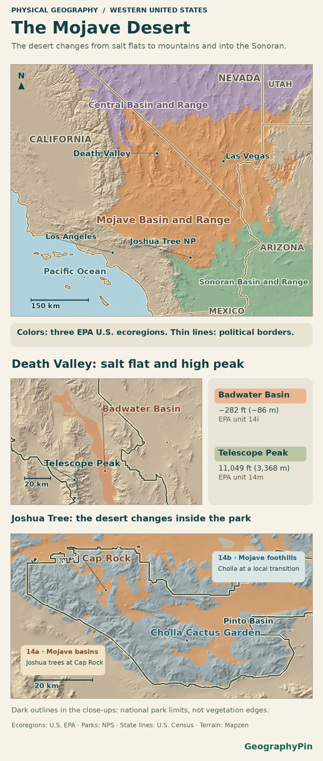
Death Valley: a salt basin and a high mountain in one region
Compare Badwater Basin with Telescope Peak
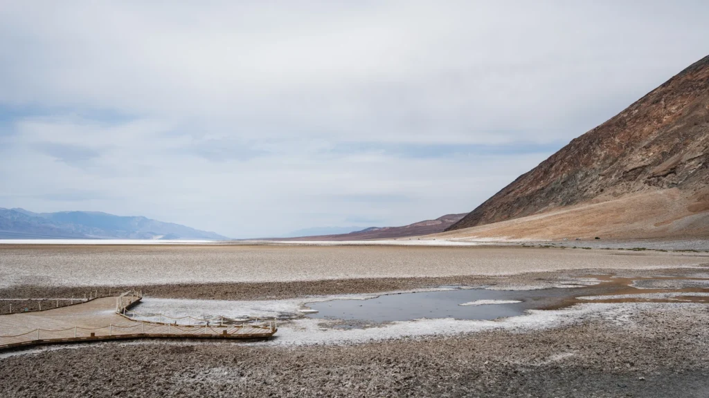
In Death Valley, salts are carried downhill into a basin with no outlet. Water can briefly spread over the floor; evaporation leaves minerals behind. Badwater Basin reaches 282 feet (86 meters) below sea level. In the same national park, Telescope Peak reaches 11,049 feet (3,368 meters). The elevation difference is roughly 11,300 feet (3,450 meters), but both places are inside the EPA’s broad Mojave region.
At the more detailed scale, the EPA Level IV data put the Badwater reference point in Mesquite Flat/Badwater Basin (14i) and the Telescope Peak summit in Western Mojave High Elevation Mountains (14m). The smaller categories show why a map colored “Mojave” can contain both a salt flat and a high mountain without contradicting itself.
Joshua trees mark some habitats, not the entire desert
Compare Cap Rock with the Cholla Cactus Garden
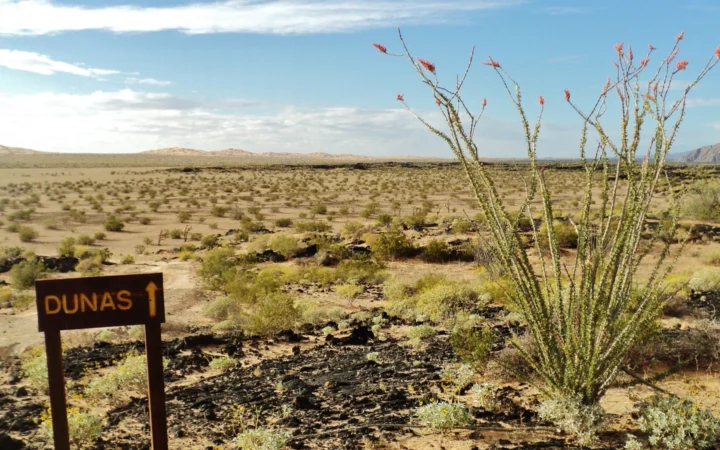
At Cap Rock, the National Park Service describes Joshua trees and other yuccas among granite formations. Farther east, the Cholla Cactus Garden is in the Pinto Basin, which the park treats as a transition between Mojave and Colorado desert landscapes. It is a cactus-dominated example, not a point that fixes the edge of the Mojave.
Both sites fall in the broad EPA Mojave region, but their Level IV classes differ. Looking at the table, notice that the park’s “transition” description and the EPA’s “Mojave” label answer different questions about the same ground. The park vegetation inventory describes the higher, generally cooler Mojave in the west and north and the lower Colorado Desert in the south and east; it does not prescribe a Mojave-wide elevation cutoff.
| Location | EPA Level IV at the point | What changes on the ground |
|---|---|---|
| Badwater Basin | 14i, Mesquite Flat/Badwater Basin | Low salt floor in Death Valley |
| Telescope Peak | 14m, Western Mojave High Elevation Mountains | High mountain immediately west of the basin |
| Cap Rock | 14a, Eastern Mojave Basins | Joshua trees, yuccas and granite in Joshua Tree National Park |
| Cholla Cactus Garden | 14b, Eastern Mojave Low Ranges and Arid Footslopes | Cactus-rich site in the park’s Mojave–Colorado transition |
The north and south transitions show different clues
Read plant communities together with terrain
To the north, the Nevada ecoregion assessment notes that colder winters make some Great Basin valleys less suitable for plants typical of the Mojave even where low valleys connect the regions. Las Vegas and Alamo, Nevada, are useful map controls. A central Las Vegas point is in the EPA’s Eastern Mojave Basins; a central Alamo point is in its Tonopah Basin, a Level IV setting of the Central Basin and Range. This is a change in the classification, not an assertion that all of Alamo or its surroundings are cold desert.
Southward the comparison is different. The USGS–EPA Arizona assessment distinguishes the adjacent Sonoran Basin and Range. In California, the National Park Service describes Cottonwood Spring in southern Joshua Tree National Park as part of the Colorado Desert, the western Sonoran setting. At the same time, recognizable desert shrubs such as creosote occur in both landscapes. One plant is a poor test on its own.
Why a park map, a plant map and a desert map disagree
A park boundary shows land managed as part of a park. A species map shows where individual plants or populations have been recorded or mapped. An EPA ecoregion is a broader classification. A detail such as the park’s woodland or cactus garden can fit inside one EPA region even when the plant community changes locally.
The 2023 U.S. Fish and Wildlife Service assessment treats western Joshua tree (Yucca brevifolia) and eastern Joshua tree (Yucca jaegeriana) separately. It reports overlap in Nevada’s Tikaboo Valley and extension of parts of the eastern species’ mapped range into neighboring EPA regions. A Joshua tree can help recognize a habitat, but no line through the last trees on a map can stand in for the desert’s edge.
Frequently Asked Questions
Why is Death Valley sometimes labeled as part of the Great Basin?
The terms describe different things. The National Park Service’s geological overview locates Death Valley in the wider Great Basin context and the Basin and Range physiographic province. The EPA Level III classification places the sampled basin floor in the Mojave Basin and Range. A geology or drainage label does not replace an ecological one.
Is a Joshua tree the same plant as a Mojave yucca?
No. The park flora identifies the Joshua tree as Yucca brevifolia and the Mojave yucca as Yucca schidigera. Both are yuccas, which is why a location such as Cap Rock can have both plants.
Are the Mesquite Flat dunes and the Badwater salt flats the same place?
No. The Mesquite Flat Sand Dunes lie near Stovepipe Wells toward central Death Valley. Badwater is a separate salt flat farther down the valley. The shared name in the EPA class does not make the two sites the same landform.
What Did We Learn Today?
The Mojave occupies low basins and high ranges between the Great Basin and Sonoran deserts. Badwater Basin and Telescope Peak are both Mojave in the broad EPA classification, while Cap Rock and the Cholla Cactus Garden illustrate local habitat changes. An ecological line, a park border and a species range each tell you something different.
Sources & Data Notes
The regional and local classes follow the EPA’s U.S. Level III and Level IV ecoregion data at named reference points. The National Park Service supplies elevation and local vegetation context; the U.S. Fish and Wildlife Service’s 2023 assessment supplies species distinctions. The regional outlines simplify transitions and are not species ranges.
Photo: Badwater Basin salt pool by Christian David, April 25, 2026, CC BY-SA 4.0 (cropped and resized, same license). Map data: Natural Earth, Mapzen Terrain Tiles, U.S. EPA Level III and IV ecoregions and National Park Service boundaries.