Geography begins with places, but it goes further than locating them on a map. It asks why landscapes and settlements differ, how places are connected, and how people and environments change one another. These questions help us understand issues ranging from water supplies and migration to urban growth and conservation.
The word geography comes from Greek roots associated with describing the Earth. Today, the subject brings together the study of physical environments, human societies and the relationships between them. Its underlying ideas provide ways to investigate the world rather than simply memorise facts about it.
The principles of geography are the ideas used to investigate where things are, why they are there, how places are connected, and how they change. Common starting points include location, place, spatial patterns, human-environment relationships and scale. There is no single universally agreed numbered list. The familiar five themes are one teaching framework within this wider subject.
Understanding Geographical Principles
Different textbooks and education systems organise geographical thinking in different ways. The Geographical Association’s guidance on concepts notes that educators do not share one definitive list, even though their frameworks have much in common.
It helps to distinguish four things:
- Concepts: ideas such as place, space, scale, interconnection and change that help us ask questions and interpret evidence.
- Teaching frameworks: organised approaches such as the five themes of geography.
- Fields of study: physical and human geography, including subjects such as climate, population and cities.
- Tools and methods: maps, GIS, remote sensing and fieldwork used to investigate those questions.
For example, the U.S. National Geography Standards, first published in 1994 and revised in 2012, organise 18 standards under six essential elements: the world in spatial terms; places and regions; physical systems; human systems; environment and society; and the uses of geography. These elements are a different framework from the five themes below.
If you are studying for an examination, use the terminology required by your course. This guide explains ideas shared across introductory geography without presenting its own list as a universal rulebook.
The Five Themes of Geography
The five themes appeared in the 1984 Guidelines for Geographic Education, developed by the Association of American Geographers and the National Council for Geographic Education. They remain a useful starting point, as illustrated by the National Park Service’s geography teaching materials.
1. Location: Where Is It?
Absolute location identifies a position using a reference system, such as latitude and longitude or a street address. Relative location describes a position in relation to something else, such as upstream from a bridge or a short journey from a port. The first tells us where to find a place; the second helps explain its connections and accessibility.
2. Place: What Is It Like?
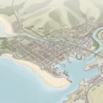
A place has physical characteristics, including landforms, climate, vegetation and wildlife, as well as human characteristics such as language, buildings, livelihoods and institutions. A river town and a mountain village may differ in both. People also give places meanings through their experiences, memories and sense of belonging.
3. Human-Environment Interaction: How Do People and Environments Affect Each Other?
People depend on water, food and other resources, adapt to environmental conditions, and modify landscapes through activities such as farming, building dams and clearing forests. These relationships work in both directions. Environmental conditions influence opportunities and risks, while human decisions change those conditions.
4. Movement: How Are Places Connected?
Movement includes the travel and migration of people, the transport of goods, and the circulation of ideas, money and information. Roads, shipping routes and communication networks connect places. Geographers examine what moves, why it moves, the routes involved and who has access to those connections.
5. Region: How Can Areas Be Grouped?
Regions organise places according to selected characteristics or relationships. National Geographic’s geography standard on regions distinguishes three useful types:
- Formal regions share a defined characteristic, such as an administrative boundary or a particular climate type.
- Functional regions are connected through an activity or network, such as a city and the surrounding area linked to it by commuting.
- Perceptual regions reflect people’s shared ideas about an area, such as their understanding of the Australian Outback. Their boundaries may be imprecise or disputed.
One place can belong to several overlapping regions. Always ask what criteria were used to draw a boundary and whether those criteria fit the question being studied.
Spatial Patterns, Processes and Scale
A map can reveal an arrangement, but explaining it requires more than describing where things are. Several related terms help keep that distinction clear:
- Distribution describes where features occur.
- Density expresses a quantity per unit area, such as residents per square kilometre.
- Pattern describes the arrangement, such as clustering or a line of settlements beside a road.
- Process explains how an arrangement develops or changes, such as erosion, migration or investment in transport.
Spatial interaction concerns connections between locations. Distance matters, but so do journey time, cost, infrastructure and political boundaries. Two nearby places may have weak connections if a mountain or a closed border separates them.
Spatial organisation and hierarchy describe relationships among places and networks. A small town may provide everyday services for nearby villages, while a regional city provides more specialised services. The relevant hierarchy depends on what is being studied; population, transport and administrative importance need not produce the same ranking.
Why Scale and Time Matter
A neighbourhood, river basin, country and the world provide different views of the same issue. A national average may conceal major local differences. This is geographical scale, distinct from map scale, which relates a distance on a map to a distance on the ground. Tasmania’s official Geography curriculum explains how scale, interconnection and change shape geographical enquiry.
Time matters too: a single image shows a moment, while comparable observations over time can reveal change. A spatial association is a starting point for investigation, not proof that one feature caused another.
Geographic Tools and Techniques
Geographical questions guide the choice of tools. Each method reveals some information while leaving other questions unanswered.
Maps and Cartography
Topographic maps show terrain and elevation; political maps emphasise boundaries; thematic maps focus on a subject such as rainfall or population. Always check the title, legend, scale, date and source.
Every flat map projection introduces distortion. Shape, area, distance and direction cannot all be preserved everywhere at once. As the U.S. Geological Survey explains, the appropriate projection depends on the purpose and area being mapped. A map suitable for comparing countries’ areas may be unsuitable for another task.
Geographic Information Systems
GIS connects geographic locations with information about them. It can bring layers such as roads, buildings and flood zones together for analysis. NOAA’s GIS overview describes applications including coastal planning and environmental response. A sophisticated map still depends on suitable data and careful interpretation.
Remote Sensing
Remote sensing collects information from a distance, often using satellites or aircraft. It can help track vegetation, land cover and environmental change. NOAA’s introduction to remote sensing explains the basic approach. Such observations can be combined with other evidence in a GIS.
Fieldwork and Data Collection
Fieldwork includes direct observations, measurements and, where appropriate, interviews or surveys. It helps connect maps and theories with conditions on the ground. However, firsthand data is not automatically accurate or representative. Sampling choices, measurement methods, timing and missing observations all affect the conclusions.
The Royal Geographical Society’s fieldwork guidance places collecting, analysing and evaluating evidence at the centre of geographical enquiry.
Principles in Physical Geography
Physical geography investigates natural environments, their spatial patterns and the processes that shape them. Its fields of study include:
- Earth processes: plate tectonics, volcanism and the rock cycle help explain the formation and distribution of many landscapes.
- Weather and climate: short-term atmospheric conditions and longer-term patterns influence water availability, vegetation and human activities.
- Biogeography and ecosystems: the distribution of organisms, their environmental relationships and the factors affecting biodiversity.
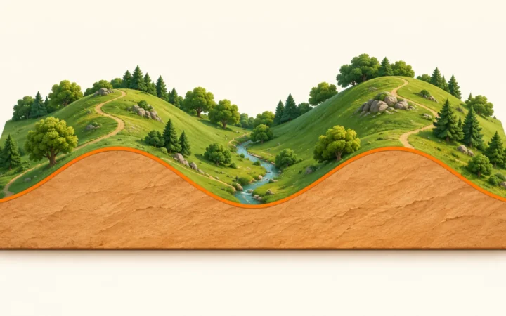
- Landforms and landscapes: mountains, valleys, coasts and deserts, including changes caused by weathering, erosion, deposition and glaciation.
These subjects are connected. For example, studying a river involves its drainage basin, rocks, rainfall, vegetation and sediment, as well as human changes to land and water. Looking at these relationships helps explain why a process has different effects in different places.

Principles in Human Geography
Human geography studies societies, their use of space and their relationships with environments. Its subjects include:
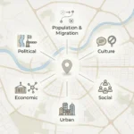
- Population and demographics: where people live and how populations change through births, deaths, migration and ageing.
- Cultural geography: language, religion, customs, identity and the ways people give meaning to places.
- Economic geography: the location and organisation of production, work, resources, trade and development.
- Political geography: territories, boundaries, governance and the geographical dimensions of power.
- Urban geography: the growth, structure and everyday functioning of towns, cities and metropolitan areas.
Physical conditions matter, but they do not determine a society’s culture or future. Institutions, technologies, histories and people’s choices also shape outcomes. A complete geographical explanation considers these influences together.
The relationship between physical and human geography is central to England’s geography curriculum, which emphasises interacting processes, spatial variation and change over time.
Applying Geography to Real-World Issues
Geographical thinking can improve decisions by connecting a problem with its location, wider relationships and consequences. The American Association of Geographers’ Applied Geography group describes work on risks, infrastructure, access to services, resources and transport.
- Conservation and sustainability: examine habitats, resource use and the effects of different management choices on people and ecosystems.
- Globalisation and cultural diversity: trace connections between places while considering how communities experience cultural and economic change differently.
- Urban planning: compare land uses, transport access, population needs and environmental constraints.
- Geopolitics and international relations: study how borders, resources and networks influence relationships between states and communities.
A Worked Example: A Town Beside a River
This is a hypothetical example. Suppose a town is considering new housing near a river. A geographical investigation could ask:
- Location and place: where is the proposed site, and what are its terrain, land use and surrounding neighbourhoods like?
- Patterns and processes: where has flooding occurred, and which physical and human processes could explain it?
- Connections and scale: how might upstream land use, drainage and transport links affect the site and other communities?
- Evidence and change: what do maps, historical records, field observations and suitable models show, and what uncertainties remain?
- Choices and consequences: how would different options affect housing access, costs, habitats and exposure to flooding?
This approach does not produce an automatic answer. It makes assumptions, trade-offs and evidence clearer so that decisions can be better informed.
Frequently Asked Questions
Are there exactly five principles of geography?
No single numbered list is universal. The familiar set of five refers to the themes of location, place, human-environment interaction, movement and region. Other educational frameworks organise geographical concepts differently.
What is the difference between location and place?
Location tells us where something is. Place includes what that location is like, its physical and human characteristics, and the meanings people attach to it.
Why is scale important in geography?
Patterns and explanations can change when we move from a local view to a regional or global one. A country-wide average, for example, can hide differences between its neighbourhoods.
Are physical and human geography separate subjects?
They are broad, connected branches of geography. Physical geography focuses on natural environments and processes; human geography focuses on societies and their spatial relationships. Questions about rivers, cities or food supplies often require both.
Is GIS a principle of geography?
GIS is a system for working with geographical information. It helps investigate questions about location, patterns and connections, but it is a tool rather than a geographical principle.
What Did We Learn Today?
Geography helps us connect where things are with why they are there, how they interact and how they change. The five themes offer a useful introduction, while ideas about patterns, processes, scale and evidence deepen that understanding.
We also learned to distinguish concepts from tools and fields of study. Combining physical and human geography, choosing suitable methods and checking the limits of our evidence makes geographical knowledge more useful in everyday decisions.
Sources & Data Notes
Checked November 9, 2026. This is a conceptual introduction, not a numerical dataset or a syllabus for a particular examination.
- Concepts and frameworks: the Geographical Association explains variation in concept lists. NCGE documents the U.S. standards and their six essential elements.
- Five themes and regions: National Park Service teaching material, the ERIC catalogue record for the 1984 guidelines, and National Geographic’s region standard.
- Scale, processes and enquiry: the official Tasmanian Geography course, England’s geography curriculum, and RGS fieldwork guidance.
- Methods: USGS on map projections and NOAA explanations of GIS and remote sensing.
- Applications: AAG Applied Geography. The river-town exercise is illustrative and is not a report about a real planning proposal.
Terminology note: “principles” is used here as a broad introductory term. Concepts, themes, standards, branches and methods are related but are not interchangeable. The national examples describe their own educational contexts rather than a universal curriculum.