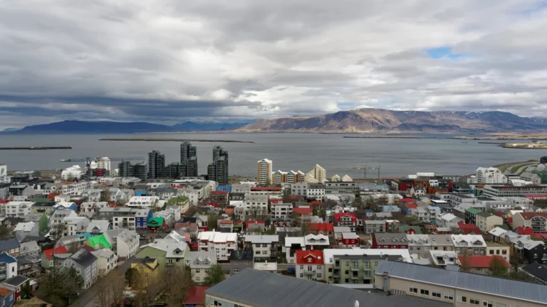
Iceland’s familiar glaciers and volcanoes are only part of its geography. The contrast between a rugged interior and inhabited coastal areas explains just as much about the country, from the concentration of people around Reykjavík to the importance of rivers, geothermal heat and the surrounding ocean.
Iceland is a North Atlantic island country, conventionally part of Northern Europe, with Reykjavík as its capital. Its geography combines volcanic terrain along the Mid-Atlantic plate-boundary system, extensive highlands, glacier-covered areas and inhabited coastal lowlands. The North American–Eurasian plate boundary crosses Iceland, but tectonic plates and political or cultural regions are different geographic concepts.
How to use this article: Explore the volcanic setting, compare the main landscapes, or distinguish Reykjavík from the wider capital region.
1. Locate Iceland and read its map
Iceland lies in the North Atlantic between Greenland and northern Europe. Its main island sits just south of the Arctic Circle, with Reykjavík on the southwestern coast. Smaller offshore islands are also part of the country, so “Iceland” can mean the state as a whole as well as its principal island.
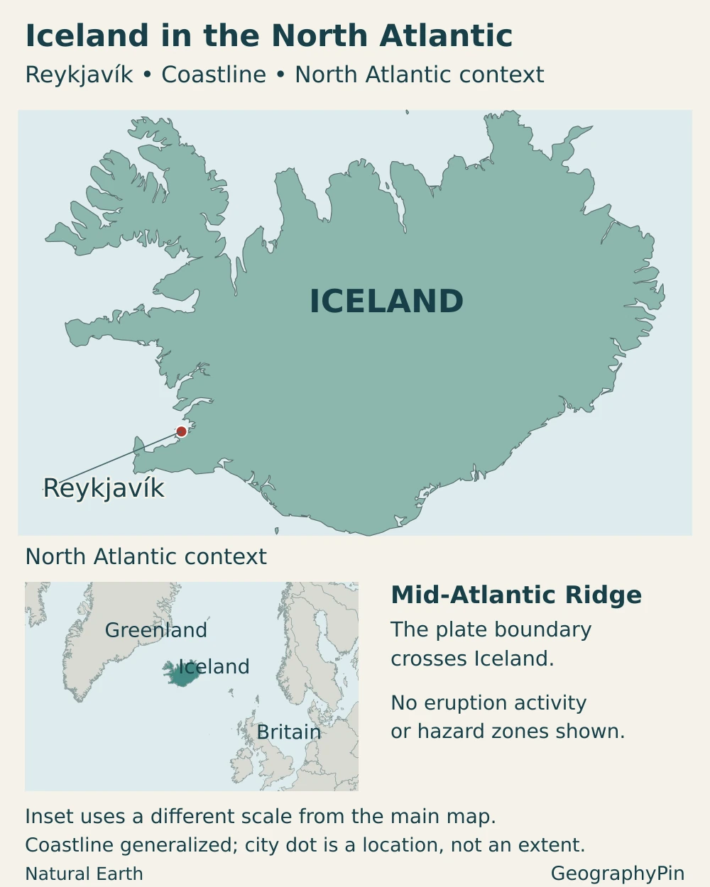
On a political or regional map, Iceland belongs with Northern Europe and the Nordic countries. On a tectonic map, the island crosses the boundary between the North American and Eurasian plates. Neither classification cancels the other: one describes human geographic grouping, while the other describes moving pieces of Earth’s outer shell.
The distinction is explored in the separate guide to whether Iceland is in North America or Europe. For the country profile, the essential point is that a plate boundary is not an international border, and Iceland is not divided into two sovereign countries by a geological line.
2. Country facts with dates and definitions
| Item | Figure or description |
|---|---|
| Capital | Reykjavík |
| Population | 397,710 residents at the end of the third quarter of 2026, Statistics Iceland release published November 13, 2026 |
| Approximate surface area | About 40,000 square miles (103,000 km²), rounded country-area figure |
| Official language | Icelandic; Icelandic Sign Language has separate recognition and protections in the same language legislation |
| Currency | Icelandic króna (ISK) |
| Political system | Parliamentary republic |
| National parliament | Alþingi, with 63 members |
| Local government | Municipalities beneath the national level; regional statistical groupings are not federal states |
The population refers to a particular quarter-end, not a forecast or a new census. The area is deliberately rounded: published surface-area totals vary with measurement and coverage, and this figure should not be treated as an exact dry-land-only calculation. Glacier-covered ground is not a second country-area category to add on top of the national total.
3. Volcanoes, glaciers and coastal lowlands
Why Iceland is volcanic
Iceland lies where the North American and Eurasian plates move apart along the Mid-Atlantic Ridge system. Magma rises and new crust forms in this divergent setting. Iceland’s unusual concentration of volcanism is also associated with the Iceland mantle plume, an upwelling of hot material beneath the region.
The boundary on land is not a single open crack running cleanly across the island. Rifting and volcanism occupy zones and interacting volcanic systems. The Reykjanes Peninsula in southwestern Iceland provides a concrete example, with several volcanic systems along the plate-boundary zone. A small-scale map can locate the broad setting, but cannot show every fissure, fault or magma pathway. Volcanoes can produce lava flows, ash or gases, with effects that depend on the individual system and eruption.
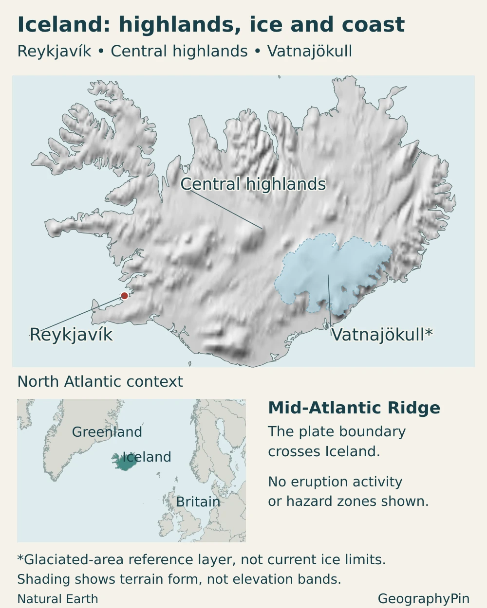
The main landscapes and their differences
| Landscape | Where to look | Why it matters |
|---|---|---|
| Southwestern coastal lowlands | Reykjavík and surrounding settled areas | The main concentration of population and services, close to Atlantic transport connections |
| Central highlands | Much of the interior | Elevated, exposed terrain with lava, rock, sediment and locally vegetated areas; much less densely settled than coastal districts |
| Glacier-covered areas | Vatnajökull in the southeast and other ice caps | Stored ice, outlet glaciers, meltwater and landscapes changing as ice advances or retreats |
| Fjord coasts and valleys | Especially the northwest and east | Strongly indented coastlines and glacially shaped relief that channel settlements and transport routes |
| Southern outwash plains | Below glacier outlets toward the coast | River-deposited sediment and shifting channels, with some areas exposed to glacial outburst floods |
Vatnajökull is Iceland’s largest ice cap. It is not one uniform tongue of ice: ice domes feed numerous outlet glaciers, which move into different valleys and lowlands. The national park reported an ice-cap area of roughly 2,900 square miles (7,500 km²) in 2023. That dated footprint is not a claim that its margins remain fixed today.
Ice and volcanic terrain overlap. Some volcanoes lie beneath glaciers, while extensive lava fields have no permanent ice cover. The highlands likewise contain more than glaciers: barren ground, mountains, wetlands, vegetation and river corridors occur in different places. These distinctions make the physical map more useful than the slogan “land of fire and ice” alone.
4. Climate, rivers and environmental contrasts
The surrounding ocean moderates Iceland’s climate. Warm Atlantic waters influence the south and west, helping coastal winters remain milder than latitude alone might suggest. This does not make Iceland warm in an everyday sense: summers are generally cool, storms are important, and the highland interior is colder than the coast.
Rainfall is uneven. Moist air and relief produce particularly wet conditions around southern mountain and glacier margins, while parts of the interior north of Vatnajökull are much drier. Reykjavík’s weather is therefore not a reliable description of every fjord, mountain pass or glacier. The same maritime setting that moderates temperatures also contributes to rapidly changing weather.
How ice and rivers reshape the land
Not every Icelandic river is glacier-fed. Rivers can be supplied by direct runoff, groundwater springs or snow and glacier melt, often in combination. Þjórsá in the south is Iceland’s longest river, at about 143 miles (230 km). Comparing it with Jökulsá á Fjöllum in the northeast shows why catchment size alone does not determine flow: the wetter southern setting and the drier terrain north of the highland glaciers produce different water balances.
Glaciers store water and release meltwater into rivers. Where those rivers carry large loads of sediment toward the coast, they build broad outwash plains, known as sandur. Channels can divide, shift and carry sediment away from the glacier margin. A flat-looking plain may consequently be an actively changing river landscape rather than an unchanging empty surface.
A jökulhlaup is a glacial outburst flood, involving the release of water stored beneath or beside ice. An eruption beneath a glacier can trigger one, but eruptions are not the only cause: geothermal melting and drainage of ice-dammed lakes can also be involved. A flood does not by itself prove that a volcano is erupting.
Vatnajökull National Park documents retreat and thinning of its southern outlet glaciers. Retreat alters rivers, lakes, slopes and exposed ground, while individual glaciers can behave differently over shorter periods. A dated glacier outline is useful geographic information; it is not a permanent boundary or a precise forecast of where ice will be in a future year.
Volcanic and flood hazards are localized and change with events. A country overview cannot identify a safe route through an active area. Current warnings and hazard maps belong with the Icelandic Meteorological Office, rather than being inferred from a simplified national map.
5. People, cities and languages
Reykjavík is not the entire capital region
Statistics Iceland reported 253,680 residents in the capital region at the end of the third quarter of 2026, compared with 397,710 nationally. That is about 63.8% of the country’s population. The capital-region figure includes more than Reykjavík municipality and must not be labeled as Reykjavík city’s population.
This concentration contrasts with the interior and with the smaller settlements distributed around the coast. Coastal land offers a different combination of access, terrain and climate from the highlands, while ports connect communities to fishing grounds and external trade. The national pattern is therefore highly uneven even though the country’s overall population is comparatively small.
Regional centers outside the southwest remain important to surrounding communities. Akureyri in the north, for example, belongs to a different coastal and valley setting from Reykjavík. A map focused only on the capital would miss how distance, fjords and mountain terrain affect everyday connections elsewhere on the island.
Language and community
Icelandic is the country’s national and official language. The language law also recognizes Icelandic Sign Language as the first language of people who depend on it for expression and communication, and of their children, and sets out obligations to support its use. This is a distinct legal provision, not simply another name for spoken Icelandic.
Official-language status does not imply that all residents have the same first language or background. Iceland’s population includes people born abroad and people holding different citizenships. Citizenship, birthplace and language are separate measures; none should be substituted for another when describing the community.
6. Government and economy in their geographic setting
Iceland is a parliamentary republic. The president is head of state, while the prime minister leads the government. Alþingi is the national legislature. Municipalities provide the local tier of government; the regions used to describe population or geography should not be mistaken for constituent countries or sovereign states.
Fishing and marine industries connect the economy directly to the surrounding seas. Energy-intensive industry has a different geographic foundation: access to electricity and port infrastructure. Services, commerce and public administration are concentrated especially in the main urban areas, while tourism brings economic activity to a wider range of places.
Statistics Iceland’s preliminary tourism accounts put tourism’s direct contribution at 8.8% of GDP in 2025. This is a defined national-accounts measure, not the share of every business touched indirectly by visitors. It illustrates the sector’s importance without implying that Iceland’s entire economy depends on tourism.
Geothermal heat is not the same as all energy
Geothermal resources are especially important for heating buildings. The National Energy Authority describes geothermal district heating as the dominant source of domestic heat, with electricity used in many places without that access. Water and underground heat thus support different kinds of infrastructure, rather than every home simply drawing heat directly from a volcano.
Hydropower is the main source of Iceland’s electricity, and geothermal generation also contributes. Reservoirs help manage variation in water availability, while transmission lines must cross terrain exposed to weather and volcanic activity. Electricity is only one part of energy use. Petroleum products remain important in transport and fishing. A renewable electricity supply therefore does not mean that the whole economy is fossil-fuel-free. This distinction also matters when comparing energy statistics between countries.
Natural resources create opportunities and constraints together. Rivers and geothermal fields can supply energy, while their use affects landscapes and requires decisions about development and conservation. The country’s small population does not remove those tradeoffs, or the need to connect widely separated communities and production sites.
Frequently Asked Questions
Is Iceland a member of the European Union?
No. Iceland is not an EU member, but it participates in the European Economic Area. Being geographically and culturally European is different from belonging to the EU.
Does Iceland share a land border with another country?
No. Iceland is an island country without an international land border. Greenland and other North Atlantic neighbors are separated from it by sea.
What Did We Learn Today?
Iceland’s geography brings together a volcanic plate-boundary setting, glacier-shaped terrain, a cold highland interior and ocean-influenced coastal settlements. These features help explain its uneven population distribution and its uses of marine resources, water and geothermal heat. The capital region is larger than Reykjavík municipality, glacier margins change over time, and a geological plate boundary is not the same thing as a political or cultural boundary.
Sources & Data Notes
Population and capital-region totals refer to the end of the third quarter of 2026. The capital-region share is calculated from those published totals and rounded, not substituted for a city-proper figure. The country’s surface area is approximate; no precise population density is derived from it. Vatnajökull’s quoted footprint is dated 2023. Tourism’s 2025 direct GDP contribution is preliminary and may be revised.
- Statistics Iceland: population and capital region, third quarter 2026
- UN Statistics Division: Iceland country profile and rounded surface area
- Nordic cooperation: Iceland’s political and regional context
- Alþingi: membership of the national parliament
- Alþingi: Icelandic language and Icelandic Sign Language Act, current text
- University of Iceland: Glacial landscapes of Iceland, 2021 research chapter
- British Geological Survey: divergent boundaries and volcano formation
- Icelandic Meteorological Office: general climate
- Icelandic Meteorological Office: climate contrasts, 2018 assessment
- Vatnajökull National Park: ice-cap structure and dated 2023 extent
- Vatnajökull National Park: precipitation and ecosystem contrasts
- Vatnajökull National Park: glaciology and outwash landscapes
- Icelandic Meteorological Office: glacial outburst floods
- Icelandic Meteorological Office: volcanic hazards
- Statistics Iceland: preliminary tourism satellite accounts for 2025
- National Energy Authority: district heating
- OECD: Iceland environmental and energy overview
- Icelandic Institute of Natural History: river types and catchment contrasts
- National Energy Authority: hydropower and electricity security
- Icelandic Meteorological Office: Reykjanes Peninsula volcanic systems
Older scientific sources support stable physical processes and regional contrasts, not present eruption status or current glacier boundaries. The 2018 climate assessment is not used as a current weather report. Energy categories are kept separate: electricity, building heat and total energy use are not equivalent. Simplified country maps do not replace official hazard maps.
Maps and illustration: Original GeographyPin cartography uses public-domain Natural Earth country outlines and city locations, with Natural Earth shaded relief. The main maps use a Lambert azimuthal equal-area projection centered on Iceland; their North Atlantic insets use a different scale. Terrain shading depicts landform, not measured elevation classes, and the central-highlands label identifies a broad landscape rather than a surveyed boundary.
Vatnajökull’s blue reference area comes from Natural Earth’s historical glaciated-area layer, which includes formerly glaciated ground. It is not a present-day ice-margin inventory or a glacier-area measurement. No precise plate-boundary line, current eruption activity or hazard zones are mapped. The cover clips a public-domain Iceland flag vector into the geographic outline as an original decorative composition, not a complete rectangular flag.