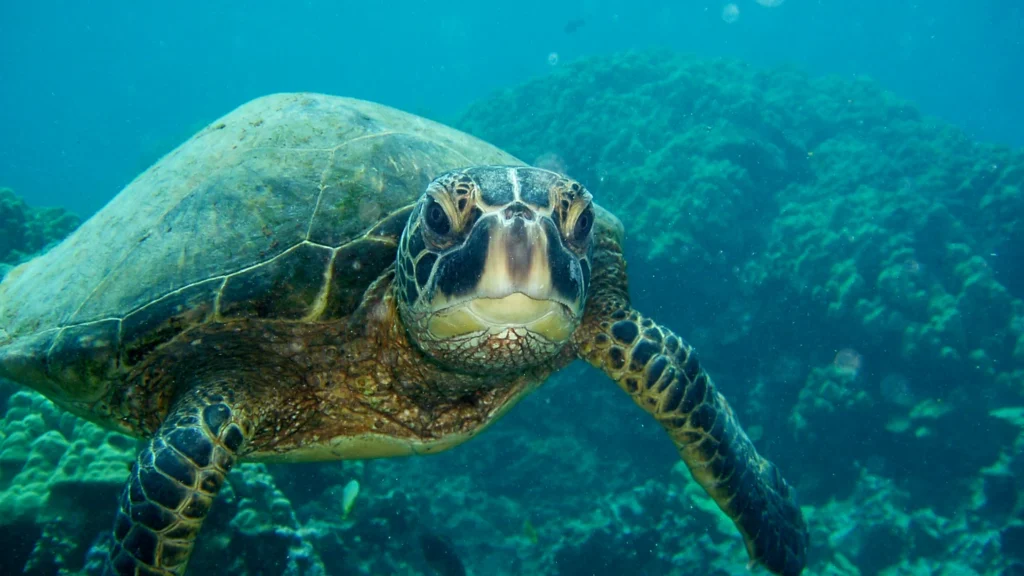
Green sea turtles migrate between places that serve different needs. Adult females come ashore to lay eggs, but many feed in shallow coastal waters far from their nesting beaches. A nesting map therefore shows only one part of green sea turtle habitat.
Green sea turtles can feed hundreds of miles from the shores where they breed. Two monitored examples link the Northwestern and main Hawaiian islands, and the central South Atlantic and coastal Brazil. Satellite tags tell us which journeys individual turtles made while their tags transmitted, not where every member of a population went.
How to use this article: Compare nesting with feeding habitat, then see the Hawaiian and South Atlantic examples and what tracking samples miss.
What nesting beaches and feeding grounds tell you
Nesting sand and shallow feeding waters
A nesting survey documents a narrow part of the life cycle: females come onto land and lay eggs in sand. The dots can show which surveyed parts of a coast are used for nesting. They do not plot every animal at sea, and gaps in a survey do not prove that turtles are absent.
Older juveniles and many adults also use shallow water where seagrasses and algae grow. A seagrass map shows one kind of potential food habitat, not confirmed turtle presence. Some turtles feed on algae where there is little or no seagrass, and not all mapped meadows are used by the same group. Many young turtles spend an earlier stage in the open ocean, away from both the beach and a coastal feeding ground.
Two regions show how far nesting and feeding can be apart
The Hawaiian and South Atlantic studies
In Hawaiʻi, researchers used satellite tags to follow breeding migrations of 20 green turtles from 1992 to 2014. Of the 17 tracked away from the Northwestern Hawaiian Islands breeding area, 15 traveled to the main Hawaiian Islands. One went south to Johnston Atoll and another tag stopped transmitting before reaching the main islands. That sample helps explain the map’s broad connection, not an exclusive division: NOAA also records nesting in the main Hawaiian Islands.
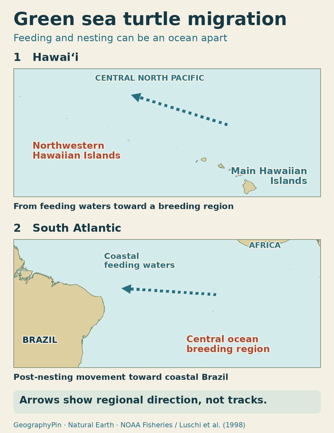
In the South Atlantic, researchers tagged six adult females after nesting in 1997. Five reached waters near eastern Brazil while their tags still transmitted, after 33 to 47 days of movement. The study was published in 1998. That documents a cross-ocean connection for those five turtles; it gives neither a fixed corridor nor a population-wide return rate. See our world oceans map to place the Pacific and Atlantic examples side by side.
What a tracked corridor can and cannot show
What tracking samples miss
A satellite tag provides a series of locations from one animal while it keeps transmitting. A line between two fixes connects observations; it is not a photograph of the intervening swim. When researchers combine many tracks, the result can reveal frequently used areas, but it still depends on the tags, sample and years.
That helps explain why three maps of the same species can look different. A nesting survey marks breeding shores. A feeding survey marks where turtles were observed using a habitat. A tracking map includes open water between places. Where one map leaves a blank, another may show an important part of the journey.
Why global range and regional conservation boundaries differ
Green sea turtles occur in the Atlantic, Indian and Pacific oceans, primarily in tropical and subtropical waters and also in some temperate waters. A global range account summarizes where the species can occur. It does not imply that every coast within that range supports equal numbers of turtles, or that turtles can be expected at a specific location today.
A conservation boundary answers another question. The IUCN’s 2025 global assessment lists green turtles as Least Concern but also assesses regional subpopulations separately. NOAA and the U.S. Fish and Wildlife Service list 11 distinct population segments under the U.S. Endangered Species Act. The global category neither cancels those U.S. listings nor describes every regional population. Neither legal management boundaries nor a global assessment map can substitute for observations of feeding, nesting or migration.
Frequently Asked Questions
Do all green sea turtles migrate the same distance?
No. The distance depends on where an animal feeds and breeds. The Hawaiian and South Atlantic links are examples, not minimum distances or a typical route for the whole species.
Does an adult green turtle have to return to shore to feed?
No. Algae and seagrasses are food found underwater. Nesting females come onto land to lay eggs, but neither feeding nor movement between feeding grounds requires coming ashore.
Why might a satellite track stop in open water?
A tag can stop transmitting before the animal stops moving. The end of the plotted line is the last usable transmission, not necessarily the turtle’s destination.
Can feeding and nesting happen in the same broad island group?
Yes. The nearby coasts do not have to serve only one purpose. NOAA documents both uses around the main Hawaiian Islands even though many turtles migrate farther northwest to reproduce.
What Did We Learn Today?
Nesting beaches, feeding areas and migration observations are different kinds of evidence. The Hawaiian and South Atlantic examples show why a turtle can depend on widely separated places. None of those layers, on its own, marks the full range of the species.
Sources & Data Notes
Show sources and map notes
- NOAA Fisheries green turtle species account and research overview: global occurrence, diet and habitat as the turtles mature.
- NOAA Fisheries Hawaiian migration overview and NOAA Hawaiian nesting/feeding context. Regions are generalized; no site coordinates, individual tracks, or modeled range boundaries are displayed.
- P. Luschi and colleagues, 1998 study of post-nesting migration between the central South Atlantic and Brazil. The count describes the published sample, not the population. The regional graphic is an original summary, not a reproduction of the authors’ paths.
- IUCN global 2025 assessment and Marine Turtle Specialist Group regional assessments; NOAA Fisheries U.S. listing rule. Status and source records checked November 22, 2026.
- Map: Natural Earth land outlines, public domain. This article displays only two regional examples, not the distribution or management boundaries.
- Featured photo: Claire Fackler / NOAA, Hawaiian Islands Humpback Whale National Marine Sanctuary, public domain. Cropped and converted to WebP. It shows a green turtle underwater, not a nesting or tracking record.
- Balazs, Parker and Rice, 2017 volume (published online 2018), satellite tracking in Hawaiʻi.
