Where is Gonio Fortress? Map, coordinates, and identity
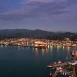
Gonio Fortress stands on Georgia’s subtropical Black Sea rim in the Adjara region, just north of the Turkish border at Sarpi. Sources place it roughly 12–15 km south of Batumi, reflecting different city reference points. The fort occupies the left bank of the Chorokhi (Çoruh) River where it enters the sea, a choke point that commanded traffic between the coastal plain and the interior valleys of the Adjaristskali and Chorokhi. For navigational context, the site sits near 41°34′N, 41°34′E (≈41.57 N, 41.57 E).
The location matters. In antiquity the region belonged to Colchis/Lazica, a corridor between Anatolia and the Caucasus. Roman garrisons here could monitor maritime movement and inland roads in a single glance, while later Byzantine and Ottoman authorities reused the enclosure to stabilize the seaward edge of their Caucasian frontiers. Today, the fortress forms the core of the Gonio‑Apsaros Archaeological‑Architectural Museum‑Reserve—an open‑air complex with galleries and active research areas—as of 21 September 2025.
Local names & pronunciation
Georgian uses Gonio (გონიო) and the compound name Gonio‑Apsaros (გონიო‑აფსაროსი), while Latin and Greek sources prefer Apsaros/Apsyrtos. Russian materials often render it Гонио. The museum’s signage and regional literature commonly employ the bilingual pairing “Gonio–Apsaros,” acknowledging the Roman toponym and the modern settlement.
| Metric | Value |
|---|---|
| Distance from Batumi | ≈12–15 km south (sources vary by reference point) |
| Approx. coordinates | 41°34′N, 41°34′E (≈41.573° N; 41.573° E) |
| Plan dimensions | ≈222 m × 195 m (rectangle) |
| Perimeter & wall height | ≈900 m; walls ~5 m (up to ~7 m at corners) |
| Towers (present/original) | 18 standing; ~22 originally |
| Area enclosed | ≈4.75 ha |
Why it mattered: from Roman Apsaros to Byzantine and Ottoman stronghold
The first secure references to the site appear in 1st–2nd‑century authors (e.g., Pliny and Appian), and archaeology confirms a Roman stone fort laid out on a near‑rectangular plan. Its mission was classic frontier control: secure the Lazican shore, police river mouths, and anchor communications between Trapezus (Trabzon) and points north toward Phasis. When Batumi lay far smaller than today, Apsaros was the Roman face of the Black Sea in this quadrant.
Usage fluctuated with geopolitics. Stratigraphic and textual evidence suggest an interruption between the later 4th and early 6th century, followed by Byzantine attention as the Lazica wars reshaped the frontier. Centuries later, Ottoman control added defensive merlons and other superstructures, re‑arming the walls for early‑modern needs. The result is a palimpsest—Roman ashlar foundations, Byzantine rebuilds in rubble and brick, Ottoman crenellations—readable along a single circuit.
Roman Apsaros (1st–3rd c. AD)
The Roman phase established the enclosure, gates, and internal buildings such as baths and barracks. Imported tablewares, amphorae, and military tiles stamped with Latin legends point to a garrisoned, supply‑linked outpost. Finds concentrate inside the walls, implying limited civilian spillover compared with other provincial forts.
Byzantine rebuilding and the Lazica frontier (6th c. AD)
After a lull, the fort’s south wall shows signs of reworking in the era of Justinian, when the Lazica conflict pushed the imperial defensive line back and forth along the coast. Architectural layers in rubble and brick fit with broader patterns of early Byzantine fortification across the eastern Black Sea region.
Ottoman modifications (16th–19th c.)
Later, Ottoman rule left visible crenellations and other refinements, adapting the enclosure to firearms and changing garrison needs. The interior housed a small mosque alongside earlier Roman‑Byzantine remains—material testimony that empires tend to repurpose strong positions rather than abandon them.
Reading the walls: architecture, measurements, gates, and waterworks
Gonio’s plan is unusually teachable. The rectangle measures about 222 m by 195 m, enclosing ≈4.75 hectares behind a 900‑meter circuit. Wall height averages around 5 m and rises toward 7 m at the corner towers. Eighteen towers punctuate the extant line (likely twenty‑two originally). The western gate remains the primary entrance today, while other historical gates are bricked—an adaptation visible on approach.
Construction sequences survive on the masonry surface: large dressed ashlars at the base (Roman), later rubble/brick lifts (Byzantine), and crenellated merlons (Ottoman). Inside the circuit, you can still trace sewers, water conduits, cobbled pavement, bathhouses of differing scale, and the footprint of the principia (headquarters). For a deeper dive into those layers, see the open‑access archaeological study by Emzar Kakhidze (illustrated plans and sections).
Visiting today: hours, tickets, and how to get there
The fortress anchors the Gonio‑Apsaros Archaeological‑Architectural Museum‑Reserve. Official listings currently cite daytime visiting (often 10:00–18:00) with guided options. Published prices vary by source and update cycle: adults are shown between 3 GEL and 10 GEL; student/child concessions are lower; children under a certain age are free. Because tariffs and hours can change seasonally, confirm before you go and bring small cash for local guides.
From Batumi, municipal bus no. 16 and minibuses no. 33 and 88 run to Gonio; taxis serve the route as well. The site’s address is typically listed as 55 Apsarosi/Apsaros Avenue, Gonio. For practical details, use the region’s official Visit Ajara listing and the Georgian Museums directory page—both maintained by public agencies and updated periodically.
Research, legends, and what archaeologists are finding
Regional tradition associates Gonio with the tomb of the Apostle Matthias, commemorated on site as a symbolic grave; this has not been demonstrated archaeologically. What the spades have confirmed is a rich military complex: two bathhouses of different scale near the south gate, a barracks block east of the principia, stamped tiles with Latin inscriptions, and coin sequences that chart the fort’s rise and quieter phases. Recent international missions continue to open new trenches inside the curtain walls, refining dates and building sequences.
The fort’s artifact pattern is also telling: imports and stamped building materials concentrate within the enclosure, with relatively little civilian scatter outside. That distribution argues for a tight, service‑driven garrison rather than a sprawling civilian suburb—useful context when comparing Apsaros with other Roman stations along the eastern Black Sea. If you’re preparing a study visit, begin with Kakhidze’s illustrated report above and the region’s public‑facing portals; these provide a grounded baseline before you read more technical interim field reports.
FAQ
When was Gonio Fortress built?
Archaeology and literary sources point to the 1st century AD for the Roman stone fort known as Apsaros. Later phases include early Byzantine rebuilding (6th century) and Ottoman modifications from the 16th century onward. You can see traces of each in the masonry.
How big is it?
The enclosure measures about 222 m × 195 m with a ~900 m perimeter and roughly 4.75 hectares inside. Eighteen towers stand today; evidence suggests about twenty‑two originally.
Is the Apostle Matthias buried at Gonio?
The site preserves a symbolic tomb and a long‑standing local tradition. However, excavations have not produced definitive archaeological proof of the apostle’s burial. Treat it as cultural memory rather than a confirmed find.
How do I get there without a car?
From Batumi, take city bus no. 16 or minibuses no. 33/88 to Gonio, or a taxi. Plan 25–35 minutes depending on traffic along the coastal road and border queues near Sarpi.
What Did We Learn Today?
- Gonio (Apsaros) is a 1st‑century Roman fort near Batumi at ≈41°34′N, 41°34′E.
- Walls measure ≈222 m × 195 m; perimeter ≈900 m; area ≈4.75 ha with 18 standing towers.
- Masonry layers reveal Roman bases, Byzantine rebuilds, and Ottoman merlons.
- Visiting logistics: buses 16/33/88; hours typically 10:00–18:00; adult tickets reported 3–10 GEL.
- Archaeology confirms baths, barracks, stamped tiles, and rich military material culture.