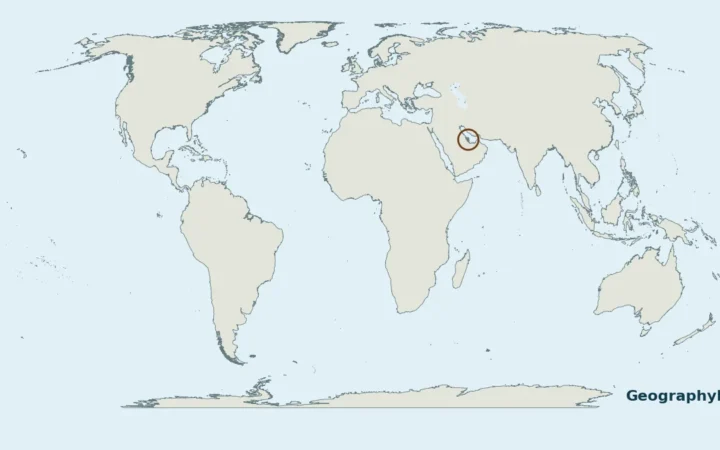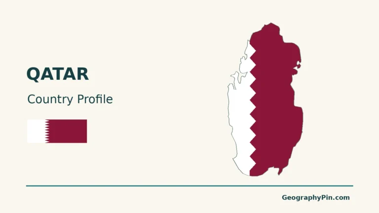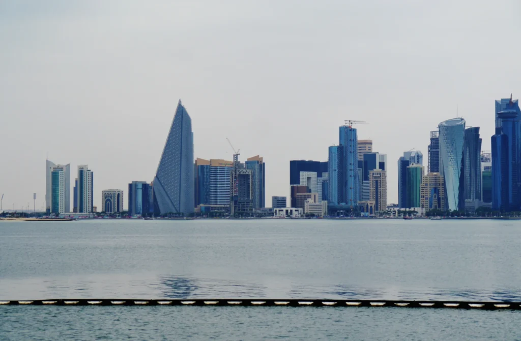
Doha is Qatar’s capital on the peninsula’s east coast. Its waterfront and surrounding urban districts are easier to understand when three things are kept separate: the named city, the municipality used for statistics, and the larger urban region connected to neighboring places.
Doha is Qatar’s capital beside a bay on the peninsula’s eastern coast. Doha Municipality is an administrative unit, while the wider urban region extends into neighboring municipalities. Reclamation and waterfront development have changed the shoreline, so neither the municipality nor a familiar skyline represents the whole city-region.
How to use this article: Distinguish the geographic units, examine the changing coast, or check what the census counts.
1. Doha on Qatar’s East Coast
The Government Communications Office identifies Doha as Qatar’s governmental seat and principal commercial and financial hub. It stands on the eastern side of the Qatar peninsula, facing the Persian Gulf, also called the Arabian Gulf.
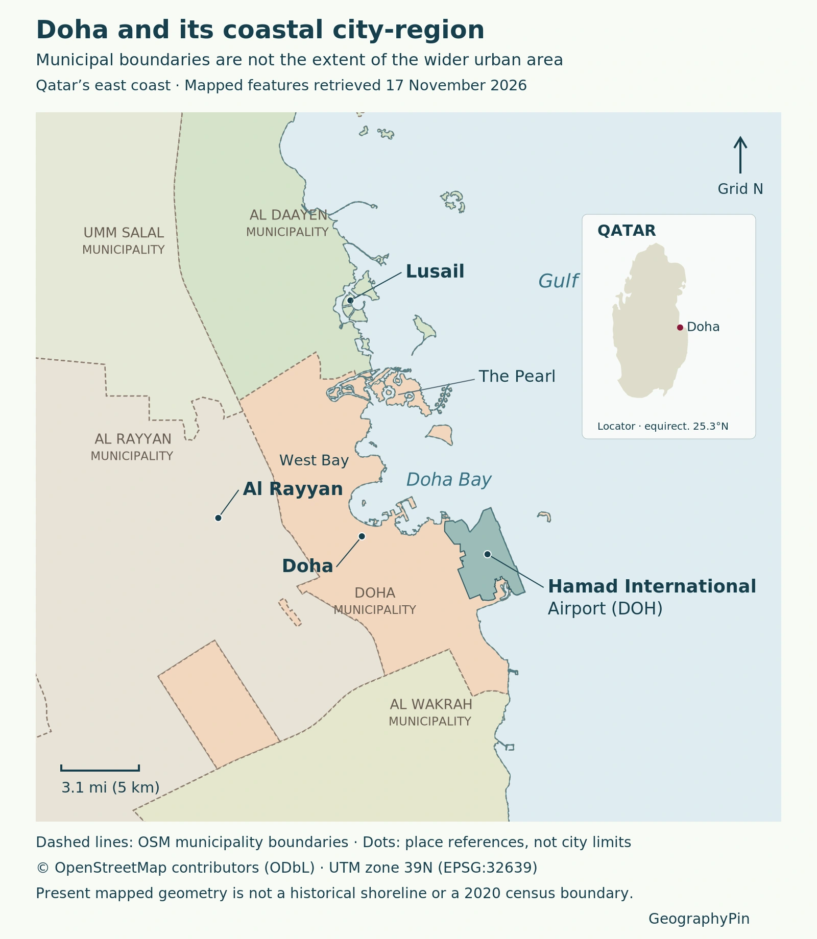
At country scale, the essential distinction is between Qatar, the state, and Doha, its capital. At city scale, the useful landmarks are the bay, neighboring urban centers and the airport. The Qatar location map explains the peninsula and surrounding countries; the map here focuses on the capital’s immediate region.
Doha’s waterfront is not one single district. West Bay, the older downtown area and the airport-side coast occupy different parts of the urban setting. Recognizing those separate locations makes the map more informative than using one skyline photograph as a stand-in for the entire capital.
2. City, Municipality and Wider Urban Area
Three meanings that should not be mixed
| Term | What it describes | Main caution |
|---|---|---|
| Doha, the city | The named capital and its urban setting | A place name alone does not specify a statistical boundary |
| Doha Municipality | An administrative area used in the census | Its figures apply to that municipality |
| Wider or metropolitan Doha | The connected urban region across municipal lines | The extent depends on the planning or statistical definition |
The Qatar National Master Plan’s centre hierarchy makes the distinction concrete. It lists West Bay, Doha Downtown and Airport City in Doha Municipality, while identifying metropolitan centers in Al Rayyan and Al Daayen municipalities.
The Al Daayen development strategy, whose cover is dated June 2014, explicitly places its southern urban area within Metropolitan Doha. This is evidence that the wider urban system crosses an administrative line, not a current population estimate or proof that the whole municipality is continuously built up.
A municipal boundary can be mapped precisely from a named administrative dataset. A wider urban boundary requires a separate definition, such as a planning area or a measured built-up footprint. Drawing a smooth outline around nearby places would not establish either one.
3. A Bay Reshaped by Coastal Development
Reclamation changes more than the outline
Doha Bay is shallow and partly enclosed; reclamation has reshaped its coastline.
A 2024 study by Lecart and colleagues compared modeled coastal configurations for 1980, 2000 and 2020. It examined how the changing shoreline affected water residence time: the time a parcel of water remains in a defined area before leaving.
The model found that northern developments after 2000, especially The Pearl, increased residence time in parts of the bay. The circulation effect extended beyond the reclaimed land itself.
The results are modeled comparisons, not measurements of present-day bathing-water quality. The study reused modern bathymetry for earlier configurations and did not include wind-generated waves. Read the study’s methods and limitations.
4. Lusail, Al Rayyan and Hamad Airport
Lusail provides northern context for Doha’s growth. The national master-plan hierarchy places it in Al Daayen Municipality, not Doha Municipality. A connection to metropolitan Doha does not erase that administrative distinction.
Al Rayyan provides western urban context. The planning hierarchy identifies Al Rayyan North, including Education City, and Al Rayyan South as metropolitan centers in Al Rayyan Municipality. The municipality’s full extent should not be confused with a single built-up neighborhood beside Doha.
Hamad International Airport is a major landmark on the southeastern coastal side of the city-region. It also provides a well-dated reclamation example: a May 2014 Qatar Airways announcement stated that 60% of the airport’s land had been reclaimed from the sea. That is a historical description of the airport development, not a claim that 60% of Doha is reclaimed.
The announcement also distinguished Hamad from the older Doha International Airport. Their names and nearby locations can cause confusion, so the map labels Hamad specifically rather than using an ambiguous “Doha airport” marker.
5. What Doha’s Population Figure Counts
A dated municipal count, not a metropolitan total
Qatar’s official open-data census table reports 1,186,023 residents in Doha Municipality in 2020. The same dataset reports 826,786 in Al Rayyan Municipality and 100,083 in Al Daayen Municipality. These are three administrative counts, not interchangeable estimates of Doha city.
Adding them together would not create a valid metropolitan population. Entire neighboring municipalities can include land outside the urban region, while a different metropolitan definition may include areas elsewhere. A defensible total needs an explicit boundary and a matching population dataset.
The census year matters as much as the unit. These figures describe 2020, not a November 2026 headcount. They are included to demonstrate the difference between municipal and wider urban statistics, rather than to imply that the city’s population has remained unchanged.
When comparing another number labeled “Doha population,” first ask whether it counts the municipality, a built-up area, a metropolitan planning region or another definition. A larger number is not necessarily a contradiction; it may be counting a different area. Consult the official municipality dataset.
What Did We Learn Today?
Doha’s geography combines a coastal capital, an administrative municipality and a wider urban region. Neighboring centers and the airport help locate it at city scale, while dated reclamation research explains why the coastline has changed. Population figures become meaningful only when their year and geographic unit are kept together.
Sources & Data Notes
Population figures use 2020 municipal census units. The Al Daayen strategy is a dated planning source, not a current built-up-area survey. The coastal study was published in 2024 and modeled 1980, 2000 and 2020 configurations; the airport reclamation statement dates to 2014. Municipal outlines on the map are the 2026 OpenStreetMap snapshot identified in its caption, not reconstructed 2020 census boundaries.
- Government Communications Office: Facts about Qatar
- Qatar National Master Plan: Centre Plans
- Al Daayen Municipality: Vision and Development Strategy, cover dated June 2014
- State of Qatar Open Data: Population by municipality, 2010 and 2020 censuses
- Lecart and colleagues (2024): Land reclamation and water residence time in Doha Bay
- Qatar Airways: May 2014 announcement of the move to Hamad International Airport
- National Planning Council: Qatar Atlas
Doha’s skyline across the water from Museum of Islamic Art Park, 15 January 2023. Photo: Zairon, via Wikimedia Commons (CC BY 4.0; resized).