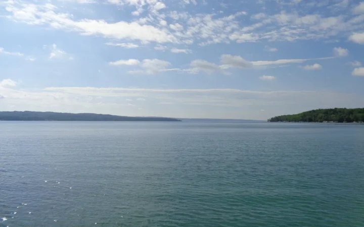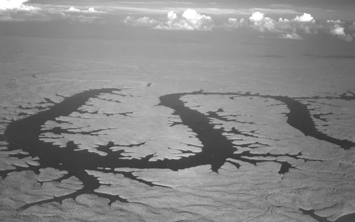
Deep Creek Lake is in Maryland, but its water does not drain to Chesapeake Bay. The lake sits on the inland side of an Appalachian drainage divide. Follow its outlet beyond the dam and you end up in the Mississippi River system.
Deep Creek Lake drains inland, not toward Chesapeake Bay
Deep Creek Lake is a man-made reservoir in Garrett County, in Maryland’s western Appalachian highlands. The dam holds back Deep Creek on the west side of the Eastern Continental Divide.
Water enters the Youghiogheny River system and eventually reaches the Gulf of Mexico through the Ohio and Mississippi rivers, not Chesapeake Bay.
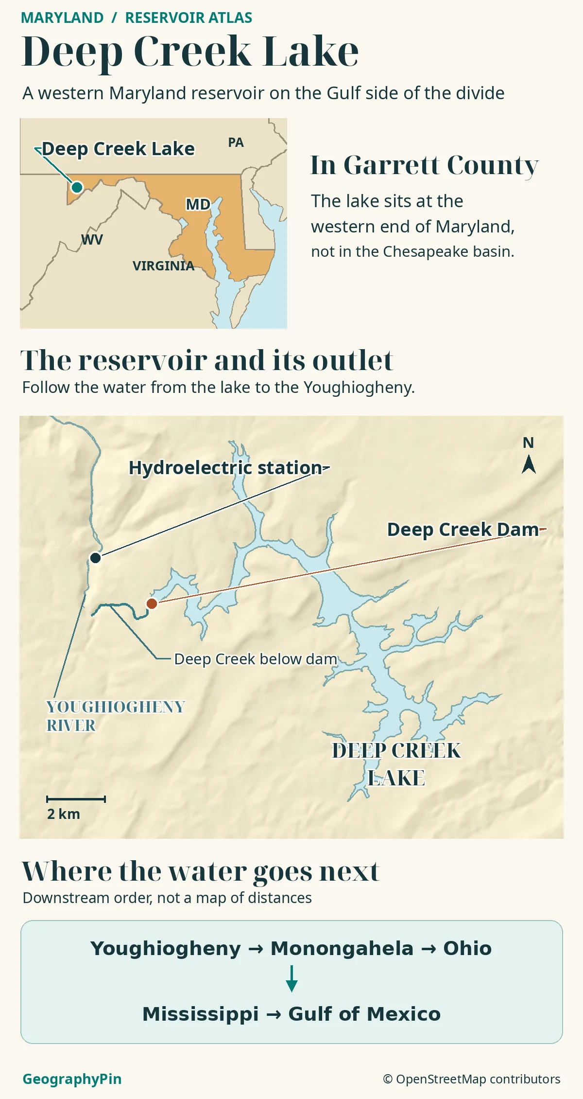
How to use this article: Start with the lake locator, then see the two paths to the river and the downstream river chain.
Find Deep Creek Lake in western Maryland
Deep Creek Lake is entirely within Garrett County, Maryland’s westernmost county. It lies on a high part of the Appalachian Plateau just west of the Allegheny Front, the steep eastern edge of that plateau in this area. The reservoir occupies a low part of this high country rather than the crest of a ridge.
Use Garrett County and Oakland to orient the map
Look north of Oakland for the branching lake. McHenry is near the northern arm, and Deep Creek Lake State Park is on the eastern side near Meadow Mountain. The state park is a place on the shore; it is not another name for the whole reservoir or for every point of access around it.
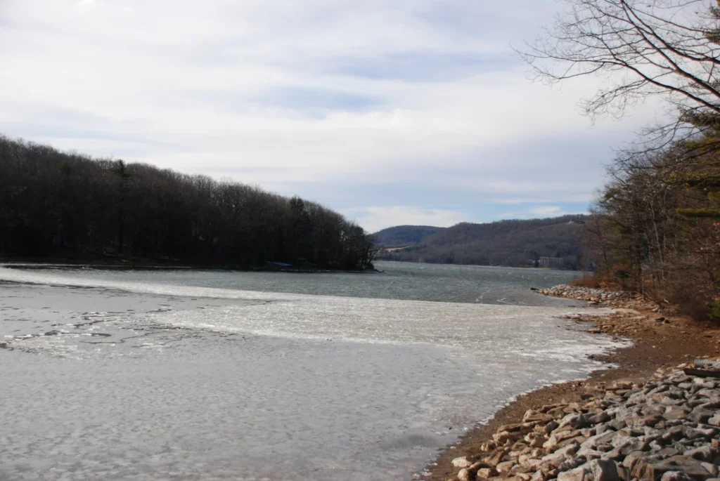
Garrett County’s high valleys and coves
The Maryland Department of Natural Resources puts the reservoir at about 3,900 acres (15.8 km²) at full pool. That is the water surface at a reference level, not the area of land draining into it. The lake’s catchment includes higher slopes and streams that feed coves as well as the reservoir itself.
The lake is so branched because the dam flooded a valley network, rather than creating a straight-sided basin. The arms extend into former stream valleys. This is why two shoreline points can look close across the water but be farther apart by land. A map drawn from a different water level may show small changes in shallow coves without moving the dam.
The dam and the drop to the powerhouse
The Deep Creek hydroelectric project was completed in 1925, according to Maryland DNR. The earth-and-rockfill dam sits across Deep Creek on the reservoir’s western outlet. It keeps water at a higher elevation than the Youghiogheny valley below. That difference in elevation is useful for generating power.
The creek and the power tunnel are not the same route
Deep Creek is a tributary of the Youghiogheny, but the hydroelectric project also sends water through a dedicated power tunnel to a lower powerhouse on the river. Its discharge goes into the Youghiogheny through a tailrace, the channel that carries water away from the turbines. A creek line below the dam and the engineered path to the generating station are different features. Both belong to the same downstream river system.
Trace the water to the Gulf
From the Youghiogheny through Pittsburgh
The Youghiogheny reaches Pennsylvania and joins the Monongahela at McKeesport. In Pittsburgh, the Monongahela meets the Allegheny to form the Ohio River. The Ohio joins the Mississippi near Cairo, Illinois; the lower Mississippi then runs to the Gulf of Mexico.
Downstream sequence: Deep Creek Lake → Youghiogheny → Monongahela → Ohio → Mississippi → Gulf of Mexico. This is a catchment connection, not a boating route. The first rivers take the water away from Maryland’s Atlantic-draining side before the Mississippi turns the combined flow toward the Gulf Coast.
The Eastern Continental Divide separates rivers draining inland through the Mississippi system from rivers draining toward the Atlantic on the other side. State boundaries do not decide that direction. In this case, the lake’s position west of the divide tells you more about where the water goes than the fact that it is in Maryland.
What a relief map adds to the shoreline
Start with a locator if you want to place the lake within Maryland. Use contours or relief if you want to understand why an outlet is there. Shaded ridges help separate the reservoir’s branching low ground from the higher terrain around it, and the lower river valley makes it easier to understand why the powerhouse sits below the lake.
Relief alone does not show the depth of the reservoir or the operation of a dam. Contours describe land elevation unless the map explicitly includes a survey of the lakebed. Regulated lake levels and releases can vary, so a shoreline or downstream arrow is not a measurement of water depth or present flow.
Frequently Asked Questions
Why do older USGS records say “Deep Creek Reservoir”?
A USGS report uses Deep Creek Reservoir for the dam station. Maryland DNR and newer USGS monitoring use Deep Creek Lake. In this Garrett County setting, those names describe the same impoundment, although the monitoring sites may be in different places.
Is the state park the same as the Natural Resources Management Area?
No. Deep Creek Lake State Park adjoins the larger lake management area. A state park marker identifies a visitor site on one shore, not the dam or the full managed shoreline.
Is the Youghiogheny part of the Potomac River basin?
No. The Youghiogheny drains through the Monongahela and Ohio to the Mississippi. The Potomac reaches Chesapeake Bay. Following the river names instead of the state line prevents the two drainage systems from being confused.
What Did We Learn Today?
Deep Creek Lake occupies flooded valleys in Garrett County. The dam and its separate hydroelectric works send water into the Youghiogheny system on the inland side of the divide. The downstream chain reaches the Gulf through the Mississippi, while the lake area and shoreline describe the reservoir itself, not its drainage basin.
Sources & Data Notes
The Maryland DNR lake and management-area summary gives the location, creation date and full-pool area. Its Deep Creek Project description explains the dam and separate hydroelectric route. See also the separate state park, the USGS monitoring locator and the historical USGS reservoir record. The Army Corps’ tributary appendix and USGS river classification supply downstream connections.
Map: GeographyPin; locator shapes from the U.S. Census 2025 cartographic files, water and sites from OpenStreetMap contributors (ODbL) and Mapzen/AWS relief, checked November 20, 2026. The drainage diagram gives downstream order, not distances or basin limits.
December 2008 photograph by Sasha S, CC BY-SA 3.0, resized and converted to WebP under the same license. Editorial responsibility: Zurab Koniashvili (Z.K. Atlas); AI tools assisted in preparation.