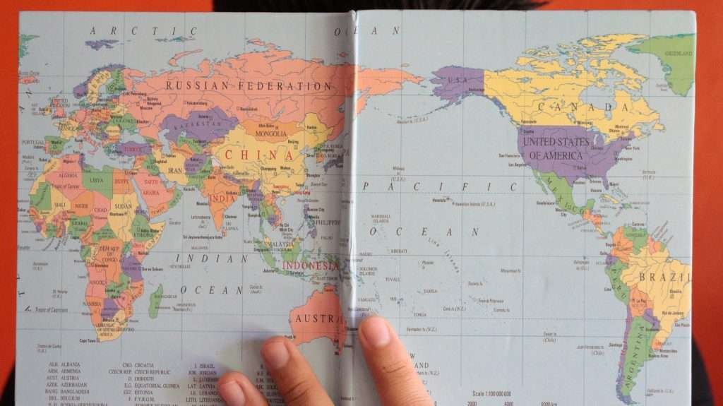
The continents of the world are the planet’s largest, conventionally recognized landmasses. Most English-language curricula teach seven: Africa, Antarctica, Asia, Europe, North America, South America, and Australia/Oceania. A continent is defined by convention more than strict science, which is why 5-, 6-, and 7-continent models all exist in different traditions.
What Is a Continent? Definition and Criteria
A continent is a very large, continuous area of land that people agree to treat as a distinct region. That word “agree” matters: the definition is conventional. Encyclopædia Britannica describes a continent as a “large continuous mass of land conventionally regarded as a collective region,” noting that the familiar list is seven (Asia, Africa, North America, South America, Antarctica, Europe, and Australia). Sometimes Europe and Asia are combined into “Eurasia,” showing that usage can vary by context and tradition. Authoritative overview at Britannica.
In everyday geography, islands near a continent’s shallow continental shelf are usually considered part of that continent (for example, Great Britain with Europe). In geology, however, a continent is tied to the underlying “continental crust,” which is thicker and less dense than oceanic crust. That geologic view can include submerged shelves and even mostly underwater regions. This explains why a geologist might treat New Zealand as part of a largely submerged continent called “Zealandia,” whereas a school atlas still places New Zealand within Oceania. See the contrast between geographic convention (Britannica) and geologic evidence for Zealandia (GSA Today).
Geographic vs. Geologic Views
Geography focuses on human use, history, and map clarity—hence tidy boundaries like the Ural Mountains or the Isthmus of Panama. Geology follows the rock: continental shields, platforms, and shelves. These lenses often overlap, but not perfectly. This is why “what is a continent?” can have more than one correct answer—depending on whether your goal is navigation, culture, or Earth science.
| Metric | Geographic convention | Geologic perspective |
|---|---|---|
| Unit of analysis | Named landmasses recognized by tradition | Continental crust (often includes shelves and nearby islands) |
| Examples | “Europe,” “Asia,” “North America” | Cratons, shields; Zealandia as a mostly submerged continent |
| Boundary style | Historical/cultural lines and major landforms | Tectonic and crustal characteristics |
How Many Continents Are There? 7 vs. 6 vs. 5
Most English-speaking schools teach a 7-continent model: Africa, Antarctica, Asia, Europe, North America, South America, and Australia (often broadened to “Australia/Oceania”). This model emphasizes cultural history and clear regional groupings. Britannica lists the same seven, while noting that some traditions merge or split them differently. See Britannica’s note on variants.
In several European, Latin American, and East Asian curricula, a 6-continent model is common. One version merges Europe and Asia into “Eurasia” (Africa, Antarctica, Eurasia, North America, South America, Australia/Oceania). Another merges North and South America into a single “America” (Africa, Antarctica, Asia, Europe, America, Australia/Oceania). Why the difference? Because continental boundaries were drawn over centuries for navigation and history, long before plate tectonics gave us a deeper geologic map.
The 7-Continent Model
This is the default in many English-language atlases and textbooks. It cleanly distinguishes Europe from Asia for historical reasons and splits the Americas at the Isthmus of Panama—roughly 400 miles (640 kilometers) of land that joins the two.
The 6-Continent Models
Two common versions exist: (1) Eurasia + separate North and South America, or (2) America (combined) + separate Europe and Asia. Both reflect equally valid conventions. Britannica and other references acknowledge these alternatives alongside the seven. More on the alternatives.
The 5-Continent Idea (Olympic Symbolism)
The Olympic flag shows five interlocking rings. In the Olympic movement, these rings symbolize the union of five inhabited “parts of the world” (Africa, the Americas, Asia, Europe, and Oceania)—not a scientific vote against Antarctica, but a symbol of universality.
Where Are the Boundaries Drawn?
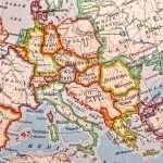
Some borders are straightforward; others are traditional rather than purely physical. A standard Europe–Asia divide runs along the Ural Mountains and Ural River, across the Caspian Sea, then either along the crest of the Greater Caucasus or the Kuma–Manych Depression, reaching the Black Sea and Turkish Straits. Encyclopædia Britannica and National Geographic both describe these conventions.
Two narrow land bridges are classic separators. The Isthmus of Suez connects Africa and Asia; many references treat the Suez Canal—about 120 miles (193 kilometers) long—as the practical dividing line today. The Isthmus of Panama links North and South America across roughly 400 miles (640 kilometers). Both isthmuses are famous because they concentrate movement of people, goods, species, and even ocean water (once cut by canals).
Continents vs. Tectonic Plates
Continents and plates are not the same thing. Earth’s lithosphere is broken into tectonic plates that move a few inches (centimeters) per year. Some plates carry entire continents; others carry slices of several. Over hundreds of millions of years, continents merge into supercontinents (like Pangaea) and then rift apart. These long cycles help explain mountain belts, ocean basins, and why the continents’ positions have changed through time. For a clear primer, see Britannica on plate tectonics.
From Pangaea to Today
Pangaea assembled about 335 million years ago and began breaking up roughly 175–200 million years ago, splitting into Laurasia (north) and Gondwana (south). Those pieces drifted to form our present continental arrangement. The story is ongoing: today’s Red Sea rift and East African Rift are examples of future plate boundaries in the making.
Zealandia—A Mostly Submerged “Eighth” Continent?
Geologists have compiled strong evidence that the New Zealand–New Caledonia region sits on a distinct, mostly submerged continent called Zealandia (about 94% underwater). It is not part of the traditional 7-continent school model, but shows how a geologic lens can produce different—but valid—groupings. GSA Today paper on Zealandia.
List of the 7 Continents with Key Facts
The table below compiles standard area figures from Encyclopædia Britannica; highest points from Britannica/USGS/NatGeo; and approximate population shares using UN-based aggregates (via Our World in Data and UN WPP 2024). Exact percentages vary by definition and data source.
| Continent (7-model) | Area (sq mi / km²) | Highest point (ft / m) | Population share (≈2025) | Boundary notes |
|---|---|---|---|---|
| Asia | ≈17,226,000 sq mi (≈44,614,000 km²) | Mount Everest — 29,032 ft (8,848.86 m) | ≈62% | Ural Mountains/River, Caspian, Caucasus, Turkish Straits |
| Africa | ≈11,724,000 sq mi (≈30,365,000 km²) | Kilimanjaro — 19,341 ft (5,895 m) | ≈19% | Suez land bridge to Asia; Mediterranean/Atlantic/Indian Oceans |
| North America | ≈9,355,000 sq mi (≈24,230,000 km²) | Denali — 20,310 ft (6,190 m) | ≈7–8% | Connected to South America via ~400 mi (640 km) Isthmus of Panama |
| South America | ≈6,878,000 sq mi (≈17,814,000 km²) | Aconcagua — ~22,831 ft (~6,959 m) | ≈5–6% | Linked to North America at Panama |
| Antarctica | ≈5,500,000 sq mi (≈14,200,000 km²) | Vinson Massif — 16,050 ft (4,892 m) | ≈0% | Uninhabited permanently; governed by Antarctic Treaty |
| Europe | ≈3,930,000 sq mi (≈10,180,000 km²) | Mount Elbrus — 18,510 ft (5,642 m) | ≈9% | Conventionally distinct from Asia despite one landmass (Eurasia) |
| Australia/Oceania | ≈3,290,000 sq mi (≈8,510,000 km²) | Puncak Jaya (Oceania) — 16,024 ft (4,884 m) | ≈0.5–1% | Includes Australia plus Pacific islands (usage varies); “Oceania” is broader than the Australian mainland |
FAQ
How many continents are there?
It depends on convention. The most common English-language model lists seven. Some regions teach six (either merging Europe+Asia as Eurasia or North+South America as “America”). The Olympic “five continents” reflect symbolism about inhabited regions, not a scientific boundary.
Why are Europe and Asia considered separate continents?
Historical and cultural tradition. They share one landmass (Eurasia), but for millennia Europeans treated Europe as a distinct “peninsula of peninsulas.” Standard boundaries use the Ural Mountains/River, Caspian, Caucasus, and Turkish Straits (a conventional, not purely geologic, line).
Is Australia a continent or is it “Oceania”?
Both terms are used. “Australia” can mean the continent-sized mainland (plus Tasmania). “Oceania” is a broader regional term that includes Australia and many Pacific islands (Melanesia, Micronesia, Polynesia). Many atlases use “Australia/Oceania” to make this clear.
What’s the lowest land point on any continent?
The shores of the Dead Sea in the Asia–Africa rift system, at roughly −1,407 ft (−429 m) below sea level, mark Earth’s lowest exposed land elevation.
What Did We Learn Today?
- “Continent” is a convention: seven is common, but 6- and 5-continent models are also taught.
- Geography and geology draw lines for different reasons; shelves and submerged crust complicate borders.
- Europe–Asia boundaries follow the Urals, Caspian, and Caucasus by tradition, not strict geology.
- Asia is the largest and most populous continent; Antarctica is vast but uninhabited year-round.
- Zealandia shows why geologists sometimes recognize continents the school atlas does not.