Wooded ridges, open pastures and steep-sided valleys give the Black Forest a distinctive landscape. But its name hides several different ideas: a mountain region, a changing forest landscape and a much smaller national park. Separating them makes its geography easier to understand.
The Black Forest is an upland in southwestern Germany, east of the Upper Rhine plain. Its mountains form the eastern flank of a rift basin, with Feldberg as the highest summit. The region includes forests, farms and settlements; it is neither one continuous primeval forest nor a single national park.
Read the landscape: Decode the map outline, distinguish two meanings of the Danube source, or compare the region and national park.
1. Where is the Black Forest?
The Black Forest, or Schwarzwald, is an upland in southwestern Germany, within Baden-Württemberg. It rises east of the Upper Rhine plain, opposite France, and extends south toward the High Rhine near Switzerland. It is a broad mountain landscape rather than a single ridge or one municipality.
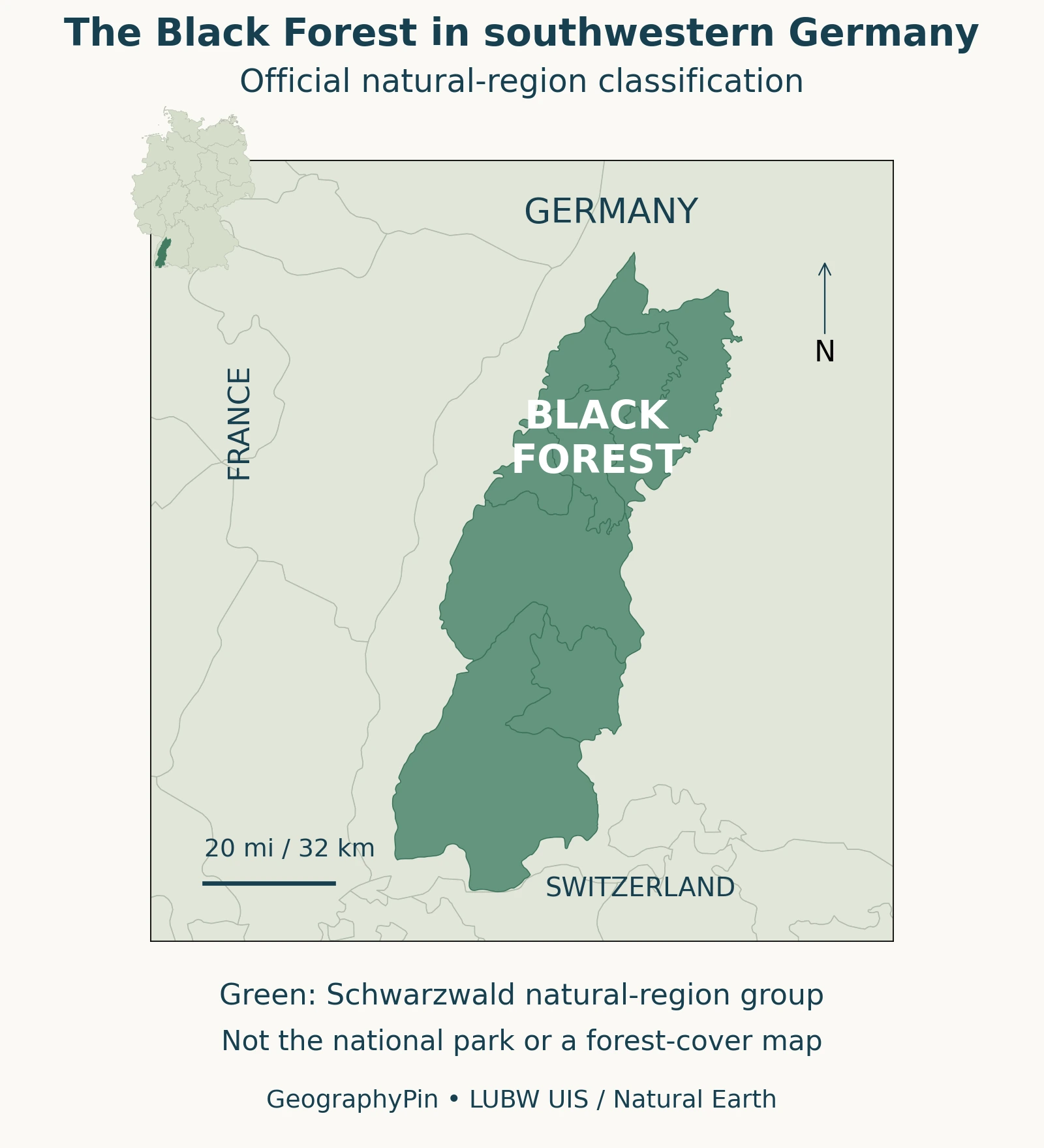
What the green outline means
The map follows an official natural-region classification rather than tracing every wooded hillside. The six constituent units are grouped as Schwarzwald in the state environmental agency’s dataset. Their shared outline answers a physical-geography question: which landscape belongs to this regional grouping?
That is different from asking where trees grow, where a tourism organization operates, or which land is legally protected. Towns, roads, farms and open slopes can lie inside the green area. The boundary is a documented regional convention, not a claim that the landscape changes abruptly at every point on its edge.
2. Why mountains rise beside the Upper Rhine
The Black Forest forms the eastern highland flank of the Upper Rhine Graben; the Vosges form the western flank. A graben is a down-dropped part of the crust associated with extension and faulting. The LGRB: Upper Rhine and High Rhine region explains the region through subsidence, fault movement and uplift of its flanks, not simply erosion by a large river.
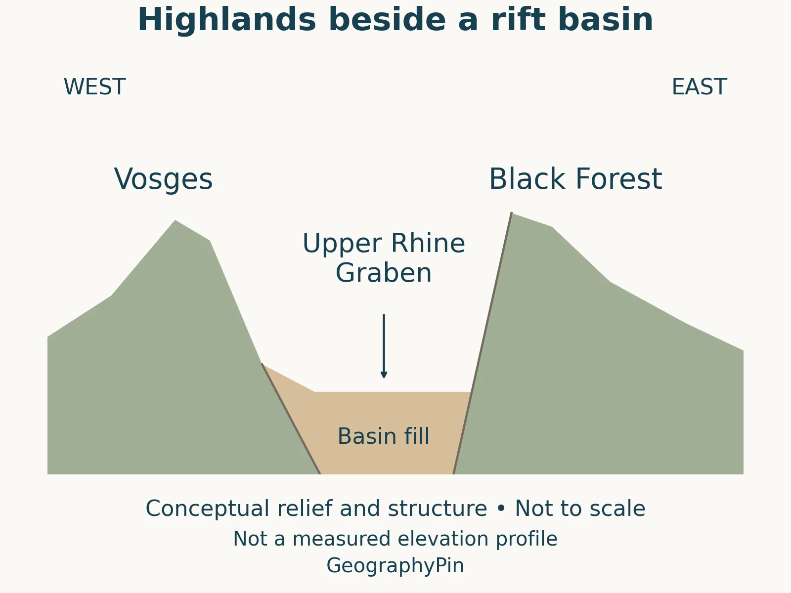
Sediments accumulated in the basin. The simplified diagram is not to scale and cannot establish the depth of buried rock beneath any town.
The Rhine occupies this lowland, but the river did not excavate the entire tectonic depression. Keeping those processes separate helps explain why the broad basin and its bordering mountains belong to the same geological story.
3. Relief, rocks and the highest summit
The LGRB: Schwarzwald landscape describes a strongly dissected western side facing the Rhine plain and a generally gentler transition eastward. The highest country lies in the south. Feldberg reaches about 4,898 feet (1,493 meters), according to the LGRB: tectonic regions; this is summit elevation above the national height reference, not the vertical climb from a trailhead.
Rock types also vary. Granite and metamorphic basement are important in the southern Black Forest, while younger sandstone cover is prominent in northern and eastern areas. A forested skyline therefore does not imply that every ridge is made of the same material.
Rivers dissected the uplifted landscape; later glaciers modified higher terrain. Southern ice-cap landscapes and northern cirques record different glacial settings, superimposed on the older tectonic framework.
These connections between rock, relief and surface processes are central to physical geography. The useful question is not just how high a mountain is, but why its slopes, valleys and neighboring lowlands take their particular forms.
4. A watershed between the Rhine and Danube
The Black Forest also divides drainage systems. The LGRB: Breg source identifies the Breg spring northwest of Furtwangen as the source of one of the Danube’s two headstreams. The Breg meets the Brigach at Donaueschingen; downstream from that confluence, the river is called the Danube.
Nearby, the Elz begins on the other side of the watershed and belongs to the Rhine drainage system. Springs close together on a map can therefore feed different river basins. A watershed is a divide in the direction water drains, not necessarily a spectacular knife-edge ridge.
Two ways to identify the Danube source
There is a naming distinction, too. The well-known spring at Donaueschingen and the headwater source of the Breg answer different versions of the question “Where does the Danube begin?” One concerns the traditional named source; another follows the headstream farther upstream. Neither should be silently substituted for the other when explaining a map.
5. Forests, pastures and a lived-in landscape
The name can suggest an unbroken ancient forest, but land use has repeatedly changed the scenery. The Black Forest National Park: forest history, discussing the northern Black Forest, describes clearance, grazing and timber use, followed by reforestation that produced forests different from their earlier condition. Today’s tree cover should not automatically be described as untouched primeval woodland.
In the southern region, the Black Forest Biosphere Reserve: land use explains how agriculture helped create meadows and pastures, including communal grazing land known as Allmendweiden. Open grassland is therefore not always evidence that a slope lies above a natural climatic treeline. People have helped maintain parts of this open landscape.
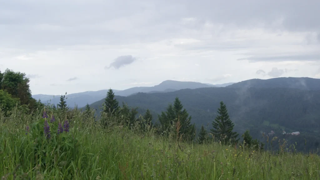
Forest management, farming and settlement belong alongside geology in an explanation of the Black Forest. A photograph may show wooded ridges fading into the distance, yet that view alone cannot establish the age of the trees, their planting history or the legal status of the land.
Nor does “managed” mean the landscape lacks ecological value. The biosphere reserve’s work connects land use with maintaining a varied cultural landscape. Understanding that relationship is more informative than dividing every hillside into either pristine wilderness or worthless human alteration.
6. The Black Forest is not one national park
Black Forest National Park protects only part of the wider mountain region. Its official Black Forest National Park: location and zoning states that an expansion on January 1, 2026 connected its formerly separate parts. The park now covers around 43 square miles (112.5 square kilometers), or approximately 11,250 hectares.
That update matters when reading older maps: the familiar description of two disconnected park sections no longer describes the current arrangement. The locator in this article deliberately maps the broader natural region, not either the old or new park boundary.
The national park also has different management zones, rather than one uniform category of undisturbed forest. Its location within the larger Black Forest Middle/North Nature Park is another reminder that similarly named protected areas are not interchangeable.
Compare the region, park and map
| Term or measurement | What it means here |
|---|---|
| Black Forest / Schwarzwald | The broader upland region shown by the LUBW natural-region grouping. |
| Feldberg: 4,898 ft (1,493 m) | Summit elevation, not the ascent required by every walking route. |
| National park: around 43 sq mi (112.5 km²) | A protected area within the region, using the official post-expansion description. |
| Green map shading | A regional classification, not measured forest cover or a national-park outline. |
What Did We Learn Today?
The Black Forest combines an ancient geological framework with later erosion, glaciation and long-standing human land use. Its natural-region outline, present tree cover and national-park boundary answer different questions. Reading those distinctions correctly is the key to understanding its map.
Sources & Data Notes
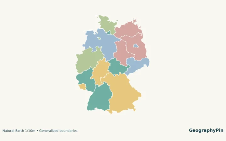
The locator combines six LUBW Naturraum units, numbered 150–155, grouped as Schwarzwald. It does not map forest cover, ownership or protected-area status. The north-up main view uses an equirectangular projection centered at 48.3°N; the Germany inset has a separate scale.
Cartography: GeographyPin. LUBW natural-region data, used under the LUBW use agreement: Grundlage: Daten aus dem Umweltinformationssystem (UIS) der LUBW Landesanstalt für Umwelt Baden-Württemberg. Context boundaries: Natural Earth, public domain. No official endorsement is implied.
The original relief diagram is conceptual, not a measured elevation transect or subsurface survey. Elevation converts meters to feet using 3.28084 and rounds to the nearest foot. Park area retains the official approximate value; 100 hectares equals 1 square kilometer. Park information reflects the expansion effective January 2026, not the older two-part arrangement.
- LGRB: Schwarzwald landscape
- LGRB: Upper Rhine and High Rhine region
- LGRB: tectonic regions
- LGRB: Breg source
- Black Forest Biosphere Reserve: land use
- Black Forest National Park: forest history
- Black Forest National Park: location and zoning
Featured photograph: Forested ridges viewed from Blauen in June 2022. Photo: Barbara-Ingeborg / Wikimedia Commons, CC0; cropped and converted to WebP. It is a historical view, not evidence of current weather or access.