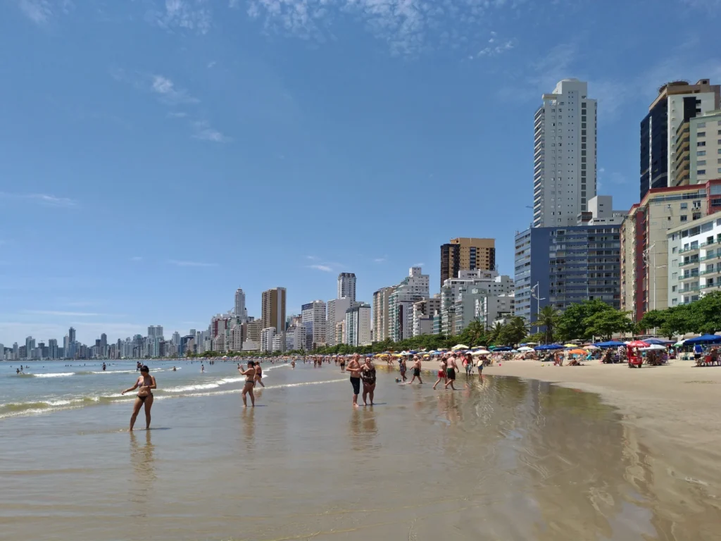
Balneário Camboriú’s seafront skyline is only one part of its geography. Behind the towers is a coastal municipality with a curved central beach, hills and a river connection to an inland neighbor. Its famous beachfront also has an engineering history: a beach photograph needs a date if it is being used to explain how the shore changed.
Balneário Camboriú is a coastal municipality in Santa Catarina, southern Brazil, facing the Atlantic Ocean. It is distinct from neighboring Camboriú. Praia Central forms its prominent urban beachfront, while the Camboriú River links the coast with an inland catchment. Sand added in 2021 widened the central beach, but did not freeze its shoreline in place.
1. Where is Balneário Camboriú?
Balneário Camboriú lies on the Santa Catarina coast in southern Brazil. It is a municipality in its own right, not a district of the similarly named Camboriú. The locator below highlights both areas so the shared name does not hide the administrative distinction.
Find the two neighboring municipalities
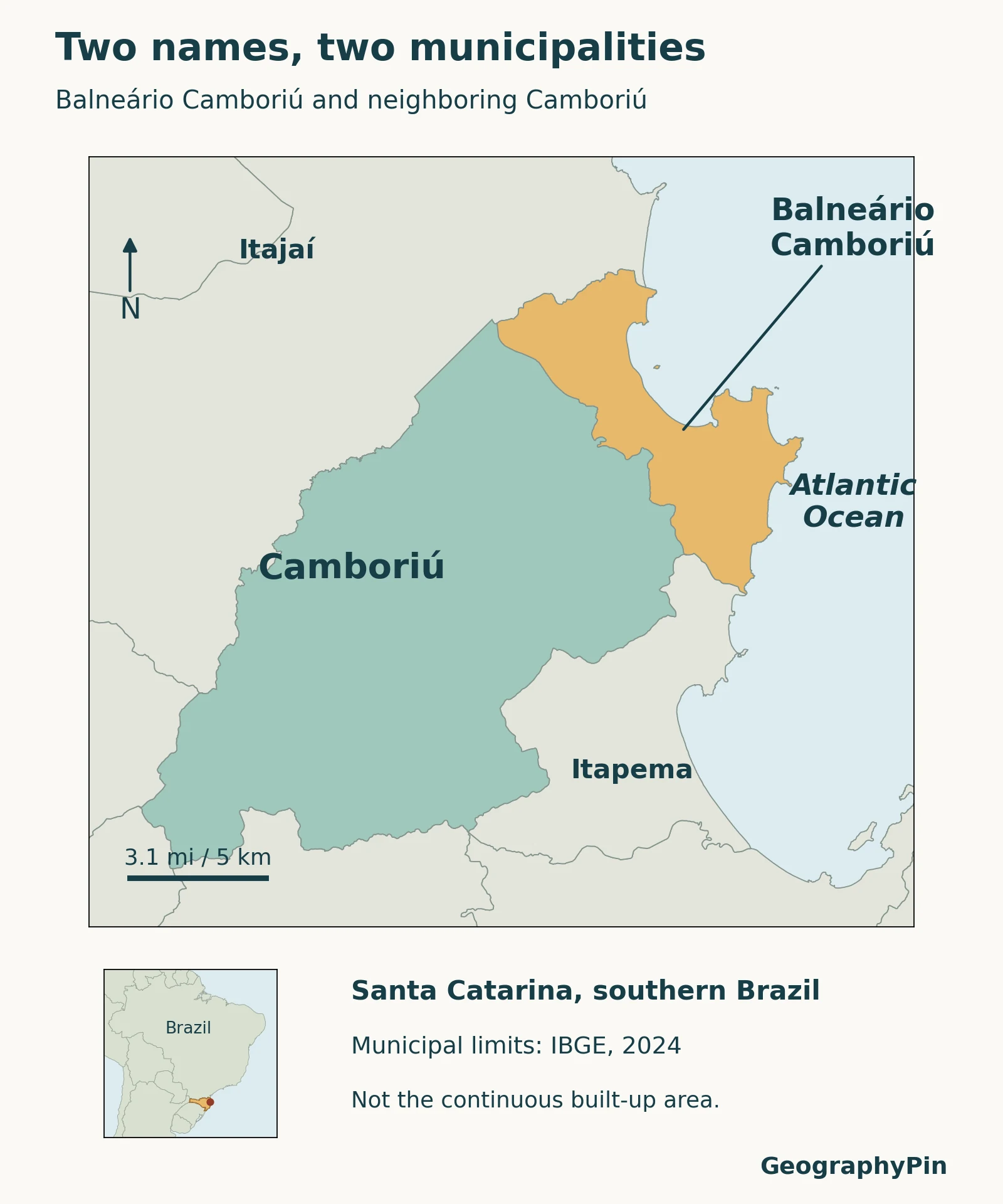
The highlighted outline is the municipal territory in the IBGE 2024 boundary dataset. It is not the edge of the continuous built-up area, the boundary of a bay or the perimeter of a tourism district. Buildings can form a visually continuous urban landscape across an administrative line without making the two municipalities identical.
That distinction becomes important when looking up population, area or public services. A value for Balneário Camboriú must be compared with the same municipality’s territory, not with a broader urban region or neighboring Camboriú. The IBGE identifiers are different: 4202008 for Balneário Camboriú and 4203204 for Camboriú.
2. The bay, beachfront and surrounding terrain
Praia Central is the city’s best-known urban beachfront. The photograph shows the curved shore and closely built waterfront. The sea edge and the urban street edge are different features, and the width of sand between them is not a fixed administrative measurement.
The municipal planning study describes Praia Central between the Camboriú River mouth at the southern end and the Marambaia mouth and Pontal Norte area at the northern end. Farther north, it identifies rocky coastal terrain around Morro do Careca and Praia dos Amores. These named places help distinguish the central urban beach from the wider coastal setting.
Read the coast with the photograph’s date in mind
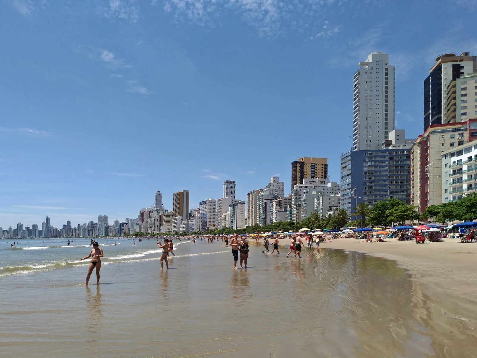
This photograph records the coast before the 2021 nourishment project. It can illustrate the relationship between the bay and the urban skyline, but it cannot establish present-day beach width. A tower or headland may help orient a view; its presence does not tell us the tide level or shoreline position at another date.
The central waterfront is also not the entire municipality’s coastline. An account of work at Praia Central should not be presented as a measurement of every beach in Balneário Camboriú. “The city,” “the municipality,” “the bay” and “the central beach” are useful terms only when their different scopes remain clear.
3. Why Balneário Camboriú and Camboriú are different
Santa Catarina’s Law 960 of April 8, 1964 created the municipality of Balneário de Camboriú by separating it from Camboriú. The IBGE historical account records its installation on July 20, 1964 and the later name change to Balneário Camboriú in 1979. These are different milestones: the legal creation date and the installation date need not be identical.
Today, the coastal municipality and its inland neighbor should not be treated as alternative spellings of one place. Their shared history explains the similar names, but it does not justify combining their populations or applying one municipality’s land area to the other.
The river provides a useful example of a physical connection across this administrative distinction. Brazil’s National Water and Sanitation Agency describes the Camboriú River’s mouth in Balneário Camboriú and a water-conservation project upstream in neighboring Camboriú. A catchment can link places that have separate local governments.
The agency’s project description concerns watershed management and restoration work. It is not a guarantee of present-day water quality at the river mouth or swimming conditions on the coast. For the broader idea of studying land and water processes separately from administrative boundaries, see physical geography.
4. How the central beach was widened
A dated engineering change, not a permanent shoreline
The diagram compares historical sand-strip widths, not current conditions.
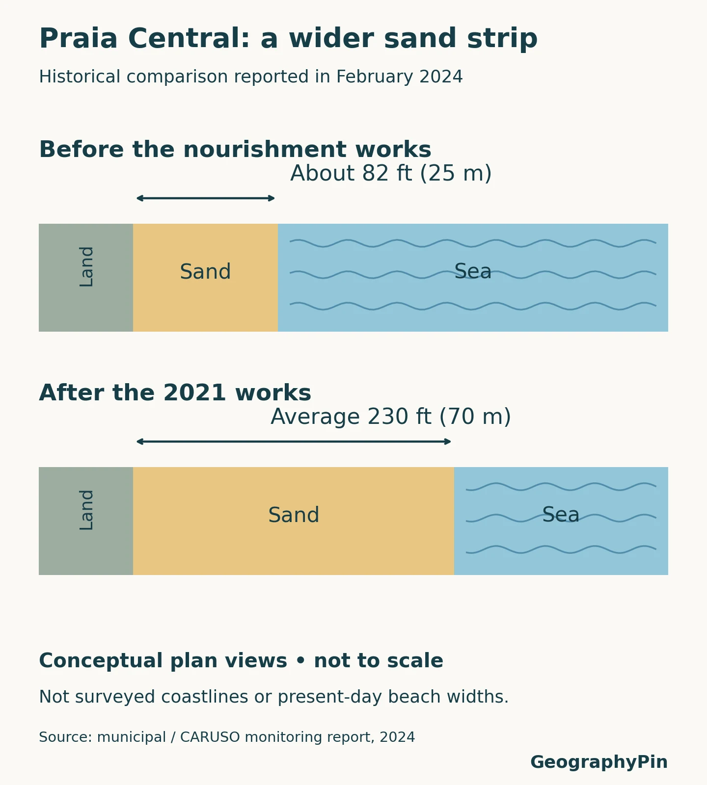
Monitoring recorded sand loss in Barra Sul and gains in most other sections. Nourishment did not make the shore behave uniformly.
A beach-width diagram is not a surveyed map of two complete shorelines. To compare actual shoreline positions, the dates, tidal reference, measurement method and location along the beach must be compatible. An average width cannot be drawn as a precise new boundary around the whole bay.
5. Facts that belong to the municipality
| Item | Description | Scope or date |
|---|---|---|
| Country and state | Brazil; Santa Catarina | Municipal location, not a separate state. |
| Municipal area | About 17.46 square miles (45.214 km²) | IBGE 2024 municipal boundary dataset. |
| Municipal identifier | 4202008 | Balneário Camboriú, distinct from Camboriú’s 4203204. |
| Creation | April 8, 1964 | State Law 960; installation followed on July 20. |
Municipal area is not beach area. It covers the administrative territory, including land away from the beachfront. A number reported in square kilometers therefore cannot tell us how much recreational sand is available along Praia Central.
Population comparisons require the same care. A census count, a later resident-population estimate and a count of seasonal visitors describe different populations at different times. None should be relabeled as the others simply because all appear in descriptions of a tourist city.
Reading the map, the dated photograph and the engineering comparison together gives a clearer picture: one coastal municipality, a neighboring municipality with a related name, and a physical shoreline that continues to change within that administrative setting.
What Did We Learn Today?
Balneário Camboriú and Camboriú are separate municipalities connected by geography and history. The coastal city’s urban beachfront is only part of its territory, and a dated photograph cannot establish today’s shoreline. Comparing administrative boundaries, river connections and historical beach changes reveals different aspects of the same place without confusing their scales.
Sources & Data Notes
Municipal boundaries and the area figure use the IBGE 2024 municipal dataset. They are not built-up-area boundaries or a cadastral survey. The beach graphic is an original conceptual comparison, not traced survey lines. The photograph was taken in 2018, before nourishment. Current beach widths, water quality and access conditions are not established by these historical materials.
- IBGE: Santa Catarina municipal boundaries, 2024, identifiers, polygons and area; municipal mesh methodology and attribution terms. Original map credits IBGE data and Natural Earth context.
- Santa Catarina Law 960, April 8, 1964 and IBGE municipal history, administrative separation and naming.
- Municipal planning study, Praia Central, river mouths and surrounding coastal terrain.
- ANA: Camboriú water-conservation project, river and upstream municipal context.
- Municipal/CARUSO monitoring report, February 2024, historical beach comparison and monitoring findings.
- Photograph: HVL / Wikimedia Commons, CC BY 4.0; taken December 21, 2018, resized and converted to WebP. No claim of a current shoreline or skyline.