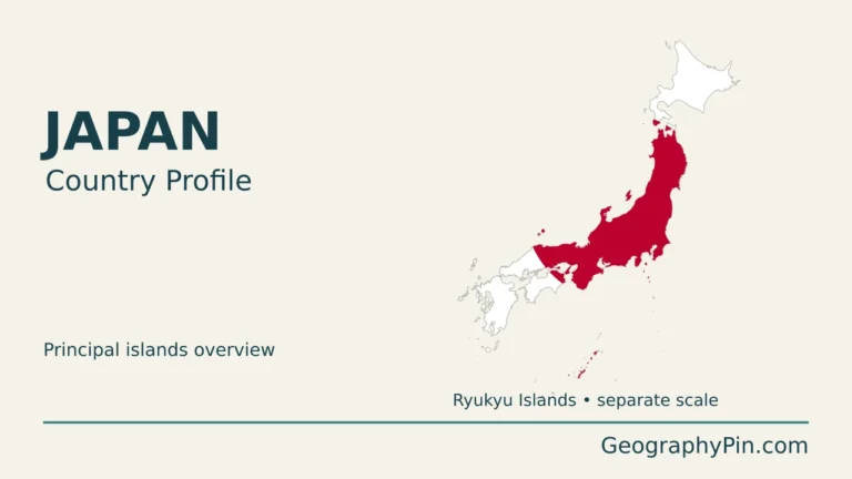
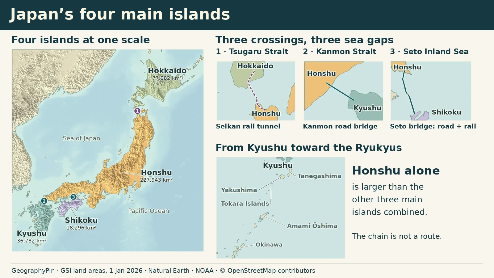
Honshu looks long on a Japanese islands map, but the bigger surprise comes when the four main islands are drawn at the same scale: it is larger than the other three put together. The gaps between them tell a different story, from a railway beneath the Tsugaru Strait to bridges that hop across islands on the way to Shikoku.
Japan’s four main islands are Honshu, Hokkaido, Kyushu and Shikoku, in descending order of area. Honshu makes up about 63% of their combined area. The Tsugaru Strait separates Hokkaido and Honshu, while the Seto Inland Sea and Kanmon Strait help distinguish Shikoku and Kyushu from western Honshu.
How to use this article: Compare the four island areas, then see why Tsugaru’s railway tunnel differs from the Seto and Kanmon crossings. Follow the island arc beyond Kyushu for the southwest context.
Japan’s four main islands at one scale
Compare their areas, not just their lengths
Start with Honshu, the long island that bends southwest from the Tsugaru Strait. Hokkaido lies across that strait to the north. In the west, Shikoku sits across the Seto Inland Sea from Honshu and Kyushu lies beyond the narrow Kanmon Strait. A numbered list can make the last two sound alike, but Kyushu has roughly twice Shikoku’s area.
| Island | Area | Share of these four |
|---|---|---|
| Honshu | 227,943.31 km² | 63.1% |
| Hokkaido | 77,982.37 km² | 21.6% |
| Kyushu | 36,781.79 km² | 10.2% |
| Shikoku | 18,296.12 km² | 5.1% |
The Geospatial Information Authority of Japan’s island-area survey gives Honshu about 88,009 square miles (227,943 square kilometers). The other three add up to about 51,375 square miles (133,060 square kilometers). That makes Honshu about 1.7 times as large as the other three combined. These percentages compare four landmasses only; they are not shares of an official national total.
Hokkaido and Honshu: the rail link beneath Tsugaru
Find the sea gap, then look below it
At Honshu’s northern tip, the Tsugaru Strait separates Aomori from southern Hokkaido. The fixed link is the Seikan railway tunnel, not a road bridge. Its north and south portals are inland, so the line extends well beyond the water drawn on a coastline map.
JR Hokkaido’s engineering description measures the full tunnel at about 33.5 miles (53.85 kilometers) but the portion beneath the seabed at about 14.5 miles (23.3 kilometers). Neither number is the shortest distance between the two islands. The difference is a good reminder to read whether a map is measuring the water, the built structure or only its undersea section.
Shikoku and Kyushu: bridges above, tunnels below
Distinguish the Seto Inland Sea from the Kanmon Strait
Crossing to Shikoku takes you over an island-filled inland sea. The bridge operator lists three corridors from Honshu. From east to west, they are Kobe–Awaji–Naruto, Seto-Chuo and Nishi-Seto, also called the Shimanami Kaido. These are not three single spans. The eastern route crosses Awaji Island, while the western one steps across several islands. The central Great Seto Bridge system carries both road and rail.
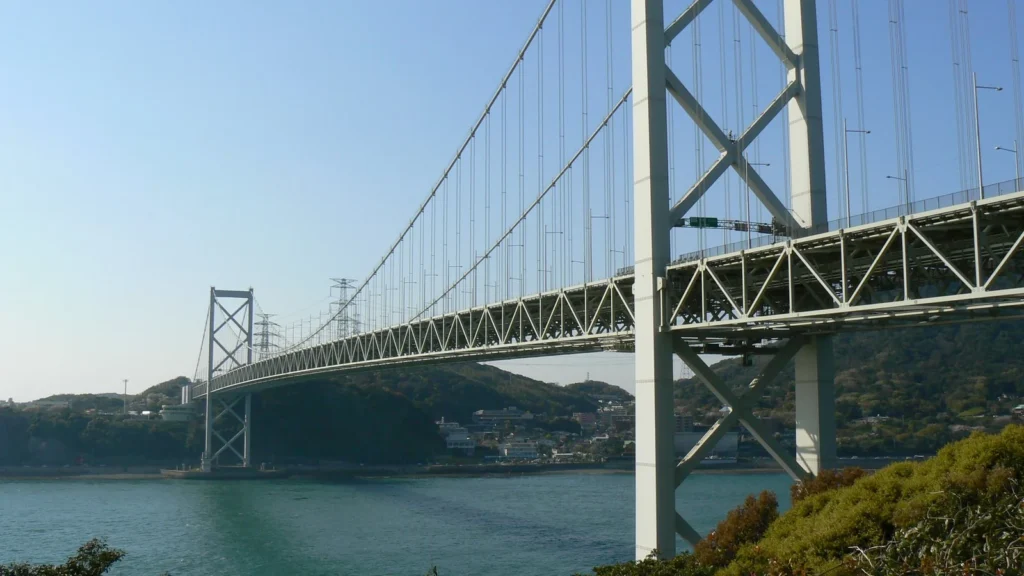
At the western end of Honshu, the geography changes. Shimonoseki on Honshu faces Moji on Kyushu across the Kanmon Strait. The Kanmon Bridge crosses above the water. The separate Kanmon road tunnel has an undersea footpath below the roadway. A narrow blue channel on a map can therefore represent separate islands without telling you how people cross it.
Beyond Kyushu: the long island chain toward Taiwan
Follow the chain beyond Okinawa
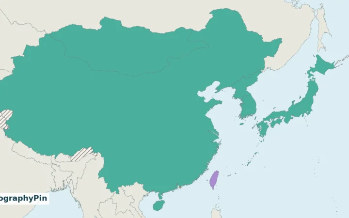
The land does not end at Kyushu. Japan’s environment ministry maps an arc running southwest through the Ōsumi, Tokara and Amami islands before Okinawa. Beyond Okinawa are further groups including Miyako and Yaeyama. Okinawa is a useful landmark within the arc, not its far end or a name for every island on it.
Different scales reveal different things. The arc is easiest to see on a map that includes Kyushu and Taiwan, while individual islands and the intervening water are more visible in a close-up. The ministry’s Ryukyu distribution map also labels the broader gaps between parts of the chain. That is geographic orientation, not a claim that each named chain is an administrative unit or an indication of how to travel between islands.
Frequently Asked Questions
How many Japanese islands does the GSI count include?
The agency reported 14,125 in 2023 using its January 2022 digital base map. Its criteria generally count naturally formed islands with a perimeter of at least 328 feet (100 meters) and also include islands identified in relevant laws. The perimeter is the distance around the land, not its area.
Is Hokkaido the island the same size as Hokkaido the prefecture?
No. The ranking compares the physical landmass of Hokkaido. The prefecture’s jurisdiction covers more than that one landmass; the same GSI publication, for example, separately lists the offshore island of Rishiri in Hokkaido.
Where does Sado belong on a Japanese islands map?
Sado sits off northwestern Honshu in the Sea of Japan, not on the southwest Ryukyu arc. It is a separate island in Niigata Prefecture, even though most of that prefecture is on Honshu.
What Did We Learn Today?
Use the four-island comparison to see Honshu’s size, then read the crossings one by one: under Tsugaru by rail, across the Seto Inland Sea via bridge chains and above or below the Kanmon Strait. Okinawa lies farther southwest within a long arc of islands, not among the four main landmasses.
Sources & Data Notes
The Geospatial Information Authority of Japan’s January 1, 2026 island-area survey supplies the four island areas and context for offshore islands. The comparison adds only the four listed areas and rounds each share to one decimal place; square miles are converted and rounded. GSI’s separate 2023 count has a different purpose and data date. JR Hokkaido, the Honshu–Shikoku Bridge Expressway Company, the Japan Tourism Agency and the environment ministry verify the crossings and the southwest island chain.
Photo: Kanmon Bridge by Full Moon, April 10, 2009, CC BY 3.0 (cropped and resized). Map data: Natural Earth, NOAA ETOPO 2022, OpenStreetMap contributors (ODbL).