An internal line on a Soviet map could become an international boundary without physically moving. But that does not mean every line was already settled or every modern state began in 1991. The former Soviet republics make more sense when you keep constitutional names, recognition and control separate.
An internal line can become an international border
The late Soviet Union had 15 union republics, which correspond to 15 independent countries today, including the three Baltic states that restored their independence. Many lines between republics became international borders when the USSR dissolved. That transition did not settle every boundary or turn a line of military control into a recognized border.
How to use this article: Check which republics count, then see what it takes to define a border, how Georgia’s restoration act fits and where modern treaty and control questions differ.
Fifteen Union Republics, Not Fifteen Identical Transitions
The 1977 Soviet Constitution lists 15 union republics. They were top-level constituent units: not every province, autonomous republic or allied country. Late Soviet maps draw both an outer border and lines separating constituent republics, so the type of line matters as much as its location.
Only top-level republics enter the comparison
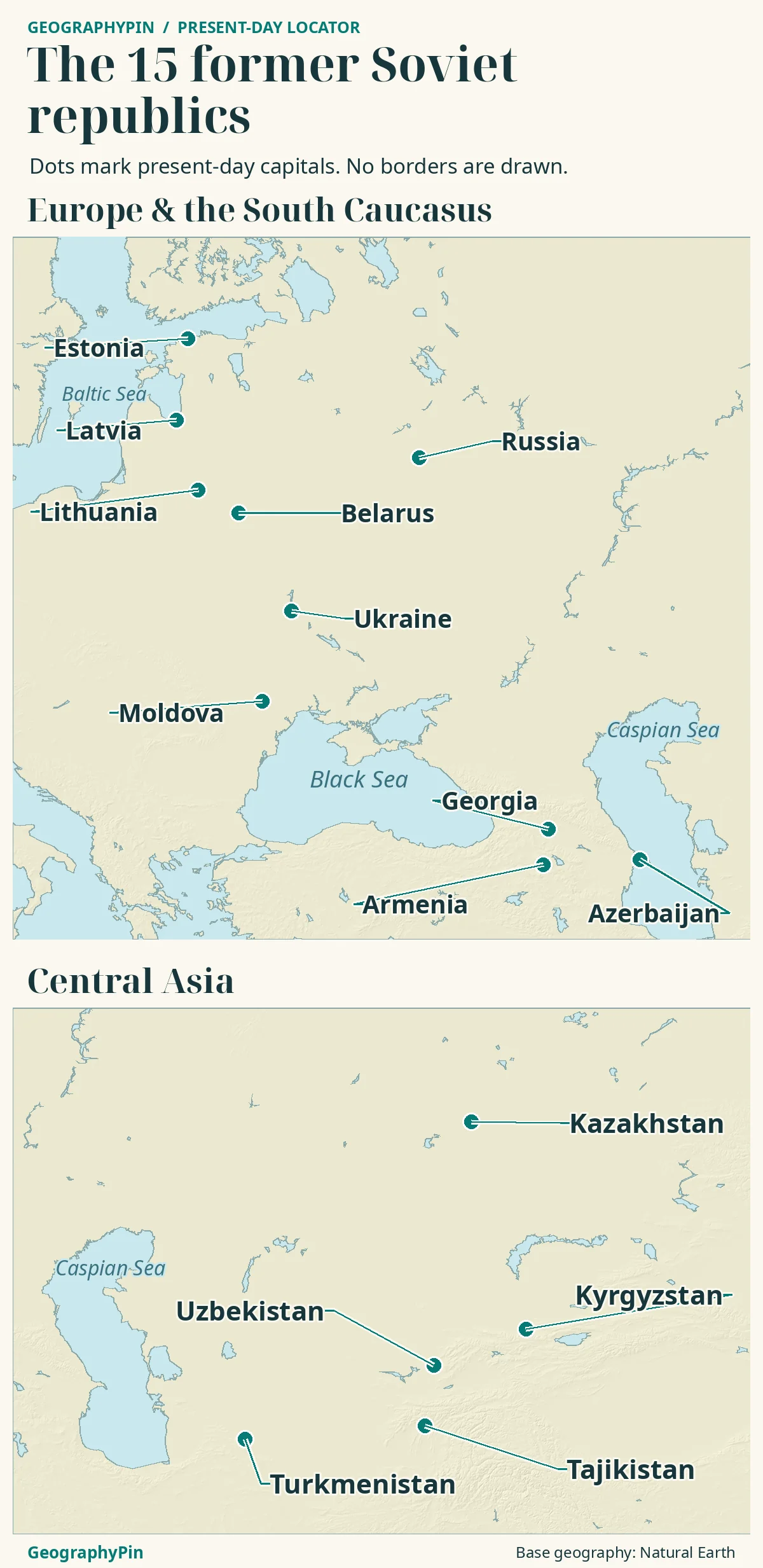
Poland joined the Warsaw Pact as an ally of the Soviet Union, not as a Soviet union republic. A military alliance roster is not the same as a state’s administrative roster. An autonomous republic inside a union republic also was not a sixteenth member of the Union. The count in the table is an institutional and geographic reference, not a claim that all the modern countries in it were founded for the first time in 1991.
| Geographic group | Soviet names | Names today | Distinction to keep in mind |
|---|---|---|---|
| Baltic | Estonian, Latvian and Lithuanian SSRs | Estonia, Latvia and Lithuania | Separate acts restored independence; all three admitted to the UN in September 1991. |
| Western republics | Byelorussian, Ukrainian and Moldavian SSRs | Belarus, Ukraine and Moldova | Belarus and Ukraine already held UN seats; Moldova was admitted as a separate member after the breakup. |
| Russia, across Europe and Asia | Russian Soviet Federative Socialist Republic (RSFSR) | Russian Federation (Russia) | Its December 1991 letter notified the UN that it continued the USSR’s membership. |
| South Caucasus | Armenian, Azerbaijan and Georgian SSRs | Armenia, Azerbaijan and Georgia (country) | Soviet-era union-republic labels do not describe all the same legal histories; Georgia’s April 1991 act expressly restored independent statehood. |
| Central Asia | Kazakh, Kirghiz, Tajik, Turkmen and Uzbek SSRs | Kazakhstan, Kyrgyzstan, Tajikistan, Turkmenistan and Uzbekistan | Existing republics became separate states; treaties later specified some shared lines and junctions. |
What Changed When a Republic Line Became a State Border
The December 21, 1991 Alma-Ata Declaration records the signatories’ commitment to respect one another’s territorial integrity and existing borders. As the union dissolved, lines previously used to separate republics could now separate sovereign states. The line did not have to move for its legal meaning to change.
A border principle is not a boundary survey
Delimitation is the process of agreeing where a boundary runs, commonly in texts and on maps. Demarcation marks it in the landscape. Both are more precise tasks than recognizing a neighbor as a state. A political map can show country names correctly without having parcel-level detail about a border crossing.
Restored Independence and UN Membership Followed Different Paths
Lithuania’s act of March 11, 1990 says that prewar acts underpin the re-established state. Estonia’s August 20, 1991 resolution invokes the Republic of Estonia’s continuity. Latvia’s May 4, 1990 declaration began a restoration process later completed in August 1991. These are restoration acts, not a common founding date for the three countries.
Georgia also used the language of restoration
Georgia’s April 9, 1991 act expressly restored Georgian state independence on the basis of the May 26, 1918 act. The three Baltic examples are often discussed together, but they are not a reason to erase the wording of Georgia’s own document.
UN membership follows its own chronology. Belarus and Ukraine were original UN members in 1945 even while within the USSR; that did not make them independent states in 1945. Russia’s December 24, 1991 notification continued the USSR’s UN membership in practice. Continuity of a seat is not authority over another republic’s territory.
When Present Borders Need More Than the Old Map
Three different questions can arise at the same edge of a map. Are the two states independent? Have they agreed the exact boundary? Who controls the territory on a particular date? A source may answer one without answering the others.
Central Asian agreements and the Ukraine contrast
| Instrument or event | What the source establishes | What it does not establish |
|---|---|---|
| December 21, 1991: Alma-Ata Declaration | The participating states affirmed respect for each other’s territory and existing borders. | It did not provide a new survey, settle every disputed stretch or turn a Soviet subunit into a sixteenth successor. |
| March 13 and 31, 2025: Central Asia | Kyrgyzstan and Tajikistan signed a state-border treaty; later that month the two countries and Uzbekistan signed a border-junction treaty. | These are later diplomatic instruments; they do not imply that there was no international border relationship before the treaties. |
| March 27, 2014: Ukraine’s territorial integrity | The UN General Assembly reaffirmed Ukraine’s territorial integrity within its internationally recognized borders. | This is not a description of present military control. Neither a claimed annexation nor a front line supplies a replacement for the legally referenced border. |
The Central Asian example shows how an agreement can resolve the location of sections of an already international boundary decades after statehood. The Ukraine example shows why international recognition and control cannot be merged into one map label. Use the source and its date rather than inferring the answer from the color on an old map.
How to Read the Names on a Present-Day Map
Historic English spellings such as Kirghiz SSR and Moldavian SSR help identify Soviet-era entities in English-language references. On a present-day reference, use Kyrgyzstan and Moldova. Treat the historical name as an aid to matching sources, not an alternative contemporary country name. Likewise, the RSFSR was one constituent republic, not another name for the whole USSR.
Before comparing two maps, identify the political date, the mapmaker’s convention for disputed areas, and whether the line is a state boundary, joint limit or control line. Those checks avoid the false impression that a modern flag, a UN membership record and an historical map show identical things.
Frequently Asked Questions
Why is Georgia’s UN admission date later than its restoration of independence?
Restoring independence and being admitted to the UN are separate events. Georgia’s act restored state independence on April 9, 1991; the UN admitted Georgia on July 31, 1992. A membership date is therefore not a substitute for the date of the national act.
Was the Commonwealth of Independent States a renamed Soviet Union?
No. The 1991 founding texts say the USSR was ending. The Commonwealth was set up as cooperation among separate states, not as the renamed federal union with the same territory or constitution.
Did the Soviet Union always have 15 republics?
No. The United Nations’ 1947 Yearbook lists 16 union republics, including the Karelo-Finnish SSR. In 1956 it became an autonomous republic within the Russian SFSR. The 15 in the table are the late Soviet roster, not a count for every year of the USSR.
What Did We Learn Today?
The historic count comes from the top-level republics, not the USSR’s allies or internal autonomous areas. The breakup changed the legal role of many lines, but recognition, delimitation and territorial control are different questions. The Baltic and Georgian restoration acts and the later Central Asian agreements make those distinctions concrete.
Sources & Data Notes
The 15-member roster follows Article 71 of the 1977 Constitution. Historic names use standard English spellings and are grouped for geographic readability. The Alma-Ata text, national restoration acts and UN records are distinguished by date. The comparison explains selected legal and geographic distinctions, not an exhaustive account of territorial claims or a live control map. Sources checked November 2026.
- NATO archive chronology: signatories to the 1955 Warsaw Treaty
- USSR Constitution (1977), Article 71; historical Novosti English translation
- United Nations archive, A/47/60 and S/23329: Alma-Ata Declaration and annexes
- UN Dag Hammarskjöld Library: December 24, 1991 continuity notification
- UN Dag Hammarskjöld Library: original members, including Belarus and Ukraine
- UN General Assembly: Georgia admitted July 31, 1992
- UN member records: current country names and dates of admission
- Estonia: August 20, 1991 decision on national independence
- Latvia: report on the declaration and transition to restored independence
- Lithuania: March 11, 1990 Act on the Re-establishment of the State
- Georgia: April 9, 1991 Act of Restoration of State Independence
- UN: March 2025 Central Asian border agreement and trilateral summit
- UN Peacebuilding Commission: text identifies state-border junction treaty
- UN General Assembly Resolution 68/262 on Ukraine’s territorial integrity
- United Nations Yearbook 1947, page 312: sixteen union republics
- Library of Congress country study: Karelo-Finnish republic and its 1956 reclassification
Map: GeographyPin original. Land, lakes and capital references use Natural Earth public-domain physical vectors and populated places v5.1.2; relief from AWS Terrain Tiles, mixed observation dates. No political, control or historical boundary layer is drawn. The two windows do not depict each country’s complete extent.
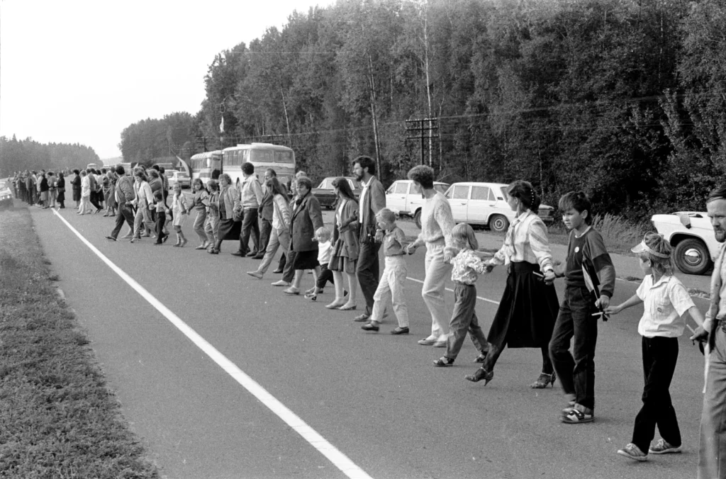
Photo: Saulius Gruodis / Lithuanian State Central Archives, Baltic Way in Lithuania’s Molėtai region, August 23, 1989, CC BY 4.0. Resized and converted to WebP only. This earlier independence demonstration is not a photograph of the USSR’s 1991 dissolution.