Tybee Island sits where Savannah’s river entrance meets Georgia’s Atlantic barrier coast. Locating the shipping approach, ocean beach and southern tidal inlet makes the island much easier to understand than treating every shore as the same beach.
Where the river entrance meets the Atlantic
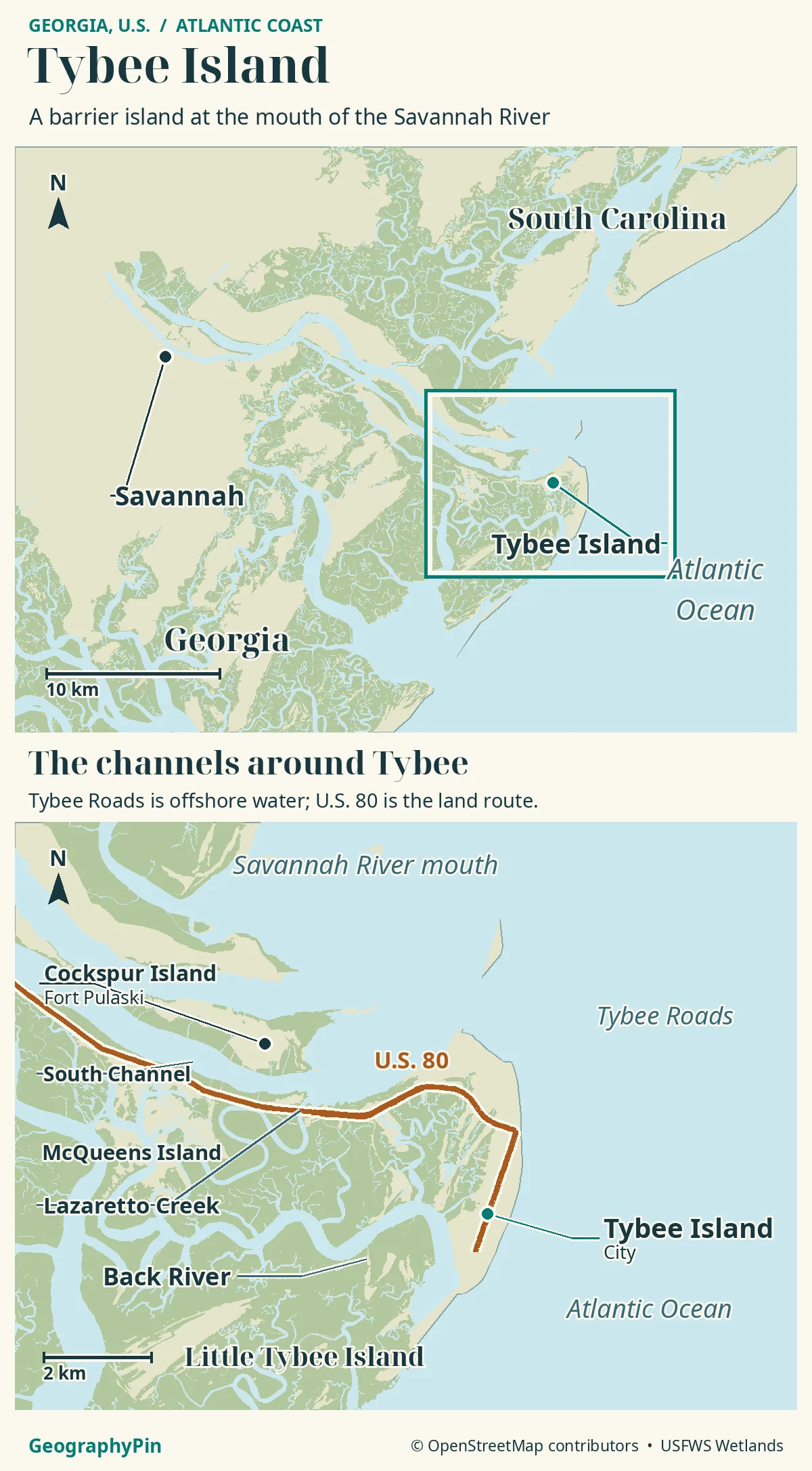
Tybee Island lies east of Savannah in Georgia, the U.S. state. The Savannah River entrance is north of the island, the Atlantic Ocean is east, Lazaretto Creek is west and Back River is south. Ships pass nearby because the port’s navigation approach runs through the river-mouth waters beside Tybee.
How to use this article: locate Tybee’s four shores, understand the shipping entrance, distinguish Tybee Roads from U.S. 80, see why Little Tybee is separate.
The Island on a Regional Map
Locate the four sides of Tybee
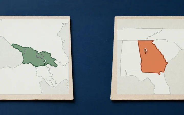
Tybee Island is a barrier island on the Atlantic coast of Georgia, the U.S. state, east of Savannah in Chatham County. It is not in Georgia, the country in the Caucasus. The ocean-facing beaches belong to a coastal landscape of tidal creeks, marsh and neighbouring islands.
The simplest way to read the map is to identify the water on each side. The city’s geographical description places the Savannah River to the north, Lazaretto Creek to the west, Back River to the south and the Atlantic Ocean to the east. Those names explain why photographs taken a short distance apart can show ships, surf, marsh or a quiet-looking inlet.
| Side | Water or feature | What it helps explain |
|---|---|---|
| North | Savannah River entrance and nearby shipping channel. | Large commercial vessels passing near the northern shore. |
| East | Atlantic Ocean. | The main ocean-facing beach landscape. |
| South | Back River and the tidal separation toward Little Tybee. | A distinct inlet-side shore, not a dry-land extension to another island. |
| West | Lazaretto Creek and marsh. | The coastal-water crossing on the road approach. |
Savannah River Mouth
Why ships and beaches appear together
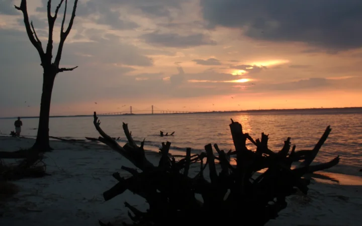
Savannah’s port is upriver, but ships traveling between the Atlantic and its terminals must pass through the river’s coastal entrance. Tybee occupies the southern side of that entrance landscape. The beach and the shipping route appear together because they share the river-mouth setting, not because the main port terminals stand on Tybee’s oceanfront.
The City of Tybee Island identifies the federally maintained Savannah Harbor navigation channel north of the island. It connects the ocean approach with the Savannah River and the upriver port facilities. A ship seen offshore from North Beach is therefore following a transport corridor, not arriving at a beach-side cruise terminal.
This geography has a practical consequence. The city’s account of USACE research describes potentially hazardous waves generated by large vessels along the northern, river-facing shore. A beach view that looks sheltered from ocean surf is not automatically free of powerful water movement.
Observe current warnings and lifeguard guidance rather than using the apparent size or distance of a ship to decide that the water will remain calm. This map explains where the channel and shore meet; it does not predict a particular vessel’s wake.
Tybee Roads
A waterway name, not a highway
Tybee Roads is a marine place-name. On nautical mapping it labels the approach waters near the Savannah River entrance, not the streets of Tybee or the road from Savannah. The actual road approach is U.S. Highway 80.
NOAA’s Coast Pilot describes the dredged approach channel passing through Tybee Roads before turning into the Savannah River. That is useful geographical context, but a general visitor map should not be used to steer a boat through the entrance. Current charts, notices and local navigation information serve a different purpose.
On a map, Tybee Roads belongs offshore, while U.S. 80 follows the land approach from Savannah. The marine place-name describes a water area, not a single ship’s track.
Cockspur Island is another feature worth keeping separate. Fort Pulaski stands there, not on the developed beach island. U.S. 80 crosses the coastal island-and-marsh landscape, and the park approach branches from that road. Passing the fort entrance on the way to Tybee does not mean the fort is on Tybee itself.
Back River
Little Tybee is across tidal water
Back River marks Tybee’s southern side. Beyond the developed island lies Little Tybee, a separate coastal landscape of marsh, upland and beach. Georgia’s Department of Natural Resources describes Little Tybee as undeveloped and accessible by boat, rather than by a road continuing south from Tybee.
Do not mistake exposed sand for a dependable connection between the islands. The City of Tybee has warned specifically against walking or swimming to the south-end sandbar because of the surrounding swift currents. A low-water photograph does not turn that area into a walking route.
The word “little” can also mislead. The DNR description includes extensive marsh as well as dry upland, so judging an island’s extent from its beach or wooded patches alone leaves out much of the coastal system. There is no need to treat marsh as empty space between the “real” islands.
Developed Tybee and the boat-access landscape beyond its southern shore are separate destinations. Any visit to Little Tybee requires appropriate local arrangements and conditions.
Shoreline and Jurisdiction in Context
Separate the island, city and surrounding land
Tybee Island is both a physical place-name and the name of an incorporated city. The island’s shoreline is not a substitute for a municipal or protected-land boundary; administrative questions require the relevant boundary map.
The approach from Savannah reinforces that distinction. McQueens Island lies west of Tybee, with Lazaretto Creek between them. The National Park Service identifies Cockspur Island and McQueens Island as different parts of the Fort Pulaski setting, separated by the Savannah River’s South Channel.
U.S. 80 crosses these waterways and marshes using transport infrastructure. The road connection does not make every visible island part of Tybee, nor does it make the marsh a continuous strip of buildable ground. On a useful map, bridges stay narrow and tidal creeks remain visible.
Different map layers answer different questions. A coastline helps locate land and water; a public-access map helps locate a beach entrance; a flood or jurisdictional map describes another set of conditions. None should silently substitute for the others.
For day-to-day access, use the city’s current maps and notices. For navigation, use the appropriate current marine information. For understanding the place, begin with the four-sided coastal setting: river entrance north, ocean east, Back River south and Lazaretto Creek west.
Frequently Asked Questions
Is Fort Pulaski the same place as Tybee Island’s lighthouse?
No. Fort Pulaski is on Cockspur Island. Tybee Island’s lighthouse is a separate landmark on Tybee. Locate the site name before choosing the road turn or destination pin.
Does “Back River” always identify the water south of Tybee?
No. The name also occurs elsewhere in the Savannah River system. NOAA describes another Back River near Hutchinson Island upriver. Check the adjacent island names and map extent instead of selecting the first result with that waterway name.
What Did We Learn Today?
Tybee is a barrier island beside a major river entrance, not simply Savannah’s oceanfront. Tybee Roads names approach waters, U.S. 80 is the road connection, and Back River separates the developed southern shore from the Little Tybee landscape. These distinctions explain the island’s varied shorelines without turning a locator map into a navigation guide.
Sources & Data Notes
- City of Tybee Island: geographical setting in Repetitive Loss Area Analysis
- City of Tybee Island: USACE ship-induced wake study
- NOAA Coast Pilot 4, Chapter 7: Savannah River and Tybee Roads
- NOAA Coast Pilot 4, Chapter 8: Tybee coastal waterways
- Georgia DNR: Little Tybee Island
- National Park Service: Lazaretto Creek and neighbouring islands
- National Park Service: Fort Pulaski directions
- City of Tybee: archived south-end sandbar warning
- City of Tybee: public maps
Sources checked November 19, 2026. NOAA chapter files are dated November 15, 2026, but include some older observations; no historic channel depths or bridge clearances are presented as current measurements. The city sandbar warning is an archived 2019 notice, used for its explicit hazard warning, not as a complete statement of current beach rules. No tide window, sailing route or access guarantee is supplied.
Map: GeographyPin original atlas using OpenStreetMap coastlines, U.S. 80 and places retrieved November 19, 2026, © OpenStreetMap contributors, ODbL. Marsh and estuarine water from U.S. Fish and Wildlife Service National Wetlands Inventory; underlying survey dates vary. No ship tracks, municipal boundary or sandbar access route is shown.
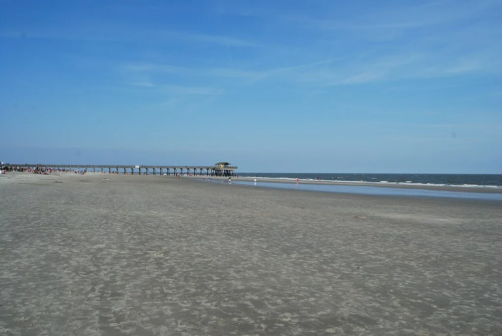
Photograph: Tybee Beach, Rick Shu, March 21, 2015, CC BY-SA 3.0. Resized and converted to WebP.