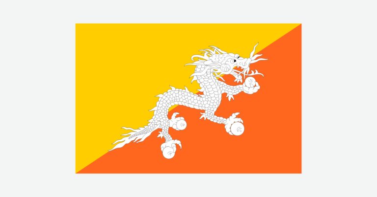
Bhutan’s geography is defined by steep differences in elevation and by valleys threaded between mountain ridges. A journey from the southern foothills toward the northern Himalayas crosses contrasting climates, vegetation and settlement patterns, not a single uniform mountain environment.
Bhutan is a landlocked country in the eastern Himalayas, between India and China. Thimphu is its capital. Warm southern foothills rise toward temperate valleys and cold alpine terrain, while rivers connect the interior with plains to the south.
How to use this article: Interpret boundary status, compare physical regions, explore seasonal climate, or check population scope.
1. Locate Bhutan and Interpret Its Borders
Between the Himalayan crest and India’s plains
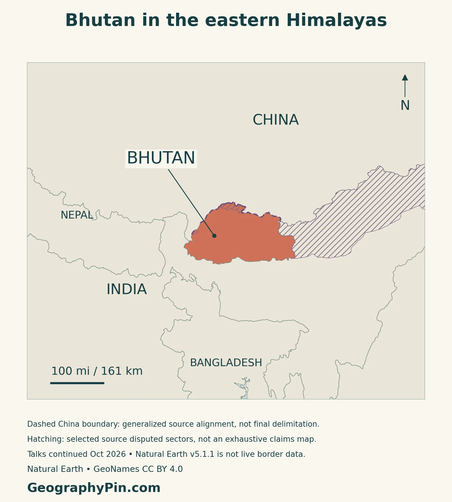
China lies to Bhutan’s north, while India borders it on the west, south and east. Bhutan has no coastline. Its southern edge meets the foothill and plain landscapes along India, whereas the northern side lies among high Himalayan terrain.
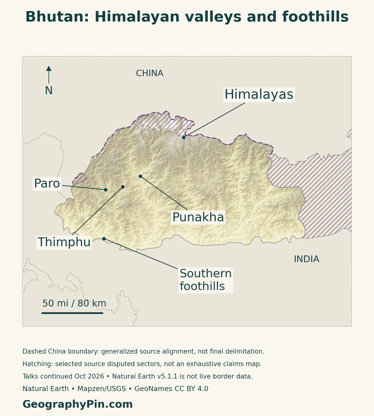
Thimphu, Paro and Punakha are useful reference points in western Bhutan, but they do not represent the whole country. The national map also includes mountain and valley systems extending well to their east.
The China boundary requires a qualification
Bhutan and China were still conducting boundary negotiations in October 2026. Their joint release on the 16th Expert Group Meeting, held in Thimphu on October 13–15, described work on the negotiation roadmap and a technical team addressing delimitation and demarcation.
The maps therefore use an approximate, qualified China-facing alignment. Hatched areas show selected disputed sectors identified in the source dataset, not an exhaustive map of every claim or an announcement of a newly agreed border.
2. Elevation Belts and Valley Landscapes
Three broad belts, with local variations
The World Meteorological Organization describes a warm, humid southern belt, a cooler central belt and an alpine northern belt. These broad divisions help organize the landscape, but actual conditions also depend on which slope or valley a place occupies.
| Setting | Physical character | Human connection |
|---|---|---|
| Southern foothills | Lower, warmer terrain rising from the plains | Connections with India and subtropical farming environments |
| Middle mountains and valleys | Ridges separated by more sheltered valley floors | Towns, fields and transport routes occupy usable valley space |
| Northern high Himalayas | High peaks and alpine terrain, with glaciers at the highest elevations | Highland livelihoods and headwaters contrast with lower valleys |
Why neighboring valleys can feel far apart
Mountain ridges divide Bhutan’s interior into separate drainage corridors. The older FAO physiographic survey identifies Paro, Thimphu and Punakha among the middle-range valleys, with steep slopes limiting the extent of level ground.
On a small-scale map, two towns may appear close. Their practical connection depends on the terrain between them, not just the straight-line distance. A valley floor can offer space for fields and buildings while nearby slopes rise sharply above it.
Thimphu is a river-valley city
The capital’s municipality places Thimphu along the Wang Chhu in west-central Bhutan, at elevations of roughly 7,375–8,688 feet (2,248–2,648 meters). Its urban area stretches along the valley rather than spreading across a broad lowland plain.
That setting brings water, transport and development into close proximity. It also means the municipal city, the surrounding valley and Thimphu district are different geographic units; their names should not be treated as interchangeable population boundaries.
3. Climate, Rivers and Mountain Hazards
Elevation changes temperature; monsoon winds bring summer rain
Bhutan’s National Centre for Hydrology and Meteorology describes winter from December to February, spring or pre-monsoon conditions from March to May, summer monsoon from June to September, and autumn in October and November.
Its Climate Atlas for 1996–2025 shows a broad pattern of wetter southern foothills and lower rainfall toward the northern highlands. Temperature also varies strongly with elevation. Local terrain complicates these national patterns, so the climate of Thimphu should not be used as a proxy for every valley or mountain pass.
Climate maps combine observations with estimates
The atlas uses station observations and spatial interpolation to represent conditions between instruments. High mountains have fewer observing stations. Its maps summarize a 30-year climate period; they are neither a daily forecast nor proof that every location inside one color has identical conditions.
Punakha links two tributaries to a larger river
At Punakha, the Pho Chhu and Mo Chhu join to form the Punatsang Chhu. The basin continues toward India and the Brahmaputra system. This connects high mountain catchments, settled valleys and lower plains within one drainage network.
River names change along some cross-border systems. The Wang Chhu is also known as the Raidak downstream, while the Punatsang Chhu is associated with the Sankosh system. A country boundary is not the end of the river.
Glacial lake outbursts differ from monsoon floods
A glacial lake outburst flood is a sudden release of lake water, not simply the normal summer rise of a river. NCHM’s 2021 operating procedure describes monitoring and warning arrangements for the Punakha–Wangdue valley, developed after damaging floods from the high headwaters.
Heavy monsoon rain creates additional flood and landslide hazards. Landslides can damage roads or block rivers, creating temporary impoundments that threaten downstream areas. A valley that is useful for settlement can therefore also concentrate exposure to water arriving from much farther upstream.
4. Farming, Hydropower and Forests
Agriculture follows local growing conditions
Bhutan’s agricultural environments vary with altitude, rainfall and slope. A government-authored FAO horticultural account distinguishes subtropical, temperate and alpine farming zones rather than treating the country as one crop-growing region.
Temperate fruit cultivation provides one example: apples have been grown in western valleys including Paro, Thimphu and Haa, while warmer zones support different crops. Site conditions and access to land and water matter more than a national average temperature.
Highlands are working landscapes, too
Cold highland terrain is not empty of human activity. Yak husbandry supports mountain communities, and FAO’s December 2024 account describes work with Bhutan’s livestock department to improve yak-wool harvesting, processing and marketing.
This is a different livelihood system from irrigated valley agriculture or an urban service economy. Its viability depends not only on the animals and grazing environment but also on skills, processing and routes to market.
Steep rivers are also an energy resource
Tala Hydropower Plant is located on the Wang Chhu in Chhukha district. India’s embassy records its commissioning in 2006–2007 and installed capacity of 1,020 megawatts.
Installed capacity describes the plant’s generating capability, not a guarantee of constant output. Hydropower remains connected to river conditions, which is why Bhutan’s hydrometeorological agency identifies it as a climate-sensitive sector alongside agriculture and forestry.
Measured forest cover and a constitutional rule are different
Article 5(3) of Bhutan’s Constitution requires at least 60% of the country’s total land to remain under forest cover for all time. That is a legal minimum, not a survey result.
The 2023 National Forest Inventory report estimated forest cover at 69.71% for 2022. Keeping the year matters: the figure does not measure forest cover continuously, and it should not be relabeled as a 2026 observation.
5. Country Facts with Dates and Scope
Bhutan: a dated national reference
| Item | Reference |
|---|---|
| Capital | Thimphu |
| Population | 790,718: 2026 national resident-population projection |
| National area | About 14,824 square miles (38,394 square kilometers) |
| National language | Dzongkha |
| Currency | Ngultrum (Nu.) |
| Government | Democratic constitutional monarchy |
| Administrative structure | 20 dzongkhags (districts) |
A projection is not a new census
The 2026 population figure comes from the National Statistics Bureau’s 2019 projection series for 2017–2047. It projects residents using assumptions about fertility, mortality and migration, rather than counting the population anew in 2026.
The series starts from 727,145 residents in the 2017 census. A larger enumeration total included transient tourists, so the two baselines should not be substituted for one another. “Resident” also does not mean “Bhutanese citizens only.”
Read area and language labels as defined
The area figure is the national total used in official references, not a separately verified dry-land-only figure or an area calculated from this article’s generalized map. Dzongkha’s constitutional designation is national language; it does not imply that every resident has the same mother tongue.
For regional context, use the South Asia countries map and the Asia countries and capitals list.
What Did We Learn Today?
Bhutan’s elevation belts and narrow valleys help explain its climate, settlement and livelihoods. Rivers link high headwaters with towns, hydropower and downstream plains, while the same corridors can carry floods. Thimphu’s valley setting differs from the southern foothills and alpine north. Dated statistics and qualified boundary mapping are essential companions to the physical map.
Sources & Data Notes
Population is the NSB 2019 series’ resident projection for 2026, not a new enumeration or a citizenship count. The 2022 forest estimate and constitutional minimum describe different things. Official national area is not derived from the illustrative GIS outline. The October 2026 boundary release reports ongoing negotiations, not a completed settlement. Older physical and agricultural accounts are used for enduring landscape relationships, not their obsolete population, area, project-status or production figures. Climate normals and hazard explanations are not current weather warnings.
- Bhutan Ministry of Foreign Affairs and External Trade, 15 October 2026: continuing boundary negotiations and technical-team work
- World Meteorological Organization: broad southern, central and northern climate belts
- FAO physiographic survey: middle-range valleys and river connections; old area, projects, flood claims and numerical inventories not used
- Thimphu Thromde: capital’s river-valley setting and elevation range; undated economic-share claim not used
- NCHM Climate Atlas (2026): 1996–2025 climate period, seasonal patterns and station/interpolation method
- NCHM: rainfall, landslide/river-blockage hazards and climate-sensitive sectors; old projections and event totals not used
- NCHM (March 2021): Punakha–Wangdue warning system and Pho Chhu/Mo Chhu confluence; no current warning-status claim
- Government-authored FAO horticultural account: altitude and crop geography; historical production totals not used
- FAO, December 2024: yak-wool livelihood and training example
- Embassy of India in Bhutan: Tala project location, commissioning and installed capacity
- Bhutan for Life: forest inventory’s 2022 estimate, distinct from constitutional minimum
- National Statistics Bureau (2019), Population Projections 2017–2047, Table 4.2: 2026 resident projection; original report on UNFPA host
- Ministry government brochure: national area, capital and ngultrum only; old economic statistics not used
- Constitution of Bhutan (2008), Articles 1 and 5: government, districts, national language and forest minimum
- Department of Forests and Park Services, National Forest Inventory (2023): forest estimate for 2022; original report on project-partner host
Map method: Original GeographyPin cartography uses public-domain Natural Earth v5.1.1 geometry and actual Mapzen/USGS elevation data. GeoNames reference points are used under CC BY 4.0. The actual source China-facing alignment is dashed; hatching identifies selected source disputed sectors, including adjacent Arunachal Pradesh in the body maps. This is not an exhaustive claims map, a present-day control inventory or a finalized delimitation. The October 2026 negotiating context does not make the source geometry live boundary data. Settlement markers retain their source coordinates. Himalayas and southern foothills markers are regional references, not range or climate-zone boundaries. No river network is drawn. The feature combines a decorative flag-filled outline with its complete dragon preserved, a separate intact national flag and qualified selected-sector hatching.