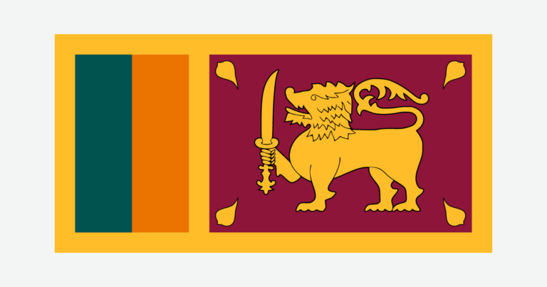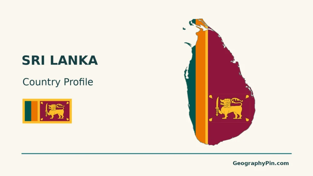
Sri Lanka’s south-central highlands contrast with surrounding plains and coastal settlements. Rivers and reservoirs connect these landscapes, while seasonal winds bring different rainfall patterns to the west and east.
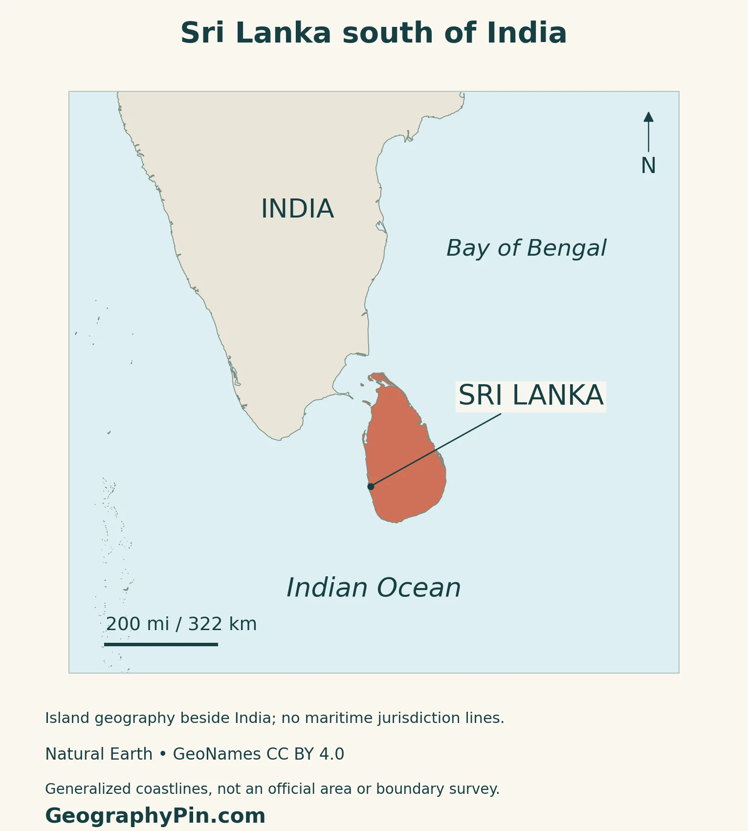
Sri Lanka lies southeast of India, across the Palk Strait and neighboring shallow waters. Its main landscape contrast is between the central highlands and surrounding lowlands. Sri Jayawardenepura Kotte is the administrative capital and seat of Parliament; nearby Colombo is the commercial capital.
How to use this article: Distinguish capital roles, compare physical regions, compare rainfall seasons, or check the final census.
1. Locate Sri Lanka and Read the Map
An island beside southern India
Sri Lanka belongs to South Asia but has no land border with India. The Palk Strait lies to the north, while the Gulf of Mannar separates the island’s northwest from southern India. The wider Indian Ocean surrounds the island to the south.
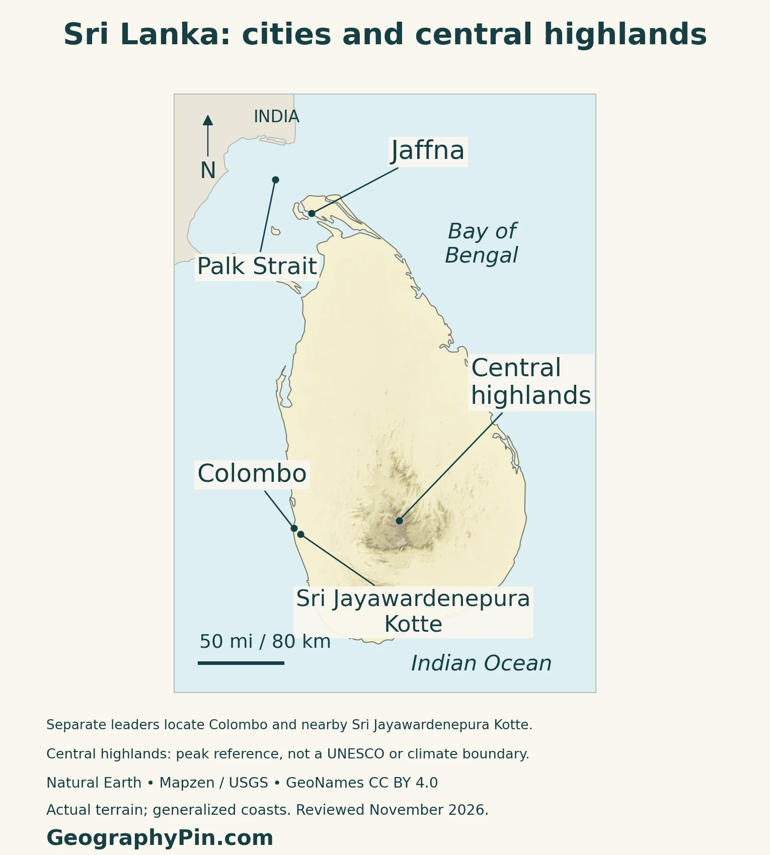
Jaffna marks the northern peninsula, Colombo lies on the west coast, and the highlands occupy the south-central interior. These reference points help distinguish a north–south journey from a coast-to-highland one.
Kotte and Colombo have different roles
Sri Jayawardenepura Kotte is identified by its municipal council as the administrative capital, and Parliament confirms that its complex is located there. Colombo remains the commercial capital. The two are close enough to require separate, carefully placed map labels rather than treating them as one point.
2. Highlands, Plains and Rainfall Zones
Compare terrain before comparing climate
The central highlands are a varied mass of peaks, plateaus, valleys, ridges and escarpments rather than a single mountain. Lower plains surround them, becoming especially broad toward the north and east. Piduruthalagala reaches about 8,281 feet (2,524 meters), the island’s highest point.
| Region or setting | Landscape | Geographic connection |
|---|---|---|
| South-central highlands | Rugged slopes, plateaus and enclosed valleys | Cooler uplands and headwaters above the surrounding plains |
| Southwestern lowlands | Lower terrain beside wetter hill slopes | Wet-zone forest and cultivated landscapes |
| Northern and eastern plains | Broad, flatter or gently rolling lowlands | Seasonal rainfall makes water storage important |
| Northern peninsula and coastal margins | Low coastal terrain beside straits and the ocean | A contrasting setting to the inland mountain core |
The dry zone is seasonal, not a desert
The wet zone occupies the southwest and parts of the hill country. Much of the north and east belongs to the dry zone, with an intermediate belt between the two.
The government’s National Adaptation Plan describes the wet zone as generally receiving more than about 98 inches (2,500 millimeters) of rain annually, and the dry zone less than about 69 inches (1,750 millimeters).
Montane forest and lowland rainforest are different settings
The UNESCO Central Highlands property consists of three components: Peak Wilderness, Horton Plains and Knuckles. These protect montane and submontane forests and associated habitats; the designation does not cover every part of the geographic highlands.
Sinharaja, a separate World Heritage property in the southwest, protects lowland rainforest on terrain crossed by ridges, valleys and streams. Together these sites illustrate how the island’s elevation and moisture contrasts support different forest environments, rather than one uniform tropical landscape.
3. Why Rain Seasons Differ Across the Island
Four seasons, with changing regional emphasis
| Season | Usual months | Main pattern |
|---|---|---|
| First inter-monsoon | March–April | Showers and thunderstorms during the seasonal transition |
| Southwest monsoon | May–September | Rain favors the southwest and western slopes of the highlands |
| Second inter-monsoon | October–November | Widespread rain, with depressions sometimes important |
| Northeast monsoon | December–February | Rain is important in the north, north-central areas and east |
Seasonal winds and the highlands redistribute rainfall; the same coast is not equally exposed throughout the year.
Seasonal airflows connect the island to different seas
A study published in 2025 tracked atmospheric water vapor at Matara on the south coast from March 2020 to February 2021. Its observations and analysis linked southwest-monsoon moisture mainly to the Arabian Sea and Indian Ocean; northeast-monsoon air had different source regions, including the Bay of Bengal and surrounding land areas.
That one-site study is not a rainfall calendar for every beach. It helps explain why a single island can receive moisture along changing routes as the monsoon circulation shifts.
Heavy rain and water shortage pose different problems
Sri Lanka’s Disaster Management Centre distinguishes river flooding, flash flooding and localized flooding, often in urban areas. Its landslide guidance links slope failures with intense monsoon and inter-monsoon rainfall, while also recognizing the effects of land use and changes to slopes.
Drought presents a different problem: rainfall deficits can reduce water available for crops and hydropower. A wet-zone or dry-zone label describes a broad background climate, not the conditions on a particular day or the safety of an individual site.
4. Water, Farming and Connected Settlements
Dry-zone tanks store seasonal water
In Sri Lankan water management, a “tank” often means a reservoir, not a small household container. FAO describes the traditional cascaded tank-village system as a chain of reservoirs within a small catchment. Water spilling from an upper tank can enter a lower one, while sluices release water to paddy fields.
The surrounding landscape matters too. Woodland, gardens, fields, drainage lines and villages form parts of the system. Tanks can support fish as well as crops, and cultivation calendars respond to seasonal rainfall. This is a managed agricultural landscape, not simply a set of natural lakes.
Mahaweli water serves irrigation and electricity
The Mahaweli system shows how upland water connects different parts of the island. The Ceylon Electricity Board explains that its reservoirs and diversions provide irrigation and other water uses alongside electricity generation.
At Polgolla, part of the water is diverted toward the North Central Province through the Ukuwela–Bowatenna route. Water continuing along the Mahaweli passes through the Victoria, Randenigala and Rantambe sequence. Storage and operating decisions therefore connect rainfall in a catchment with farming and energy needs elsewhere.
Tea is not confined to the highest mountains
Sri Lanka’s Export Development Board places tea-growing areas mainly in the central highlands and southern inland regions. It distinguishes high-grown tea above about 3,937 feet (1,200 meters), mid-grown tea between about 1,969 and 3,937 feet (600–1,200 meters), and low-grown tea below about 1,969 feet (600 meters).
Nuwara Eliya, Kandy and Ruhuna illustrate different growing regions. Elevation, climate and terrain help distinguish their tea, so a photograph of a cool mountain estate represents only one part of the industry’s geography.
Colombo connects the island with maritime networks
Colombo’s port gives the west-coast urban area a role beyond national administration. The Sri Lanka Ports Authority identifies it as a South Asian transshipment hub linked to major east–west shipping routes. Transshipment means cargo is transferred between vessels as part of a wider journey.
That coastal connection contrasts with the agricultural and water-storage landscapes inland. The national economy cannot be read from tea fields alone: ports and urban services also shape how the island connects with the world.
5. Country Facts with Dates and Definitions
Sri Lanka: dated country reference
| Item | Reference |
|---|---|
| Administrative capital | Sri Jayawardenepura Kotte, seat of Parliament |
| Commercial capital | Colombo |
| Population | 21,781,800: final 2024 census, reference date 19 December 2024 |
| Total area | About 25,962 square miles (67,240 square kilometers) |
| Land area | About 24,055 square miles (62,302 square kilometers) |
| Languages | Sinhala and Tamil are official and national languages; English is the link language |
| Currency | Sri Lanka rupee (LKR) |
| Government | Unitary republic |
| Administrative structure | Nine provinces and 25 administrative districts |
Use the final census, not an earlier provisional total
The final census report, released in April 2026, gives the population at the December 2024 reference moment. It uses usual residence, rather than simply counting everyone where they happened to be on census night. The result is a dated census figure, not a population estimate for November 2026.
Western Province contained 6,117,341 residents, or 28.1% of the national total. That provincial figure should not be relabeled as the population of Colombo city or its metropolitan area.
Total area includes inland water
The area figures follow the Survey Department’s 2024 recomputation, reproduced in the 2025 statistical data sheet. Total area combines land with about 1,907 square miles (4,938 square kilometers) of inland water. Older references often retain a different area series, so their totals should not be mixed with this revised land figure.
For regional context, use the South Asia countries map and the Asia countries and capitals list.
What Did We Learn Today?
Sri Lanka’s south-central highlands, surrounding plains and seasonal winds create a varied island landscape. The west and east do not share the same rainfall pattern, and the dry zone is not a desert. Reservoirs connect water with farming and power, tea grows at several elevations, and Colombo’s port adds a maritime connection. Kotte’s parliamentary role should be distinguished from Colombo’s commercial importance.
Sources & Data Notes
Population uses the final 2024 census report released in April 2026, with its December 2024 reference date and usual-residence method. Area uses the Survey Department’s 2024 recomputation and DCS 2025 land/water breakdown. Unit conversions are rounded. Older terrain and climate references support enduring physical patterns, not their obsolete area or demographic figures. Rainfall seasons describe broad climatology, not current forecasts. Forest-property boundaries should not be confused with entire geographic regions.
- Department of Census and Statistics: physical relief and broad rainfall seasons; old area and demographic figures not used
- National Adaptation Plan 2016–2025, pages 26–28: seasonal rainfall and wet, dry and intermediate zones; not a claim that this is the latest plan
- Wu and colleagues (2025), Atmospheric Chemistry and Physics: Matara water-vapor observations, March 2020–February 2021
- Disaster Management Centre: flood and landslide processes; historical hazard totals and projections not used
- FAO drought portal: water shortages, agriculture and hydropower; old population figures and event recency not used
- FAO GIAHS: cascaded tank-village water management and associated land use
- Ceylon Electricity Board: Mahaweli reservoir, diversion, irrigation and hydropower functions
- Sri Lanka Export Development Board: tea-growing elevations and regions; undated production/employment totals not used
- Sri Lanka Ports Authority, 25 August 2025: Colombo’s transshipment and shipping-route role
- UNESCO: three components of the Central Highlands property and montane forest context
- UNESCO: Sinharaja’s southwestern lowland rainforest setting
- DCS: final 2024 census, usual-residence method, national and Western Province totals
- Survey Department: country extent recomputation announced in August 2024
- DCS 2025 statistical data sheet: revised total, land and inland-water area only
- Kotte Municipal Council: administrative and commercial capital distinction
- Parliament of Sri Lanka: location in Sri Jayawardenepura Kotte
- Parliament-hosted constitutional compilation through the 21st Amendment: unitary state and language provisions
- UNData: Sri Lanka rupee currency code only; population and old area series not used
Map method: Original GeographyPin cartography uses public-domain Natural Earth v5.1.1 country geometry and actual Mapzen/USGS elevation data. GeoNames reference points are used under CC BY 4.0. Colombo and Kotte retain separate source coordinates; leaders do not move the cities. The central-highlands marker is a regional reference, not a UNESCO-property boundary. No wet/dry climate-zone boundaries are drawn. Generalized coastlines are not the dataset used for the official national-area calculation. The feature combines a decorative flag-filled outline, with its complete lion panel preserved, and a separate intact national flag.