Senegal’s geography is easiest to understand by following its Atlantic coast, northern river valley and the narrow corridor of The Gambia. That corridor partly separates Casamance from the north, while Dakar occupies a peninsula whose name is easily confused with an offshore island country.
Senegal between the Atlantic and the Sahel
Senegal is a West African country with an Atlantic coastline and Dakar as its capital. Its landscapes range from the dry northern interior and Senegal River valley to wetter Casamance in the south. The Gambia extends inland between northern and southern Senegal, but an eastern land connection keeps Senegal’s territory continuous.
How to use this article: Distinguish Cap-Vert from Cabo Verde, locate the Sahel transition, understand Casamance’s land connection, or compare rainfall seasons.
1. Senegal’s Atlantic location and land neighbors
Senegal occupies the western edge of mainland Africa. The Atlantic Ocean lies to its west, Mauritania to its north and Mali to its east. Guinea and Guinea-Bissau border the south, while The Gambia extends inland from the Atlantic along the Gambia River.
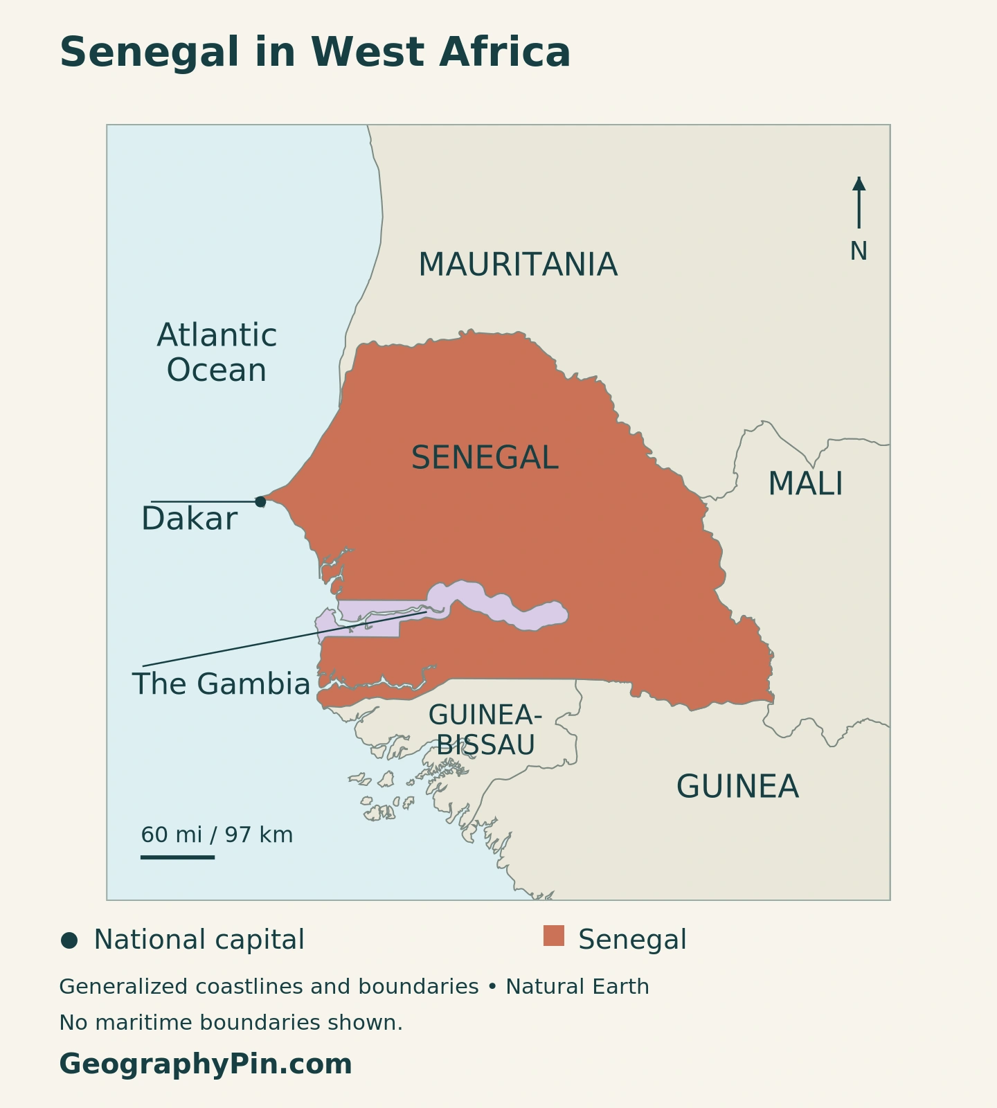
That narrow Gambian corridor is the most distinctive feature of Senegal’s political outline. It lies between much of northern Senegal and the southern region of Casamance, but it does not cut the country into two disconnected pieces. Senegalese territory continues around its eastern end.
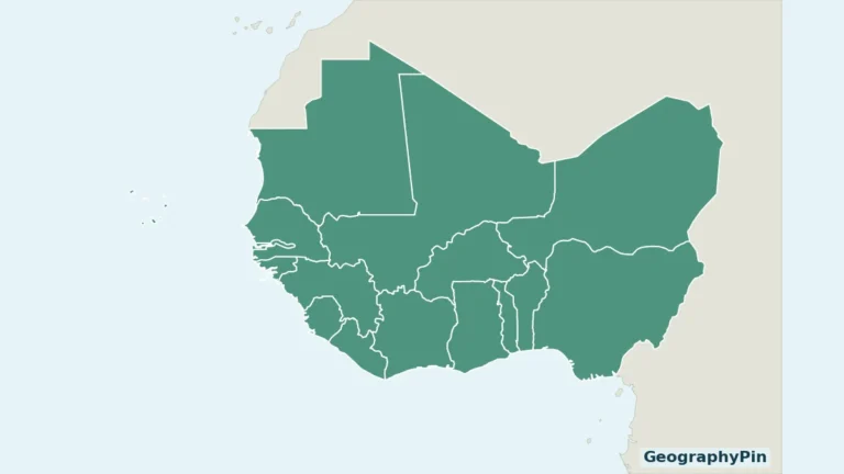
For the wider setting, use our West Africa countries map. Senegal is a mainland country with ocean access, not an island state and not a landlocked Sahelian country.
Cap-Vert is a peninsula, not Cabo Verde
Dakar stands on the Cap-Vert Peninsula, which projects into the Atlantic. The peninsula belongs to Senegal. Cabo Verde, also known in English as Cape Verde, is a separate island country offshore. Similar names do not indicate a shared national territory.
On a small regional map, the peninsula may look like a short coastal projection. At city scale it becomes a major organizing feature: Dakar’s urban area occupies the peninsula and extends toward the mainland. NASA’s historical satellite view and accompanying account document that outward expansion, though its older population figures should not be treated as current totals.
2. Country facts with clear statistical dates
| Fact | Reference |
|---|---|
| Official name | Republic of Senegal |
| Capital | Dakar |
| Population projection | 19,575,061 residents in 2026, ANSD demographic projections 2023–2073. |
| Census reference | 18,126,390 residents in the final 2023 census report. |
| Surface area | About 75,951 square miles (196,712 square kilometers), UNData reference year 2023; not land area alone. |
| Official language | French; national languages have a separate constitutional status. |
| Currency | West African CFA franc (XOF). |
| Administrative regions | 14 regions; these are government divisions, not physical landscape zones. |
| Regional setting | West Africa, with an Atlantic coastline. |
The 2026 figure is a projection, not a new headcount. ANSD, Senegal’s national statistical agency, builds its projection series from the 2023 census and demographic assumptions. Its published national total is retained here rather than recomputed from rounded components.
The census comparison uses the resident population, including residents temporarily absent, rather than a total that also includes visitors. That distinction matters when different numbers appear under the same “2023 census” label. A census year, a publication year and a projection year answer different questions; none should be silently substituted for another.
3. From the northern plains to the greener south
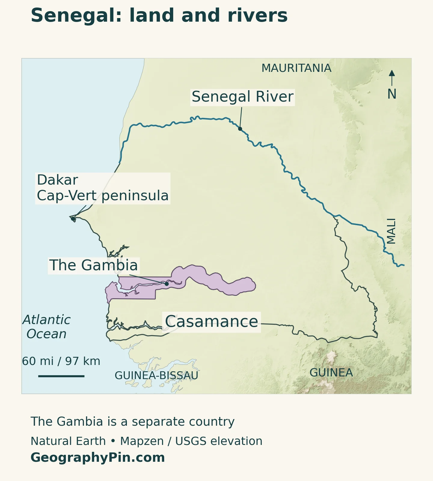
Much of Senegal consists of relatively low terrain, but the country is not one uniform plain. River valleys, coastal environments, dry interior landscapes and the higher southeastern borderland create different settings. The physical map is especially useful when read alongside the unusual international boundary around The Gambia.
| Setting | Where to look | Geographical importance |
|---|---|---|
| Senegal River valley | Northern edge, toward Saint-Louis | A river corridor within a comparatively dry northern setting. |
| Ferlo and the northern interior | Inland south of the river valley | Dry pastoral landscapes associated with the Sahel transition. |
| Niayes coastal belt | Atlantic side between Dakar and Saint-Louis | Coastal horticultural environments distinct from the drier interior. |
| Central farming belt | Interior around the groundnut basin | An agricultural landscape between northern and southern environments. |
| Casamance | South of The Gambia | Wetter southern landscapes, river and estuary settings. |
| Southeastern Senegal | Toward Kédougou and the Guinea frontier | Higher terrain contrasts with the broad lowlands farther west. |
These are orientation regions, not six provinces with identical legal boundaries. A river valley follows drainage and terrain; an agricultural zone reflects land use as well as climate. Neither needs to coincide with the border of an administrative region.
The Sahel transition does not mean all of Senegal is desert
The dry northern interior belongs to the broader Sahelian setting, whereas southern Senegal has wetter conditions. The word “Sahel” should not erase this contrast. It describes a transition zone south of the Sahara, not a claim that Dakar, Casamance and every intervening landscape share a desert environment.
Reading the map from north to south is useful, but reading from coast to interior adds another dimension. A coastal growing area and an inland pastoral area at similar latitude can still have different soils, water access and land uses. Country-scale colors cannot show every local variation.
4. Why Casamance is partly separated by The Gambia
A connected region with an indirect northern route
Casamance lies south of The Gambia. Traveling directly between parts of northern Senegal and Casamance can therefore involve crossing an international border. An alternative overland connection stays within Senegal by passing east of The Gambia.
This makes Casamance partly separated in practical travel geography, but not an exclave. An exclave is detached from the rest of its country; Casamance retains a land connection through eastern Senegal. The map’s continuous Senegalese outline is the simplest way to see the distinction.
The Gambia is an independent country, not a Senegalese province. It also has its own Atlantic coastline, so describing it as completely enclosed by Senegal is inaccurate. It has only one land neighbor, a pattern explained in our guide to countries with one land neighbor.
Why connectivity matters beyond the map outline
Distance alone does not explain access between regions. Border crossings, bridges, road quality and the location of markets all influence how easily people and goods move. A short line drawn between two places can cross another country even when a longer domestic route exists.
Regional development programs reflect that practical problem. In June 2026, the World Bank approved additional support for territorial development in Casamance and Kédougou, including rural connectivity and agricultural value chains. Those are planned or financed activities, not evidence that every proposed road or facility is already complete.
5. Rivers and rainfall shape different water landscapes
The Senegal River follows much of the country’s northern boundary with Mauritania and reaches the Atlantic near Saint-Louis. Its importance extends beyond Senegal: the basin is shared across national borders. The river’s name does not mean its entire drainage system lies within the country.
OMVS, the Senegal River basin organization, brings together Guinea, Mali, Mauritania and Senegal. Its work links water supply, agriculture, energy, transport and environmental protection. These connected purposes explain why decisions upstream can matter to people and ecosystems elsewhere in the basin.
The Gambia River and the Casamance River belong to different drainage systems. A country boundary around The Gambia should not be mistaken for the boundary of the entire Gambia River basin. Similarly, Casamance can refer to a river and a wider southern region; the two names do not denote an identical area.
One broad wet season, with substantial regional differences
Senegal’s 2025 agricultural adaptation plan describes a broad wet season from June to October and a dry season from November to May, while emphasizing strong variation across space and time. Those months are national orientation, not a promise that rain begins and ends on the same dates everywhere.
The north is generally drier than the south. Rain-fed farming therefore faces a different seasonal context from irrigated agriculture along a river. Access to water also depends on soils, storage, infrastructure and salinity, not simply on whether a blue line appears nearby.
A rainy season can contain damaging dry spells as well as heavy downpours. Conversely, a dry-region label does not rule out flooding. These distinctions are important when interpreting a climate map: an average describes a pattern, not the full range of conditions experienced in any particular year.
6. Dakar, Saint-Louis and a multilingual country
Dakar is the national capital and a major Atlantic urban center. Its peninsula setting helps explain why the shape of the coastline is important to understanding the city. A national map locates Dakar; a metropolitan map is needed to show its neighborhoods and surrounding urban development.
Saint-Louis offers a different geographical example. Its historic island settlement sits near the mouth of the Senegal River. UNESCO identifies the island’s river setting, planned streets, quays and architecture as integral to its heritage. The city illustrates the connection between a river corridor, maritime access and settlement history.
These two places should not stand in for the entire country. Inland towns, southeastern communities and Casamance settlements occupy other environmental and transport settings. A capital-centered account misses the distances and connections that organize daily life beyond the Atlantic urban concentration.
French is the official language under Senegal’s Constitution. The same constitutional article recognizes national languages, naming Diola, Malinké, Pular, Sérère, Soninké and Wolof, together with other national languages that are codified. “Official language” and “national language” therefore have different legal meanings; the named list is not a claim that only six Senegalese languages exist.
Language, administrative geography and physical geography should be read as overlapping layers, not interchangeable maps. A river valley may contain several communities, while speakers of a language may live in more than one region or country.
7. An economy connected to coast, countryside and neighbors
Senegal’s economic geography combines maritime connections, cities and rural production. Coastal access supports fishing and trade; inland areas bring agricultural and pastoral landscapes into the national economy. Neither a port photograph nor a groundnut field can represent all of those activities.
The 2025 agricultural adaptation plan distinguishes horticulture in the Niayes, river-valley agriculture and southern farming environments. These differences help explain why a single national farming calendar or water-management solution would be inadequate. The relevant question is which combination of soils, rainfall and water access supports a particular place.
The World Bank’s country overview also identifies hydrocarbons as part of the changing economy. Oil and gas activity should not obscure services, agriculture or the transport links that connect production with consumers. A new resource sector can change national accounts without making every region experience the same opportunities.
The clearest country-level picture is therefore a network: Dakar’s Atlantic position, northern river cooperation, interior production areas and southern connectivity all matter. Infrastructure and institutions determine how well these geographical connections function; the map shows opportunities and constraints rather than a predetermined economic outcome.
Frequently Asked Questions
Is Casamance an exclave of Senegal?
No. Casamance lies south of The Gambia but remains connected to the rest of Senegal through territory east of The Gambia. Direct routes north can cross another country; the territory itself is not detached.
Are Cap-Vert and Cabo Verde the same place?
No. Cap-Vert is the Senegalese peninsula where Dakar is located. Cabo Verde is a separate Atlantic island country.
Does Senegal completely surround The Gambia?
Senegal is The Gambia’s only land neighbor, but The Gambia also has an Atlantic coastline. It is not enclosed on every side by Senegalese territory.
What Did We Learn Today?
Senegal combines an Atlantic urban coastline, a shared northern river corridor, dry interior landscapes and wetter southern environments. The Gambia shapes routes between northern Senegal and Casamance without turning Casamance into an exclave. Dakar’s Cap-Vert Peninsula is distinct from Cabo Verde, and dated population figures become clearer when projections are kept separate from census counts.
Sources & Data Notes
Population follows ANSD’s published 2026 resident-population projection and final 2023 resident census count. ANSD-authored reports were read through the linked mirrors. Surface area uses UNData’s 2023 reference and is converted to rounded square miles. Historical geographical sources support stable landscape descriptions, not current population or economic totals. Development financing is distinguished from completed infrastructure.
- Senegal Embassy in Qatar: stable physical geography and administrative regions
- ANSD: Demographic Projections 2023–2073, national resident-population table, printed page 12; mirrored copy
- ANSD: final 2023 census thematic report, July 2025, resident-population definitions; mirrored copy
- UNData: surface area, currency and statistical footnotes
- Constitutional Council: Constitution, Articles 1–2, language status and capital
- NASA Earth Observatory: Dakar and the Cap-Vert Peninsula, historical satellite context
- Senegal ministries: 2025 agricultural climate-adaptation plan, physical regions and rainfall context
- FAO: Senegal’s water and agroecological settings, stable geographical context
- OMVS: shared Senegal River basin and cooperation sectors
- UNESCO: Island of Saint-Louis and its river-mouth setting
- World Bank: June 2026 Casamance and Kédougou development financing
- World Bank: national geography and economic context
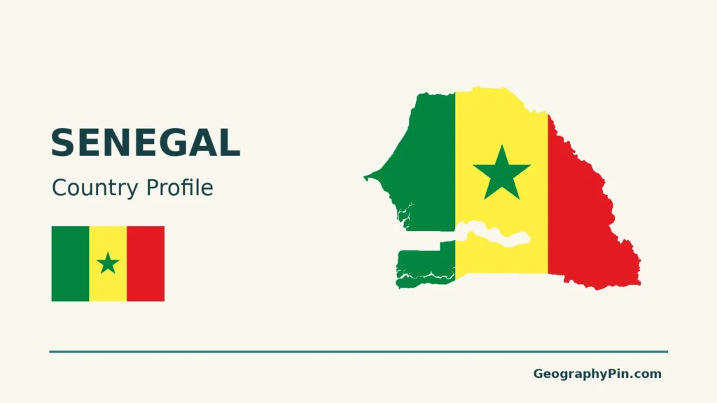
Map method: Original GeographyPin maps use public-domain Natural Earth country boundaries, Dakar’s location and the Senegal River line. Relief uses Mapzen Terrain Tiles with USGS SRTM and GMTED2010 data. Terrain colors represent elevation, not vegetation. Maps use Web Mercator, with scale varying by latitude. Casamance is a broad regional label, not a surveyed boundary. The Gambia is shown separately; its Atlantic coastline and Senegal’s eastern land connection are retained. The Gambia and Casamance river courses are not depicted. The cover is an original flag-and-outline design.