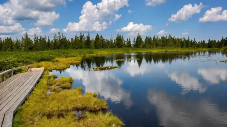
A mountain lake and an Adriatic waterfront can both be Slovenian scenes. The country’s compact outline brings together Alpine terrain, limestone plateaus, eastern lowlands and a short coast, rather than one uniform landscape. Following those transitions explains more than a list of scenic places: it shows how water, settlement and transport connect across the country.
Slovenia lies where Alpine, Dinaric, Pannonian and Mediterranean influences meet. Its northwestern mountains contrast with karst terrain, eastern plains and hills, and an Adriatic coast in the southwest. Ljubljana is the capital. This combination explains how a small country can contain mountain environments, underground rivers and a working seaport without belonging to just one landscape region.
How to use this article: Compare the landscape settings, distinguish Kras from karst, or trace water toward two seas.
1. Locate Slovenia between the Alps and Adriatic
Slovenia borders Italy to the west, Austria to the north, Hungary to the northeast and Croatia to the south and southeast. Its southwestern coast reaches the northern Adriatic Sea. That maritime connection is real, even though mountains and inland landscapes occupy much more of the national outline.
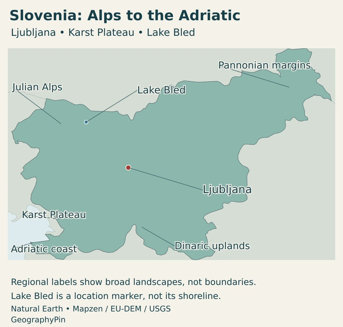
The country sits at a meeting point of several European geographic settings. Regional labels such as Central, Southern or Southeastern Europe depend on the classification being used; the more concrete explanation is the meeting of the Alps, Dinaric terrain, Pannonian influences and the Adriatic. These are overlapping geographic relationships, not four administrative divisions.
Slovenia is also a different country from Slovakia. Ljubljana is Slovenia’s capital. Similar English names do not mean the two share a government, territory or coastline, and a map should not substitute one for the other.
2. Country facts, Ljubljana and administrative scope
| Item | Detail |
|---|---|
| Capital | Ljubljana |
| Population | 2,138,751 residents on July 1, 2026; final SURS release October 29, 2026. |
| Reported area | 7,827 sq mi (20,271 km²), as listed in the Slovenian government overview. This is not presented as a newly measured 2026 area. |
| Government | Parliamentary republic |
| Currency | Euro (€) |
| Local government | 212 municipalities; statistical reporting also uses 12 regions. |
| Official language framework | Slovenian; Italian and Hungarian also have official status in the relevant minority areas. |
Population and statistical-region data: Source: SURS. The area follows the government overview’s reporting convention; it is not used here to calculate population density.
The population figure counts residents rather than only Slovenian citizens. Its July 1, 2026 reference date is separate from the October release date. Comparing national population with a city or municipality also requires matching boundaries: a municipal count can include settlements beyond the central built-up area.
Slovenia’s 212 municipalities are units of local self-government. Its 12 statistical regions serve a different purpose, allowing regional data to be compared. They should not be treated as a set of federal states or confused with the four broad landscape influences used in this article.
3. Four landscape influences in one country
Alpine, Dinaric, Pannonian and Adriatic settings
| Setting | What to look for | Geographic significance |
|---|---|---|
| Alpine northwest | Julian Alps, high relief and mountain valleys | Elevation and terrain influence climate, water divides and settlement routes. |
| Dinaric and karst terrain | Limestone landscapes, plateaus, depressions and caves | Water can move underground rather than remain in visible surface channels. |
| Pannonian east and northeast | Lower plains and hills toward the Pannonian Basin | A different terrain and climatic setting from the high Alps. |
| Adriatic southwest | Coastal settlements and nearby inland hills and plateaus | Mediterranean influence and direct maritime access. |
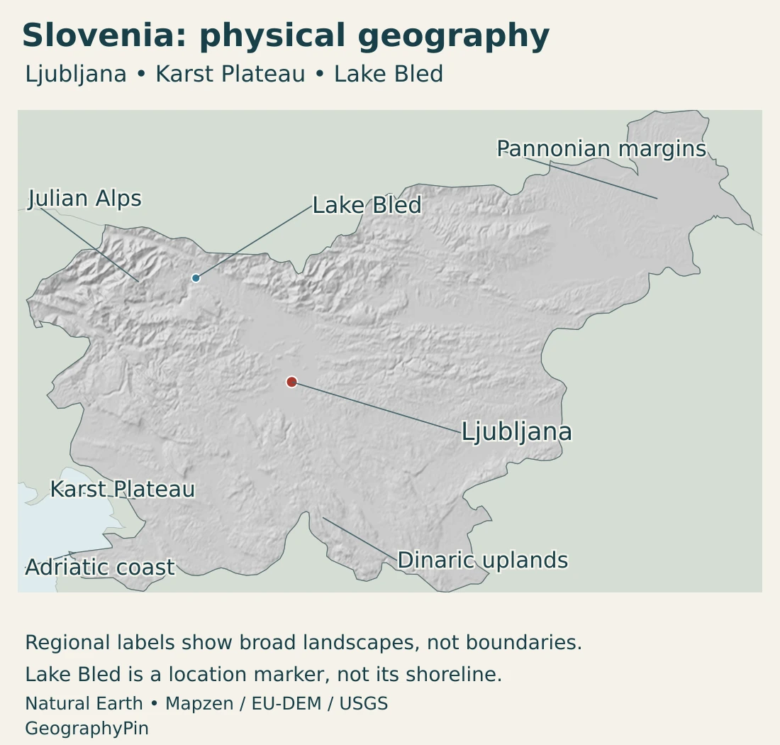
The Julian Alps provide the clearest mountain anchor. Triglav National Park lies in northwestern Slovenia, near Italy and Austria, and its namesake mountain is the country’s highest peak at 9,396 ft (2,864 m). A mountain summit is an extreme point, not a representative elevation for Ljubljana or the coastal towns.
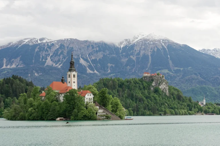
Lake Bled is a recognizable place in the northwestern landscape, but it should not stand in for all Slovenian lakes or for the whole Alpine region. The country’s physical variety includes both surface-water scenery and landscapes whose drainage is much less visible.
Kras is a place; karst is also a type of landscape
Kras is the name of a limestone plateau in the Slovenia–Italy border region. Its German name, Karst, entered international scientific terminology. Lowercase “karst” now describes landscapes shaped by the dissolution of soluble rock and associated drainage, not just this particular plateau.
That distinction prevents a common map-reading mistake. A label for the Karst Plateau marks a geographic region; a statement that a landscape is karstic describes its processes and features. Karst landforms occur elsewhere in Slovenia and across the world, so the regional name is not a boundary around every cave or underground stream.
Škocjan Caves make the process tangible. The Reka River enters an extensive limestone cave system with an underground canyon and collapsed depressions. The surface and underground landscape are therefore parts of one connected water system, not unrelated attractions.
4. Climate, rivers and underground water
Slovenia’s climate reflects its geographic transitions. Mediterranean influence is strongest near the coast, Alpine conditions shape the northwestern mountains, and more continental influences characterize much of the interior and east. These categories are a starting point: altitude, slope exposure and local terrain can produce marked differences within a short distance.
Moist air meeting mountain barriers helps explain the high precipitation of the Julian Alps and nearby Dinaric terrain. A valley floor and an exposed summit do not have the same conditions. Likewise, the coast is not simply a warmer copy of the interior, and a national average hides much of the contrast that matters on the ground.
Water flows toward the Adriatic and Black Sea
Slovenian mountain divides separate water flowing toward the Adriatic from water eventually reaching the Black Sea. The Soča belongs to the Adriatic drainage, while the Sava connects with the Danube system. This is a useful example of how neighboring valleys can belong to different continental drainage routes.
The map’s national boundary and a watershed boundary answer different questions. One describes territory; the other describes where water goes. Rivers can cross political borders, while a mountain divide inside one country can separate flows bound for different seas.
Karst adds an extra layer. At Škocjan, the Reka disappears underground rather than ceasing to exist. A surface map with relatively few blue channels can therefore conceal a substantial underground drainage system. Protecting water in this setting means considering connections between the surface and the subsurface, not only the visible riverbanks.
The relationship between rock and water also explains why a cave, a spring and a collapsed depression may belong to the same landscape story. These features are not evidence that all Slovenian drainage is underground; mountain streams, ordinary river valleys and lakes remain equally important parts of the country.
5. People, cities and languages
Ljubljana is the national capital and an important central urban focus. Maribor is another major urban center, while many people live in smaller municipalities and settlements. The municipal map is consequently more detailed than a short list of large cities suggests.
Settlement follows practical opportunities within varied terrain: valleys, basins, lower hills and the coast provide different settings from steep mountain slopes. Connections between these places matter as much as their individual sizes. A municipal boundary defines local government, not necessarily the full extent of everyday commuting and economic relationships.
Slovenian is the official language. Italian and Hungarian also have official status alongside Slovenian in the areas where the respective minorities reside. This is a territorial language arrangement, not a claim that every municipality has the same three-language framework.
The national population includes both Slovenian and foreign citizens. Citizenship, residence and language are different categories, so one cannot be inferred automatically from another. A country profile can describe the official-language framework without assuming every resident has the same linguistic background.
6. Government and economic connections
Slovenia is a parliamentary republic. Its president is head of state, while the prime minister leads the government. It joined the European Union in 2004 and adopted the euro in 2007. National institutions, municipal self-government and statistical regions operate at different levels and should not be conflated.
Manufacturing and services are part of the country’s economy alongside tourism. The government’s October 2026 economic review discusses export-oriented manufacturing, including pharmaceutical products and road vehicles. These activities help explain why links with wider European markets matter, rather than treating the country only as a landscape destination.
Koper provides a concrete example of the country’s economic geography. Its Adriatic port is connected by rail with inland destinations, including locations in Austria, Hungary and Slovakia. A relatively short coast can therefore have significance beyond its physical length: maritime access connects with transport corridors reaching well into Europe.
Mountain and karst landscapes support another set of activities. Triglav National Park’s management combines conservation with attention to inhabited landscapes and local livelihoods. The landscape is not an unoccupied backdrop; settlements, cultural practices and environmental protection coexist within it.
These examples should not reduce Slovenia to either a port or a scenic destination. The useful geographic point is the interaction of places: coastal infrastructure connects with inland markets, the capital links national institutions and services, and rural or mountain communities occupy different local settings. Physical variety shapes opportunities without determining a single economic role for every region.
Frequently Asked Questions
How can Slovenia have both Alps and a Mediterranean coast?
Its territory lies where several geographic settings meet. The Julian Alps occupy the northwest, while the southwestern edge reaches the northern Adriatic. Inland transitions include Dinaric terrain and eastern Pannonian influences.
Is the Karst Plateau the same thing as karst?
No. Kras, or the Karst Plateau, is a particular geographic region. The broader scientific term karst describes landscapes shaped by soluble rock and related drainage processes, which occur in many places.
Are Slovenia and Slovakia the same country?
No. They are separate European countries. Slovenia’s capital is Ljubljana and it has an Adriatic coast. Similar names should not be used interchangeably.
What Did We Learn Today?
Slovenia brings Alpine, Dinaric, Pannonian and Adriatic settings into a compact territory. Its mountains, coast and karst landscapes differ in terrain and water movement, while rivers connect the country with two sea basins. Ljubljana’s capital role, the municipal map and statistical regions describe different aspects of national life. The Karst Plateau is a specific place, whereas karst is also a wider scientific term.
Sources & Data Notes
- SURS — Population, 1 July 2026. Final release October 29, 2026: 2,138,751 residents, not a count restricted to Slovenian citizens. Source: SURS.
- Government of Slovenia — About Slovenia. Ljubljana, geographic setting and reported area of 20,271 km². The overview labels this land surface but does not provide a new survey year or detailed water-accounting definition.
- Government of Slovenia — Municipalities in numbers. 212 municipalities and the local self-government framework.
- SURS — Slovenian regions and municipalities. Twelve statistical regions and their distinction from 212 municipalities. Source: SURS.
- Government of Slovenia — Official language. Slovenian and the territorial official status of Italian and Hungarian in the relevant minority areas.
- European Union — Slovenia. Parliamentary republic, capital, EU membership and euro adoption. Population and area above use the separately identified Slovenian references.
- Slovenian Environment Agency — Country introduction. Physical and climatic influences, carbonate terrain and groundwater. Regional geographic context, rather than a current statistical inventory.
- Slovenian Environment Agency — The Alps. Mountain precipitation, terrain contrasts and Adriatic–Black Sea drainage divides.
- Slovenian Environment Agency — Environment in the Palm of Your Hand. River-system connections with the Danube–Black Sea and Adriatic basins; qualitative drainage geography.
- Triglav National Park — Basic information. Northwestern Alpine location, Triglav’s 2,864 m summit and the relationship between conservation and inhabited landscapes.
- ZRC SAZU — Karst in Slovenia. The named Kras/Karst Plateau and the wider scientific landscape term.
- UNESCO — Škocjan Caves. Reka River, underground limestone canyon and collapse features.
- Port of Koper — Railway connections. Rail connections linking the Adriatic port with inland European destinations; no fixed timetable is implied.
- IMAD — Slovenian Economic Mirror 6/2026. October 20, 2026 review of manufacturing, services and exports, including pharmaceuticals and road vehicles.
Map sources and scope: Original GeographyPin maps use public-domain Natural Earth country boundaries and populated-place coordinates. A Lambert azimuthal equal-area projection centered at 46°N, 15°E keeps Slovenia and its neighbors in one geographic frame, without relocated insets.
The physical map uses real elevation data accessed through Mapzen Terrain Tiles, rather than an illustrated mountain texture. Hillshade shows terrain form, not elevation categories. Produced using Copernicus data and information funded by the European Union, EU-DEM layers; global elevation data courtesy of the U.S. Geological Survey. Elevation-source attribution and terms apply. This regional map is not suitable for local navigation.
Ljubljana uses the Natural Earth city coordinate attributes. Lake Bled is located using coordinates in the PCGN Slovenia factfile; its point symbol is not a shoreline. Landscape labels indicate broad settings, not surveyed regional boundaries. The Karst Plateau label refers to the named region, not all karst terrain.
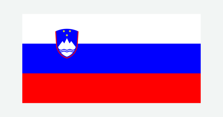
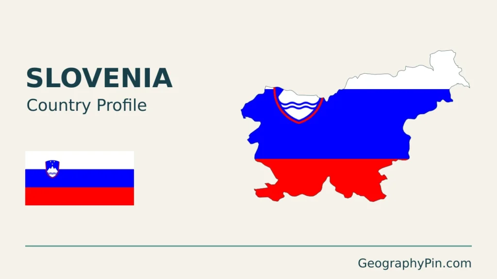
Generalized land borders are not cadastral or legal delineations and do not adjudicate boundary interpretations. No maritime boundary is drawn. The cover combines the Slovenian flag with a decorative country-outline motif and GeographyPin branding; an intact flag preserves the coat of arms.