Lake Louise is famous for its pale turquoise water beneath steep mountain slopes. Yet its name can point to three different destinations, and its color tells a story about tiny particles rather than simply the mountains reflected on the surface.
Lake Louise is a mountain lake in Banff National Park, Alberta, Canada. It is separate from the nearby Lake Louise village and ski resort. Fine mineral sediment carried by glacial meltwater helps produce its turquoise appearance. The surrounding mountain landscape includes Victoria Glacier, but the lake and glacier are different features.
How to use this article: Find the Canadian setting, distinguish the three locations, understand the turquoise water, or compare Louise and Moraine.
1. Where is Lake Louise in Canada?
Lake Louise is in Banff National Park in Alberta, in the Canadian Rocky Mountains. The same name is used for the nearby community and a ski resort, but they are not all at the lakeshore. Choosing the right destination on a map is the first step to understanding the area.
A mountain lake, not the whole Lake Louise area
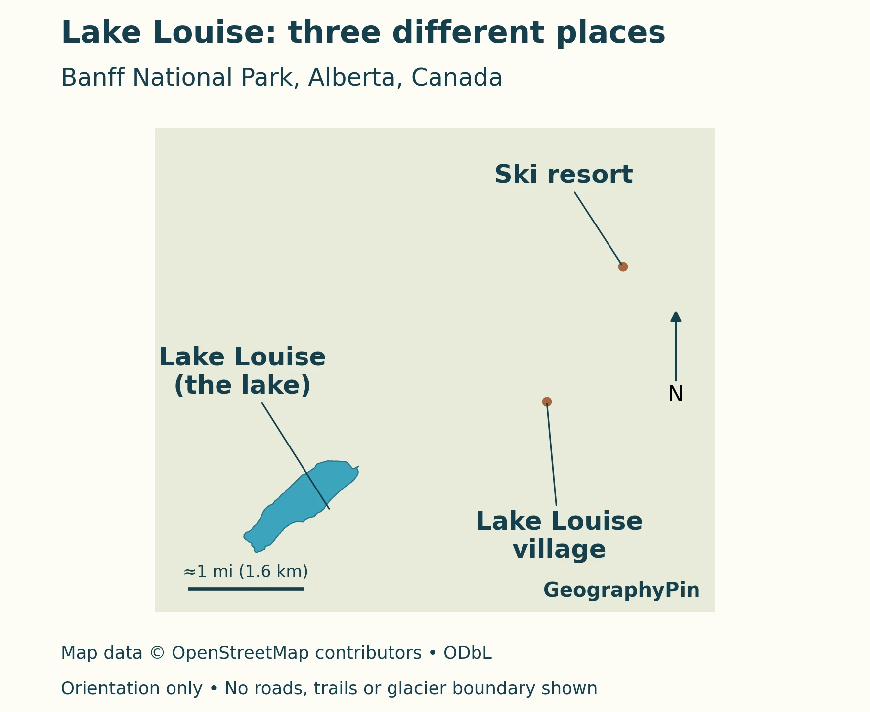
The regional locator places the lake within western Canada. The more detailed map separates the waterbody from the village and resort. These two scales serve different purposes: one establishes the region, while the other prevents three nearby destinations from being mistaken for one.
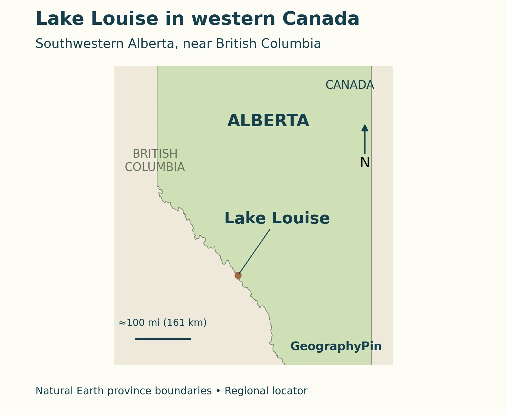
The lake’s surroundings include steep mountain slopes, forest and glacial scenery. Parks Canada treats Upper Lake Louise and the community as distinct places in its planning and visitor information. The broad phrase “Lake Louise area” also includes other destinations, notably Moraine Lake and surrounding valleys; it is not a boundary around the lake itself.
2. Lake, village and ski resort: which is which?
The lake lies southwest of the community, while the ski resort is farther northeast on the other side of the valley. Their shared name is convenient for describing a region but can be misleading when identifying a specific arrival point.
Three destinations on one map
| Place | What the name identifies |
|---|---|
| Lake Louise lakeshore | The mountain lake and its shoreline visitor area. |
| Community of Lake Louise | The settlement and visitor-service area in the valley, not the lakeshore. |
| Lake Louise Ski Resort | The separate ski-area base; Parks Canada identifies this as the location of its Lake Louise Park and Ride. |
Parks Canada’s area map labels the lakeshore at approximately 5,679 feet (1,731 meters) and the community at approximately 5,039 feet (1,536 meters). These are mapped reference elevations for different places, not competing answers to one question. The difference also explains why a village address does not imply a location beside the lake.
The plan’s dots are location references, not outlines of the entire village or ski area. Its label pointers are not roads, trails or recommended routes. Use the geographic map to identify the correct destination, then the operator’s current directions to reach it.
3. Why is Lake Louise turquoise?
The pale blue-green water is associated with very fine mineral particles carried into the lake by glacial meltwater. The European Geosciences Union’s Lake Louise explanation identifies these suspended particles as rock flour. The effect comes from the interaction of light with the water and sediment, not from the lake being filled with a blue dye.
From grinding ice to colored water
As a glacier moves, it can grind rock into particles much smaller than sand. The National Park Service distinguishes this fine material from glacial till, which includes an unsorted mixture of sizes, from tiny grains to large rocks. Fine rock flour is readily transported in water and can remain suspended rather than immediately settling.
Sunlight interacting with suspended sediment helps produce the cloudy or milky appearance of many glacier-fed waters. The process can yield different colors, so the word “glacial” does not guarantee an identical shade of turquoise in every lake.
NASA’s explanation of turquoise glacial lakes describes how fine particles settle slowly and affect the light returning to an observer. Its example is from New Zealand, not a measurement of Lake Louise, but it explains the same general optical mechanism. Lake color depends on what is in the water and how light interacts with it; it is not simply a reflection of a blue sky.
This distinction matters when reading photographs. A bright color is evidence of an optical appearance, not a measurement of depth, temperature or drinking-water safety. Two images taken under different conditions need not look alike to show the same lake.
4. The glacier setting behind the view
Victoria Glacier is part of the mountain setting associated with Lake Louise. Its name is recorded in Canada’s official geographical names database. A named glacier on a locator, however, is not the same thing as a surveyed outline of the ice at a particular date.
A landscape with both ice and liquid water
A glacier is moving ice; a lake is a body of liquid water occupying a basin. Meltwater and sediment can link the two, but they remain different geographic features. For the broader distinction, see what a lake is.
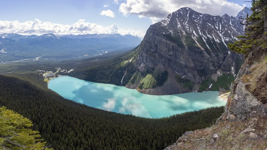
Photographs are especially useful for showing the relationship between water, valley walls and the mountains above. They are less reliable for judging the present edge or thickness of a glacier unless the observation date and viewpoint are controlled. The featured photograph is a landscape image, not a current glacier inventory or evidence that an ice margin has remained unchanged.
The same caution applies to an appealing line drawn toward a glacier. It might be a label pointer rather than an access route. This article’s maps do not prescribe a walk onto ice or show mountaineering access. Glacier travel and nearby mountain terrain require information far beyond a simple place-name map.
5. Lake Louise versus Moraine Lake
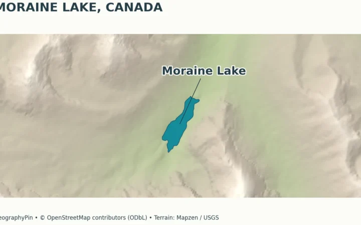
Lake Louise and Moraine Lake are separate lakes in Banff National Park. They are often discussed together in visitor information, but one is not a bay, alternate name or viewpoint of the other. An itinerary that lists both involves two destinations.
Similar scenery does not mean the same place
Parks Canada’s area map labels Moraine Lake separately at approximately 6,191 feet (1,887 meters), higher than its Lake Louise lakeshore reference. Those elevations describe the places shown on that map; they are not measurements of either lake’s depth.
The lakes also have separate access arrangements. A road or shuttle instruction for one should not automatically be applied to the other. Consult Parks Canada’s Lake Louise and Moraine Lake information when planning a visit, rather than assuming a shared name for the area means shared parking or identical seasonal access.
The comparison is useful beyond travel planning: similar turquoise water can occur in different basins. Color alone cannot identify a lake. Use the shape, surrounding landforms and mapped location together, especially when matching a photograph to a destination.
6. A protected landscape, not just a viewpoint
The Lake Louise area contains alpine and subalpine habitats as well as heavily visited scenic places. Parks Canada identifies the Fairview and Whitehorn wildlife corridors as important routes for large carnivores, including grizzly bears, wolves and lynx. A quiet-looking patch of forest may therefore have a function that is not apparent from a visitor map.
Check conditions for the activity, not only the destination
Visitor management addresses more than congestion at a photograph stop. Parks Canada’s planning material discusses wildlife movement, water quality, emergency access and the effects of crowded roads and trails. Its proposed or evolving management measures should not be read as a guarantee that every route or activity will be available at all times.
For water recreation, use the park’s current water-activity rules. The park manages different waters in different zones and applies measures to prevent aquatic invasive species. Do not assume that permission to bring equipment to one lake applies to another.
For walks and mountain outings, check the official visitor page and linked trail reports. A lakeshore visit and an excursion into surrounding mountain terrain are different activities. Snow, ice and seasonal hazards can change what is appropriate even when the lake remains an accessible sightseeing destination.
What Did We Learn Today?
Lake Louise is a lake, not a single label for every nearby destination. The village and ski resort occupy separate locations, and Moraine Lake is another basin. Glacial sediment helps explain the turquoise water, while the mountain setting connects the lake with a wider landscape of ice, rock, forest and wildlife. Maps, photographs and current visitor guidance each answer different questions.
Sources & Data Notes
Elevations are approximate site references from Parks Canada’s area map, with rounded unit conversions; they are not lake-depth measurements. The regional locator uses generalized Natural Earth provincial boundaries. The detailed map uses OpenStreetMap lake geometry and separate settlement and resort points, not attraction boundaries or routes. Neither map shows a current glacier outline.
- Parks Canada: Lake Louise and Moraine Lake, destination and current access information.
- Parks Canada: Lake Louise area map, place distinctions and reference elevations.
- European Geosciences Union: rock flour in Lake Louise, lake-specific color explanation.
- National Park Service: glacial till and glacial flour, sediment processes.
- NASA: how glaciers turn lakes turquoise, general optical mechanism illustrated in New Zealand.
- Natural Resources Canada: Victoria Glacier, official geographical name, not a current ice survey.
- Parks Canada: Lake Louise visitor-use management, conservation and management context.
- Parks Canada: water activities, current rules and invasive-species prevention.
- Map data: Natural Earth, public domain, and © OpenStreetMap contributors, ODbL. Map styling: GeographyPin.
Featured photograph: Lake Louise viewed from Beehive in 2019, by Chensiyuan, CC BY-SA 4.0. Resized and converted to WebP; the derivative retains the same license. This viewpoint is not presented as a photograph of Victoria Glacier.