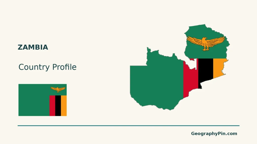
Zambia combines plateau country, river valleys and a cross-border Copperbelt.
Zambia is a landlocked country in south-central Africa, with Lusaka as its capital. The Zambezi, Kafue and Luangwa belong to one major drainage system; northern rivers also feed the Congo basin. Lake Kariba is a reservoir shared with Zimbabwe, and the Copperbelt is a major mining region, not the whole country.
How to use this article: Locate the country on the map, read the physical map, explore rainfall seasons, or check the population reference.
1. Locate Zambia and Its Neighbors
Eight neighbors and no coastline
Zambia is a landlocked country in south-central Africa. Its neighbors are Angola, the Democratic Republic of the Congo, Tanzania, Malawi, Mozambique, Zimbabwe, Botswana and Namibia. UN statistical geography groups Zambia within Eastern Africa, while national descriptions also place it in Southern Africa.
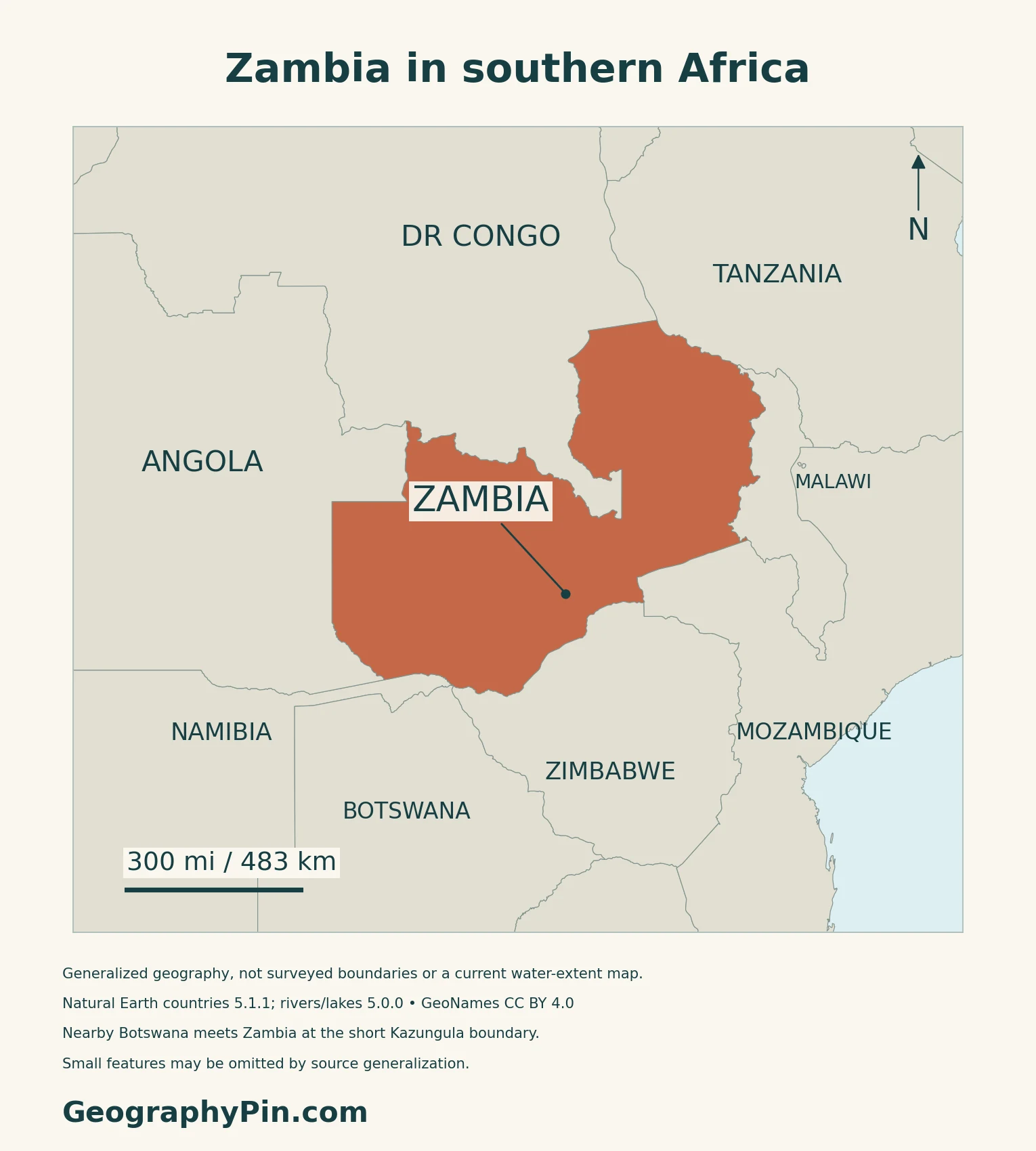
Lusaka is the capital and government seat
Lusaka is both the national capital and the seat of government.
2. Read the Plateau and River Systems
A plateau is not a flat, uniform surface
| Setting | Physical character | Distinction |
|---|---|---|
| Plateau interior | Broad uplands interrupted by valleys and ridges | Elevation varies within the country |
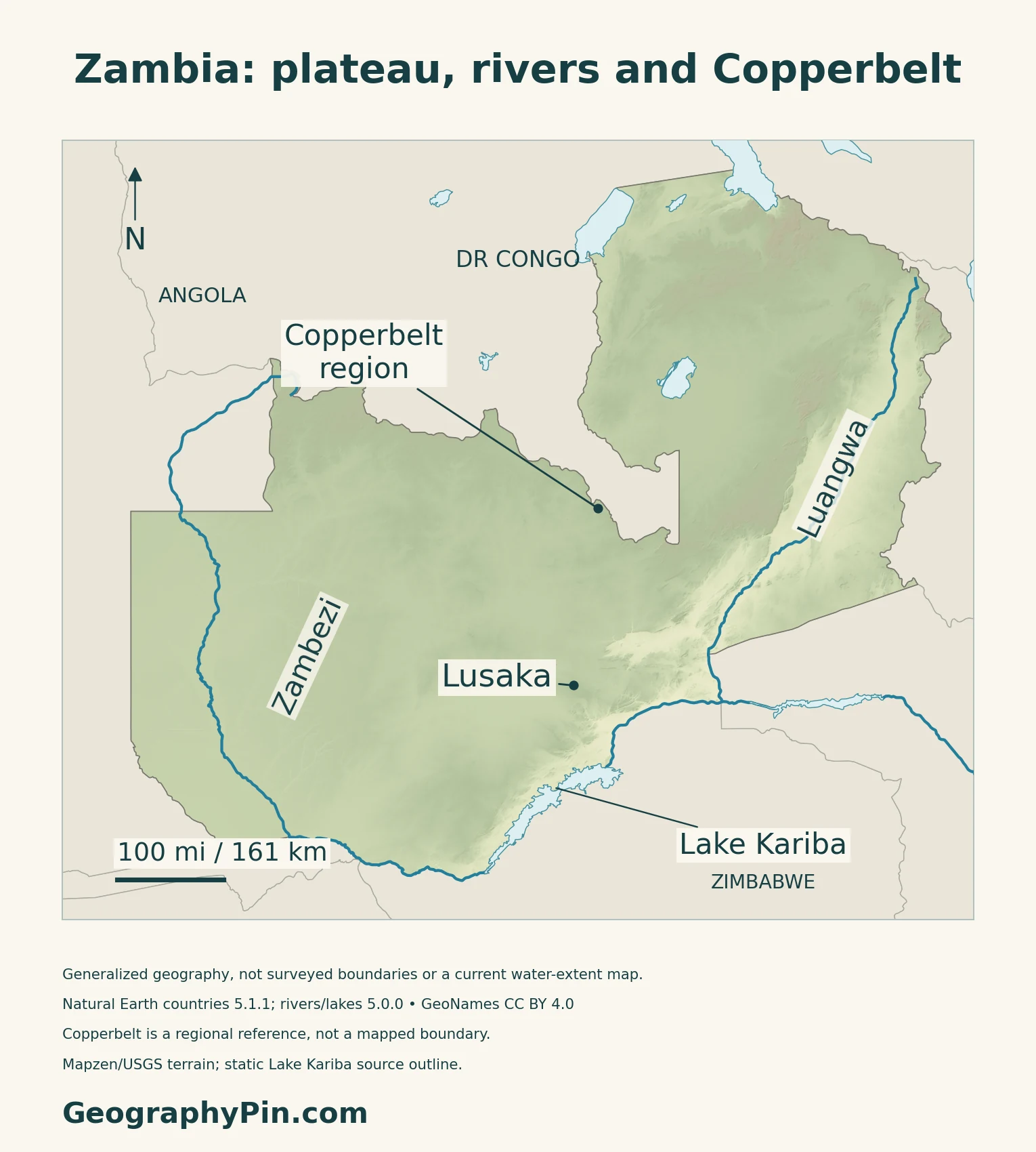
| Zambezi and tributaries | Zambezi, Kafue and Luangwa drainage | Not the whole national drainage area |
| Northern drainage | Chambeshi–Luapula system | Part of the Congo basin |
| Lake Kariba | Reservoir on the Zambezi | Shared with Zimbabwe |
| Copperbelt | Mineral-bearing region toward DR Congo | Regional reference, not a basin boundary |
Two major drainage systems cross one country
ZESCO’s 2024 Zambia–Tanzania interconnector assessment describes a plateau dissected by river systems. The Zambezi and its tributaries, including the Kafue and Luangwa, contrast with the Chambeshi–Luapula system, which belongs to the Congo basin.
The same report identifies higher ground along the Congo–Zambezi watershed in the northeast. A watershed separates routes taken by runoff; it is not necessarily an international boundary.
The national overview is different from the full river journey
The traditionally named Zambezi rises in northwestern Zambia, but its basin and downstream course extend well beyond the country. Zambia’s relationship with the river includes headwaters, tributaries, border reaches and a major reservoir.
For the complete course, source definitions and downstream sequence, use the separate Zambezi River map and guide.
3. Connect Rainfall, Storage and Agriculture
The wet season is followed by two different dry periods
The Zambezi River Authority describes a hot, wet season broadly from November to April, followed by a cooler dry period and then a hotter dry period before the rains return. This basin-wide pattern is useful for orientation, but it does not specify the rainfall received by every district.
A reservoir outline is not a measure of available electricity
Kariba stores water for power generation on its north and south banks. The Zambezi River Authority publishes dam and reservoir design data separately from changing lake levels, inflows and operating information.
A mapped shoreline is therefore a geographic reference, not a live reading of storage or power output. Rainfall in the upstream catchment, river inflow and water use influence the reservoir over time.
Rainfall connects crops, livestock and fisheries
FAO’s Zambia SCALA overview identifies maize, soybeans, horticulture, livestock and fisheries among important agricultural activities. It emphasizes that changing rainfall patterns affect rainfed crops as well as livestock, fisheries and aquaculture.
The programme’s proposed catchment-based work combines watershed restoration with agricultural and pasture management.
4. Understand the Copperbelt and Woodland Landscape
The geological belt crosses the DR Congo border
A USGS assessment published in 2014 examines sediment-hosted copper deposits in the Roan Group of the Katanga Basin across Zambia and the Democratic Republic of the Congo. It distinguishes known deposits from modelled possibilities for undiscovered resources.
The Copperbelt label here identifies the region without implying that its limits match a province or national boundary.
Valley vegetation differs from much of the plateau
Zambia’s national biodiversity background describes miombo woodland across much of the plateau landscape, with mopane and munga woodlands associated with hotter, drier southern valleys, including the Zambezi and Luangwa.
This older national reference is used for broad ecological contrasts, not a current forest-cover percentage.
5. Dated Country Facts and Institutions
| Item | Reference | Date or scope |
|---|---|---|
| Capital | Lusaka | National capital and government seat |
| Population | About 23.00 million | ZamStats medium-variant projection, July 1, 2026 |
| Surface area | About 290,585 sq mi (752,612 km²) | UNData reference year 2023; total surface, not land alone |
| Official language | English | Constitution, Article 258 |
| Currency | Zambian kwacha (ZMW) | National currency |
| Government | Unitary presidential republic | Constitutional structure |
| Administration | Ten provinces | ZamStats national report, March 2026 |
Keep the census and projection dates separate
The 2022 census reported 19,693,423 usual residents, with September 8, 2022 as its reference date. ZamStats’ March 2026 projection report uses that de jure census framework, adjusts the base population and models births, deaths and migration. Its medium-variant figure for July 1, 2026 is 23,003,214, not a new census count.
Official language and provincial geography
Article 258 makes English the official language while requiring the state to respect, promote and protect linguistic diversity. It permits other languages in education and legislative, administrative or judicial work as prescribed; it does not designate a fixed list of “national languages.”
The ten provinces are Central, Copperbelt, Eastern, Luapula, Lusaka, Muchinga, Northern, North-Western, Southern and Western. These administrative units are different from river basins and physical regions.
What Did We Learn Today?
Zambia drains toward both the Zambezi and Congo systems. Seasonal rain connects agriculture with river flow and storage, while the Copperbelt and woodland landscapes add other geographic patterns.
Sources & Data Notes
Population projections and census counts retain their different dates and methods. Surface area is not relabelled as land-only. Legal references include the original Constitution and the subsequent amendment check. Terrain and drainage descriptions use the 2024 ZESCO project assessment for stable national geography, not its project-area findings as national measurements. The older biodiversity background supports broad woodland contrasts only. The 2014 USGS work assesses geological resources, not current production. Kariba design information is separate from live storage and electricity output; no reservoir-status claim is made here.
- ZamStats: Population and Demographic Projections 2023–2047, national report dated March 25, 2026
- ZamStats: 2022 Census National Analytical Report; usual-resident count and reference date
- UNData: Zambia surface area, 2023 reference; currency and statistical region
- Constitutional provisions: Articles 4, 91 and 258, 2016 text hosted by WIPO
- National Assembly: Constitution Amendment Act 13 of 2025, checked for later changes
- ZESCO: Zambia–Tanzania Interconnector ESIA update, November 2024; national topography and drainage section
- Zambezi River Authority: named river geography and basin seasons
- Zambezi River Authority: Kariba reservoir and power-station technical references
- Zambezi River Authority: river monitoring, distinct from static design information
- FAO: Zambia SCALA agriculture and catchment-resilience overview
- USGS: Central African Copperbelt resource assessment, 2014
- Zambia biodiversity clearing-house: historical national background and woodland contrasts, posted 2006
Map method: Original GeographyPin maps use public-domain Natural Earth countries 5.1.1 and rivers/lakes 5.0.0. The country outline is generalized, including around the short Botswana boundary. Supplied Zambezi and Luangwa paths are retained; Lake Kariba is a static source polygon, not current water extent or a lake-allocation ruling. No basin boundary is inferred. Copperbelt is a regional reference near Ndola, not a province or mineral-deposit perimeter. GeoNames coordinates are credited under CC BY 4.0. Real Mapzen Terrain Tiles provide relief with Mapzen/USGS and upstream credits; lake water is shown neutrally rather than as terrain. WGS84 scales apply locally. The cover uses the same source outline and the public-domain Commons flag rendition, preserving a complete separate flag.


