What is Geography?
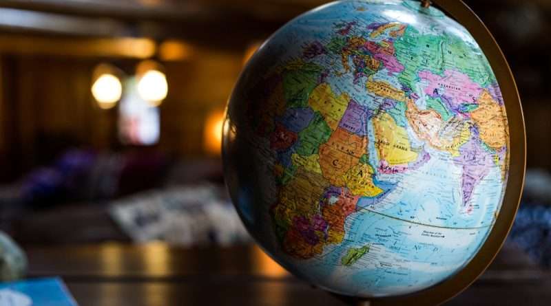
Geography is the study of places, spaces, and the relationships between people and their environments. It spans Earth’s physical features (climates, landforms, water) and human systems (cultures, economies, cities), asking where things are, why they are there, and how they change over time. Its tools include maps, GIS, remote sensing, and GPS.
Definition and Scope of Geography
At its core, geography studies places and the connections between them. A widely cited definition describes geography as “the study of places and the relationships between people and their environments,” emphasizing both Earth’s physical properties and human societies. This captures three essential questions: what is where, why is it there, and why does it matter. For a clear, classroom-tested explanation, see National Geographic’s overview of geography.
The discipline’s relevance is broad: it helps us understand our natural environments, the pressures they face, and how interconnected our communities are—from local neighborhoods to global trade. The Royal Geographical Society summarizes these roles succinctly, highlighting how geography informs choices about managing our world and the importance of location in decision-making.
Physical vs. Human Geography
Physical geography examines natural systems—atmosphere, oceans, landforms, ecosystems. Human geography focuses on people and places—cultures, economies, politics, and urban life. Together they reveal how volcanoes shape settlements, how climate influences crops, or how transport networks reshape regions. Many geographers work at the interface (nature–society), studying everything from water scarcity to disaster risk.
Environmental & Geospatial Perspectives
Modern geography also includes environmental geography (human–environment interactions) and geospatial science (GIS, remote sensing, GPS). These perspectives connect on-the-ground observations with spatial data to support better decisions—for example, mapping wildfire risk, planning public transit, or tracking habitat loss.
| Branch | What it asks | Typical tools |
|---|---|---|
| Physical geography | How do climate, landforms, coasts, and rivers work? | Field surveys, climate datasets, satellite imagery |
| Human geography | Why do cities grow here? How do cultures and economies shape space? | Census/market data, interviews, spatial statistics |
| Environmental geography | How do people and environments affect each other? | Land-use/land-cover change analysis, risk mapping |
| Geospatial science | Where are things, and what patterns emerge? | GIS, remote sensing, GPS/GNSS, cartography |
Tools of Modern Geography: Maps, GIS, Remote Sensing, GPS
Today’s geographers use digital maps and spatial databases to connect location with data. A geographic information system (GIS) helps create, manage, analyze, and map many data types—revealing patterns and relationships (for instance, how heat islands overlap with low-tree-cover neighborhoods). See Esri’s succinct definition of GIS for a practitioner’s view of the technology.
Remote sensing gathers information from afar—aircraft and satellites. Since Landsat 1 launched on July 23, 1972, continuous satellite images have helped track forests, glaciers, and cities worldwide, creating a 50-year record of Earth’s changing land surface. The U.S. Geological Survey maintains the program history.
GPS/GNSS provides precise positioning, navigation, and timing, enabling everything from smartphone maps to aircraft routing. An authoritative starting point is the U.S. government’s portal at GPS.gov, which explains how the space, control, and user segments work together.
One more big picture fact: the global ocean covers about 70–71% of Earth’s surface—roughly 360 million square kilometers (139 million square miles)—so coastal processes and marine weather strongly shape life on land. This is why oceanic data and climate-ocean links feature heavily in geographic studies.
GIS in Plain Language
Think of GIS as a “smart map” that stores layers: roads, schools, rainfall, income, tree cover. By stacking and analyzing layers, GIS answers spatial questions: Where are the safest routes? Which neighborhoods lack parks? Where should new clinics go to minimize travel time?
Remote Sensing (Landsat and beyond)
From early Landsat images to today’s high-resolution constellations, remote sensing tracks Earth systematically—burn scars after wildfires, retreating glaciers, expanding cities, seasonal crops, and more. Analysts combine multiple dates to detect change and quantify trends.
GPS and GNSS
GPS is part of a wider family of satellite navigation systems (GNSS). Phones and vehicles often use several constellations for better accuracy. Survey-grade receivers can reach centimeter-level precision with corrections, enabling applications from precision farming to autonomous vehicles.
Methods & Spatial Thinking
Geographers blend qualitative and quantitative methods. They conduct fieldwork and interviews; they also run spatial statistics (like clustering or accessibility models) to test patterns. They work across scales, from a single street to an entire continent, because processes can look different at each scale. They also consider time, since change—erosion, migration, urban sprawl—is often the story.
Maps are powerful, but every map simplifies reality. Projections (like the Mercator projection commonly seen online) preserve angles for navigation but stretch landmasses toward the poles, so Greenland appears much larger than it is. Understanding these trade-offs helps readers evaluate maps critically and avoid misleading comparisons.
A Short History: From Shadows in Egypt to Satellites in Space
Geography has deep roots. Around 240 BCE, the librarian Eratosthenes compared the Sun’s angle at Syene (Aswan) and Alexandria at noon on the solstice to estimate Earth’s circumference—an impressively close figure near 25,000 miles (40,000 kilometers). Centuries later, better instruments, global voyages, and the rise of national mapping agencies refined our planetary picture.
| Year | Milestone | Why it matters |
|---|---|---|
| c. 240 BCE | Eratosthenes estimates Earth’s circumference | Introduces quantitative, spatial reasoning using simple observations. |
| 1569 | Mercator’s world map and projection | Made rhumb-line navigation practical; shaped mapmaking for centuries. |
| 1830 | Royal Geographical Society founded (London) | Institutional support for exploration, education, and geographic science. |
| 1912 | Wegener presents continental drift hypothesis | Seeds modern plate tectonics—revolves how we view Earth’s dynamics. |
| 1972 | Landsat 1 launch (ERTS-1) | Begins continuous global land imaging—vital for climate, agriculture, cities. |
Real-World Impact & Careers
Climate & environment: Because the ocean covers about 71% of Earth’s surface and holds ~97% of its water, marine–atmosphere interactions drive weather and climate—key to planning for storms, floods, and drought. Geographers integrate oceanic, atmospheric, and land data to map risk and design adaptation strategies for communities and infrastructure.
Cities & mobility: Spatial analysis improves bus routes, bike lanes, and emergency response times. Business & logistics: Location analytics optimizes delivery networks and store placement. Conservation & food: Remote sensing tracks deforestation and crop health, guiding sustainable land-use. Disasters: GPS-enabled field mapping speeds damage assessments after earthquakes and floods.
FAQ
Is geography just memorizing capitals and maps?
No. Memorization is a small part. Modern geography explains why places differ and how systems connect (climate, economies, cultures). It uses data, models, and fieldwork to solve real problems—from flood risk to transport planning.
How is geography different from geology or history?
History organizes events by time, while geography organizes knowledge by place and space—asking where things occur and why there. This “spatial lens” complements geology’s focus on Earth materials and processes.
What are common geography careers?
GIS analyst, urban planner, environmental consultant, hazard and emergency planner, transportation or market-location analyst, conservation scientist, educator, and more. Skills in mapping, data analysis, and communication transfer across sectors.
Why do some world maps look “wrong”?
All flat maps distort Earth. Projections trade off properties (area, shape, distance, direction). The familiar Mercator preserves angles (good for navigation) but enlarges high-latitude areas; equal-area maps keep area fairer but distort shapes.
What Did We Learn Today?
- Geography studies places, spaces, and people–environment relationships—asking what is where, why there, and why it matters.
- It blends physical, human, environmental, and geospatial branches, powered by GIS, remote sensing, and GPS.
- Earth’s ocean covers ~71% of the surface (≈139 million sq mi / 360 million km²), shaping climate and risk.
- From Eratosthenes (c. 240 BCE) to Landsat (since 1972), geographic knowledge builds through measurement and imagery.
- Geographic thinking informs daily choices and major policies—transport, climate adaptation, business logistics, conservation.