A UTM coordinate can look like an unexplained string of large numbers. Reading it becomes easier once you separate the grid zone from the two distances and check the reference system behind them.
UTM coordinates identify a position using a numbered zone, a hemisphere, an easting and a northing, with both grid values expressed in meters. The datum is essential context. Unlike latitude and longitude, UTM uses a flat coordinate grid for a limited part of Earth, so numbers from different zones cannot be compared directly.
How to use this article: You can decode a reference, understand southern northings, or try the distance exercise.
What a Complete UTM Coordinate Contains
UTM stands for Universal Transverse Mercator. It is a family of projected coordinate systems, not a replacement name for GPS. A receiver or mapping program can describe the same measured point in latitude and longitude or in a UTM grid.
Read the reference before the numbers
Consider this complete educational example: WGS 84 / UTM zone 18 North, easting 580,736 m, northing 4,504,695 m. It represents the rounded conversion of 40.6892° N, 74.0445° W, a point near the Statue of Liberty. The values describe a point, not the boundary or exact center of the entire landmark.
| Part | Value | Meaning |
|---|---|---|
| Datum | WGS 84 | The underlying reference system |
| Zone | 18 | The longitudinal grid zone |
| Hemisphere | North | The northern version of that zone |
| Easting | 580,736 m | Position across the grid |
| Northing | 4,504,695 m | Position up the grid |
Keep all five pieces together when sharing a location. Easting and northing alone are incomplete because the same pair can occur in multiple zones and hemispheres. A file may store this context in its coordinate reference system rather than repeat it beside every row.

How Zones Divide the World
The normal UTM layout has 60 longitudinal zones, each 6° wide. Numbering starts at 180° longitude and increases eastward: zone 1 normally covers 180°W to 174°W, and zone 18 covers 78°W to 72°W. Its central meridian is 75°W.
The narrow zones keep projection distortion manageable for regional mapping. They do not make Earth flat or remove every difference between a map distance and a distance on the ground. The PROJ documentation describes UTM as a family of Transverse Mercator projections with different central meridians.
Normal UTM coverage extends from 80°S to 84°N. Beyond that, the related Universal Polar Stereographic system, UPS, is used. Special zone-width exceptions occur around southwest Norway and Svalbard, so a simple six-degree rule is not a complete zone-selection method for every location.
A zone boundary is a coordinate-system boundary. It is not a physical line on the landscape. A project that crosses one needs a consistent mapping choice rather than a spreadsheet that subtracts coordinates assigned to different grids.
What Easting and Northing Actually Measure
Why the central meridian is 500,000
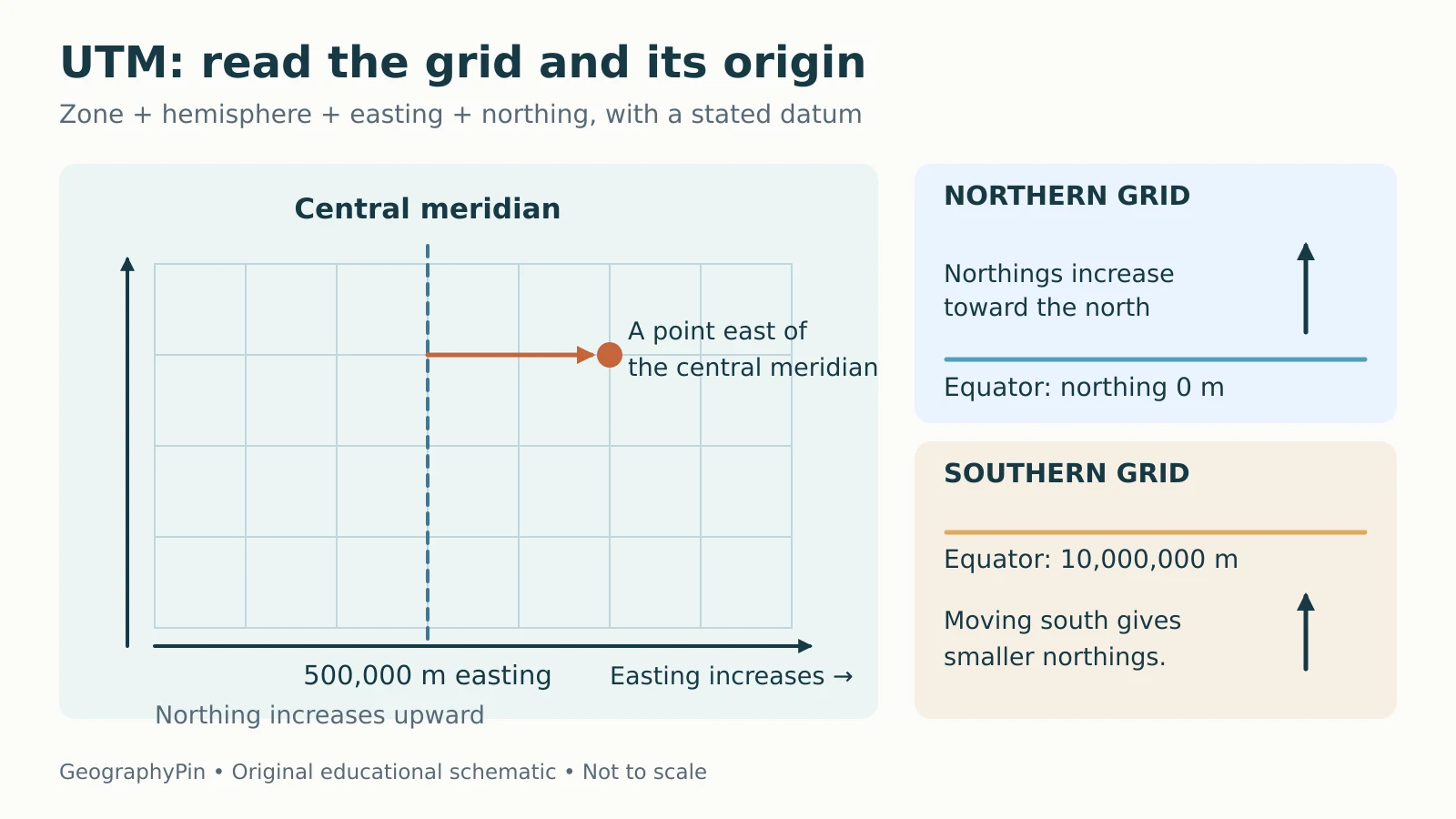
Within each zone, the central meridian is assigned an easting of 500,000 meters. This added offset is called a false easting. A point with an easting of 580,736 is therefore 80,736 grid meters east of the central meridian at its corresponding grid northing, not 580,736 meters east of Greenwich.
Values below 500,000 lie west of the central meridian within normal use of the zone. The USGS explanation of UTM map coordinates uses the same convention to explain how grid labels work.
Why southern northings are still positive
In the Northern Hemisphere, the Equator has a northing of zero and values increase northward. In the Southern Hemisphere, the Equator is assigned a false northing of 10,000,000 meters. Values decrease as you move south from it, while still increasing toward grid north.
For example, a southern northing of 6,000,000 meters places the point 4,000,000 grid meters south of the Equator. It does not mean the point is in the Northern Hemisphere. This is why the hemisphere must accompany the numbers.
Read a Grid and Estimate a Short Distance
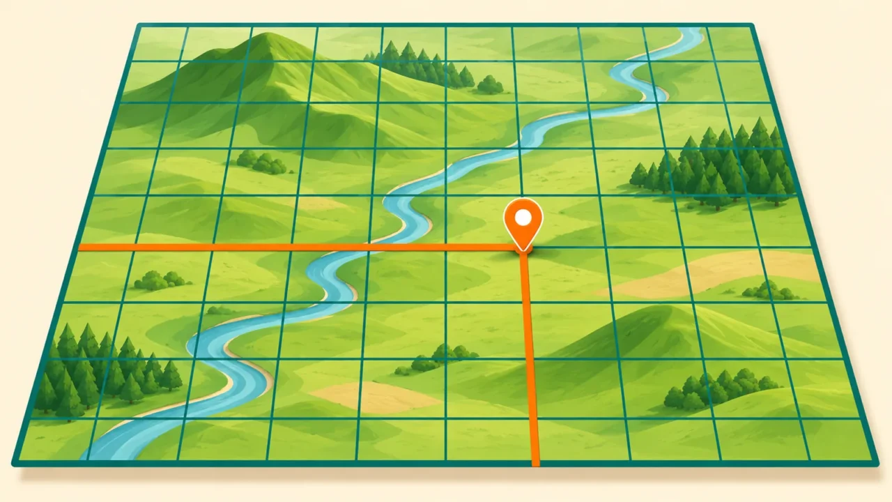
On a map carrying a UTM grid, read across to the easting first and then up to the northing. Check the map collar for its zone, datum and grid spacing. Small digits in printed labels can supply leading numbers that are easy to overlook.
A checked 3–4–5 grid example
Suppose two fictional points use the same UTM zone, hemisphere and datum. Point A is E 500,000, N 4,500,000. Point B is E 500,300, N 4,500,400. B is 300 grid meters east and 400 grid meters north of A.
The straight grid distance is the square root of 300² + 400², which is 500 meters, about 1,640 feet. That result is a planar grid distance, not a trail length or an exact ground-survey distance. Terrain, elevation and projection scale matter when the task requires greater accuracy.
GeographyPin’s map-reading guide explains how scale, symbols and contours add information that the coordinate pair alone cannot provide.
UTM, MGRS and Latitude Are Different Formats
Latitude and longitude are angular coordinates. UTM eastings and northings are projected coordinates in meters. MGRS, the Military Grid Reference System, expresses a grid location using a zone designator, letters for a 100,000-meter square and numeric offsets within that square.
Be especially careful with a letter after a zone number. In a label such as “UTM zone 18N,” N often means Northern Hemisphere. In an MGRS reference such as “18T WL 80735 04695,” T is a latitude-band letter, not a hemisphere abbreviation. MGRS band S is also in the Northern Hemisphere; it does not mean south.
Use the full words North or South when writing a plain UTM reference for beginners. Do not convert a band letter into a hemisphere by guessing. The National Geospatial-Intelligence Agency’s coordinate-system guidance distinguishes these notations.
Check Accuracy Before You Use the Result
UTM is not inherently more accurate than latitude and longitude. As the USGS explains, they are different ways to position a point. Writing more digits cannot improve a poor GPS observation or a rough map estimate.
Nor does the word UTM specify the datum. Coordinates based on WGS 84 and coordinates based on a regional datum can identify different ground positions even when their zone and numbers look alike. Surveying and engineering may also require a particular reference-frame realization, coordinate epoch and transformation method.
For a routine check, enter the original latitude and longitude in GeographyPin’s coordinate converter, confirm the expected region and retain the displayed zone and hemisphere. For boundary, engineering or safety-critical work, use authoritative data and an appropriate professional workflow.
- Confirm the zone and hemisphere.
- Keep easting before northing unless fields explicitly say otherwise.
- Record the datum or full coordinate reference system.
- Keep the native meter units.
- Do not subtract values from different grids.
- Distinguish displayed precision from measured accuracy.
What Did We Learn Today?
A UTM reference works only when its grid context travels with its numbers. Zones organize the projection, false origins keep ordinary grid values convenient, and the hemisphere explains how northings relate to the Equator. Read the coordinate first, check its datum and format, then decide whether the task needs a rough map estimate or a more rigorous measurement.
Sources & Data Notes
UTM definitions follow USGS, NGA and PROJ documentation. The Statue of Liberty example is a rounded WGS 84 conversion; the 3–4–5 exercise uses explicitly fictional points in one grid. Meter values are preserved as coordinate-system units. Diagrams are original schematics, not survey products.