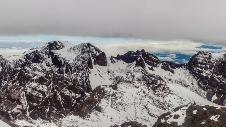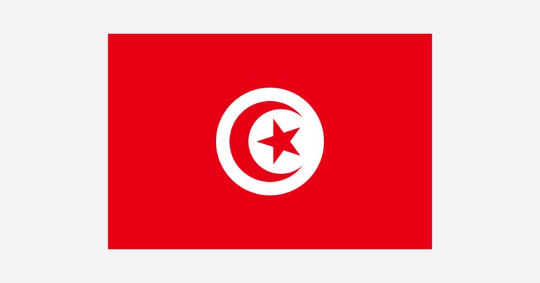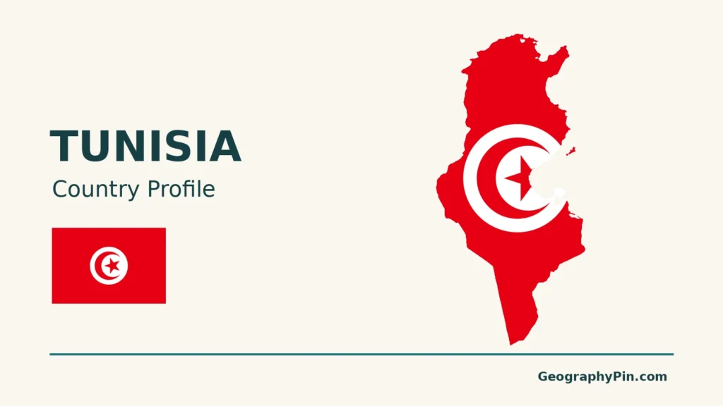
Tunisia’s geography changes markedly between its Mediterranean coast and its Saharan south. Mountains, river valleys and cultivated plains lie between those two familiar images, and its coastal region called the Sahel is easily confused with a very different region elsewhere in Africa.
Tunisia is a North African country bordering Algeria, Libya and the Mediterranean Sea, with its capital at Tunis. Its landscapes extend from Atlas-related northern uplands and the Medjerda valley through central steppe and coastal plains to southern salt basins and Sahara desert. Rainfall generally decreases southward, but terrain and coastal exposure create important local differences.
How to use this article: Compare the northern uplands, locate the Tunisian Sahel, or understand the Medjerda’s water role and Chott el Djerid.
1. Where Tunisia sits on the map
Tunisia occupies part of Africa’s northern Mediterranean shore. Algeria is to its west, Libya to its southeast, and the sea borders its northern and eastern sides. Its position belongs to the Maghreb, the western part of North Africa, rather than to the countries south of the Sahara.
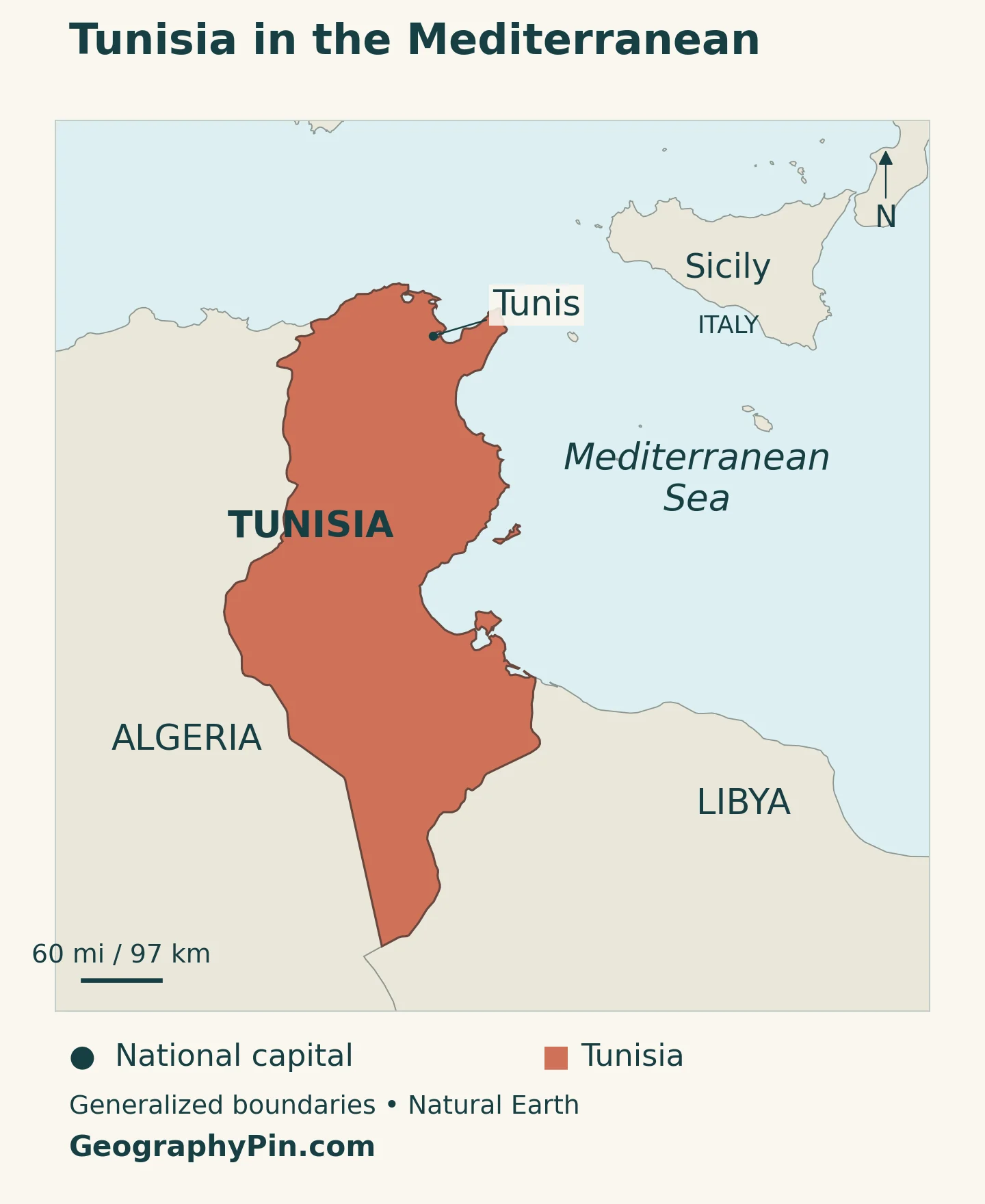
Start with the coast, then look inland. The northern shoreline faces the central Mediterranean; the eastern shoreline turns toward the Gulf of Hammamet and Gulf of Gabès. Tunis lies in the northeast, while the country extends much farther south into dry basins and desert terrain. That long inland reach is why a beach photograph alone gives an incomplete impression of Tunisia.
The North Africa countries map places Tunisia within the wider region and explains why North Africa and the Maghreb are not identical groupings.
2. Country facts, with dates and definitions
| Fact | Reference |
|---|---|
| Official English name | Republic of Tunisia |
| Capital | Tunis; the 2022 Constitution places the presidency and both legislative chambers in the capital. |
| Population | 11,992,843, INS estimate for January 1, 2026; national population, not Tunis alone. |
| Surface area | About 63,170 square miles (163,610 square kilometers); UNData surface-area figure, reference year 2023, not a land-only measurement. |
| Official language | Arabic, under Article 6 of the 2022 Constitution. |
| Currency | Tunisian dinar (TND). |
| Administrative divisions | 24 governorates; listed in the UK PCGN’s 2025 country factfile. |
The population figure comes from Tunisia’s Institut National de la Statistique. It is an estimate for a specified date, not a live population counter. International projections may show a different total because their reference dates and estimation methods differ.
Area figures also need their labels. “Surface area” and “land area” are not interchangeable, especially in a country with large salt depressions. The table keeps the UNData surface-area definition rather than subtracting an assumed amount of water or presenting a salt-flat area as permanent open water.
3. From the Atlas uplands to the Sahara
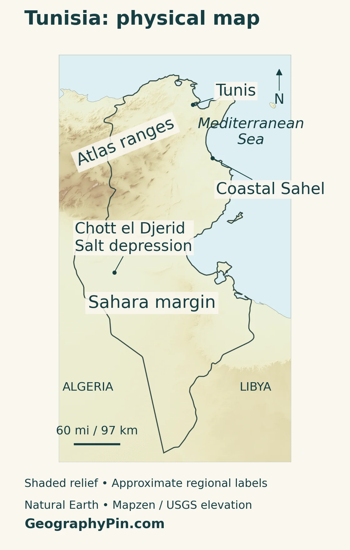
The useful contrast is not simply coast versus desert. Tunisia also has northern mountains, river plains, interior steppe and salt basins. The physical regions below are an explanatory grouping, not a set of administrative boundaries.
| Landscape | Where to look | What distinguishes it |
|---|---|---|
| Northern uplands and Medjerda valley | North and northwest | Atlas-related ranges and a major river corridor. |
| Dorsale and central steppe | Interior, extending toward the northeast | Mountain chains, plateaus and increasingly dry plains. |
| Tunisian Sahel | East-central Mediterranean coast | Coastal plains around Sousse, Monastir and Mahdia. |
| Chotts and Saharan south | Southwest and south | Salt depressions, dunes and rocky desert landscapes. |
The mountains continue into Tunisia
The Atlas system does not stop at the Algerian border. In northern Tunisia, ranges and valleys break up the landscape. The Dorsale Tunisienne, or Tunisian Dorsal, extends from the western border toward the northeast; it is not one uninterrupted wall.
Farther south, high and low steppes form a transition toward the chotts and Sahara. The Grand Erg Oriental is a dune region, while the Dahar adds a different, rocky upland landscape. “Desert” therefore does not mean that the entire south is a continuous sheet of sand.
The Tunisian Sahel is a coastal region
Here, Sahel means the east-central coastal region associated with Sousse, Monastir and Mahdia. It is not the continental African Sahel belt along the southern edge of the Sahara. Confusing the two names puts the Tunisian region on the wrong side of the desert.
Monastir provides a useful example of the coastal landscape’s human geography: agricultural plains sit alongside urban areas, industry and tourism. The sea-facing location does not make the region exclusively a beach destination or remove the need to manage scarce water.
Sousse’s older port role also helps explain this coast. UNESCO describes its medina as part of a historic coastal defense system. The modern urban belt developed in a place with a much longer relationship to maritime trade, rather than on an otherwise empty shore.
4. Climate and water explain the regional contrasts
In broad terms, the north has a Mediterranean pattern of hotter, drier summers and milder, wetter winters. Central Tunisia is a transition toward semiarid conditions, and the south is increasingly influenced by the Sahara. Elevation and exposure create local variation within that north-to-south pattern.
A national average cannot describe all of these settings well. Rainfall in the northern uplands, conditions on the eastern coast and water availability around a southern oasis answer different questions. The division is gradual; there is no single line where every Mediterranean characteristic ends and desert begins.
The Medjerda links a river basin across the border
The Medjerda rises in eastern Algeria and crosses northern Tunisia to the Gulf of Tunis. FAO describes it as the country’s major perennial stream. Perennial means that flow persists through the year, not that the amount of water stays constant.
The river is also a reminder that scarcity and flooding can affect the same country. JICA’s basin-management account describes the January 2003 flood, when downstream plains near Tunis were submerged for more than a month, damaging homes and crops and disrupting transport. Water management must address both storing limited supplies and moving dangerous floodwater safely.
Chott el Djerid is not a permanent freshwater lake
Chott el Djerid, also spelled Chott El Jerid, is a broad salt depression in southwestern Tunisia between the Tozeur and Kebili areas. The Tunisian submission on UNESCO’s Tentative List describes it as rarely covered by water today. Its surface should not be read like a blue freshwater lake on a map.
Evaporation, saline ground and groundwater are central to understanding this landscape. Water beneath the surrounding region helps sustain oases, but a salt basin does not itself provide a readily usable freshwater supply. The UNESCO entry is a Tentative List submission, not an inscription as a World Heritage Site.
Beyond individual basins, the World Bank identifies water scarcity, coastal erosion and flood risk as major climate challenges. These affect different places in different ways: an eroding shoreline and a dry inland farm need different responses, even when both are discussed under climate adaptation.
5. People, cities and languages
Tunis is both the capital and the main starting point for understanding the northeast. Its national role should not be confused with the administrative unit called Tunis or with a wider metropolitan population. A city proper, a governorate and an urban agglomeration can each produce a different figure.
Other important places help orient the country rather than simply extend a population ranking. Sousse and Monastir identify the east-central coastal belt. Tozeur and Kebili frame the salt-basin landscape in the southwest. Reading these places together connects settlement with the physical landscape.
Arabic is the official language. In everyday speech, Tunisian Arabic is commonly used, while Modern Standard Arabic serves formal written settings. French is widely used in business and administration, but that usage does not make it a second constitutionally official language.
Place names may consequently appear in several Roman-script spellings. “Chott el Djerid” and “Chott El Jerid,” for example, name the same feature. A spelling variation is not evidence of a different lake, city or administrative region; the location and context matter.
For a wider capital-city comparison, the African countries and capitals reference distinguishes countries where capital functions are divided between different cities.
6. Government and economy in their geographic setting
The 2022 Constitution defines Tunisia as a republic and a unitary state. It places executive authority with the president, assisted by a government headed by a head of government. Its legislative framework has two chambers. These are constitutional arrangements, not a rating of how political institutions operate in practice.
Governorates organize territory for administration. They should not be confused with physical regions such as the Sahel or Dorsale: a boundary drawn for government does not necessarily follow a mountain range, agricultural zone or climatic transition.
The economy combines agriculture, manufacturing and services. The World Bank identifies olive oil and other agricultural products, automotive and aeronautics components, tourism, and business services among its activities. A profile based only on resorts would miss much of the country’s production and employment.
The regional pattern of farming reflects the water contrast. FAO’s drought profile places much cereal production in the north and identifies olive cultivation strongly with the central region. Livestock and irrigated fruit production add other uses of land and water. Drought can therefore affect crops, export earnings and water services together, rather than remaining a problem confined to the desert.
Coastal location also creates a transport opportunity, but proximity to shipping routes is not the same as efficient access to them. The World Bank’s 2025 connectivity study emphasizes port handling, customs, logistics and links between ports and inland transport. Its message is practical: geography supplies the location, while infrastructure and institutions determine how effectively it is used.
That distinction links the country’s main themes. Tunisia’s Mediterranean frontage supports connections beyond Africa, its uplands and plains shape farming, and its dry southern basins make water a defining constraint. None of those settings alone represents the whole country.
Frequently Asked Questions
Is Tunis another name for Tunisia?
In English, Tunis is the capital city and Tunisia is the country. Arabic uses Tūnis for both, so translations and map labels need context.
Does Tunisia’s Mediterranean coast mean the whole country has a Mediterranean climate?
No. The northern Mediterranean pattern gives way to drier central and southern conditions. Even a coastal location is not enough to identify the climate of the whole country.
Why do reference pages give different population totals for Tunisia?
Check the date and method before comparing them. A census count, a national estimate and an international projection are different statistical products. This profile uses the INS national estimate for January 1, 2026, not a projection borrowed from another year.
What Did We Learn Today?
Tunisia is best understood as a connected sequence of Mediterranean coast, northern uplands, central transition and Saharan basins. The Medjerda shows why rivers and floods matter even in a water-stressed country, while Chott el Djerid shows why a salt depression is not equivalent to a freshwater lake. Keeping physical regions, administrative units and dated statistics separate makes both the map and the country easier to read.
Sources & Data Notes
Population is the INS estimate for January 1, 2026. Surface area follows UNData’s 2023 reference and is rounded in square miles. Constitutional descriptions use the 2022 text; the PCGN factfile is used for names and administrative divisions, not its older constitutional citation. Older environmental and climate references support stable physical patterns, not present-day population, water-supply totals or forecasts. Physical regions are explanatory groupings rather than official administrative zones.
- INS: population estimate for January 1, 2026
- UNData: Tunisia profile and reference-year footnotes
- 2022 Constitution: Articles 2, 4, 6, 56–57, 87 and 93
- UK PCGN: Tunisia toponymic factfile (2025), names and administrative divisions
- Tunisia Ministry of Environment: physical regions
- Office des Tunisiens à l’Étranger: Monastir and the Tunisian Sahel
- UNESCO: Medina of Sousse
- Tunisian submission to UNESCO’s Tentative List: Chott El Jerid
- UNDP: Tunisia’s broad climatic regions
- FAO: Mediterranean drainage and the Medjerda
- JICA: integrated management of the Medjerda basin
- FAO: Tunisia drought vulnerability and agriculture
- World Bank: Tunisia country overview
- World Bank: Tunisia Country Climate and Development Report
- World Bank: trade connectivity and ports (2025)
Map method: Original GeographyPin maps use public-domain Natural Earth country outlines and place locations. Shaded relief uses Mapzen Terrain Tiles with USGS SRTM and GMTED2010 data. The maps use a north-up Web Mercator projection; the scale is approximate away from the scale bar. Physical-region labels locate broad areas, not measured regional boundaries. The Chott el Djerid marker locates the salt depression, not its perimeter or present water coverage. No Medjerda river course is drawn. The country-profile cover is an original flag-and-outline design, not a physical map.