Switzerland’s mountain scenery can obscure the geography of daily life: most people do not live among the highest peaks. The useful starting point is the contrast between the Alps, the settled Swiss Plateau, and the Jura, followed by the rivers that carry water out of the country in several directions.
Switzerland is a landlocked central European country bordered by France, Germany, Austria, Liechtenstein, and Italy. Its three main physical regions are the Alps, Swiss Plateau, and Jura. The Plateau concentrates much of the population, while Alpine drainage divides send water toward the North Sea, Mediterranean, Adriatic, and Black Sea.
How to use this article: Compare the three physical regions, follow the drainage divides, or clarify the geography of shared lakes and language regions.
1. Where is Switzerland?
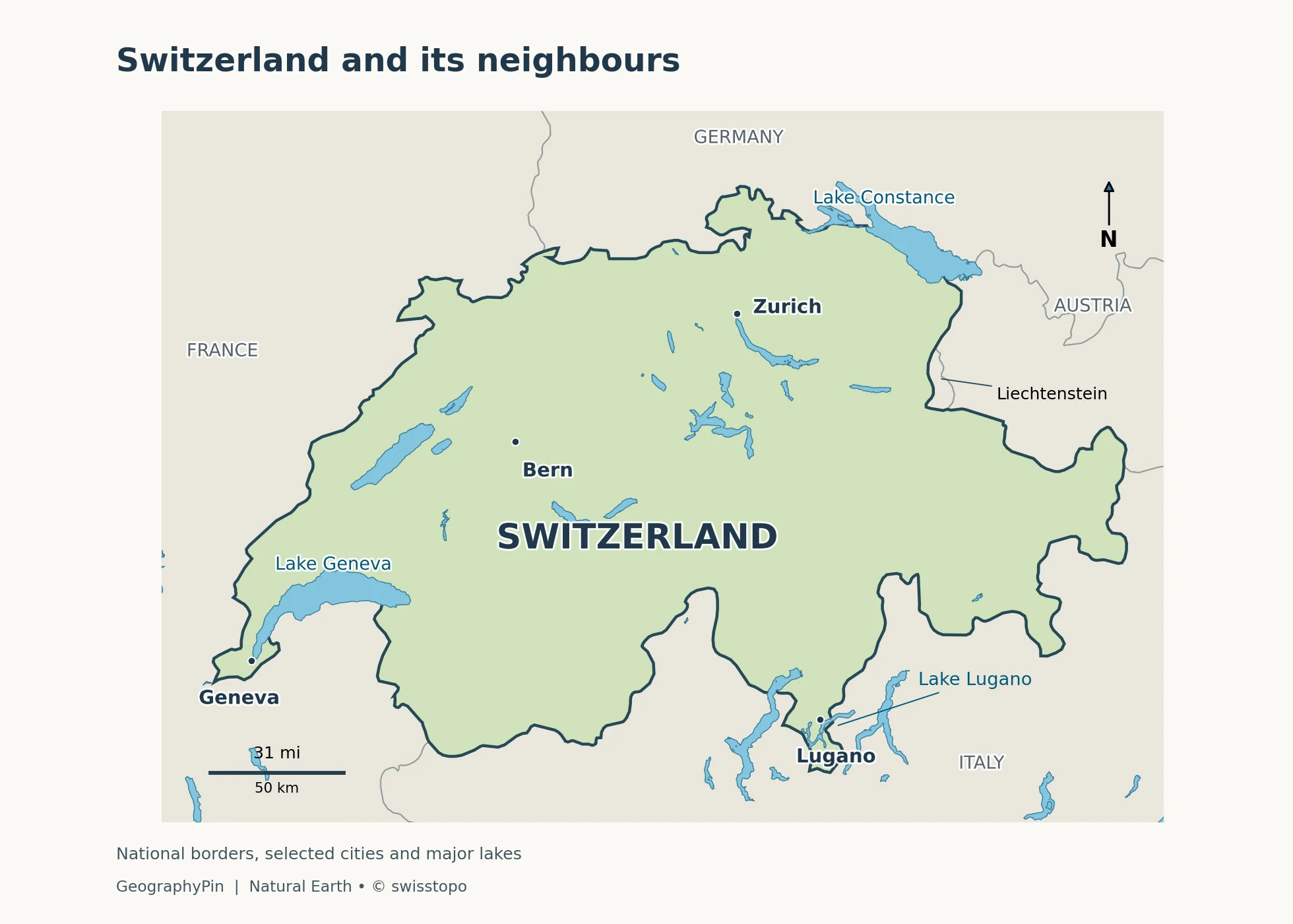
Switzerland is a landlocked country in central Europe. France borders it to the west, Germany to the north, Austria and Liechtenstein to the east, and Italy to the south. Its territory reaches across the Alps rather than stopping at their main crest: Ticino and several southern valleys lie on the Italian-facing side.
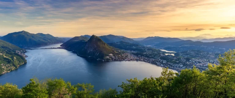
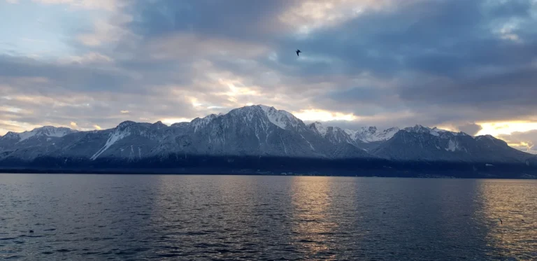
Lake Geneva anchors the southwest, Lake Constance the northeast, and the Rhine connects the northern borderlands with the rest of Europe. These are useful reference points because the outline alone conceals the country’s strongest contrast: high mountain terrain beside a much more densely settled belt of lower land.
Bern is the federal city
Bern is the seat of the federal government and parliament and functions as the country’s capital. The Swiss authorities use the term federal city: Switzerland does not have an officially designated capital in the conventional legal sense. Zurich is the largest municipality, but that does not make it the capital.
The Swiss Confederation is a federal state with 26 cantons. Cantons are political units, not physical regions; a canton can include lowlands, mountain slopes, and high peaks.
2. National facts and what they measure
| Measure | Value and scope |
|---|---|
| Total surface area | About 15,943 square miles (41,291 square kilometers), including inland waters |
| Population | 9,127,100 permanent residents on December 31, 2025 |
| Federal structure | 26 cantons |
| National languages | German, French, Italian, and Romansh |
| Highest summit | Dufourspitze, 15,203 feet (4,634 meters) |
| Main physical regions | Alps, Swiss Plateau, and Jura |
The population is the Federal Statistical Office’s final figure for the end of 2025, published in August 2026. It includes Swiss and foreign permanent residents; it is neither a count of Swiss citizens worldwide nor a real-time population estimate. Earlier provisional releases gave a different total.
Area needs a scope note too. Total surface area and land area are not interchangeable in a country with large lakes. This table uses the FSO land-use publication’s national total of 41,291 square kilometers. The federal geography overview gives 41,285 square kilometers; the small difference is retained here as a source difference, not interpreted as a territorial change. It should not be compared with another country’s land-only figure as if both measured the same thing.
3. The Alps, Swiss Plateau, and Jura
Three regions, three different landscapes
The three-region model explains Switzerland more clearly than the idea of one continuous mountain landscape. Federal descriptions put the Alps at roughly three fifths of national territory, the Plateau at about three tenths, and the Jura at about one tenth. These are broad physical divisions, not canton boundaries.
The Alps occupy the higher southern and central country. Dufourspitze in the Monte Rosa massif is Switzerland’s highest summit. Long valleys interrupt the mountain mass: the Rhône valley in Valais and the Inn valley in the Engadine are inhabited corridors, not empty spaces between peaks. Passes and tunnels connect valleys that would otherwise be separated by high ridges.
The Swiss Plateau, also called the Central Plateau or Mittelland, extends from Lake Geneva toward Lake Constance between the Jura and the Alps. “Plateau” does not mean a level plain: hills, river valleys, and lakes divide the landscape. The federal Plateau overview places more than two thirds of the population here, alongside intensive farming and the densest transport network.
The Jura follows the country’s northwestern side and continues across the French border. Its wooded ridges and intervening valleys form a different mountain landscape from the high Alps. The Jura mountain region is larger than the canton named Jura; confusing the two hides much of the range.
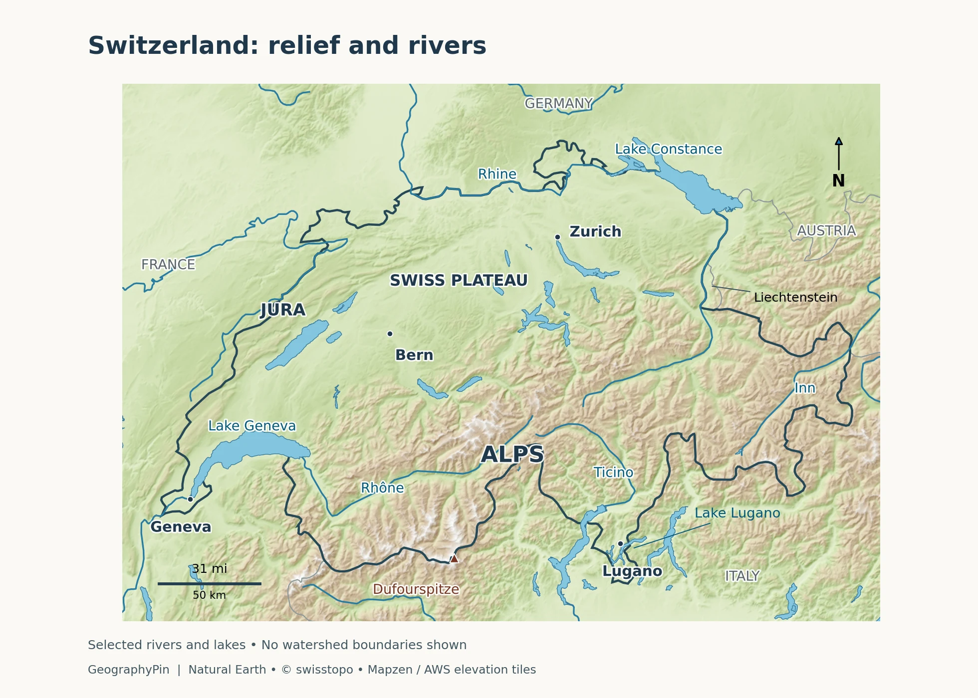
Compare three named places: Geneva sits at the southwestern end of the Plateau; Bern is farther northeast within that lower, settled belt; Dufourspitze rises far to the south in the Alps. They illustrate why a national average elevation says little about the surroundings of an individual Swiss city.
4. Where Swiss rivers take their water
A drainage divide is not a national border
A drainage divide separates land whose runoff reaches different river systems. Switzerland spans several such divides. Water falling on opposite sides of a ridge may eventually enter different seas, even when both slopes belong to the same canton.
| Swiss river or area | Onward route |
|---|---|
| Rhine and Aare system | Rhine → North Sea |
| Rhône and Lake Geneva | Rhône → Mediterranean Sea |
| Ticino and other Po tributaries | Po → Adriatic Sea |
| Inn in the Engadine | Danube → Black Sea |
| A small eastern drainage area | Adige → Adriatic Sea |
The Federal Office for the Environment identifies the Rhine basin as the largest Swiss drainage area. The Aare gathers water from tributaries including the Reuss and Limmat before joining the Rhine. The Rhine’s wider river system therefore receives water from much of northern Switzerland, not just from places beside the river itself.
To the southwest, the Rhône runs through Valais and Lake Geneva before continuing through France. To the south, the Ticino connects Alpine runoff with the Po system. To the east, the Inn links the Engadine to the Danube. The small Adige drainage area means that a four-river summary is useful but not exhaustive.
These connections explain why Swiss water management involves neighboring countries. Snowmelt, rainfall, reservoirs, and glacier melt affect the timing of downstream flows; a river basin cannot be managed by looking only inside a political border.
5. Lakes and routes across the mountains
Lake Geneva and Lake Lugano cross borders
Lake Geneva, or Léman, is shared by Switzerland and France. CIPEL, its international water-protection commission, gives a whole-lake surface area of about 224 square miles (580 square kilometers). That is the lake’s total area, not the part belonging to Switzerland. The Rhône enters at its eastern end and leaves at Geneva.
Lake Lugano lies across Ticino in Switzerland and Lombardy in Italy. Its branching form crosses the frontier rather than fitting neatly on one side. CIPAIS distinguishes a northern basin, a southern basin, and the smaller Ponte Tresa basin near the Tresa outlet. The frontier cuts across the water; it does not mark the shoreline.
Lake Maggiore is also shared with Italy. Lake Constance meets Switzerland, Germany, and Austria. Whole-lake surface area is therefore different from the area within Switzerland. The surrounding catchment, the land supplying water to the lake, is another distinct area.
Passes and tunnels solve different problems
A mountain pass crosses a relatively low point in a ridge; a base tunnel passes through the mountain at a lower level. Switzerland’s New Rail Link through the Alps uses the Lötschberg, Gotthard, and Ceneri base tunnels to improve north–south connections. The Gotthard Base Tunnel is about 35 miles (57 kilometers) long.
The geography has not disappeared because a railway can go through it. Routes still connect particular valley corridors, and the older high-level crossings and newer low-level tunnels serve different journeys. The federal transport authority describes the base-tunnel network as a way to reduce gradients and make rail freight more efficient.
6. Elevation, climate, and changing ice
Height changes temperature, snow cover, and the land available for farming and settlement. Exposure matters as well: an inner valley sheltered by mountains can be relatively dry, while a nearby slope facing moist air receives much more precipitation. A single “Swiss climate” description cannot represent both the high Alps and the lower lake shores.
Atlantic air influences Switzerland, while the Alps form a barrier between northern and southern weather patterns. The federal climate overview highlights dry valley climates in Valais and Graubünden and the warm, dry downslope wind known as the foehn. Those contrasts help explain why conditions differ sharply over short distances.
Ice loss is changing the high mountains. In October 2026, ETH Zurich reported GLAMOS findings that Swiss glaciers had lost more than 5% of their ice volume in 2026 and nearly 20% over the preceding five years. These are ice-volume changes, not a statement that every glacier lost the same fraction of its length or mapped area. The observation describes a specific measurement period, not a constant annual rate.
For the country profile, the key consequence is geographic: retreat changes the landscape and the seasonal storage of water. The response differs between glaciers and valleys, so a national percentage should not be applied mechanically to a specific lake or river.
7. Population, cities, and languages
Settlement and language maps tell different stories
Switzerland’s population is not spread evenly over its territory. Cities, towns, and farming concentrate in the Plateau and accessible valleys, whereas the highest ground supports far fewer permanent residents. Zurich, Geneva, Basel, Lausanne, and Bern form distinct urban centers rather than a single capital dominating the entire country.
The four national languages have recognizable regional patterns. German predominates across much of the north, center, and east; French in the west; Italian in Ticino and parts of Graubünden; and Romansh in parts of Graubünden. These are broad patterns, not claims that everyone within a region speaks the same language.
Everyday Swiss German comprises several dialects, while standard German is important in written communication. Language borders also do not simply trace mountain divides or canton boundaries: Bern, Fribourg, Valais, and Graubünden are officially multilingual cantons.
National-language status is not identical to federal administrative status. German, French, and Italian are the Confederation’s general official languages. The Federal Chancellery explains that Romansh is also an official language when federal authorities communicate with Romansh speakers. This distinction is more informative than describing the country as four completely separate language territories.
8. The economy in its geographic setting
The Swiss economy is not mainly an Alpine tourism economy. Services employ most workers, while pharmaceuticals, chemicals, machinery, electrical engineering, and metals are important industrial activities. Tourism has a particular role in many mountain areas, but it is one part of a wider national economy.
Location connects these activities. The Plateau brings population, businesses, farmland, and transport into relatively close contact. Alpine routes connect northern and southern Europe, while Basel’s Rhine ports show how a landlocked country can still participate in inland-waterway trade. Dense connections matter alongside the constraints imposed by mountains.
Political geography adds another distinction: Switzerland is in Europe but is not a member of the European Union. Its relations with the EU are organized through bilateral agreements. Being geographically central to a continent does not automatically mean belonging to every institution associated with it.
Frequently Asked Questions
What does “Swiss Confederation” mean?
Swiss Confederation is the country’s name. Despite that historic wording, Switzerland has been a federal state since 1848, with powers divided between the Confederation, cantons, and communes.
Are the Alps entirely within Switzerland?
No. The Alpine region extends into several countries. The Swiss Alps are the part within Switzerland, not a separate range containing the whole European mountain system.
What Did We Learn Today?
Switzerland makes more sense as a relationship between regions than as a country of mountains alone. The Plateau concentrates settlement, the Alps divide and channel water and transport, and the Jura frames the northwest. Shared lakes, multilingual cantons, and a federal political system show why physical, linguistic, and administrative boundaries should be read as different layers of the same map.
Sources & Data Notes
Population refers to permanent residents at December 31, 2025, using the final FSO release. National area includes inland waters; lake measurements refer to the whole lake where stated. Regional proportions are rounded, not surveyed boundaries. Glacier figures describe 2026 ice-volume change. U.S. customary conversions are rounded.
- Federal geography overview: national area and regional divisions; Federal regional profiles: Swiss Plateau; Federal regional profiles: Alps; Federal regional profiles: Jura; FSO: Land use in Switzerland, 2018 results (2021), national territory including waters
- Federal Statistical Office: final population results for 2025
- Federal Office for the Environment: international water cooperation; Hydrological Atlas: river-basin definitions, including Adige; Federal overview: lakes and river connections
- CIPEL: Lake Geneva measurements; CIPAIS: Lake Lugano and its basins
- Federal Office of Transport: Alpine base-tunnel network
- Federal climate overview
- ETH Zurich / GLAMOS: glacier observations in 2026
- Federal overview: language geography; Federal Chancellery: Romansh language status
- Federal overview: political system and Bern; Federal Chancellery: federalism
- Federal overview: economic sectors; Federal Chancellery: international agreements
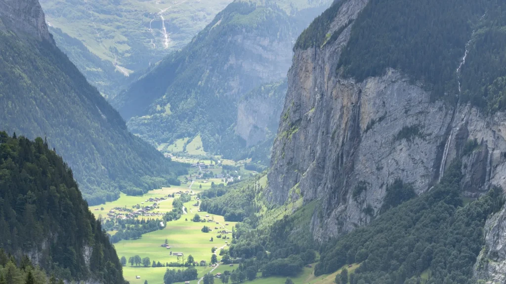
Featured photograph: Lauterbrunnen Valley by kuhnmi, CC BY 2.0; resized, minimally cropped to 16:9, and converted to WebP.
Maps by GeographyPin use Natural Earth public-domain geography, swissTLMRegio 2026 lake geometry © swisstopo, and Mapzen terrain tiles. Relief is calculated from elevation data, not illustrated terrain. Web Mercator projection; the scale bar is approximate near the map center. Selected rivers are not a complete network, and no watershed boundary is inferred from their lines. Lake polygons include their cross-border portions and were transformed from Swiss LV95 coordinates; the international boundary is not treated as a shoreline.
Terrain acknowledgments: produced using Copernicus data and information funded by the European Union (EU-DEM); Austrian elevation data © offene Daten Österreichs; GMTED2010 and SRTM data courtesy of the U.S. Geological Survey; ETOPO1 data from NOAA. Terrain source and attribution details.