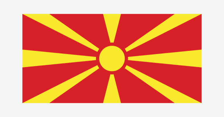
North Macedonia is a country; Macedonia can also refer to a wider historical and geographical region. Within the state’s present borders, mountain basins, the Vardar corridor and shared lakes explain more than a simple north–south label.
North Macedonia is a landlocked Balkan state with Skopje as its capital. It is not identical to the wider Macedonia region. Mountains surround interconnected basins and the Vardar corridor, while lakes Ohrid and Prespa cross international borders. Reading the terrain alongside the state boundary helps distinguish physical geography from regional names and administrative divisions.
How to use this article: Clarify the country name, compare mountain basins, or follow the shared water systems.
1. Separate the Country From the Wider Name
North Macedonia is a state, not the whole Macedonia region
North Macedonia is a landlocked country in southeastern Europe. Albania lies to its west, Greece to its south and Bulgaria to its east; Serbia and Kosovo are along its northern side. Kosovo’s independence is disputed, so the locator distinguishes its boundary convention rather than implying universal recognition.
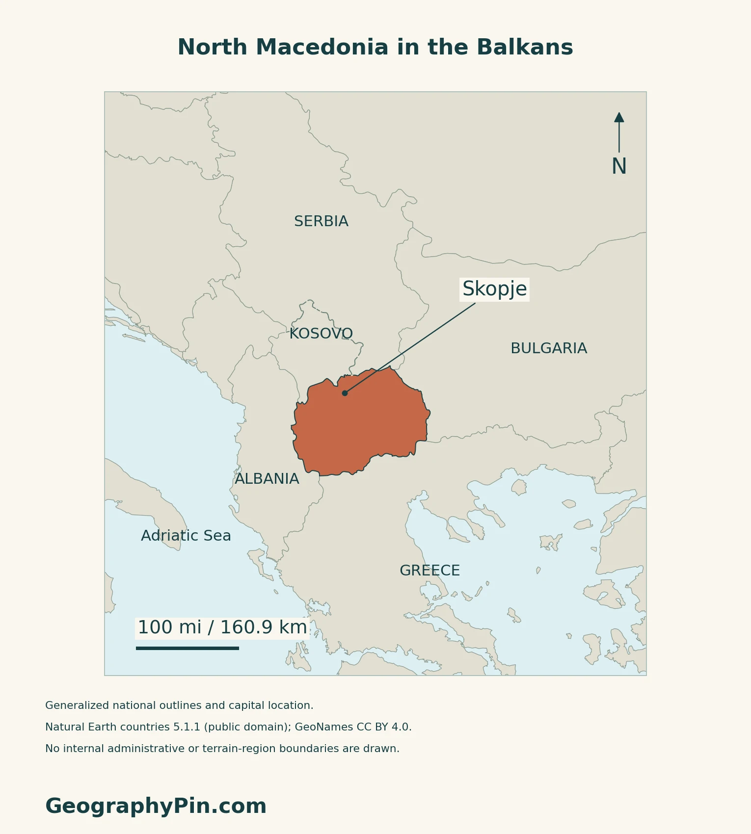
The geographical and historical term Macedonia is broader than this state. The Austrian Academy of Sciences describes a historical area extending across modern North Macedonia, Greece and Bulgaria.
The Prespa Agreement provides the official name Republic of North Macedonia and the short name North Macedonia. The UN treaty register records entry into force on February 12, 2019. Article 7 distinguishes the meanings of Macedonia and Macedonian in the two parties’ respective contexts, including Greece’s northern region.
For a continental locator, use the Europe country maps.
2. Read the Basins Between the Mountains
A basin-and-range landscape, not one continuous plain
The landscape consists of mountain ranges separated by basins and valleys. A basin is a lower area enclosed or partly enclosed by higher terrain; it need not contain a lake. The Vardar corridor connects several such settings rather than cutting through a single uniform lowland.
| Setting | How to read it |
|---|---|
| Polog and Skopje basin | Upper Vardar settings separated and bordered by mountain ranges and gorges. |
| Veles, Tikveš and the southern Vardar basins | Successive lower-valley settings toward the Greek border. |
| Pelagonia | A broad basin extending south across the border toward Florina in Greece. |
| Ohrid and Prespa | Southwestern lake basins surrounded by mountain relief. |
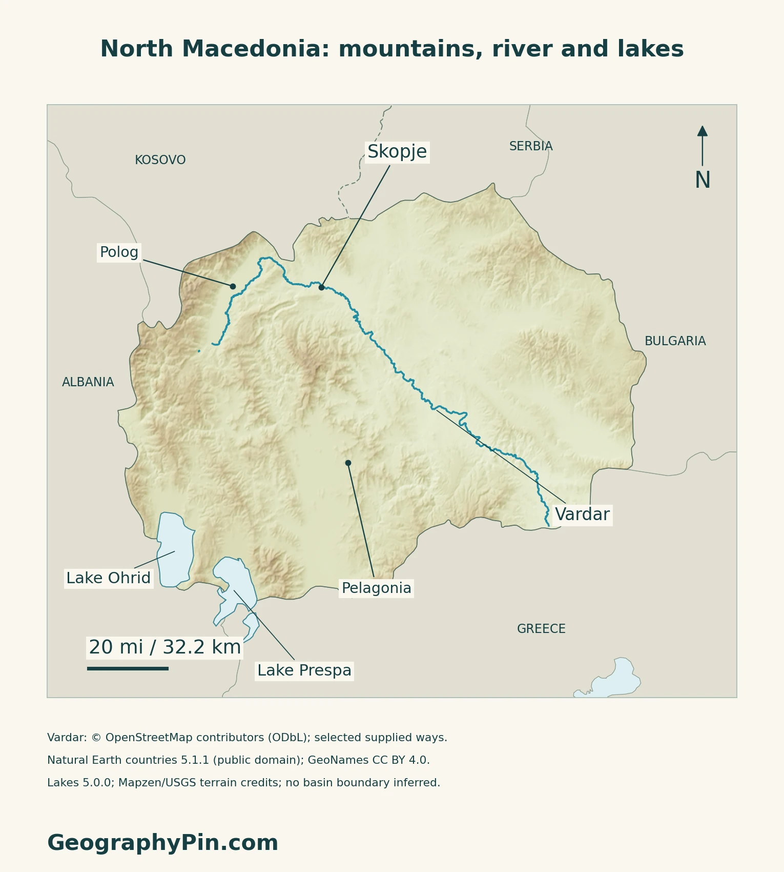
These names help interpret the relief map; they are not a complete set of official regions. In particular, a statistical region bearing a familiar landscape name is not necessarily identical to that physical basin.
Skopje and the Vardar corridor concentrate activity
North Macedonia’s November 2026 climate submission identifies the Skopje agglomeration and the Vardar corridor as important concentrations of population and economic activity. The capital is therefore both a national administrative centre and part of this valley system.
3. Follow Rivers and Shared Lakes
The national boundary does not contain a whole water system
The Vardar continues through Greece toward the Aegean Sea. Other parts of the country drain in different directions: the Crn Drim belongs to the Adriatic system.
The southwestern lakes also cross borders. Ohrid is shared with Albania, while Great Prespa is shared with Albania and Greece.
A June 2026 account by the Hydrobiological Institute Ohrid and UNDP explains that water moves from Prespa toward Ohrid through underground karst channels. A surface map cannot display that connection simply by drawing a river between the lakes.
Lake Ohrid’s protected landscape crosses the border
UNESCO’s Ohrid property combines natural and cultural heritage. Its original inscriptions covered the North Macedonian part; the property expanded into Albania in 2019. The lake’s distinctive freshwater species and the historic lakeside settlements are both part of its value.
World Heritage status does not mean that the lake is free of environmental pressure. UNESCO identifies wastewater, poorly coordinated development and tourism-related pressures among the concerns. Those issues are about the shared lake and surrounding landscape, not merely the municipal boundary of Ohrid.
4. Understand Climate and Environmental Contrasts
Elevation and exposure complicate a single climate label
The country lies between Mediterranean and continental climatic influences. The environment ministry’s geographic baseline describes mountains limiting the penetration of maritime air, with colder high-altitude conditions distinct from the valleys. A lowland summer description is therefore not a reliable description of every mountain location.
The November 2026 climate submission differentiates hazards geographically: flood exposure in Skopje and lower valleys, landslides on steep terrain, and drought and heat pressures in agricultural lowlands. These are planning assessments, not a forecast for a particular day or a claim that every district faces the same risk.
A higher lake level is not proof of ecological recovery
The June 2026 institute–UNDP account reported increased Prespa inflows after unusually wet conditions in late 2025 and spring 2026. Its central caution was that short-term hydrological improvement should not be confused with lasting ecosystem recovery.
5. Check Dated Country Facts
| Item | Reference |
|---|---|
| Capital | Skopje, designated in Constitution Article 6 |
| Population estimate | 1,819,074 at December 31, 2025; State Statistical Office |
| Surface area | About 9,928 sq mi (25,713 km²); UNData’s 2023 reference |
| Official-language framework | Macedonian in Cyrillic; Albanian under the 20% constitutional and statutory mechanism |
| Currency | Denar (MKD) |
| Government | Republic |
| Municipalities | 80; ten are within the City of Skopje |
Resident counts and enumeration totals are not interchangeable
The 2021 census recorded 1,836,713 residents at September 5, 2021. Its larger total of 2,097,319 people enumerated also included 260,606 non-residents. The later figure in the table is an estimate, not another census. The statistical office updates population using births, deaths and net migration.
How the 20% language provision works
Constitutional Amendment V makes Macedonian and its Cyrillic script official throughout the country and in international relations. It also provides official use for a language spoken by at least 20% of citizens, subject to its provisions. Article 1 of the language law expressly identifies Albanian under that threshold. Local official-language use has its own rules; this is not a claim that every municipality has the same language profile.
For a broader capital reference, see European countries and their capitals. Its counting convention is separate from this country profile.
What Did We Learn Today?
State boundaries, historical regions and physical basins answer different questions. North Macedonia’s profile becomes clearer when its current name is separated from wider regional usage, and its river and lake systems are read across borders rather than confined to them.
Sources & Data Notes
Sources, dates and map conventions
Population is the statistical office’s estimate for December 31, 2025, not a census count or a count of all citizens abroad. The 2021 census resident and non-resident totals are kept separate. The original Constitutional Court edition, including Amendment V, and the Language Inspectorate’s law were read directly. Area follows UNData’s 2023 surface convention; municipal totals follow the statistical office’s territorial classification. Physical geography from the 2012 environmental plan is used only for stable terrain, drainage and climatic context, not its outdated population, municipalities or protected-area counts. The November 2026 climate submission supplies dated settlement and hazard context, not a weather forecast. UNESCO property boundaries are not state borders. No precise lake area, depth or present shoreline measurement is asserted.
- State Statistical Office: population estimated at December 31, 2025
- State Statistical Office: population-estimate methodology
- State Statistical Office: 2021 census first dataset, March 30, 2022
- State Statistical Office: municipalities and territorial classification
- UNData: surface area, currency and capital
- Constitutional Court: Constitution with Amendments I–XXXVI, March 2022 edition
- Language Inspectorate: Law on the Use of Languages, Article 1
- Original Prespa Agreement, Article 1
- Greek Foreign Ministry: Prespa Agreement entry into force, February 12, 2019
- UN Treaty Collection: Prespa Agreement and entry into force
- Prespa Agreement: original registered text, Articles 1 and 7
- Austrian Academy of Sciences: TIB 16 physical and historical landscapes
- Environment ministry: July 2012 geographic and climate baseline, pages 14–17
- North Macedonia: November 2026 NDC submission, national circumstances
- UNESCO: Natural and Cultural Heritage of the Ohrid region
- Hydrobiological Institute Ohrid and UNDP: Prespa monitoring, June 8, 2026
Map method: Original maps use public-domain Natural Earth countries 5.1.1 and lakes 5.0.0, plus GeoNames coordinates under CC BY 4.0. Vardar geometry is from © OpenStreetMap contributors, ODbL, retrieved 17 November 2026; supplied ways are drawn without invented joins. Lake polygons are generalized, not current water levels. The shared Kosovo–Serbia source boundary is dashed; this convention does not resolve disputed recognition. Polog and Pelagonia are GeoNames regional reference points, not mapped basin boundaries. Mapzen terrain retains Mapzen/USGS upstream credits; source heights are unchanged and no negative samples occur within the country mask. No mountain-basin or administrative regions are drawn. Scales use local WGS84 distances. The flag uses Flagpedia’s explicitly reusable rendition; the official state-symbol sheet confirms its eight rays and 1:2 proportions. The cover applies continuous decorative flag fill to the outline beside the complete flag.